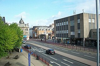
Hamilton is a large town in South Lanarkshire, Scotland. It serves as the main administrative centre of the South Lanarkshire council area. It sits 10 miles (16 km) south-east of Glasgow, 37 miles (60 km) south-west of Edinburgh and 74 miles (120 km) north of Carlisle. It is situated on the south bank of the River Clyde at its confluence with the Avon Water. Hamilton is the county town of the historic county of Lanarkshire and the headquarters of the modern local authority of South Lanarkshire.

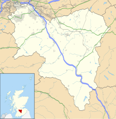
South Lanarkshire is one of 32 unitary authorities of Scotland. It borders the south-east of the City of Glasgow and contains some of Greater Glasgow's suburbs,also containing many towns and villages. It also shares borders with Dumfries and Galloway, East Ayrshire, East Renfrewshire, North Lanarkshire, the Scottish Borders and West Lothian. It includes part of the historic county of Lanarkshire.

Lanarkshire, also called the County of Lanark, is an historic county, lieutenancy area and registration county in the central Lowlands of Scotland.

Cambuslang is a town on the south-eastern outskirts of Glasgow, Scotland. With approximately 30,000 residents, it is the 27th largest town in Scotland by population, although, never having had a town hall, it may also be considered the largest village in Scotland. It is within the local authority area of South Lanarkshire and directly borders the town of Rutherglen to the west. Historically, it was a large civil parish incorporating the nearby hamlets of Newton, Flemington, Westburn and Halfway.

Motherwell is a large town and former burgh in North Lanarkshire, Scotland, United Kingdom, south east of Glasgow. It has a population of around 32,120. Historically in the parish of Dalziel and part of Lanarkshire, Motherwell is the headquarters for North Lanarkshire Council. Geographically the River Clyde separates Motherwell from Hamilton to the west whereas the South Calder Water separates Motherwell from Carfin to the north-east and New Stevenston and Bellshill towards the north.

Blantyre is a town and civil parish in South Lanarkshire, Scotland, with a population of 16,900. It is bounded by the River Clyde to the north, the Rotten Calder to the west, the Park Burn to the east and the Rotten Burn to the south.

Erskine is a town in the council area of Renfrewshire, and historic county of the same name, situated in the West Central Lowlands of Scotland. It lies on the southern bank of the River Clyde, providing the lowest crossing to the north bank of the river at the Erskine Bridge, connecting the town to Old Kilpatrick in West Dunbartonshire. Erskine is a commuter town at the western extent of the Greater Glasgow conurbation, bordering Bishopton to the west and Renfrew, Inchinnan, Paisley and Glasgow Airport to the south. Originally a small village settlement, the town has expanded since the 1960s as the site of development as an overspill town, boosting the population to over 15,000. In 2014, it was rated one of the most attractive postcode areas to live in Scotland.

Wishaw is a large town in North Lanarkshire, Scotland, on the edge of the Clyde Valley, 15 miles (24 km) south-east of Glasgow city centre. The Burgh of Wishaw was formed in 1855 within Lanarkshire. it formed a joint large burgh with its neighbour Motherwell from 1920 until its dissolution when Scottish local authorities were restructured in 1975, and was then in Motherwell district within the Strathclyde region until 1996. The town is part of the Motherwell and Wishaw constituency. It has the postal code of ML2 and the dialling code 01698.

The town of Carluke lies in the heart of the Lanarkshire countryside in South Lanarkshire, Scotland, 4.7 miles northwest of Lanark and 4.2 mi (6.8 km) southeast of Wishaw.

Uddingston is a small town in South Lanarkshire, Scotland. It is on the north side of the River Clyde, south-east of Glasgow city centre, and acts as a dormitory suburb for the city.

Lambhill is an area in the city of Glasgow, Scotland. It is situated north of the River Clyde, approximately 2 miles (3.2 km) north of the city centre.

Law is a village situated between Carluke and Wishaw in South Lanarkshire, Scotland with a population of around 2,800. The village lies on the border of North Lanarkshire.
Braidwood is a small village near Carluke, in South Lanarkshire, Scotland. The medieval barony of Braidwood included the Tower of Hallbar.
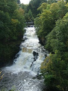
The Clyde Walkway is a foot and mountain bike path which runs from Glasgow, Scotland, to just above the UNESCO World Heritage site of New Lanark. The path runs close to the River Clyde for most of its length. It was completed in 2005, and is now designated as one of Scotland's Great Trails by NatureScot. The route is 65 kilometres (40 mi) long, and combines rural sections on the upper Clyde in South Lanarkshire, including the Clyde Valley Woodlands National Nature Reserve and the Falls of Clyde, with urban walking through the centre of Glasgow. About 155,000 people use the path every year, of whom about 7,750 undertake multi-day journeys.

Newhouse is a hamlet and major road interchange located in North Lanarkshire, Scotland, sited immediately east of the Eurocentral industrial park, two miles west of the village of Salsburgh, 1.8 miles (2.9 km) east of Holytown and about 4 miles (6.4 km) north east of Motherwell.

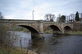
Dalserf is a small village of only a few streets in South Lanarkshire, Scotland. It lies on the River Clyde, 2 miles (3 km) east of Larkhall and 7 miles (11 km) south east of Hamilton. As of 2006, the village itself has a population of 52.
Garrion Bridge is a small hamlet spanning the border between North Lanarkshire and South Lanarkshire, Scotland. It is located on the banks of the Clyde Valley, 18 miles (29 km) south-east of Glasgow. The hamlet is most commonly associated with the nearby town of Wishaw.
Chapelhall is a village outside the town of Airdrie in North Lanarkshire, Scotland. With house building, the distinction between Airdrie and Chapelhall is being eroded. Established as a small mining village in the 19th century, it now has population of around 6,560. Chapelhall is situated just off the M8 motorway 13 miles (21 km) east of Glasgow city centre and around 33 miles (53 km) west of Edinburgh. Chapelhall is also near to many of Lanarkshire's main towns, such as Bellshill, Coatbridge, Motherwell, Hamilton and Cumbernauld, as well as being around 3 miles (4.8 km) away from Airdrie town centre. The Eurocentral freight village/industrial estate is just a mile or so away and employs people from around Lanarkshire, Glasgow and West Lothian. The rail-freight village links with Grangemouth docks 28 miles (45 km) away,.

The Clyde Valley Woodlands National Nature Reserve (NNR) comprises six separate woodland sites in the Clyde Valley region of South Lanarkshire, Scotland. These six sites are located along a 12 km section of the River Clyde and its tributaries, and lie close to built-up areas such as Hamilton and Lanark on the southern outskirts of Greater Glasgow. The sites can be easily accessed by about two million people living in the surrounding urban areas, making the reserve unique amongst Scotland's NNRs, most of which tend to be located in more remote areas. The six sites are:

Broomhouse is a residential area in Glasgow, Scotland. It is about 6 miles (10 km) east of the city centre. Historically a small mining village and later the site of the Glasgow Zoo, in the early 21st century it grew substantially as an affluent commuter suburb.