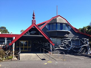
Rosedale, Auckland

Last updated

Rosedale
Rosedale, Auckland
Coordinates: 36°44′49″S174°42′40″E / 36.747°S 174.711°E / -36.747; 174.711
CountryNew Zealand
City Auckland
Local authority Auckland Council
Electoral ward Albany ward [1]
Local board Upper Harbour Local Board
Postcode(s)
0632
Albany Pinehill Windsor Park
Schnapper Rock
Pfeil oben.svg
Pfeil links.svgRosedalePfeil rechts.svg
Pfeil unten.svg
Windsor Park
Schnapper Rock Unsworth Heights Sunnynook

Rosedale is a suburb on the North Shore of Auckland, New Zealand. It is located 12 kilometres north of the city centre, to the south of the suburbs of Pinehill and Albany. It is under the local governance of the Auckland Council.

Contents

History

The business and light industrial area of Rosedale was given the name North Harbour Industrial Estate when construction commenced on it in the 1990s. The former North Shore City Council the changed the name of this area back to Rosedale in 2009, as a result of a broader review of suburb names and boundaries in the North Shore. [2] This area is sometimes referred to by the former name. Business North Harbour, the association responsible for the area's business improvement district, retains the place name of North Harbour in their name. Business North Harbour was unhappy with the name change to Rosedale, describing the name as a "stinker" due to the association with the Rosedale Wastewater Treatment Plant and former landfill located in the suburb. [3] Some businesses in Rosedale use North Harbour in their names and as the suburb in their addresses.

This area of the suburb is also sometimes referred to as Interplex, arising from the 47 hectare "interplex@albany" business park subdivision that commenced construction in 2001 and was completed in 2006. [4]

On the name of Rosedale, The New Zealand Geographic board states "the name for Rosedale has existed for many years, but the current boundary is newly defined. In 1961 new large Oxidation Ponds were built in the valley between Rosedale Road in the North and Sunset Road in the South. They were named Rosedale Oxidation Ponds and at that time were surrounded by rural holdings." [5] Newspaper articles from the 1890s show that there was a Rosedale estate in the Albany area owned by the Stevenson family, where an orchard was cultivated. [6] [7]

Infrastructure and services

The suburb is home to the Rosedale Wastewater Treatment Plant, the second largest sewage works in Auckland. The plant was initially opened in 1962, and now processes the wastewater of an estimated 253,000 inhabitants, servicing the area of the North Shore from Devonport to Long Bay. [8] A notable feature of the area is Rosedale Dam, containing treated wastewater fed from the sewage works. The dam is visible when travelling through State Highway 1. In the event of a dam breach, the dam poses a risk of flooding to the local community within the flow path hazard zone. The dam is at the greatest risk of a breach during an earthquake or high rainfall event. [9]

Rosedale is also known for the large general refuse landfill that operated from the 1950s to 2009, accepting only clean fill from 2002 to 2008. [10] The landfill was bordered by Greville Road on the north, Rosedale Road on the south, State Highway 1 on the west and Hugh Green Drive on the east. The area is now the Rosedale Landfill Reserve and public access is prohibited due to toxic gas and liquid run off. The high levels of volatile methane gas present are harnessed for power generation. [11] The suburb remains a hub for refuse services with a Waste Management transfer station operating adjacent to the bottom of the former landfill site on Rosedale Road. A large Envirowaste transfer and recycling facility is also located in the suburb on Constellation Drive.

Demographics

Historical population
YearPop.±% p.a.
2006450    
2013564+3.28%
2018816+7.67%
Source: [12]

The North Harbour statistical area, that Rosedale is included in, had a population of 816 at the 2018 New Zealand census, an increase of 252 people (44.7%) since the 2013 census, and an increase of 366 people (81.3%) since the 2006 census. There were 276 households. There were 432 males and 387 females, giving a sex ratio of 1.12 males per female. The median age was 38.7 years, with 84 people (10.3%) aged under 15 years, 186 (22.8%) aged 15 to 29, 366 (44.9%) aged 30 to 64, and 183 (22.4%) aged 65 or older.

Ethnicities were 64.7% European/Pākehā, 5.9% Māori, 1.1% Pacific peoples, 29.0% Asian, and 4.0% other ethnicities (totals add to more than 100% since people could identify with multiple ethnicities).

The proportion of people born overseas was 45.2%, compared with 27.1% nationally.

Although some people objected to giving their religion, 52.6% had no religion, 37.5% were Christian, and 7.0% had other religions.

Of those at least 15 years old, 192 (26.2%) people had a bachelor or higher degree, and 93 (12.7%) people had no formal qualifications. The median income was $34,900. The employment status of those at least 15 was that 381 (52.0%) people were employed full-time, 84 (11.5%) were part-time, and 15 (2.0%) were unemployed. [12]

Related Research Articles

<span class="mw-page-title-main">North Shore, New Zealand</span> Suburban area in Auckland, North Island, New Zealand

The North Shore is part of the large urban area of Auckland, New Zealand, located to the north of the Waitematā Harbour. To the east, has the Hauraki Gulf, to the west, is West Auckland, to the south, has the Waitematā Harbour and Central Auckland, to the north has the Hibiscus Coast. From 1989 until 2010, North Shore City was an independent city within the Auckland Region, until it was incorporated into the Auckland Council.

<span class="mw-page-title-main">Birkenhead, New Zealand</span> Suburb in Auckland, New Zealand

Birkenhead is a suburb of Auckland, in northern New Zealand. It is located on the North Shore of the Waitemata Harbour, four kilometres northwest of the Auckland CBD.

North Harbour is a suburb on the North Shore of Auckland, New Zealand. It is located 12 kilometres north of the city centre, to the south of the suburb of Albany. The suburb has not been officially designated as a suburb by Auckland Council, the territorial authority. The place name holds no official status with the New Zealand Geographic Board, nor is it used by New Zealand Post. North Harbour is, however, a statistical area used in Statistics New Zealand datasets and North Harbour East and North Harbour West are area units. The general area that embodies what is referred to as the suburb of North Harbour is made up of parts of Albany, Rosedale, Schanpper Rock and Pinehill.

<span class="mw-page-title-main">Hunua Ranges</span> Mountain range and regional park in New Zealand

The Hunua Ranges is a mountain range and regional park to the southeast of Auckland city, in the Auckland and Waikato regions of New Zealand's North Island. The ranges cover some 250 square kilometres (97 sq mi) and rise to 688 metres (2255 ft) at Kohukohunui.

<span class="mw-page-title-main">Albany, New Zealand</span> Suburb in Auckland, New Zealand

Albany is one of the northernmost suburbs of the contiguous Auckland metropolitan area in New Zealand. It is located to the north of the Waitematā Harbour, 15 kilometres (9 mi) northwest of the Auckland city centre. The suburb is in the Albany ward, one of the thirteen administrative divisions of Auckland Council. Much of the land to the north of Albany is semi-rural.

Ramarama, previously known as Sheppards Bush, is a small community at the far south of the Auckland Region in New Zealand's North Island, located just to the north of the Bombay Hills. Ramarama has an off-ramp at exit 466 on the motorway south of Auckland. The suburb is effectively sliced in two by the motorway, this section of which was constructed in 1978.

<span class="mw-page-title-main">Browns Bay, New Zealand</span> Suburb in Auckland, New Zealand

Browns Bay is one of the most northernmost suburbs in the contiguous Auckland metropolitan area, located in the North Shore. Named after the Brown family who settled here in 1876, Browns Bay became a holiday destination in the late 19th century. The area gradually developed into a suburb of Auckland in the 1950s, and was the administrative centre for the East Coast Bays City from 1975 until it was disestablished in 1989. During the 1990s, the suburb became a hub for the South African New Zealander community.

<span class="mw-page-title-main">Mairangi Bay</span> Suburb in Auckland, New Zealand

Mairangi Bay is a coastal suburb of North Shore, Auckland, located in the northern North Island of New Zealand, on the south-east-facing peninsula forming the northern side of the Waitematā Harbour. Mairangi Bay came under the local governance of the North Shore City Council until subsumed into the Auckland Council in 2010.

<span class="mw-page-title-main">Māngere Bridge (suburb)</span> Suburb of Auckland in New Zealand

Māngere Bridge is a suburb of Auckland, New Zealand, under the local governance of the Auckland Council. Surrounded by the Manukau Harbour, the area is the most north-western suburb of South Auckland, and is connected to Onehunga in central Auckland by three bridges that cross the Māngere Inlet. Many features of the Auckland volcanic field are found in and around Māngere Bridge, including Māngere Mountain, a 106-metre-high (348 ft) feature in the centre of the suburb, and Māngere Lagoon, a volcanic tidal lagoon opposite Puketutu Island in the harbour. The suburb is also home to Ambury Regional Park, a working farm and nature sanctuary run by Auckland Council, that connects to the Kiwi Esplanade and Watercare Coastal walkways.

<span class="mw-page-title-main">Māngere Inlet</span>

Mangere Inlet is an arm of the Manukau Harbour, the southwestern of the two harbours of Auckland, New Zealand and itself an arm of the Tasman Sea. The inlet lies between the Auckland isthmus and South Auckland, and has a size of 6.6 km2 and a catchment of 34.5 km2, being considered to extend to just west of Onehunga. It is an environment highly modified by land reclamation and human uses, with the northern shoreline especially affected. However, the inlet also acts as a natural sedimentation sink, thus being especially at risk of contamination.

<span class="mw-page-title-main">Northern Busway, Auckland</span> Busway in Auckland, New Zealand

The Northern Busway is a segregated busway that runs along the eastern side of the Northern Motorway, part of State Highway 1, in the north of Auckland, New Zealand, linking the North Shore with the northern end of the Auckland Harbour Bridge. As of May 2022, the busway consists of two-way lanes running between Albany Station and Akoranga Station, and from Akoranga Station a southbound-only lane that joins the harbour bridge approaches just south of the Onewa Road on-ramp system. Between 2008 and 2022 the busway terminated at Constellation.

<span class="mw-page-title-main">Huia, New Zealand</span> Coastal settlement in West Auckland, New Zealand

Huia is a western coastal settlement in West Auckland, New Zealand and forms part of the Waitākere Ranges Regional Park. The majority of houses in Huia are located along Huia Road, which arcs around Huia Bay and heads west towards Little Huia.

<span class="mw-page-title-main">Wattle Downs</span> Suburb in Auckland, New Zealand

Wattle Downs is a suburb of South Auckland, New Zealand.

<span class="mw-page-title-main">Kilbirnie, New Zealand</span> Suburb of Wellington City, New Zealand

Kilbirnie is a suburb of Wellington in New Zealand, 3 kilometres (1.9 mi) to the south-east of the city centre. Travellers can reach Kilbirnie from the Wellington central business district via the Mount Victoria Tunnel and Hataitai, or over Mount Victoria, or around the coast.

<span class="mw-page-title-main">Puketutu Island</span>

Puketutu Island, also known as Te Motu a Hiaroa, is a volcanic island in the Manukau Harbour, New Zealand, and is part of the Auckland volcanic field. European settlers called it Weekes' Island, but this was eventually abandoned in favour of the historical Māori name. However this can confuse as there are multiple hills called Puketutu in the North Island of New Zealand. The island is joined to the mainland via a causeway known as Te Ara Tāhuna.

<span class="mw-page-title-main">Weymouth, New Zealand</span> Suburb of Auckland

Weymouth, also known as Weymouth by the sea, is a southern suburb of Auckland, New Zealand. It is located adjacent to Clendon Park and Manurewa, some 25 kilometres (16 mi) southeast of Auckland city centre, and is sited on a peninsula between the southeastern shore of the Manukau Harbour and that Harbour's Pahurehure Inlet.

Water supply and sanitation in the Wellington region involves the provision of the "three waters" – drinking water, stormwater, and wastewater services in the Greater Wellington region.

<span class="mw-page-title-main">Onemana</span> Beach village in New Zealand

Onemana is a 1970s beach village on the eastern side of the Coromandel Peninsula of New Zealand, with a beach, a surf club, fire station and dairy. It lies 3 km (1.9 mi) to the east of State Highway 25, south of Pauanui and north of Whangamatā. The Wharekawa River and Opoutere are just to the north and west.

Rosedale Park, is a reserve and sports ground in the suburb of Rosedale in Auckland, New Zealand. It is the home ground of NRFL Northern Conference side Albany United, North Harbour Softball and North Harbour Hockey.

<span class="mw-page-title-main">Oruarangi Creek</span> River in New Zealand

The Oruarangi Creek is a stream in Māngere, in the Auckland Region of New Zealand's North Island. It flows from Māngere into the Manukau Harbour.

References

  1. "Postcode Boundaries - Albany & North Shore Wards" (PDF). NZ Post. Retrieved 27 May 2017.
  2. "Rethink on Rosedale". kura.aucklandlibraries.govt.nz. Retrieved 21 July 2021.
  3. "Our new name's a stinker". kura.aucklandlibraries.govt.nz. Retrieved 21 July 2021.
  4. "interplex@albany". Cambridge Estates. 25 September 2018. Retrieved 20 July 2021.
  5. "New Zealand Gazetteer Official Name Rosedale" . Retrieved 21 July 2021. The name for Rosedale has existed for many years, but the current boundary is newly defined. In 1961 new large Oxidation Ponds were built in the valley between Rosedale Road in the North and Sunset Road in the South. They were named Rosedale Oxidation Ponds and at that time were surrounded by rural holdings.
  6. "ORCHARD PROSPECTS AT ALBANY" . Retrieved 21 July 2021.
  7. "BIRTHS" . Retrieved 21 July 2021.
  8. "Rosedale Wastewater Treatment Plant (WWTP) Upgrade - Water Technology". www.water-technology.net. Retrieved 21 July 2021.
  9. "Watercare - Rosedale Treatment Plant Dam". www.watercare.co.nz. Retrieved 20 July 2021.
  10. Assessment of Effects – Corridor Encroachment on Rosedale Landfill (epa.govt.nz)
  11. "Landfill revamp delayed". Stuff. 14 June 2010. Retrieved 20 July 2021.
  12. 1 2 "Statistical area 1 dataset for 2018 Census". Statistics New Zealand. March 2020. North Harbour (118600). 2018 Census place summary: North Harbour