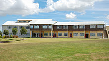
Demographics
Windsor Park covers 0.84 km2 (0.32 sq mi) [1] and had an estimated population of 1,710 as of June 2023, [2] with a population density of 2,036 people per km2.
Historical population| Year | Pop. | ±% p.a. |
|---|
| 2006 | 1,500 | — |
|---|
| 2013 | 1,614 | +1.05% |
|---|
| 2018 | 1,683 | +0.84% |
|---|
| Source: [4] |
Windsor Park had a population of 1,683 at the 2018 New Zealand census, an increase of 69 people (4.3%) since the 2013 census, and an increase of 183 people (12.2%) since the 2006 census. There were 642 households, comprising 747 males and 936 females, giving a sex ratio of 0.8 males per female. The median age was 43.3 years (compared with 37.4 years nationally), with 258 people (15.3%) aged under 15 years, 315 (18.7%) aged 15 to 29, 675 (40.1%) aged 30 to 64, and 438 (26.0%) aged 65 or older.
Ethnicities were 49.7% European/Pākehā, 3.2% Māori, 1.6% Pacific peoples, 47.2% Asian, and 3.0% other ethnicities. People may identify with more than one ethnicity.
The percentage of people born overseas was 58.6, compared with 27.1% nationally.
Although some people chose not to answer the census's question about religious affiliation, 49.4% had no religion, 39.0% were Christian, 0.2% had Māori religious beliefs, 1.4% were Hindu, 0.7% were Muslim, 2.5% were Buddhist and 1.6% had other religions.
Of those at least 15 years old, 471 (33.1%) people had a bachelor's or higher degree, and 168 (11.8%) people had no formal qualifications. The median income was $27,300, compared with $31,800 nationally. 222 people (15.6%) earned over $70,000 compared to 17.2% nationally. The employment status of those at least 15 was that 558 (39.2%) people were employed full-time, 174 (12.2%) were part-time, and 33 (2.3%) were unemployed. [4]

Dannevirke, is a rural service town in the Manawatū-Whanganui region of the North Island, New Zealand. It is the main centre of the Tararua District.

Tokomaru Bay is a small beachside community on the remote East Coast of New Zealand's North Island. It is 91 km north of Gisborne, on State Highway 35, and close to Mount Hikurangi. The district was originally known as Toka-a-Namu, which refers to the abundance of sandflies. Over the years the name was altered to Tokomaru Bay.
Kaikohe is the seat of the Far North District of New Zealand, situated on State Highway 12 about 260 km from Auckland. It is the largest inland town and highest community above sea level in the Northland Region. With a population of over 4000 people it is a shopping and service centre for an extensive farming district and is sometimes referred to as "the hub of the north".

Richmond is a town and the seat of the Tasman District Council in New Zealand. It lies 13 kilometres (8 mi) south of Nelson in the South Island, close to the southern extremity of Tasman Bay. The town, first settled by Europeans in 1842, was named in 1854 after the town of Richmond on Thames near London. The town has an estimated population of 19,200 as of June 2023.

Murupara is a town in the Whakatāne District and Bay of Plenty Region of New Zealand's North Island. The town is in an isolated part of the region between the Kaingaroa Forest and Te Urewera protected area, on the banks of the Rangitaiki River, 65 kilometres southeast of Rotorua. Indigenous Māori also make up over 90% of the population.

Papamoa or Papamoa Beach is a suburb of Tauranga, located about 11 kilometres from the city centre. It is the largest residential suburb in Tauranga. It is bordered to the west by Arataki and Mount Maunganui, the east by the Kaituna River and to the south by State Highway 2.
Flaxmere is a township in the Hastings District and outlying suburb of Hastings City, in the Hawke's Bay Region of New Zealand's North Island. It consists of a series of cul-de-sacs, radiating from a main street.
Moerewa is a small town in the Northland Region of the North Island of New Zealand. It is located close to the Bay of Islands five kilometres to the west of Kawakawa.

Ōtaki is a town in the Kāpiti Coast District of the North Island of New Zealand, situated half way between the capital city Wellington, 70 km (43 mi) to the southwest, and Palmerston North, 70 km (43 mi) to the northeast.

Seatoun, an eastern suburb of Wellington, the capital city of New Zealand, lies on the east coast of the Miramar Peninsula, close to the entrance to Wellington Harbour, some seven kilometres southeast of the CBD. The suburb sits on an exposed promontory close to Barrett Reef, a dangerous area of rocky shallows upon which many ships have foundered, most notably the inter-island ferry TEV Wahine in 1968.

Matauri Bay is a bay in New Zealand, situated 30 km north of Kerikeri, in Whangaroa county, just north of the Bay of Islands. It has over a kilometre of white sand and crystal clear water, making it a popular summer destinations for surfers, divers, fishers and holidaymakers.
Onekawa is a suburb of the city of Napier, in the Hawke's Bay Region of the eastern North Island of New Zealand. Development of the suburb began in the late 1940s, after the land was acquired from then-Harbour Board.
Kennedy Bay is a locality in the north eastern Coromandel Peninsula of New Zealand. The Harataunga and Omoho Streams flow from the Coromandel Range past the settlement and into the bay to the east.

Clendon Park is a suburb of Auckland in northern New Zealand. It is located to the west of Manurewa and north of Weymouth. The suburb is in the Manurewa-Papakura ward, one of the 21 local boards of Auckland Council.
Waioeka is a rural community in the Ōpōtiki District and Bay of Plenty Region of New Zealand's North Island. It is on the east bank of the Waioeka River.
Welcome Bay is a suburb of Tauranga, New Zealand. It is located 7 kilometres (4.3 mi) from central Tauranga. Neighbouring suburbs include Hairini and Maungatapu. There are a number of schools in Welcome Bay, including three primary schools.
Mangakakahi is a suburb of Rotorua in the Bay of Plenty Region of New Zealand's North Island.

Masterton East is a suburb of Masterton, a town on New Zealand's North Island.
Rānui is a suburb of West Auckland, New Zealand, which is under the local governance of Auckland Council. The area is densely populated but close to the western fringe of the Auckland urban area.
Newfield is a suburb in the New Zealand city of Invercargill.