
South Yorkshire is a ceremonial county in the Yorkshire and the Humber region of England. It borders North Yorkshire and West Yorkshire to the north, the East Riding of Yorkshire to the north-east, Lincolnshire to the east, Nottinghamshire to the south-east, and Derbyshire to the south and west. The largest settlement is the city of Sheffield.
Anston is a civil parish in South Yorkshire, England, formally known as North and South Anston. The parish of Anston consists of the settlements of North Anston and South Anston, divided by the Anston Brook.

The River Rother, a waterway in the northern midlands of England, gives its name to the town of Rotherham and to the Rother Valley parliamentary constituency. It rises in Pilsley in Derbyshire and flows in a generally northwards direction through the centre of Chesterfield, where it feeds the Chesterfield Canal, and on through the Rother Valley Country Park and several districts of Sheffield before joining the River Don at Rotherham in Yorkshire. Historically, it powered mills, mainly corn or flour mills, but most had ceased to operate by the early 20th century, and few of the mill buildings survive.

The Moss is a brook in North East Derbyshire, England.

Wales is a village and a civil parish in the Metropolitan Borough of Rotherham in South Yorkshire, England. Historically part of the West Riding of Yorkshire, it borders to the south Derbyshire and is astride the M1 motorway. The civil parish of Wales, which has a population of 6,455, increasing to 7,069 at the 2011 Census, encompasses the village and neighbouring settlement Kiveton Park.

Treeton is a village and civil parish of the Metropolitan Borough of Rotherham in South Yorkshire, England. It is located about 4 miles (6 km) south of the town of Rotherham and 5 miles (8 km) east of Sheffield City Centre.
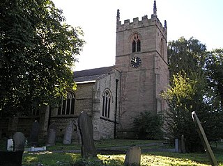
Killamarsh is a village and civil parish in North East Derbyshire, England, bordering Rotherham to the north and Sheffield to the north-west.
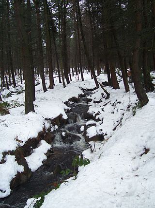
The Limb Brook is a stream in Sheffield, South Yorkshire, England. It rises at the village of Ringinglow, flowing east through Whirlow and Ecclesall Woods into Abbeydale in the Beauchief area, where it merges with the River Sheaf. Near this point part of the stream has been diverted to provide the goit for the Abbeydale Industrial Hamlet millpond, and this channel flows through what is now Beauchief Gardens.

Orgreave Colliery was a coal mine situated adjacent to the main line of the Manchester, Sheffield & Lincolnshire Railway about 5 miles (8 km) east of Sheffield and 3.5 miles (6 km) south west of Rotherham. The colliery is within the parish of Orgreave, from which it takes its name.
The Sheffield Coal Company was a colliery owning and coal selling company with its head office situated in South Street, Sheffield, South Yorkshire, England.

Brinsworth is a village and civil parish in the Metropolitan Borough of Rotherham, in South Yorkshire, England. It is situated close to the River Rother between Rotherham and Sheffield. At the time of the 2001 census it had a population of 8,950, reducing to 8,789 at the 2011 Census.
Ulley is a village and civil parish of the Metropolitan Borough of Rotherham in South Yorkshire, England. The population of the civil parish as of the 2011 census was 172. It is located about 4 miles (6 km) south of the town of Rotherham and 7 miles (11 km) east of Sheffield City Centre.
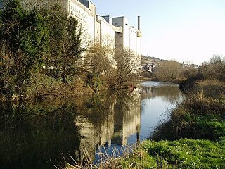
The Rother Link is a planned English canal that would connect the Chesterfield Canal at Killamarsh, via the River Rother through to the Sheffield and South Yorkshire Navigation, thus creating a new cruising ring and encouraging boats to visit the Chesterfield Canal.
National Cycle Route 6 is a route of the National Cycle Network, running from London to the Lake District.
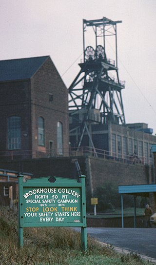
Brookhouse Colliery was a coal mine within the Metropolitan Borough of Rotherham, South Yorkshire, England. It was operational between 1929 and 1985.
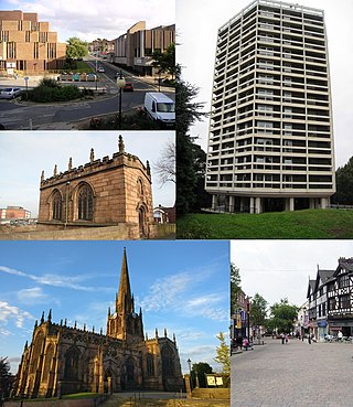
Rotherham is a minster town in South Yorkshire, England. It is the largest settlement in the Metropolitan Borough of Rotherham. Rotherham is named after the River Rother, one of two major rivers to flow through the town.

The River Drone is a river which flows south from its source on the Sheffield, South Yorkshire, border. It flows through Dronfield, Unstone and Unstone Green in Derbyshire before merging at Sheepbridge to the north of Chesterfield with the Barlow Brook. Below the junction, it is often referred to as the River Whitting. It then flows south-east till it merges with the River Rother at Brimington Road North (B6050) at Chesterfield. It is one of the three main tributaries of the Rother.

Beighton is a village 6 miles south-east of Sheffield's city centre, now classed as a historic township of the city. Due to much expansion, the village became a part of Sheffield city in 1967, and was transferred from Derbyshire to the newly created South Yorkshire, England. During much of the late 17th to 19th centuries the village was noted for its edge tool manufacturing, with Thomas Staniforth & Co Sickle works being based at nearby Hackenthorpe.
Thrybergh Country Park is a reservoir and nature reserve in South Yorkshire. It is located between Thrybergh and Hooton Roberts on the outskirts of Rotherham and opened in 1983.
Gulliver's Valley is a theme park and resort located in Rotherham, England. Construction began in 2018 at a planned cost of £37 million. The first phase, costing £7.5 million, was due to open in spring 2020 but the opening was delayed due to the coronavirus pandemic. The park officially opened on 11 July 2020.


