New Gloucester is a town in Cumberland County, Maine, United States. New Gloucester is included in the Lewiston-Auburn, Maine metropolitan New England city and town area. It is home to the Sabbathday Lake Shaker Village, the last active Shaker village in the U.S. The town's population was 5,676 at the 2020 census.

Pownal is a town in Cumberland County, Maine, United States. Pownal was included in the Lewiston-Auburn, Maine metropolitan New England city and town area. The population was 1,566 at the 2020 census. It is part of the Portland–South Portland–Biddeford, Maine Metropolitan Statistical Area. Pownal is home to Bradbury Mountain State Park.

The Midstate Trail is a scenic footpath which runs 92 miles (148 km) through Worcester County, Massachusetts, from the Rhode Island border to the New Hampshire border, approximately 45 miles (72 km) west of Boston. The trail is considered highly accessible, scenic, and remarkably rural despite its proximity to urban Boston. The trail includes the summits of Mount Wachusett and Mount Watatic, as well as many interesting geologic, historic, and natural features.

The Presumpscot River is a 25.8-mile-long (41.5 km) river located in Cumberland County, Maine, United States. It is the main outlet of Sebago Lake. The river provided an early transportation corridor with reliable water power for industrial development of the city of Westbrook and the village of South Windham.

The Salmon River is formed at the confluence of the Blackledge and Jeremy rivers about one mile west of North Westchester, Connecticut. It drains 96,000 acres and courses for 10.4 miles (16.7 km) to Salmon Cove near Moodus where it flows into the Connecticut River. The Salmon River is probably the largest stream and watershed whose sources and mouth are entirely within the limits of Connecticut.

The Royal River is a small river, 39 miles (63 km) long, in southern Maine. The river originates in Sabbathday Lake in New Gloucester and flows northeasterly into Auburn and then southerly through New Gloucester, Gray and North Yarmouth into Casco Bay at Yarmouth.

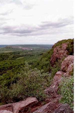
Higby Mountain or Mount Higby 892 feet (272 m), is a traprock mountain ridge located 3.75 miles (6.04 km) east of Meriden, Connecticut. It is part of the narrow, linear Metacomet Ridge that extends from Long Island Sound near New Haven, Connecticut, north through the Connecticut River Valley of Massachusetts to the Vermont border. Higby Mountain is known for its high cliff faces, unique microclimate ecosystems, and rare plant communities. It rises steeply 600 feet (180 m) above the Quinnipiac River valley and the city of Meriden to the west as a continuous 2-mile (3 km) long ledge. The mountain is traversed by the 50-mile (80 km) Mattabesett Trail.

The Bay Circuit Trail and Greenway or Bay Circuit is a Massachusetts rail trail and greenway connecting the outlying suburbs of Boston from Plum Island in Newburyport to Kingston Bay in Duxbury, a distance of 200 miles (320 km).

Spencer State Forest is a Massachusetts state forest and recreation reserve located in the town of Spencer, managed by the Massachusetts Department of Conservation and Recreation. The 92 mile (148 km) Midstate Trail passes through the state forest. The Commonwealth of Massachusetts also conducts logging in some parts of the property.

Weir River is a short stream and estuary that empties into Hingham Bay, part of Boston Harbor in Massachusetts, United States. The name is attributed to the location of a fishing weir in the stream. The river gives its name to a larger watershed and Weir River Farm, a park and nature reserve owned by The Trustees of Reservations.

Bridgton is a town in Cumberland County, Maine, United States. The population was 5,418 at the 2020 census. A resort area in Maine's Lakes Region, Bridgton is home to Bridgton Academy, a private preparatory school, and the Four on the Fourth Road Race.

Yarmouth is a town in Cumberland County, Maine, United States, twelve miles north of the state's largest city, Portland. When originally settled in 1636, as North Yarmouth, it was part of the Massachusetts Bay Colony, and remained part of its subsequent incarnations for 213 years. In 1849, twenty-nine years after Maine's admittance to the Union as the twenty-third state, it was incorporated as the Town of Yarmouth.
The Watershed Institute, formerly known as the Stony Brook–Millstone Watershed Association, is a New Jersey nonprofit organization devoted to promoting and protecting the watersheds of central New Jersey's Stony Brook and Millstone River, along with associated natural resources and beauty.
The Land Trust for Tennessee is an non-profit conservation organization working to protect Tennessee's natural, scenic, and historic landscapes and sites. Since 1999, The Land Trust has conserved more than 135,000 acres (550 km2) of land across 65-plus Tennessee counties.
The West Side Trail is a multi-use trail in Yarmouth, Maine. A Town of Yarmouth project conceived in 1988 and opened in 2014, the trailhead for the eastern portion of the trail is in the parking lot of Tyler Technologies, on Tyler Drive, on the eastern side of U.S. Route 1, immediately before the exit 15 northbound on-ramp to Interstate 295 (I-295). The trailhead for the western section is in the park and ride lot at the southbound exit 15 ramp for I-295, to the west of Route 1.

Knight's Pond Preserve is a nature preserve and public park located in Cumberland and North Yarmouth, Maine, United States.

The Chebeague & Cumberland Land Trust is a volunteer-run conservation group based in Cumberland, Maine, United States. Established in 1987 and funded by its members, it owns many preserves and trail networks, and has assisted in the creation of town-owned parks and preserves. The trust, one of eighty land trusts in Maine, covers the towns of Cumberland and Chebeague Island.

The Maine Land Trust Network promotes discussion among the eighty land trusts in Maine, United States. It was established in 1995.


