Ruby, Arizona

Last updated

Ruby, Arizona
Ruby AZ.jpg
Ruby, Arizona in 1990
USA Arizona location map.svg
Red pog.svg
Ruby, Arizona
Location in the state of Arizona
Usa edcp location map.svg
Red pog.svg
Ruby, Arizona
Ruby, Arizona (the United States)
Coordinates: 31°27′40″N111°14′15″W / 31.46111°N 111.23750°W / 31.46111; -111.23750
Country United States
State Arizona
County Santa Cruz
Elevation
[1]
4,186 ft (1,276 m)
Time zone UTC-7 (MST (no DST))
Post office opened:April 11, 1912
Post office closed:May 31, 1941

Ruby is a ghost town in Santa Cruz County, Arizona, United States. It was founded as a mining town in Bear Valley, originally named Montana Camp, so named because the miners were mining at the foot of Montana Peak.

Contents

History

Schoolhouse in 2009 Ruby School.jpg
Schoolhouse in 2009
Ruby with view of Montana Peak RubyAZ 2007.jpg
Ruby with view of Montana Peak
Section of USGS Ruby, Arizona topographic map Ruby AZ topo.jpg
Section of USGS Ruby, Arizona topographic map

Mining started circa 1877. The Montana Mine produced gold, silver, lead, zinc and copper. At its peak in the mid-1930s, Ruby had a population of about 1,200. [2]

On April 11, 1912 the mining camp's general store owner Julius Andrews established the post office. Andrews named the post office "Ruby", after his wife, Lille B. Ruby Andrews, and the mining camp soon became known as Ruby. The post office was discontinued on May 31, 1941. [3]

Between 1920 and 1922, the town of Ruby and the surroundings were the scene of three double homicides known as the Ruby Murders, which led to the largest manhunt in the history of the Southwest, which included the first airplane ever used in an Arizona manhunt. [4] [5]

The most prosperous period for Ruby was in the late 1920s and 1930s, when the Eagle-Picher Mining Company operated the mine and upgraded the camp. From 1934 to 1937, the Montana mine was the leading lead and zinc producer in Arizona. In 1936, it was third in silver production. The mine closed in 1940, and by the end of 1941 Ruby was abandoned. [2]

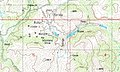
Ruby is one of the two best-preserved mining ghost towns in Arizona, along with the Vulture Mine near Wickenburg. Ruby's attractions today include approximately 25 buildings under roof, including the jail and houses, the school, the playground, mine machinery, buildings and mine workings. Ruby is entirely on private property and there is a charge for admission to the site. [2]

Public tours are occasionally offered through Pima Community College. [6]

See also

Related Research Articles

<span class="mw-page-title-main">Arivaca, Arizona</span> Unincorporated community in Pima County

Arivaca is an unincorporated community in Pima County, Arizona, United States. It is located 11 miles (18 km) north of the Mexican border and 35 miles (56 km) northwest of the port of entry at Nogales. The European-American history of the area dates back at least to 1695, although the community was not founded until 1878. Arivaca has the ZIP code 85601. The 85601 ZIP Code Tabulation Area had a population of 909 at the 2000 census.

<span class="mw-page-title-main">Gleeson, Arizona</span> Ghost town in Cochise County, Arizona

Gleeson is a ghost town situated in southeastern Cochise County, Arizona, United States. It has an estimated elevation of 4,924 feet (1,501 m) above sea level. The town was first settled as Turquoise in the 1870s in what was then the Arizona Territory, then later re-established as Gleeson in 1900.

<span class="mw-page-title-main">Kentucky Camp, Arizona</span> United States historic place

Kentucky Camp is a ghost town and former mining camp along the Arizona Trail in Pima County, Arizona, United States, near the community of Sonoita. The Kentucky Camp Historic District is listed on the National Register of Historic Places and has been since 1995. As it is located within Coronado National Forest, the United States Forest Service is responsible for the upkeep of the remaining buildings within the Kentucky Camp Historic District.

<span class="mw-page-title-main">Contention City, Arizona</span> Ghost town in Arizona, United States

Contention City or Contention is a ghost mining town in Cochise County in the southeastern part of the U.S. state of Arizona. It was occupied from the early-1880s through the late-1880s in what was then known as the Arizona Territory. Only a few foundations now remain of this boomtown which was settled and abandoned with the rise and fall of silver mining in and around the area of Tombstone.

<span class="mw-page-title-main">Tiger, Arizona</span> Former populated place in Pinal County, Arizona

Tiger is a former populated place in Pinal County in the U.S. state of Arizona. The town was settled as Schultzcirca 1881 in what was then the Arizona Territory, then later reestablished as Tiger after World War I.

Silver mining in Arizona was a powerful stimulus for exploration and prospecting in early Arizona. Cumulative silver production through 1981 totaled 490 million troy ounces. However, only about 10% of Arizona's silver production came from silver mining. More than 80% of the state's silver was a byproduct of copper mining; other silver came as a byproduct of lead, zinc, and gold mining.

<span class="mw-page-title-main">Frisco, Utah</span> Ghost town in Utah, United States

Frisco is a ghost town in Beaver County, Utah, United States. It was an active mining camp from 1879 to 1929. At its peak in 1885, Frisco was a thriving town of 6,000 people.

<span class="mw-page-title-main">Castle Dome Mountains</span> Landform in Yuma County, Arizona, US

The Castle Dome Mountains are a mountain range in Yuma County, Arizona, within the Kofa National Wildlife Refuge. Castle Dome Peak, the high point of the range, is a prominent butte and distinctive landmark. The peak is 3,780 feet (1,152 m) high, and is located at 33°05′04″N 114°08′36″W. Castle Dome was named by American soldiers at old Fort Yuma in the 1880s. Early Spanish explorers called the same peak Cabeza de Gigante, "Giant's Head."

<span class="mw-page-title-main">Castle Dome Landing, Arizona</span> Ghost town in Yuma County, Arizona

Castle Dome Landing, Arizona is a ghost town in the Castle Dome Mountains of Yuma County in the U.S. state of Arizona. It was first settled as a transport depot and mining camp around 1863 in what was then the Arizona Territory.

<span class="mw-page-title-main">Helvetia, Arizona</span> Ghost town in Pima County, Arizona

Helvetia is a ghost town in Pima County, Arizona, United States that was settled in 1891 and abandoned in the early 1920s. Helvetia is an ancient name for Switzerland. Today, only the Ray Mine and cemetery are visitable, as the rest of the town has been fenced off due to active mining operations.

<span class="mw-page-title-main">Harshaw, Arizona</span> Ghost town in Arizona, United States

Harshaw is a ghost town in Santa Cruz County in the southeastern part of the U.S. state of Arizona. The town was settled in the 1870s, in what was then Arizona Territory. Founded as a mining community, Harshaw is named after the cattleman-turned-prospector David Tecumseh Harshaw, who first successfully located silver in the area. At the town's peak near the end of the 19th century, Harshaw's mines were among Arizona's highest producers of ore, with the largest mine, the Hermosa, yielding approximately $365,455 in bullion over a four-month period in 1880.

Cerro Colorado is a ghost town in southern Pima County, Arizona. The town is located off Arivaca Road, near Arivaca, and is best known for the massacre of mining employees by Mexican outlaws and buried treasure.

<span class="mw-page-title-main">Ruby Murders</span> Murders of 6 people near Ruby, Arizona (1920–1922)

The Ruby Murders is the popular name for three separate incidents involving the deaths of six American citizens near the town of Ruby, Arizona. The first incident occurred in February 1920 when Mexican bandits robbed and killed the two owners of the Ruby Mercantile. A second attack happened in April 1921 when Mexican bandits robbed and killed the store's new owners. Two of the bandits were arrested for the crime, but they briefly escaped custody in July 1922 after killing another two men, which led to the largest manhunt in the history of the Southwest.

Rimini, is a ghost town in Lewis and Clark County, Montana, United States. It is one of the oldest mining districts in the state. It was established when silver lodes were discovered in 1864. Other names for the district were Lewis and Clark, Tenmile, Vaughn, Colorado, and Bear Gulch. It was the site of Camp Rimini.

<span class="mw-page-title-main">Mineral Park mine</span> Copper mine in Mohave County, Arizona

The Mineral Park mine is a large open pit copper mine located in the Cerbat Mountains 14 miles northwest of Kingman, Arizona, in the southwestern United States. A 2013 report said that Mineral Park has an estimated reserves of 389 million tonnes of ore grading 0.14% copper and 31 million oz of silver.

<span class="mw-page-title-main">Twin Buttes, Pima County, Arizona</span> Town

Twin Buttes is a populated place on the east flank of the Sierrita Mountains approximately twenty miles south of Tucson, in Pima County, Arizona, United States. Named after a prominent hill located next to the town, Twin Buttes was founded as a small mining town circa 1903 and abandoned around 1930. Much of the actual town site is now buried underneath mine tailings, and all that remains is the Twin Buttes Cemetery.

<span class="mw-page-title-main">Sierrita Mountains</span> Landform in Pima County, Arizona

The Sierrita Mountains is a minor mountain range about forty miles southwest of Tucson, in Pima County, Arizona. Historically, the area has seen extensive mining and ranching activity: several ranches, abandoned mines, and the large Sierrita Mine are located in the area. The highest point in the mountains is Keystone Peak, which rises to 6,188 feet (1,886 m).

<span class="mw-page-title-main">San Xavier, Arizona</span> Populated place in Arizona, United States

San Xavier is a populated place in Pima County, Arizona, United States, situated seventeen miles southwest of Tucson, and six miles northwest of Sahuarita. Originally a small silver mining camp from the 1880s, today San Xavier is little more than a collection of rural homes and partially abandoned mines. The ghost towns of Azurite and Mineral Hill were located about one mile north of San Xavier. Twin Buttes was five miles southeast.

<span class="mw-page-title-main">Silver Bell, Arizona</span> Ghost town in Arizona, United States

Silver Bell is a ghost town in the Silver Bell Mountains in Pima County, Arizona, United States. The name "Silver Bell" refers to a more recent ghost town, which was established in 1954 and abandoned in 1984. The original town, established in 1904, was named "Silverbell" and abandoned in the early 1930s. Both towns were utilized and later abandoned due to the mining of copper in the area.

<span class="mw-page-title-main">Duquesne, Arizona</span> Ghost town in Santa Cruz County, Arizona

Duquesne is a ghost town in the Patagonia Mountains in eastern Santa Cruz County, Arizona, near the international border with Sonora, Mexico. The town, which is currently under private ownership and closed to the public although the roads are almost all public, was once the headquarters of the Duquesne Mining and Reduction Company and is the site of the Bonanza Mine. Washington Camp is approximately one mile northwest of Duquesne and was where the mine's reduction plant was located.

References

  1. U.S. Geological Survey Geographic Names Information System: Ruby
  2. 1 2 3 Philip Varney, 1994, Arizona ghost towns and mining camps. Arizona Highways books, ISBN   0-916179-44-3
  3. Granger, Byrd H. (1970) Arizona Place Names, pp. 323-324, Tucson, Arizona: University of Arizona Press, ISBN   0-8165-0009-6
  4. "Ruby, Arizona - A Ghost Town Filled With Mining and Murder". Legends of America.
  5. Sherman, James (1969). Ghost towns of Arizona. US: University of Oklahoma Press. p. 131. ISBN   0-8061-0843-6.
  6. Pima College ST-210

Further reading