Tubac, Arizona

Last updated

Tubac, Arizona
Tubac Church.jpg
St. Ann's Church, Tubac, 1937
Santa Cruz County Incorporated and Unincorporated areas Tubac highlighted.svg
Location in Santa Cruz County and the state of Arizona
Urritiamapoftubac.jpg
18th century map of Tubac and surroundings
USA Arizona location map.svg
Red pog.svg
Tubac
Location in Arizona
Usa edcp location map.svg
Red pog.svg
Tubac
Location in the United States
Coordinates: 31°37′32″N111°3′7″W / 31.62556°N 111.05194°W / 31.62556; -111.05194
Country United States
State Arizona
County Santa Cruz
Area
[1]
  Total10.85 sq mi (28.10 km2)
  Land10.85 sq mi (28.09 km2)
  Water0.00 sq mi (0.01 km2)
Elevation
3,209 ft (978 m)
Population
 (2020)
  Total1,581
  Density145.75/sq mi (56.28/km2)
Time zone UTC-7 (MST (no DST))
ZIP codes
85640, 85646
Area code 520
FIPS code 04-75940
GNIS feature ID0035489

Tubac is a census-designated place (CDP) in Santa Cruz County, Arizona, United States. The population was 1,191 at the 2010 census. [2] The place name "Tubac" is an English borrowing from a Hispanicized form of the O'odham name Cuwak, which translates into English as "place of dark water". [3] When first taken into Spanish speech, it was spelled Tubaca. Finally, over time, the latter "a" was dropped. [4] Tubac is situated on the Santa Cruz River.

Contents

Tubac was the original Spanish colonial garrison in Arizona. It was depopulated during the O'odham Uprising in the 18th century. During the 19th century, the area was repopulated by miners, farmers and ranchers, but the town of Tubac is best known today as an artists' colony.

History

Established in 1752 as a Spanish presidio, the first Spanish colonial garrison in what is now Arizona, Tubac was one of the stops on the Camino Real (the "Royal Road") from Mexico to the Spanish settlements in California.

Tubac's most famous Spanish resident was Juan Bautista de Anza. While stationed at Tubac (1760–1776), de Anza built the chapel of Santa Gertrudis, the foundations of which lie beneath today's St. Ann's Church.

Apaches attacked the town repeatedly in the 1840s, forcing the Sonoran Mexicans to abandon both Tumacacori and Tubac.

Tubac was the scene of a four-day siege in 1861 among the population of Tubac, Confederate militia, and Apache warriors. [5]

The Confederates won and the Confederate flag used by the headquarters in Richmond was raised. When Union troops then started to approach Tucson, the Confederate troops left Tubac. There the town lay abandoned; grass grew in the streets and the adobe houses crumbled away. [6]

From the 1930s–1960s, Tubac evolved into an art colony. Painter Dale Nichols opened an art school in the small desert village in 1948 and restored some of Tubac's historic buildings. Students included watercolorist Al Romo and sculptor Bob Brisley. In 1955, artist Ross Stefan established a studio in the village. In 1961, the Santa Cruz Valley Art Association was formed with 80 members. This group founded the Tubac Festival of the Arts in 1964. [7] Other significant artists in the Village included Sophie and Harwood Steiger, Hal Empie and Hugh Cabot.

Geography

Tubac is located at 31°37′32″N111°3′7″W / 31.62556°N 111.05194°W / 31.62556; -111.05194 (31.625462, -111.051921). [8]

According to the United States Census Bureau, the CDP has a total area of 10.8 square miles (28.0 km2), all land. [2]

Demographics

Historical population
CensusPop.Note
2020 1,581
U.S. Decennial Census [9]

2010 census

As of the census of 2010, there were 1,191 people residing in Tubac. The racial makeup of Tubac was 76.7% non-Hispanic White, 0.6% Native American, 0.4% Black or African American, 0.59% Asian, 6.5% from other races, and 1.1% from two or more races. 20.7% of the population were Hispanic or Latino of any race.

In Tubac 1.5% of the population was age 0–4, 4.7% from 5 to 17, 51.0% from 18 to 64, and 42.5% 65 years of age or older. The population of Tubac is 52.4% female and 47.6% male.

2000 census

As of the census [10] of 2000, there were 949 people, 481 households, and 303 families residing in the CDP. The population density was 115.9 inhabitants per square mile (44.7/km2). There were 569 housing units at an average density of 69.5 per square mile (26.8/km2). The racial makeup of the CDP was 88.7% White, 1.2% Native American, 0.4% Asian, 9.0% from other races, and 0.7% from two or more races. 18.2% of the population were Hispanic or Latino of any race.

There were 481 households, out of which 12.5% had children under the age of 18 living with them, 59.3% were married couples living together, 2.9% had a female householder with no husband present, and 36.8% were non-families. 32.6% of all households were made up of individuals, and 21.0% had someone living alone who was 65 years of age or older. The average household size was 1.97 and the average family size was 2.45.

In the CDP, the population was spread out, with 12.3% under the age of 18, 2.5% from 18 to 24, 12.1% from 25 to 44, 37.8% from 45 to 64, and 35.2% who were 65 years of age or older. The median age was 58 years. For every 100 females, there were 92.5 males. For every 100 females age 18 and over, there were 89.5 males.

The median income for a household in the CDP was $39,444, and the median income for a family was $59,375. Males had a median income of $36,528 versus $30,268 for females. The per capita income for the CDP was $46,643. About 2.1% of families and 6.6% of the population were below the poverty line, including none of those under age 18 and 7.9% of those age 65 or over.

Arts and culture

The remains of the old Spanish presidio are preserved by Tubac Presidio State Historic Park. The park also features a regional museum, an underground archeology display, and other historic buildings. Modern Tubac is home to over 100 art galleries, home decor boutiques, gift shops, jewelers, potters, and artists of every kind. [11] There is a very active art school, along with several restaurants and a golf resort nestled along a verdant valley with one of the oldest stands of cottonwoods in the state. [12]

Historic ruins and structures in Tubac which includes the Presidio Captains Quarters, St. Ann's Catholic Church, the Tubac schoolhouse and various historic residences.

Notable people

Congressman Will Rogers, Jr. retired to a ranch near Tubac and is buried at the Tubac Cemetery. [13]

Related Research Articles

<span class="mw-page-title-main">Santa Cruz County, Arizona</span> County in Arizona, United States

Santa Cruz is a county in southern Arizona, United States. As of the 2020 census, the population is 47,669. The county seat is Nogales. The county was established in 1899. It borders Pima County to the north and west, Cochise County to the east, and the Mexican state of Sonora to the south.

<span class="mw-page-title-main">Pine, Arizona</span> CDP in Gila County, Arizona

Pine is an unincorporated community and census-designated place (CDP) in Gila County, Arizona, United States. The population was 1,963 at the 2010 census. Pine was established by four Mormon families in 1879.

<span class="mw-page-title-main">Strawberry, Arizona</span> CDP in Gila County, Arizona

Strawberry is an unincorporated community and census-designated place (CDP) in Gila County, Arizona, United States. The population was 961 at the 2010 census.

<span class="mw-page-title-main">Sun Lakes, Arizona</span> CDP in Maricopa County, Arizona

Sun Lakes is an unincorporated community and census-designated place (CDP) in Maricopa County, Arizona, United States. The population was 14,868 at the 2020 census. Sun Lakes is an active adult community comprising five country club communities in three homeowner associations. These include the gated communities of Oakwood and IronWood (IronOaks), the gated and non-gated communities of Palo Verde and Cottonwood, and the non-gated community of Sun Lakes 1. Sun Lakes is a master-planned community developed by Robson Communities.

<span class="mw-page-title-main">Avra Valley, Arizona</span> CDP in Pima County, Arizona

Avra Valley is a census-designated place (CDP) in Pima County, Arizona, United States. The population was 6,050 at the 2010 census, up from 5,038 in 2000.

<span class="mw-page-title-main">Green Valley, Arizona</span> CDP in Pima County, Arizona

Green Valley is an unincorporated community and census-designated place (CDP) in Pima County, Arizona, United States. The population was 22,616 at the 2020 census.

<span class="mw-page-title-main">Sells, Arizona</span> CDP in Pima County, Arizona

Sells is an unincorporated community and census-designated place (CDP) in Pima County, Arizona, United States. The population was 2,799 at the 2000 census. It is the capital of the Tohono O'odham Nation and the home of several of their tribal businesses, such as Tohono O'Odham Ki:Ki Association. Originally named Indian Oasis, by cattle-ranchers/businessmen brothers, Joseph and Louis Ménager in 1912. The Ménager brothers also built and ran the Indian Oasis Mercantile Store. The settlement took its present English name in 1918 to honor Indian Commissioner Cato Sells. The O'odham name means "Tortoise Got Wedged".

<span class="mw-page-title-main">Three Points, Arizona</span> CDP in Arizona, United States

Three Points is a census-designated place (CDP) in Pima County, Arizona, United States. The population was 5,581 at the 2010 census.
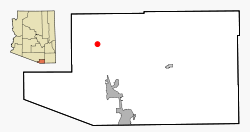
<span class="mw-page-title-main">Valencia West, Arizona</span> CDP in Pima County, Arizona

Valencia West is a census-designated place (CDP) in Pima County, Arizona, United States. The population was 9,355 at the 2010 census, a 293% increase over the population of 2,380 in 2000.

<span class="mw-page-title-main">Sacaton, Arizona</span> CDP in Pinal County, Arizona

Sacaton is a census-designated place (CDP) in Pinal County, Arizona, United States. The population was 3,254 at the 2020 census. It is the capital of the Gila River Indian Community.

<span class="mw-page-title-main">Stanfield, Arizona</span> CDP in Pinal County, Arizona

Stanfield is a census-designated place (CDP) in Pinal County, Arizona, United States. The population was 651 at the 2000 census. Shamrock Farms operates a farm in Stanfield.

<span class="mw-page-title-main">Amado, Arizona</span> CDP in Santa Cruz County, Arizona

Amado is a census-designated place (CDP) in Santa Cruz County, Arizona, United States. The population was 295 at the 2010 census.

<span class="mw-page-title-main">Sonoita, Arizona</span> CDP in Santa Cruz County, Arizona

Sonoita is a census-designated place (CDP) in Santa Cruz County, Arizona, United States. The population was 803 at the 2020 census.

<span class="mw-page-title-main">Tumacacori, Arizona</span> Historic community in Santa Cruz County, Arizona

Tumacacori is an unincorporated community in Santa Cruz County, Arizona, United States, which abuts the community of Carmen. Together, the communities constitute the Tumacacori-Carmen census-designated place (CDP). The population of the CDP was 393 at the 2010 census.

Estates of Fort Lauderdale is a former census-designated place (CDP) in Broward County, Florida, United States. The population was 1,791 at the 2000 census. It now serves as a neighborhood that is split between Hollywood, Florida and Dania Beach, Florida. Contrary to its name, it is not part of Fort Lauderdale.

<span class="mw-page-title-main">Verde Village, Arizona</span> CDP in Yavapai County, Arizona

Verde Village is a census-designated place (CDP) in Yavapai County, Arizona, United States. The population was 11,605 at the 2010 census. It is a retirement and bedroom community for Cottonwood.

<span class="mw-page-title-main">San Elizario, Texas</span> City in Texas, United States

San Elizario is a city in El Paso County, Texas, United States. Its population was 13,603 at the 2010 census. It is part of the El Paso metropolitan statistical area. It lies on the Rio Grande, which forms the border between the United States and Mexico. The city of Socorro adjoins it on the west and the town of Clint lies to the north.

<span class="mw-page-title-main">Siege of Tubac</span> Event during the Apache Wars in Arizona

The siege of Tubac was a siege during the Apache Wars between settlers and militia of Confederate Arizona and the Chiricahua Apaches. The battle took place at Tubac in present-day southern Arizona. The actual dates of this engagement have been lost to time.

<span class="mw-page-title-main">Stotonic Village, Arizona</span> Community in Pinal County, Arizona, US

Stotonic is a census-designated place (CDP) in Pinal County, Arizona, United States, located in the Gila River Indian Community. The population was 659 at the 2010 census. Stotonic Village has a median household income of $2,499 – the lowest of any CDP in Arizona

Comobabi is both a census-designated place (CDP) and a populated place in Pima County, Arizona, United States. The population was 8 at the 2010 census. It is located within the Tohono O'odham Indian Reservation.

References

  1. "2020 U.S. Gazetteer Files". United States Census Bureau. Retrieved October 29, 2021.
  2. 1 2 "Geographic Identifiers: 2010 Demographic Profile Data (G001): Tubac CDP, Arizona". U.S. Census Bureau, American Factfinder. Archived from the original on February 12, 2020. Retrieved December 4, 2012.
  3. Staff, azfamily com News. "What's in a name: Tubac". AZFamily. Retrieved February 1, 2021.
  4. Dobyns, H.F. (1959). "TubacThrough Four Centuries: An Historical Resume and Analysis, The Arizona State Parks Board". Parentseyes.arizona.edu. Archived from the original on July 2, 2010. Retrieved November 29, 2013.
  5. Walker A. Tompkins, Santa Barbara History Makers. McNally & Loftin, 1983. p. 105. ISBN   0-87461-059-1
  6. "The Arizona Sentinel Newspaper". chroniclingamerica.loc.gov. March 22, 1879. p. 1. Retrieved August 1, 2023.
  7. "Tubac Center of the Arts, History". tubacarts.org. Archived from the original on November 11, 2016. Retrieved August 1, 2023.
  8. "US Gazetteer files: 2010, 2000, and 1990". United States Census Bureau. February 12, 2011. Retrieved April 23, 2011.
  9. "Census of Population and Housing". Census.gov. Retrieved June 4, 2016.
  10. "U.S. Census website". United States Census Bureau . Retrieved January 31, 2008.
  11. "tubacvillager Publisher Publications - Issuu". issuu.com.
  12. "Home". Tubac Center of the Arts.
  13. Tubac's 'cementery': Fascinating, right down to the name, Green Valley News

Commons-logo.svg Media related to Tubac, Arizona at Wikimedia Commons