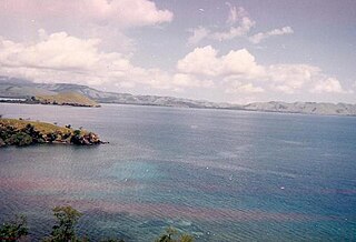
Sikka is a regency within East Nusa Tenggara province, Indonesia, on the island of Flores. It is bordered to the west by Ende Regency and to the east by East Flores Regency. It covers an area of 1,731.91 km2 and had a population of 300,301 at the 2010 census and 321,953 at the 2020 Census; the official estimate as at mid 2022 was 326,999. The capital is the town of Maumere, which comprises the districts of Alok Barat, Alok and Alok Timur.

Bangkalan Regency is a regency of East Java province in Indonesia. The seat of its government is the town of Bangkalan. The regency is located on the west side of Madura Island, bordering with Sampang Regency to the east, Java Sea to the north and Madura Strait to the west and the south sides. It covers an area of 1,260.14 km2, and had a population of 906,761 at the 2010 census and reached 1,060,377 at the 2020 census; the official estimate as at mid 2022 was 1,086,620 – comprising 535,522 males and 551,098 females.
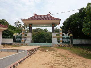
Sampang Regency is a regency of East Java province, Indonesia. It is situated on Madura Island, bordering on Pamekasan Regency to the east, the Java Sea to the north, Bangkalan Regency to the west and Madura Strait to the south. It covers an area of 1,233.3 km2, and had a population at the 2010 census of 877,772 and at the 2020 census of 969,694; the official estimate as at mid 2022 was 984,162 - comprising 488,673 males and 495,489 females. The administrative centre is the port of Sampang, on the south coast of Madura.

Indragiri Hulu is a landlocked regency (kabupaten) of Riau, Indonesia. It is located on the island of Sumatra. The original regency was split in two on 4 October 1999, with the western half being created as a separate Kuantan Singingi Regency. The regency now has an area of 8,198.71 km2 and had a population of 363,442 at the 2010 census, 408,704 at the 2015 census and 444,548 at the 2020 census; the official estimate as at mid 2022 was 464,076. The administrative seat of the regency is located at the town of Rengat.

North Bengkulu is a regency of Bengkulu Province, Indonesia, on the island of Sumatra. It originally covered much of the northern part of Bengkulu Province, but on 25 February 2003 the most northwesterly districts were split off to form a separate Mukomuko Regency, and on 24 June 2008 the most southeastern districts were likewise split off to create a new Central Bengkulu Regency. The residual regency now covers an area of 4,424.59 km2, and it had a population of 257,675 at the 2010 Census and 296,523 at the 2020 Census; the official estimate as at mid 2022 was 302,833. The administrative centre is at the town of Arga Makmur.
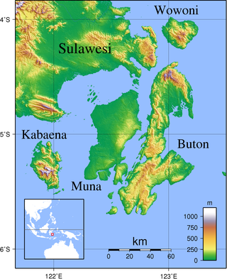
Kabaena or Tokotua is an island in the Flores Sea, Indonesia, off the coast of Sulawesi. Most of it is a part of Bombana Regency within Southeast Sulawesi province, although the southernmost district is administratively part of Central Buton Regency. The island's area is 891.49 km2 and its total population at the 2010 Census was 35,558 and at the 2020 Census was 42,877; the official estimate as at mid 2022 was 44,150.

Boalemo is a regency of Gorontalo Province, Indonesia. It is located on the northern peninsula of the island of Sulawesi. It was established in 1999 under Law Number 50/1999. It has an area of 1,831.33 km2, and had a population of 129,253 at the 2010 Census and 145,868 at the 2020 census; the official estimate as at mid 2022 was 148,526. The seat of the regency administration is the town of Tilamuta.

West Bangka Regency is a regency (kabupaten) of Bangka Belitung Islands Province, Indonesia. It comprises the northwestern part of Bangka Island, together with a number of small islands off its coast. The regency covers an area of 2,820.61 km2 and had a population of 175,110 at the 2010 Census, rising to 204,612 at the 2020 census; the official estimate as at mid 2022 was 209,791 - comprising 108,102 males and 101,689 females. The town of Muntok is its regency seat.

Mamuju Regency is a regency of West Sulawesi province, Indonesia. The regency capital is at Karema, while Mamuju town is the capital of West Sulawesi. The population of the regency was 336,879 at the 2010 Census, but it was substantially reduced by the creation of the new Central Mamuju Regency which was cut out of it on 14 December 2012. The reduced Mamuju Regency covers an area of 4,942.25 km2 and had a population of 278,764 at the 2020 Census; the official estimate as at mid 2022 was 285,616.

Dompu Regency is a regency of the Indonesian Province of West Nusa Tenggara. It is located on the island of Sumbawa and the capital is Dompu. It is bordered to the north and to the east by two non-contiguous parts of Bima Regency, and to the west by Sumbawa Regency, as well as on its coasts by Saleh Bay, Sanggar Bay, and Cempi Bay. It covers an area of 2,324.55 km2, and the population at the 2010 Census was 218,984 and at the 2020 Census was 236,665; the official estimate as at mid 2022 was 239,781.

West Sumbawa Regency is a Regency (Kabupaten) of the Indonesian Province of West Nusa Tenggara. It is located on the island of Sumbawa and has an area of 1,743.58 km2. The regency was created on 18 December 2003 from what were at that time the westernmost five districts (kecamatan) of Sumbawa Regency. The population at the 2010 Census was 114,754, and at the 2020 Census was 145,798; the official estimate as at mid 2022 was 151,775 - comprising 76,959 males and 74,816 females. The capital is the town of Taliwang.

East Flores Regency is a regency in East Nusa Tenggara province of Indonesia. Established in 1958, the regency has its seat (capital) in Larantuka on Flores Island. It covers a land area of 1,812.85 km2, and it had a population of 232,605 as of the 2010 census and 276,896 at the 2020 Census; the official estimate as at mid 2022 was 288,897. The regency encompasses the eastern tip of the island of Flores, together with all of the adjacent islands of Adonara and Solor to the east of Flores, with some much smaller offshore islands. On 4 October 1999 the island of Lembata at the eastern end of the Solor Archipelago was separated out from the East Flores Regency to create its own Regency.

Manggarai Regency is a regency in East Nusa Tenggara province of Indonesia, situated on the island of Flores. Established in 1958 the regency was reduced in size and population by the separation of West Manggarai Regency in 2003 and of East Manggarai Regency in 2007. The area of the residual Manggarai Regency is 1,344.03 km2 and its population was 292,037 at the 2010 census and 312,855 at the 2020 census; the official estimate as at mid 2022 was 317,646. The capital of the regency is the town of Ruteng.

Kupang Regency is a regency in East Nusa Tenggara province of Indonesia. It occupies the far western end of Timor Island, together with the small offshore island of Semau. Other islands to the southwest and west which were formerly part of Kupang Regency have been separated administratively - the Rote Islands Group on 10 April 2002, and the Savu Islands on 29 October 2008. The capital of Kupang Regency is at Oelamasi.

Katingan Regency is one of the thirteen regencies which comprise the Central Kalimantan Province on the island of Kalimantan (Borneo), Indonesia. It was created on 10 April 2002 from what were previously the eastern districts of East Kotawaringin Regency. The town of Kasongan is the capital of the Regency, which covers an area of 17,500 km2. The population of Katingan Regency was 146,439 at the 2010 Census and 162,222 at the 2020 Census; the official estimate as at mid 2022 was 163,989.

West Kotawaringin Regency is one of the thirteen regencies which comprise the Central Kalimantan Province on the island of Kalimantan (Borneo), Indonesia. It originally comprised the whole western part of the province, but on 10 April 2002 the most westerly districts were split off to form the new Lamandau Regency and Sukamara Regency. The population of the residual part of West Kotawaringin Regency was 235,803 at the 2010 Census and 270,388 at the 2020 Census; the official estimate as at mid 2022 was 274,935. The town of Pangkalan Bun in Arut Selatan District is the capital of West Kotawaringin Regency. The regency has an area of about 10,759 km2.

Ketapang Regency is a regency in the south of the province of West Kalimantan, on the island of Borneo in Indonesia. Ketapang Regency occupies an area of 31,588 km2, and at the census in 2010 it had 427,460 inhabitants following the splitting off of five districts in the north-west of the regency on 2 January 2007 to form the new North Kayong Regency; the 2020 census revealed a growth in population to 570,657 over the intervening decade; the official estimate as at mid 2022 was 591,917. The principal town lies at Ketapang.

The Banggai Archipelago is a group of islands, which are located at the far eastern end of Central Sulawesi, Indonesia. It makes up a regency (kabupaten) of Central Sulawesi Province of Indonesia, created on 4 October 1999 by splitting the existing Banggai Regency into a new Banggai Regency situated on the mainland of Sulawesi and a Banggai Islands Regency then comprising the entire archipelago. On 14 December 2012 a further splitting of the Regency was the removal of the more southerly seven districts to form a new Banggai Laut Regency.
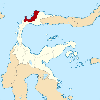
Tolitoli Regency is a regency of Central Sulawesi Province of Indonesia. It was previously part of a larger Buol Tolitoli Regency, but this was split into two on 4 October 1999 after rapid decentralization of the Indonesian government. The present Tolitoli Regency covers an area of 3,701.54 km2 and had a population of 211,296 at the 2010 Census and 225,154 at the 2020 Census; the official estimate as at mid 2022 was 228,641, comprising 116,514 male and 112,127 female inhabitants. Its regency seat is located at the town of Tolitoli, which is a port town and where its population is concentrated.
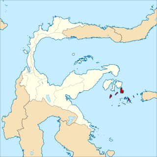
Banggai Sea Regency is a regency in the province of Central Sulawesi, Indonesia. The regency was established on 14 December 2012, partitioned from the Banggai Islands Regency. It comprises southern part of the Banggai Islands archipelago, including the main island of Banggai itself, the islands of Labobo and Bangkurung to the southwest of Banggai Island, and the numerous small Bokan Islands to the southeast. It covers a land area of 725.67 km2, and the districts now comprising the new Regency had a population of 62,183 at the 2010 Census and 70,435 at the 2020 Census; the official estimate as at mid 2022 was 71,350.


