Sadieville, Kentucky

Last updated

Sadieville, Kentucky
Sadieville-Main-St-ky.jpg
Main Street
Scott County Kentucky Incorporated and Unincorporated areas Sadieville Highlighted 2167656.svg
Location of Sadieville in Scott County, Kentucky.
Coordinates: 38°23′17″N84°32′58″W / 38.38806°N 84.54944°W / 38.38806; -84.54944
Country United States
State Kentucky
County Scott
Incorporated1880 [1]
Named for a respected area woman [2]
Area
[3]
  Total1.11 sq mi (2.88 km2)
  Land1.08 sq mi (2.81 km2)
  Water0.03 sq mi (0.07 km2)
Elevation
[4]
837 ft (255 m)
Population
 (2020)
  Total320
  Density295.48/sq mi (114.07/km2)
Time zone UTC-5 (Eastern (EST))
  Summer (DST) UTC-4 (EDT)
ZIP code
40370
Area code 502
FIPS code 21-67656
GNIS feature ID2405387 [4]
Website www.cityofsadieville.com

Sadieville is a home rule-class city in Scott County, Kentucky, in the United States. The population was 263 during the year 2000 U.S. Census. It is part of the Lexington-Fayette Metropolitan Statistical Area.

Contents

History

Sadieville is a railroad town, having grown up after the Cincinnati Southern Railroad was built through the area in 1876. The post office was established in 1878 and named for Sarah Martha "Sadie" Emison Pack, [5] a respected local. [2] The city was incorporated in 1880. [1]

The Burgess and Gano Company formerly made Sadieville the largest market for shipping yearling mules and colts in the United States. [6]

Geography

Sadieville is located where Ky. 32 crosses Eagle Creek. The site formerly boasted a covered bridge. [7] According to the United States Census Bureau, the city has a total area of 0.7 square miles (1.8 km2), all land.

Demographics

Historical population
CensusPop.Note
1890 170
1900 532212.9%
1910 467−12.2%
1920 448−4.1%
1930 52717.6%
1940 477−9.5%
1950 355−25.6%
1960 276−22.3%
1970 272−1.4%
1980 253−7.0%
1990 2550.8%
2000 2633.1%
2010 30315.2%
2020 3205.6%
U.S. Decennial Census [8]

As of the census [9] of 2000, there were 263 people, 96 households, and 79 families residing in the city. The population density was 371.8 inhabitants per square mile (143.6/km2). There were 114 housing units at an average density of 161.2 per square mile (62.2/km2). The racial makeup of the city was 93.54% White, 5.32% African American, and 1.14% from two or more races.

There were 96 households, out of which 43.8% had children under the age of 18 living with them, 70.8% were married couples living together, 9.4% had a female householder with no husband present, and 16.7% were non-families. 14.6% of all households were made up of individuals, and 11.5% had someone living alone who was 65 years of age or older. The average household size was 2.74 and the average family size was 3.00.

In the city, the population was spread out, with 30.0% under the age of 18, 6.5% from 18 to 24, 31.9% from 25 to 44, 22.1% from 45 to 64, and 9.5% who were 65 years of age or older. The median age was 35 years. For every 100 females, there were 90.6 males. For every 100 females age 18 and over, there were 84.0 males.

The median income for a household in the city was $39,583, and the median income for a family was $42,222. Males had a median income of $35,750 versus $20,500 for females. The per capita income for the city was $15,648. About 5.7% of families and 9.6% of the population were below the poverty line, including 6.3% of those under the age of eighteen and 25.0% of those 65 or over.

Notable residents

Related Research Articles

<span class="mw-page-title-main">Park City, Kentucky</span> City in Kentucky, United States

Park City is a home rule-class city in Barren County, Kentucky, United States. The population was 614 at the 2020 census. It is the entrance to nearby Mammoth Cave National Park and to Diamond Caverns, a privately owned cave attraction. Exit 48 off I-65 is the only direct access exit to the Mammoth Cave National Park.

<span class="mw-page-title-main">Salt Lick, Kentucky</span> City in Kentucky, United States

Salt Lick is a home rule-class city in Bath County, Kentucky, in the United States. The population was 303 at the 2010 U.S. Census.

<span class="mw-page-title-main">North Middletown, Kentucky</span> City in Kentucky, United States

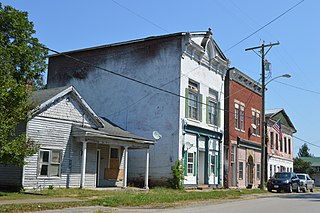
North Middletown is a home rule-class city in Bourbon County, Kentucky, in the United States. The population was 643 as of the 2010 census. North Middletown is part of the Lexington-Fayette Metropolitan Statistical Area.

<span class="mw-page-title-main">Highland Heights, Kentucky</span> City in Kentucky, United States

Highland Heights is a home rule-class city in Campbell County, Kentucky, in the United States. The population was 6,662 at the 2020 census.

<span class="mw-page-title-main">Prestonville, Kentucky</span> City in Kentucky, United States

Prestonville is a home rule-class city located at the confluence of the Ohio and Kentucky rivers in Carroll County, Kentucky, in the United States. It lies across the Kentucky River from Carrollton. The population was 161 at the 2010 U.S. Census.

<span class="mw-page-title-main">Sanders, Kentucky</span> City in Kentucky, United States

Sanders is a home rule-class city in Carroll County, Kentucky, in the United States. The population was 238 as of the 2010 census.

<span class="mw-page-title-main">Ewing, Kentucky</span> City in Kentucky, United States

Ewing is a home rule-class city in Fleming County, Kentucky, in the United States. The population was 264 at the 2010 census.

<span class="mw-page-title-main">Lancaster, Kentucky</span> City in Kentucky, United States

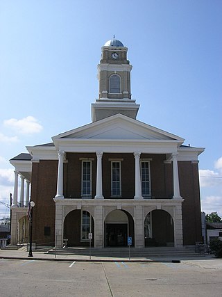
Lancaster is a home rule-class city in Garrard County, Kentucky, in the United States. It is the seat of its county. As of the year 2020 U.S. census, the city population was 3,901.

<span class="mw-page-title-main">Crittenden, Kentucky</span> City in Kentucky, United States

Crittenden is a home rule-class city in Grant and Kenton counties, Kentucky, in the United States. The population was 4,023 as of the 2020 Census, up from 3,815 as of the 2010 census, which was further up from 2,401 at the 2000 census.

<span class="mw-page-title-main">Clinton, Kentucky</span> City in Kentucky, United States

Clinton is a home rule-class city and the county seat of Hickman County, Kentucky, United States. The population was 1,388 at the 2010 census, a decline from 1,415 in 2000.

<span class="mw-page-title-main">Glenview, Kentucky</span> City in Kentucky, United States

Glenview is a 6th-class city along the southern bank of the Ohio River in northeastern Jefferson County, Kentucky, United States The population was 531 at the 2010 census.

<span class="mw-page-title-main">Norwood, Kentucky</span> City in Kentucky, United States

Norwood is a home rule-class city in Jefferson County, Kentucky, United States. The population was 370 at the 2010 census.

<span class="mw-page-title-main">Fort Mitchell, Kentucky</span> City in Kentucky, United States

Fort Mitchell is a home rule-class city in Kenton County, Kentucky, United States. The population was 8,702 at the 2020 census. It is part of the Cincinnati metropolitan area.

<span class="mw-page-title-main">Park Hills, Kentucky</span> City in Kentucky, United States

Park Hills is a home rule-class city in Kenton County, Kentucky, United States. The population was 3,162 at the 2020 census. It is a suburb of the Cincinnati metropolitan area. Much of the city was listed on the National Register of Historic Places in 2008 as the Park Hills Historic District.

<span class="mw-page-title-main">Salem, Kentucky</span> City in Kentucky, United States

Salem is a home rule-class city in Livingston County, Kentucky, in the United States. Salem is part of the Paducah, KY-IL metropolitan statistical area. The population was 752 during the 2010 census, down from 769 in 2000. It the second-largest community in Livingston County, but the census-designated place of Ledbetter has more than twice the population of Salem.

<span class="mw-page-title-main">Jeffersonville, Kentucky</span> City in Kentucky, United States

Jeffersonville is a home rule-class city in Montgomery County, Kentucky, in the United States. The population was 1,708 as of the 2020 census, up from 1,506 in 2010. It is part of the Mount Sterling micropolitan area.

<span class="mw-page-title-main">Powderly, Kentucky</span> City in Kentucky, United States

Powderly is a home rule-class city in Muhlenberg County, Kentucky, in the United States. The population was 788 as of the 2020 census.

<span class="mw-page-title-main">Pewee Valley, Kentucky</span> City in Kentucky, United States

Pewee Valley is a home rule-class city in Oldham County, Kentucky, United States. The population was 1,588 as of the 2020 census.

<span class="mw-page-title-main">Plum Springs, Kentucky</span> City in Kentucky, United States

Plum Springs is a home rule-class city in Warren County, Kentucky, in the United States. The population was 497 as of the 2020 Census. It is included in the Bowling Green metropolitan area. It is named for its location on Plum Springs Road.

<span class="mw-page-title-main">Lexington, Oregon</span> City in Oregon, United States

Lexington is a city in Morrow County, Oregon, United States. The population was 238 at the 2010 census. It is part of the Pendleton–Hermiston Micropolitan Statistical Area.

References

  1. 1 2 Commonwealth of Kentucky. Office of the Secretary of State. Land Office. "Sadieville, Kentucky". Accessed 26 August 2013.
  2. 1 2 Rennick, Robert. Kentucky Place Names, p. 260. University Press of Kentucky (Lexington), 1987. Accessed 1 August 2013.
  3. "2020 U.S. Gazetteer Files". United States Census Bureau. Retrieved March 18, 2022.
  4. 1 2 U.S. Geological Survey Geographic Names Information System: Sadieville, Kentucky
  5. Burgess, Michael & al. The House of the Burgesses, p. 177. Wildside Press, 2009. Accessed 5 October 2013.
  6. City of Sadieville. "Sadieville History". Accessed 5 October 2013.
  7. Laughlin, Robert W.M. Kentucky's Covered Bridges, p. 96. Arcadia Publishing, 2007. Accessed 5 October 2013.
  8. "Census of Population and Housing". Census.gov. Retrieved June 4, 2015.
  9. "U.S. Census website". United States Census Bureau . Retrieved January 31, 2008.