Saint Thomas Parish, Jamaica

Last updated

Saint Thomas
Saint Thomas in Jamaica.svg
Saint Thomas in Jamaica
Country Jamaica
County Surrey
Capital Morant Bay
Major towns Yallahs, Morant Bay, Seaforth, Port Morant, Bath, Golden Grove
Area
  Total742.8 km2 (286.8 sq mi)
  Rank9
Population
 (2018) [1]
  Total94,939
  Density130/km2 (330/sq mi)

Saint Thomas, once known as Saint Thomas in the East, is a suburban parish situated at the south eastern end of Jamaica, within the county of Surrey. It is the birthplace of the Right Honourable Paul Bogle, designated in 1969 as one of Jamaica's seven National Heroes. Morant Bay, its chief town and capital, is the site of the Morant Bay Rebellion in 1865, of which Bogle was a leader.

Contents

Representative George William Gordon, a wealthy mixed race businessman and politician from this district, was tried and executed in 1865 under martial law on suspicion of directing the rebellion. Governor Eyre was forced to resign due to the controversy over his execution of Gordon and violent suppression of the rebellion. Gordon was designated in 1969 as a National Hero.

Brief history

Saint Thomas was densely populated by the Taíno/Arawak when Christopher Columbus first came to the island in 1494. The Spaniards established cattle ranches at Morant Bay and Yallahs. In 1655, when the English captured Jamaica, they organised their new territory into a number of parishes. This was when Saint Thomas Parish was established, administering part of what is now Portland Parish, which was not established until 1722, and excluding what is now the western part of the parish, which was in the historic Saint David Parish. The Crown invited residents from other British colonies to settle here. About 1600 colonists, mainly from Nevis  – including the Governor of Nevis, his wife, children – settled there. In a short time, however, two-thirds of them died of tropical fevers. The colony began to rebuild. They imported enslaved Africans to work the sugar cane plantations developed in the area. In 1674, the French Admiral Du Casse, sailed from Santo Domingo and landed at Morant Bay on 17 June. For a month, he raided local settlers, killing many and carrying off their slaves. Later, bands of Maroons settled in the mountains of St. Thomas.

Saint Thomas in the East

In 1676, when Saint Thomas in the Vale Parish, the parish became known as "Saint Thomas in the East Parish". [2] It retained this name until 1 May 1867 when the parish system of colonial administration was reformed by Governor John Peter Grant who introduced A Law to Reduce the Number of Parishes (1867/No.20).

In the 18th century they joined with the Maroons in Portland parish to form the Windward Maroons.

Slaves long constituted the majority of the population of the parish. In 1834 the British government abolished slavery, ending it fully in 1838 after a four-year "apprenticeship." But decades later, freedmen struggled to gain land to cultivate and generally worked at very low wages. As they generally could not afford to pay the poll tax, so were excluded from voting.

Morant Bay Rebellion

In October 1865, the Morant Bay rebellion took place in St Thomas. Formerly enslaved people and their descendants all over Jamaica were discontented about the social injustices, particularly on the question of land tenure. Baptist deacon and preacher Paul Bogle of St. Thomas parish led a delegation of small farmers who walked 72 kilometres (45 mi) to present their grievances to Edward John Eyre the Governor of Jamaica in the capital Spanish Town, but they were denied an audience.

Angered after a case in which a peasant was convicted of trespass on a long-abandoned plantation, on 11 October, Paul Bogle and his followers, armed with sticks and machetes marched to the Court House in Morant Bay where a vestry meeting was being held. The authorities read the Riot Act, but the protestors ignored it. A few people began to throw stones at the volunteer militia, who fired into the crowd and killed seven people. Later the mob reorganized and returned, setting fire to the Court House and nearby buildings. When the custos, Maximillian von Ketelhodt, and others tried to leave the burning building, the mob killed them. A total of 25 people died on both sides that day.

During the next two days the peasants took over St. Thomas parish. The governor declared martial law in the parish and ordered troops to suppress the rebellion. More than 430 people were killed outright by soldiers in suppression of the rebellion, and more than 1,000 homes were burned to the ground, leaving thousands of people homeless. They arrested more than 300, executing some and punishing many innocent people. [3]

Representative George William Gordon, who was in touch with Paul Bogle, spoke out for the workers in the House of Assembly in Kingston. The governor ordered him arrested and returned to Morant Bay, where he was tried under martial law for conspiracy and hanged on 23 October. [3] The following day Bogle was captured by Jamaican Maroons from Moore Town, handed over to the authorities, and hanged.

A public outcry in Great Britain led to the appointment of a Royal Commission to investigate events. Although Eyre was forced to resign and twice charged with murder, his case never went to trial. [3]

In 1969, the Right Excellent Paul Bogle was named a National Hero of Jamaica, as were George William Gordon, Marcus Garvey, Sir Alexander Bustamante, and Norman Washington Manley.

Geography and demography

Saint Thomas is located at latitude 18°05'N, longitude 76°40'W, to the south of Portland, and the east of St. Andrew. With an area of 742.8 square kilometres (286.8 sq mi), it ranks as Jamaica's ninth-largest parish. It is very mountainous, with ranges that include the Port Royal Mountains, stretching from above Newcastle in St Andrew, to Albion in St Thomas; the Queensbury Ridge, between the Yallahs and Negro rivers; and to the extreme south, an isolated ridge called Yallahs Hill, with its highest elevation 730 metres (2,394 ft) above sea level. The Blue Mountains form the northern border of the parish.

The parish contains large wetlands areas, comprising the coastal area between Morant Bay and Hector's River. There are also many cliffs and beaches.

There are three main rivers in the parish; the Yallahs River, measuring 36.9 kilometres (22.9 mi) long; the Morant River, measuring 21.9 kilometres (13.6 mi) long; and the Plantain Garden River, measuring 34.9 kilometres (21.7 mi) long. The latter is the only eastward flowing river in the island.

The total population of the parish is 94,410. The ethnic makeup of Saint Thomas is 88.2% Black, 7.6% Asian, 3.2% White, and 1% Other.

"The parish has a relatively youthful population. Approximately 54.7% of the parish’s population was 29 years or younger: children under 0-14 years accounted for 27% of the population, youths of 15 to 29 years accounted for 27.7%. The working-age population (15-64 years) accounted for 64.1%, reflecting the national distribution. The elderly, 65 years and over, accounted for 8.9%; this figure is lower than the national proportion of 11.1% reported by the Economic and Social Survey Jamaica (2010)." [4]

Commerce

Agriculture plays a vital part in the economy of Saint Thomas. Sugar and bananas were the main items produced for export.The St. Thomas Parish sugar mill Golden Grove closed in July 2019. [5] Most small farmers produce domestic and orchard crops, which provide the main source of employment. Serge Island Dairies is located in the parish. St. Thomas also has many factories for food processing and electrical equipment.

Current efforts are being made by Upliftment Jamaica to create, support and provide opportunities to the people of St. Thomas, and to encourage economic and social transformation on a community and county-wide basis. Over 10,000 people benefit annually from this organization, via year-round projects and events, with numbers rapidly increasing.

Transportation

Roads

The coast of St. Thomas is skirted by the A4, which runs from Kingston to Annotto Bay. The primary secondary road runs east to west along the foot of the Blue Mountains from Golden Grove to Richmond Vale, with north-south connecting roads linking it to the A4 at Pleasant Hill [ verification needed ], Port Morant, Morant Bay, Church Corner, Belvedere, Yallahs, Albion and Eleven Mile. [6]

Rail

Rail transport in St. Thomas was formerly limited to estate light railways, such as the one serving the former Bowden banana shipment port. [7] All have ceased operation.

Sea

The Morant Point Lighthouse guards the easternmost tip of the parish and the island.

Attractions

Education

St. Thomas is home to several secondary institutions of education. Morant Bay High School, established in 1961, was the first of its kind in the parish of St. Thomas. High schools in St. Thomas include:

Politics

Saint Thomas Parish is part of two parliamentary constituencies; Saint Thomas Eastern and Saint Thomas Western.

Notable people

See also

Related Research Articles

<span class="mw-page-title-main">History of Jamaica</span> Aspect of history

The Caribbean Island of Jamaica was initially inhabited in approximately 600 AD or 650 AD by the Redware people, often associated with redware pottery. By roughly 800 AD, a second wave of inhabitance occurred by the Arawak tribes, including the Tainos, prior to the arrival of Columbus in 1494. Early inhabitants of Jamaica named the land "Xaymaca", meaning "land of wood and water". The Spanish enslaved the Arawak, who were ravaged further by diseases that the Spanish brought with them. Early historians believe that by 1602, the Arawak-speaking Taino tribes were extinct. However, some of the Taino escaped into the forested mountains of the interior, where they mixed with runaway African slaves, and survived free from first Spanish, and then English, rule.

<span class="mw-page-title-main">Saint Ann Parish</span> Parish of Jamaica

Saint Ann is the largest parish in Jamaica. It is situated on the north coast of the island, in the county of Middlesex, roughly halfway between the eastern and western ends of the island. It is often called "the Garden Parish of Jamaica" on account of its natural floral beauty. Its capital is Saint Ann's Bay. Saint Ann comprises New Seville, the first Spanish settlement in Jamaica.

Paul Bogle Jamaican Baptist deacon and activist

Paul Bogle was a Jamaican Baptist deacon and activist. He is a National Hero of Jamaica. He was a leader of the 1865 Morant Bay protesters, who marched for justice and fair treatment for all the people in Jamaica. After leading the Morant Bay rebellion, Bogle was captured, tried and convicted by the colonial government, and hanged on 24 October 1865 in the Morant Bay court house.

<span class="mw-page-title-main">Edward John Eyre</span> British explorer and colonial administrator (1815–1901)

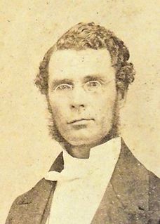
Edward John Eyre was an English land explorer of the Australian continent, colonial administrator, and Governor of Jamaica.

<span class="mw-page-title-main">Morant Bay rebellion</span> 1865 protest in Jamaica

The Morant Bay Rebellion began with a protest march to the courthouse by hundreds of people led by preacher Paul Bogle in Morant Bay, Jamaica. Some were armed with sticks and stones. After seven men were shot and killed by the volunteer militia, the protesters attacked and burned the courthouse and nearby buildings. Twenty-five people died. Over the next two days, poor freedmen rose in rebellion across most of St. Thomas-in-the-East parish.

<span class="mw-page-title-main">Saint Mary Parish, Jamaica</span> Parish of Jamaica

Saint Mary is a parish located in the northeast section of Jamaica. With a population of 114,227 it is one of Jamaica's smallest parishes, located in the county of Middlesex. Its chief town and capital is Port Maria, located on the coast. It is also the birthplace of established dancehall reggae artists, such as Capleton, Lady Saw, Ninjaman, Sizzla and Tanya Stephens. Other notable residents of St. Mary parish include bestselling author Colin Simpson, who is the great-great grandson of noted slavery abolitionist James Phillippo, famed Jamaican writer and community activist Erna Brodber, and acclaimed music producer Chris Blackwell who is credited with "discovering" Bob Marley.

Clarendon Parish, Jamaica Parish of Jamaica

Clarendon is a parish in Jamaica. It is located on the south of the island, roughly halfway between the island's eastern and western ends. Located in the county of Middlesex, it is bordered by Manchester on the west, Saint Catherine in the east, and in the north by Saint Ann. Its capital and largest town is May Pen.

<span class="mw-page-title-main">Saint James Parish, Jamaica</span> Parish of Jamaica

St. James is a suburban parish, located on the north-west end of the island of Jamaica in the county of Cornwall. Its capital is Montego Bay. Montego Bay was officially named the second city of Jamaica, behind Kingston, in 1981, although Montego Bay became a city in 1980 through an act of the Jamaican Parliament. The parish is the birthplace of the Right Excellent Samuel Sharpe, one of Jamaica's seven National Heroes.

George William Gordon Jamaican patriot and businessman

George William Gordon was a wealthy mixed-race Jamaican businessman, magistrate and politician, one of two representatives to the Assembly from St. Thomas-in-the-East parish. He was a leading critic of the colonial government and the policies of Jamaican Governor Edward Eyre.

<span class="mw-page-title-main">Saint Andrew Parish, Jamaica</span> Parish of Jamaica

Saint Andrew is a parish, situated in the southeast of Jamaica in the county of Surrey. It lies north, west and east of Kingston, and stretches into the Blue Mountains. In the 2011 census, it had 573,369, the highest population of any of the parishes in Jamaica. George William Gordon, one of Jamaica's seven National Heroes, was born in this parish.

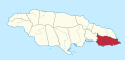
Morant Bay is a town in southeastern Jamaica and the capital of the parish of St. Thomas, located about 25 miles east of Kingston, the capital. The parish has a population of 94,410.

<i>New Day</i> (novel)

New Day is a 1949 book by Jamaican author V. S. Reid. It was Reid's first novel. New Day deals with the political history of Jamaica as told by a character named Campbell, who is a boy at the time of the Morant Bay Rebellion and an old man during its final chapters. It may have been the first novel to use Jamaican vernacular as its language of narration.

Jamaican Maroons descend from Africans who freed themselves from slavery on the Colony of Jamaica and established communities of free black people in the island's mountainous interior, primarily in the eastern parishes. Africans who were enslaved during Spanish rule over Jamaica (1493–1655) may have been the first to develop such refugee communities.

Yallahs is a town located on the southeastern coast of Jamaica in the parish of St Thomas and is home to Jordan 1don Yallahs has an estimated 10,000 inhabitants. The town was recorded as "Yealoth" in the 1662 census. It may have received its name from Captain Yallahs, a 1671 privateer, or the privateer may have received his pseudonym from the town. Yallahs' name could have simply come from the Spanish word 'yalos', meaning frost, because the high white cliffs in that area have been thought to give an appearance of frost.

Moore Town is a Maroon settlement located in the Blue Mountains and John Crow Mountains of Portland, Jamaica, accessible by road from Port Antonio. The easternmost Maroon town, Moore Town is located in the eastern end of the parish. Formerly known as New Nanny Town, Moore Town was founded in 1740 when the Peace Treaty was signed between the British colonial authorities and the Windward Maroons. This treaty allotted the Moore Town Maroons 1000 acres, but Moore Town only received 500. In 1781 the initial 500 acres was augmented with another 500 acres, taking their communal land up to 1,000 acres.

<span class="mw-page-title-main">Colony of Jamaica</span> English/British colony in The Caribbean from 1655 to 1962

The Crown Colony of Jamaica and Dependencies was an English colony from 1655, when it was captured by the English Protectorate from the Spanish Empire. Jamaica became a British colony from 1707 and a Crown colony in 1866. The Colony was primarily used for sugarcane production, and experienced many slave rebellions over the course of British rule. Jamaica was granted independence in 1962.

Human rights in Jamaica is an ongoing process of development that has to consider the realities of high poverty levels, high violence, fluctuating economic conditions, and poor representation for citizens. Jamaica is a constitutional parliamentary democracy. The context of Jamaica’s history must be considered to understand the political factors that help shape its government and economy.

Free black people in Jamaica fell into two categories. Some secured their freedom officially, and lived within the slave communities of the Colony of Jamaica. Others ran away from slavery, and formed independent communities in the forested mountains of the interior. This latter group included the Jamaican Maroons, and subsequent fugitives from the sugar and coffee plantations of coastal Jamaica.

References

  1. "Population by Parish". Statistical Institute of Jamaica. Retrieved 12 February 2020.
  2. "Parishes of Jamaica". nautarch.tamu.edu. Center for Maritime Archaeology and Conservation. Retrieved 11 June 2019.
  3. 1 2 3 Clinton Hutton, "Review: 'The Killing Time': The Morant Bay Rebellion in Jamaica by GAD Heuman, Social and Economic Studies Vol. 44, No. 1 (MARCH 1995), pp. 191-205, published by Sir Arthur Lewis Institute of Social and Economic Studies, University of the West Indies; via JSTOR; accessed 13 July 2016
  4. "Morant Bay/St. Thomas Parish Council, Jamaica", Prime Business Destinations, 2016; accessed 13 July 2016
  5. Jamaica Gleaner:20190607:Golden Grove sugar factory to close in July
  6. Esso 1:400,000 Road Map of Jamaica, 1967.
  7. Aerial view.

Coordinates: 17°54′N76°26′W / 17.900°N 76.433°W / 17.900; -76.433