Salisbury, Vermont

Last updated

Salisbury, Vermont
Congregational Church, Salisbury, Vermont.jpg
Salisbury Congregational Church
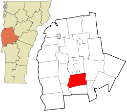
Addison County Vermont incorporated and unincorporated areas Salisbury highlighted.svg
Location in Addison County and the state of Vermont.
Coordinates: 43°54′50″N73°6′25″W / 43.91389°N 73.10694°W / 43.91389; -73.10694
CountryUnited States
State Vermont
County Addison
Chartered1761 [1]
CommunitiesSalisbury
West Salisbury
Salisbury Station
Lake Dunmore
Area
  Total30.0 sq mi (77.7 km2)
  Land28.9 sq mi (74.8 km2)
  Water1.2 sq mi (3.0 km2)
Elevation
413 ft (126 m)
Population
 (2020)
  Total1,221
  Density42/sq mi (16.3/km2)
Time zone UTC−5 (Eastern (EST))
  Summer (DST) UTC−4 (EDT)
ZIP code
05769
Area code 802
FIPS code 50-62575 [2]
GNIS feature ID1462200 [3]
Website townofsalisbury.org

Salisbury is a town in Addison County, Vermont, United States. The population was 1,221 at the 2020 census. [4]

Contents

History

Salisbury was chartered on November 3, 1761 as one of the New Hampshire Grants issued by Benning Wentworth. [5] The town may have been named after Salisbury, Connecticut (which was named after Salisbury, Wiltshire), [6] or for James Cecil, 6th Earl of Salisbury. [5]

Geography

Salisbury is located in southern Addison County along the western edge of the Green Mountains and the eastern edge of the Champlain Valley. U.S. Route 7 passes through the town leading north to Middlebury and south to Brandon and Rutland. The northern half of Lake Dunmore is in the eastern part of the town, and is the site of Branbury State Park.

According to the United States Census Bureau, Salisbury has a total area of 30.0 square miles (77.7 km2) of which 28.9 square miles (74.8 km2) is land and 1.2 square miles (3.0 km2), or 3.81%, is water. [7]

Demographics

Northern half of Lake Dunmore in Salisbury Dunmore.jpg
Northern half of Lake Dunmore in Salisbury
Historical population
CensusPop.Note
1790 446
1800 64444.4%
1810 70910.1%
1820 7211.7%
1830 90725.8%
1840 9423.9%
1850 1,0279.0%
1860 853−16.9%
1870 9025.7%
1880 775−14.1%
1890 740−4.5%
1900 692−6.5%
1910 6930.1%
1920 635−8.4%
1930 632−0.5%
1940 581−8.1%
1950 573−1.4%
1960 5750.3%
1970 64912.9%
1980 88135.7%
1990 1,02416.2%
2000 1,0906.4%
2010 1,1364.2%
2020 1,2217.5%
U.S. Decennial Census [8]

As of the census [2] of 2000, there were 1,090 people, 423 households, and 302 families residing in the town. The population density was 37.4 people per square mile (14.4/km2). There were 628 housing units at an average density of 21.5 per square mile (8.3/km2). The racial makeup of the town was 98.17% White, 0.09% Native American, 0.28% Asian, 0.18% from other races, and 1.28% from two or more races. Hispanic or Latino of any race were 0.28% of the population.

There were 423 households, out of which 34.3% had children under the age of 18 living with them, 58.9% were married couples living together, 8.3% had a female householder with no husband present, and 28.4% were non-families. 22.9% of all households were made up of individuals, and 8.0% had someone living alone who was 65 years of age or older. The average household size was 2.54 and the average family size was 2.96.

In the town, the age distribution of the population shows 25.6% under the age of 18, 6.1% from 18 to 24, 28.8% from 25 to 44, 27.2% from 45 to 64, and 12.4% who were 65 years of age or older. The median age was 39 years. For every 100 females, there were 100.4 males. For every 100 females age 18 and over, there were 97.8 males.

The median income for a household in the town was $39,500, and the median income for a family was $45,455. Males had a median income of $27,107 versus $21,827 for females. The per capita income for the town was $19,306. About 5.1% of families and 7.7% of the population were below the poverty line, including 8.6% of those under age 18 and 2.5% of those age 65 or over.

Parks and recreation

Branbury State Park, a 69-acre (28 ha) park on the shore of Lake Dunmore, is located in Salisbury. The park has 1,000 feet (300 m) of natural sandy beach, hiking trails, waterfalls, caves and camping areas. The park originally operated as a farm and then a summer boys' camp before being named a state park in 1945. [9] [10]

Notable people

Climate

This climatic region is typified by large seasonal temperature differences, with warm to hot (and often humid) summers and cold (sometimes severely cold) winters. According to the Köppen Climate Classification system, Salisbury has a humid continental climate, abbreviated "Dfb" on climate maps. [17]

Climate data for Salisbury, Vermont (1981–2010 normals), [lower-alpha 1]
MonthJanFebMarAprMayJunJulAugSepOctNovDecYear
Mean daily maximum °F (°C)29.8
(−1.2)
34.5
(1.4)
44.4
(6.9)
59
(15)
71.1
(21.7)
79.3
(26.3)
83.6
(28.7)
81.3
(27.4)
73.1
(22.8)
59.8
(15.4)
47.3
(8.5)
35.2
(1.8)
58.2
(14.6)
Mean daily minimum °F (°C)10.8
(−11.8)
13.1
(−10.5)
21.5
(−5.8)
32.8
(0.4)
43.6
(6.4)
53
(12)
57.8
(14.3)
56.6
(13.7)
49.1
(9.5)
38.1
(3.4)
29.9
(−1.2)
18
(−8)
35.4
(1.9)
Average precipitation inches (mm)2.12
(54)
2.03
(52)
2.32
(59)
3.1
(79)
3.69
(94)
3.97
(101)
4.38
(111)
4.16
(106)
3.76
(96)
3.87
(98)
3.37
(86)
3.06
(78)
39.83
(1,012)
Average snowfall inches (cm)16.7
(42)
12.3
(31)
11.6
(29)
3.3
(8.4)
0
(0)
0
(0)
0
(0)
0
(0)
0
(0)
0.5
(1.3)
4.1
(10)
15.5
(39)
64
(160)
Source: xmACIS2 (Monthly Climate Normals) [18]

Notes

  1. Mean monthly maxima and minima (i.e. the expected highest and lowest temperature readings at any point during the year or given month) calculated based on data at said location from 1981 to 2010.

Related Research Articles

<span class="mw-page-title-main">Addison County, Vermont</span> County in Vermont, United States

Addison County is a county located in the U.S. state of Vermont. As of the 2020 census, the population was 37,363. Its shire town is the town of Middlebury.

<span class="mw-page-title-main">Salisbury, Connecticut</span> Town in Connecticut, United States

Salisbury is a town situated in Litchfield County, Connecticut, United States. The town is the northwesternmost in the state of Connecticut; the Massachusetts-New York-Connecticut tri-state marker is located at the northwest corner of the town. The population was 4,194 at the 2020 census. The town is part of the Northwest Hills Planning Region.

Addison is a town in Washington County, Maine, United States. The town was named after English author Joseph Addison. The population was 1,148 as of the 2020 census.

<span class="mw-page-title-main">Cornwall, Vermont</span> Town in Vermont, United States

Cornwall is a town in Addison County, Vermont, United States. It was founded November 3, 1761. The population was 1,207 at the 2020 census.

<span class="mw-page-title-main">Goshen, Vermont</span> Town in Vermont, United States

Goshen is a town in Addison County, Vermont, United States. The population was 172 at the 2020 census.

<span class="mw-page-title-main">Hancock, Vermont</span> Town in Vermont, United States

Hancock is a town in Addison County, Vermont, United States. The town was named for John Hancock. The population was 359 at the 2020 census. Hancock is home to the Middlebury College Snow Bowl and contains Middlebury Gap through the Green Mountains.

<span class="mw-page-title-main">Leicester, Vermont</span> Town in Vermont, United States

Leicester is a town in Addison County, Vermont, United States. The population was 990 at the 2020 census. Satans Kingdom is an unincorporated community located in Leicester.

<span class="mw-page-title-main">Ripton, Vermont</span> Town in Vermont, United States

Ripton is a town in Addison County, Vermont, United States. The population was 739 at the 2020 census.
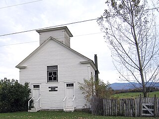
<span class="mw-page-title-main">Whiting, Vermont</span> Town in Vermont, United States

Whiting is a town in Addison County, Vermont, United States. The town was named for John Whiting, a landholder. The population was 405 at the 2020 census.

<span class="mw-page-title-main">Shaftsbury, Vermont</span> Town in Vermont, United States

Shaftsbury is a town in Bennington County, Vermont, United States. The population was 3,598 at the 2020 census.

<span class="mw-page-title-main">Waterford, Vermont</span> Town in Vermont, United States

Waterford is a town in Caledonia County, Vermont, United States. The population was 1,268 at the 2020 census.

<span class="mw-page-title-main">Huntington, Vermont</span> Town in Vermont, United States

Huntington is a town in Chittenden County, Vermont, United States. The population was 1,938 at the 2020 census.
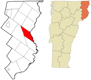
<span class="mw-page-title-main">Brunswick, Vermont</span> Town in Vermont, United States

Brunswick is a town in Essex County, Vermont, United States. The town was named after Prince Karl Wilhelm Ferdinand of Brunswick-Lunenburg. The population was 88 at the 2020 census. It is part of the Berlin, NH–VT Micropolitan Statistical Area. Brunswick is home to six mineral springs that made the town a popular resort destination in the 19th century. The land the springs are on is now owned by the Abenaki people.
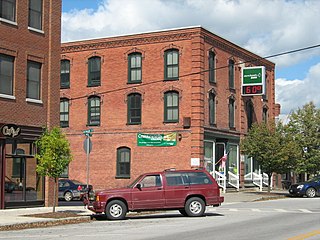
<span class="mw-page-title-main">Enosburg Falls, Vermont</span> Village in Vermont, United States

Enosburg Falls is a village in the town of Enosburgh in Franklin County, Vermont, in the United States. The population was 1,356 at the 2020 census.

<span class="mw-page-title-main">Elmore, Vermont</span> Town in Vermont, United States

Elmore is a town in Lamoille County, Vermont, United States. It was granted by the Vermont Republic in 1780, and was named for Colonel Samuel Elmore (1720–1805), one of the original grantees. The population was 886 at the 2020 census. Elmore contains the villages of East Elmore and Lake Elmore, as well as Elmore State Park, a 700-acre (2.8 km2) recreational area on the 219-acre (0.9 km2) Lake Elmore and on Elmore Mountain to the west.

<span class="mw-page-title-main">Morristown, Vermont</span> Town in Vermont, United States

Morristown is a town in Lamoille County, Vermont, United States. As of the 2020 census, the population was 5,434. Morristown is the largest town by population in Lamoille County, and its central village of Morrisville serves as the county's main commercial center.

<span class="mw-page-title-main">Vernon, Vermont</span> Town in Vermont, United States

Vernon is a town in Windham County, Vermont, in the United States. The population was 2,192 at the 2020 census. Vernon is the site of the now-defunct Vermont Yankee, the state of Vermont's only nuclear power plant, which closed in December 2014.
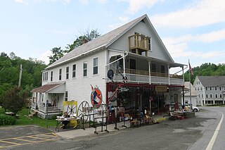
<span class="mw-page-title-main">Whitingham, Vermont</span> Town in Vermont, United States

Whitingham is a town in Windham County, Vermont, United States. The town was named for Nathan Whiting, a landholder. The population was 1,344 at the 2020 census. Whitingham is the birthplace of Brigham Young, the second president of the Church of Jesus Christ of Latter-day Saints and founder of Salt Lake City, Utah. Its village center, census-designated place, is also listed on the National Register of Historic Places as the Whitingham Village Historic District.

<span class="mw-page-title-main">Hartford, Vermont</span> Town in Vermont, United States

Hartford is a town in Windsor County, Vermont, United States. It is on the New Hampshire border, at the intersection of Interstates 89 and 91. It is the site of the confluence of the White and Connecticut rivers; the Ottauquechee River also flows through the town. The town is composed of five unincorporated villages: Hartford, Quechee, West Hartford, White River Junction and Wilder. As of the 2020 census, the population was 10,686.

<span class="mw-page-title-main">Addison, Vermont</span> Town in Vermont, United States

Addison is a town in Addison County, Vermont, United States. It was founded October 14, 1761. The population was 1,365 at the 2020 census.

References

  1. "About Salisbury, Vermont". Virtual Vermont. Retrieved November 6, 2012.
  2. 1 2 "U.S. Census website". United States Census Bureau . Retrieved January 31, 2008.
  3. "US Board on Geographic Names". United States Geological Survey. October 25, 2007. Retrieved January 31, 2008.
  4. "Census - Geography Profile: Salisbury town, Addison County, Vermont". United States Census Bureau . Retrieved January 6, 2022.
  5. 1 2 "About Salisbury, Vermont". Virtual Vermont. Retrieved November 6, 2012.
  6. "Profile for Salisbury, Vermont, VT". ePodunk. Retrieved November 6, 2012.
  7. "Geographic Identifiers: 2010 Demographic Profile Data (G001): Salisbury town, Addison County, Vermont". U.S. Census Bureau, American Factfinder. Archived from the original on February 12, 2020. Retrieved August 30, 2013.
  8. "U.S. Decennial Census". United States Census Bureau. Retrieved May 16, 2015.
  9. "Branbury State Park". Vermont State Parks. Archived from the original on November 12, 2012. Retrieved November 6, 2012.
  10. "Branbury State Park". Vermont Campground Association. Archived from the original on November 26, 2011. Retrieved November 6, 2012.
  11. Carleton, Hiram (1903). Genealogical and Family History of the State of Vermont. New York, NY: Lewis Publishing Company. p. 659.
  12. Goode, George Browne, ed. (1897). The Smithsonian Institution, 1846-1896: The History of Its First Half Century. New York, NY: The De Vinne Press. p. 139 via Google Books.
  13. "OLIN, Henry, (1768 - 1837)". Biographical Directory of the United States Congress. Retrieved November 6, 2012.
  14. Harman, Henry A. (October 25, 1892). A Memorial Sketch of John Prout: Published in the Annual Meeting Proceedings of the Vermont Bar Association. Montpelier, VT: Argus and Patriot Book and Job Printing. pp. 63–67.
  15. Sawyers, June Skinner (2012). Chicago Portraits: New Edition. Evanston, IL: Northwestern University Press. p. 290. ISBN   978-0-8101-2649-7 via Google Books.
  16. "Biography, John Eliakim Weeks". Biographical Directory of the United States Congress. Washington, DC: Historian of the United States House of Representatives. Retrieved March 6, 2024.
  17. Climate Summary for Salisbury, Vermont
  18. "NOAA 1981-2010 Climate Normals". NOAA Regional Climate Centers . Retrieved January 27, 2018.