The Sumallo River is located in southern British Columbia, in the Cascade Mountains to the east of Hope. It begins on the east slopes of Mount Payne, south of the village of Sunshine Valley. It flows north until it reaches Sunshine Valley where it turns southeast and proceeds into Manning Park. It continues southeast within the park, running alongside Highway 3 before eventually meeting the Skagit River at the northern boundary of Skagit Valley Provincial Park, to the northeast of Marmot Mountain.
Anderson Bay Provincial Park is a provincial park in British Columbia, Canada, located on the southeast end of Texada Island near the community of Gillies Bay. Created in 2000, it is approximately 35 ha. in area.
East Pine Provincial Park is a provincial park in British Columbia, Canada, located east of Chetwynd in the Peace River Block at the junction of the Pine and Murray Rivers. The park was established in 1982 and is 14.2 hectares in size.
Fossli Provincial Park is a provincial park in British Columbia, Canada, located on Stirling Arm of Sproat Lake on Vancouver Island. The 52-hectare park, west of Port Alberni, is accessible by water or private logging road. It has few services, but has a 30-minute hiking trail to an old homestead site. The homestead belonged to Helen and Armour Ford, who donated the land for the park to the province in 1974. Saint Andrew's Creek runs through the park, and is a fall spawning ground for coho salmon.
Garden Bay Marine Provincial Park is a provincial park in British Columbia, Canada at the northwest end of the Sechelt Peninsula on the lower Sunshine Coast, near the community of Madeira Park. Established in 1969, it contains approximately 163 ha.

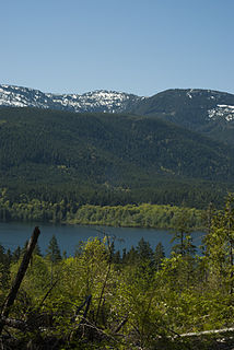
Herald Provincial Park is a provincial park in British Columbia, Canada.
Kluskoil Lake Provincial Park is a provincial park in British Columbia, Canada, located on the West Road River downstream from the Euchiniko Lakes.

Little Qualicum Falls Provincial Park is a provincial park in British Columbia, Canada, on central Vancouver Island, that encompasses the entire southern shore of Cameron Lake. The Island Rail Corridor line to Port Alberni passes through the park.
Nuntsi Provincial Park, also known as Taseko Provincial Park, is a provincial park in British Columbia, Canada, located on the west side of the Taseko River in that province's Chilcotin District, flanking both sides of Nuntsi Creek.
Prophet River Wayside Provincial Park is a provincial park in British Columbia, Canada. It is located along Prophet River, by the Alaska Highway, between the localities of Trutch and Prophet River. Originally created as a Provincial Recreation Area in 1977 with an area of 707 acres (2.86 km2), it was designated a provincial park in 1999 with an area of 111 hectares.
Sabine Channel Provincial Park, also known as Sabine Channel Marine Provincial Park, is a provincial park in British Columbia, Canada, in the waters surrounding Jervis Island in Sabine Channel, which separates Texada Island (N) from Lasqueti Island (S). Established in 2001, the parks is approximately 2,254 ha. in size.
Smelt Bay Provincial Park is a provincial park in British Columbia, Canada. It is located at the south end of Cortes Island, and has twenty-two camping sites. Eight are reservable and the rest are first-come, first-served. There is also an overflow parking lot directly next to the beach for any excess campers.

South Texada Island Provincial Park is a provincial park in British Columbia, Canada, located on the southwest side of Texada Island. Created in 1997, the park is approximately 900 ha. in area.

Squitty Bay Provincial Park is a provincial park in British Columbia, Canada, located on Lasqueti Island in the Northern Gulf Islands of the Strait of Georgia region.
The Tŝideldel First Nation is the band government of the Tsi Del Del subgroup of the Tsilhqot'in people, located in the Chilcotin District in the western Central Interior region of the Canadian province of British Columbia. It is a member of the Tsilhqot'in National Government.

The Ashnola River is a tributary of the Similkameen River, rising in the northeastern part of the North Cascades in Washington, United States, and flowing north into British Columbia, Canada, to join the Similkameen River about halfway along that river's course between the towns of Princeton and Keremeos. The river crosses the international boundary at 49°00′00″N120°19′37″W and transits Cathedral Provincial Park. It has one main tributary, Ewart Creek, which is about 25 kilometres (16 mi) long and begins virtually at the border and is entirely within Cathedral Park.
The Hiellen River is a river on Graham Island in the Queen Charlotte Islands of British Columbia, Canada. It flows north into McIntyre Bay to the east of Tow Hill, and is entirely within Naikoon Provincial Park, which covers most of the peninsula of the same name. At the mouth of the Hiellen River is Hiellen Indian Reserve No. 2, which is on the site of Hiellen, a once-large Haida village whose remaining families located to Masset during the 19th Century.
Wedge Pass, also known as Billygoat Pass, 1430 m (4692 ft), is a mountain pass in the northern Garibaldi Ranges, the southwesternmost subdivisions of the Pacific Ranges of the Coast Mountains in British Columbia, Canada. Located immediately on the southern flank of Wedge Mountain and to the immediate north of the Spearhead Range, site of the Blackcomb half of the Whistler Blackcomb Ski Area, it connects the head of Wedge Creek (W), a tributary of the Green River with those of Billgoat Creek (E), a tributary of the Lillooet River. The pass is within Garibaldi Provincial Park and has no road access.
The Douglas First Nation, aka the Douglas Indian Band, Douglas Band, or Xa'xtsa First Nation, are a band government of the In-SHUCK-ch Nation, a subgroup of the larger St'at'imc people, also referred to as Lower Stl'atl'imx. The Douglas, Skatin and Samahquam communities are related through familial ties as well as culturally and linguistically. The In-SHUCK-ch are the southernmost of the four divisions making up the Lillooet ethnographic group. The Douglas First Nation's main community is at Xa'xtsa, a village on their main reserve at the head of Harrison Lake, near the former gold rush port-town of Port Douglas.

The Terminal Range is the northernmost mountain range of the Canadian Rockies, so-named for its position at the northern terminus of the Rockies. Lying west of Muncho Lake and the Trout River, its northern perimeter is the Liard River. The Sentinel Range lies to its east.

