San Jose, Negros Oriental

Last updated
San Jose
Municipality of San Jose
SanJoseNegrosOr.jpg
Overlooking view of Tañon Strait from San Jose
Flag of San Jose, Negros Oriental.png
SanJoseNegrosOriental Seal.png
Nickname: 
Pineapple Capital of Central Visayas
Ph locator negros oriental san jose.png
Map of Negros Oriental with San Jose highlighted
OpenStreetMap
San Jose, Negros Oriental
Philippines location map (square).svg
Red pog.svg
San Jose
Location within the Philippines
Coordinates: 9°25′N123°14′E / 9.42°N 123.23°E / 9.42; 123.23
Country Philippines
Region Central Visayas
Province Negros Oriental
District 2nd district
Founded 1954
Barangays 14 (see Barangays)
Government
[1]
  Type Sangguniang Bayan
   Mayor Mel Nick S. Logronio (NP)
   Vice Mayor Sheila B. Ruiz (NP)
   Representative Manuel T. Sagarbarria
   Municipal Council
Members
   Electorate 16,043 voters (2022)
Area
[2]
  Total54.46 km2 (21.03 sq mi)
Elevation
99 m (325 ft)
Highest elevation
728 m (2,388 ft)
Lowest elevation
0 m (0 ft)
Population
 (2020 census) [3]
  Total21,956
  Density400/km2 (1,000/sq mi)
   Households
5,389
Economy
   Income class 5th municipal income class
   Poverty incidence
17.10
% (2018) [4]
   Revenue 96.38 million (2020)
   Assets 242.8 million (2020)
   Expenditure 82.19 million (2020)
   Liabilities 51.16 million (2020)
Service provider
  ElectricityNegros Oriental 2 Electric Cooperative (NORECO 2)
Time zone UTC+8 (PST)
ZIP code
6202
PSGC
IDD : area code +63(0)35
Native languages Cebuano
Tagalog

San Jose (Cebuano : Lungsod sa San Jose; Tagalog : Bayan ng San Jose), officially the Municipality of San Jose, is a 5th class municipality in the province of Negros Oriental, Philippines. According to the 2020 census, it has a population of 21,956 people. [3] It is the least populous town in Negros Oriental.

Contents

San Jose is 14 kilometres (8.7 mi) from Dumaguete.

History

The municipality of San Jose was formerly called "Ayuquitan", a name that was born due to a communication problem between the natives and Spanish Conquistadors. The story was that one day a group of Spaniards searching for flourishing communities came upon a group of natives harvesting rice. The Spaniards approached the natives and asked the name of the place while pointing to the ground filled with piles of rice chaffs. The natives thought they were asked for the name of the pile and answered "Inoquitan". From then on, the Spaniards called the place "Inoquitan". In time, the name "Ayuquitan" was adapted from the phrase "may inoquitan". In 1902 Governor Demetrio Larena considered the place as a pueblo. Pioneer Spanish Merchant is Manuel Pastor. San Jose is the home of the old Spanish families settled since 1871 like the Patero, Amiscaray, Larena, Pareja, Siglos, Remollo, Renacia, Remata, Araco, Tatel and Remoto.

San Jose was created as a town in 1954 from the barrios of Ayuquitan, Basak, Basiao, Cambaloctot, Calo, Cancawas, Hanay-Hanay, Jilocon, Lalaan, Naiba, Tapon Norte, Tampi, and sitios Guinsayawan, Kang-atid, Kangdajonog, Guilongsoran and Kaputihanan of the barrio of Siapo, all of which formerly belonged to the former municipality of Ayuquitan and then part of the municipality of Amlan. [5]

Geography

Barangays

San Jose is politically subdivided into 14 barangays. Each barangay consists of puroks and some have sitios.

PSGC Barangay Population ±% p.a.
2020 [3] 2010 [6]
074617001 Basak 4.0% 870 888 −0.20%
074617002 Basiao 3.2% 693 596 1.52%
074617004 Cambaloctot 3.2% 693 557 2.21%
074617005 Cancawas 8.0% 1,758 1,527 1.42%
074617006 Janayjanay 5.0% 1,089 933 1.56%
074617007 Jilocon 9.1% 2,004 1,728 1.49%
074617008 Naiba 4.7% 1,040 671 4.48%
074617009 Poblacion 4.2% 915 1,035 −1.22%
074617010 San Roque 3.9% 853 816 0.44%
074617011 Santo Niño 11.4% 2,509 2,195 1.35%
074617012 Señora Ascion (Calo) 9.0% 1,980 1,690 1.60%
074617013 Siapo 10.7% 2,357 2,136 0.99%
074617014 Tampi 10.3% 2,260 1,837 2.09%
074617015 Tapon Norte 13.4% 2,935 2,489 1.66%
Total21,95619,0981.40%

Climate

Climate data for San Jose, Negros Oriental
MonthJanFebMarAprMayJunJulAugSepOctNovDecYear
Mean daily maximum °C (°F)28
(82)
30
(86)
31
(88)
32
(90)
32
(90)
30
(86)
30
(86)
30
(86)
30
(86)
29
(84)
30
(86)
30
(86)
30
(86)
Mean daily minimum °C (°F)21
(70)
22
(72)
22
(72)
23
(73)
24
(75)
25
(77)
24
(75)
24
(75)
24
(75)
24
(75)
23
(73)
21
(70)
23
(74)
Average precipitation mm (inches)26
(1.0)
22
(0.9)
28
(1.1)
41
(1.6)
95
(3.7)
136
(5.4)
147
(5.8)
126
(5.0)
132
(5.2)
150
(5.9)
98
(3.9)
46
(1.8)
1,047
(41.3)
Average rainy days7.56.78.910.421.625.626.325.024.126.219.212.1213.6
Source: Meteoblue [7]

Demographics

Population census of San Jose
YearPop.±% p.a.
1960 7,547    
1970 8,840+1.59%
1975 9,517+1.49%
1980 10,938+2.82%
1990 12,821+1.60%
1995 14,952+2.92%
2000 15,665+1.00%
2007 17,250+1.34%
2010 19,098+3.77%
2015 20,413+1.28%
2020 21,956+1.44%
Source: Philippine Statistics Authority [8] [6] [9] [10]

Economy

Education

The public schools in the town of San Jose are administered by one school district under the Schools Division of Negros Oriental.

Elementary schools:

High schools:

Tourism

The town is the gateway to the Balinsasayao Twin Lakes Natural Park in Enrique Villanueva, Sibulan Town.

One of the tourist attraction of the town was the Our Lady of Lourdes Shrine in the cane fields of Sto. Niño, where a spinning sun is said to have manifested the visit of the Lady of Lourdes, devotees flock every Saturday of the month.

The Ayuquitan Festival is held every May 7, one of the highlights of the town fiesta which is celebrated on May 10. Street dancing and showdown are the main features of the festival.

The St. Paul University Farm is located in Barangay Sra. Acion.

The Port of Tampi also serves RORO services going to the island of Cebu through the Port of Bato in the municipality of Samboan.

Related Research Articles

<span class="mw-page-title-main">Canlaon</span> Component city in Negros Oriental, Philippines

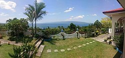
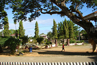
Canlaon, officially the City of Canlaon, is a 4th class component city in the province of Negros Oriental, Philippines. According to the 2020 census, it has a population of 58,822 people.

<span class="mw-page-title-main">Tanjay</span> Component city in Negros Oriental, Philippines

Tanjay, officially the City of Tanjay, is a 4th class component city in the province of Negros Oriental, Philippines. According to the 2020 census, it has a population of 82,642 people.

<span class="mw-page-title-main">Ayungon</span> Municipality in Negros Oriental, Philippines

Ayungon, officially the Municipality of Ayungon, is a 2nd class municipality in the province of Negros Oriental, Philippines. According to the 2020 census, it has a population of 47,102 people.

<span class="mw-page-title-main">Manjuyod</span> Municipality in Negros Oriental, Philippines

Manjuyod, officially the Municipality of Manjuyod, is a 2nd class municipality in the province of Negros Oriental, Philippines. According to the 2020 census, it has a population of 44,799 people.

<span class="mw-page-title-main">Siaton</span> Municipality in Negros Oriental, Philippines

Siaton, officially the Municipality of Siaton, is a 1st class municipality and the southernmost settlement in the province of Negros Oriental, Philippines. According to the 2020 census, it has a population of 83,082 people.

<span class="mw-page-title-main">Sibulan</span> Municipality in Negros Oriental, Philippines

Sibulan, officially the Municipality of Sibulan, is a second class municipality in the province of Negros Oriental, Philippines. According to the 2020 census, it has a population of 64,343 people.

<span class="mw-page-title-main">Tayasan</span> Municipality in Negros Oriental, Philippines

Tayasan, officially the Municipality of Tayasan, is a 3rd class municipality in the province of Negros Oriental, Philippines. According to the 2020 census, it has a population of 38,159 people.

<span class="mw-page-title-main">Zamboanguita</span> Municipality in Negros Oriental, Philippines

Zamboanguita, officially the Municipality of Zamboanguita, is a 4th class municipality in the province of Negros Oriental, Philippines. According to the 2020 census, it has a population of 29,569 people.

<span class="mw-page-title-main">Dalaguete</span> Municipality in Cebu, Philippines

Dalaguete, officially the Municipality of Dalaguete, is a 1st class municipality in the province of Cebu, Philippines. According to the 2020 census, it has a population of 74,596 people.

<span class="mw-page-title-main">Dumanjug</span> Municipality in Cebu, Philippines

Dumanjug, officially the Municipality of Dumanjug, is a 3rd class municipality in the province of Cebu, Philippines. According to the 2020 census, it has a population of 57,823 people.

<span class="mw-page-title-main">Ginatilan</span> Municipality in Cebu, Philippines

Ginatilan, officially the Municipality of Ginatilan, is a 5th class municipality in the province of Cebu, Philippines. According to the 2020 census, it has a population of 16,906 people.

<span class="mw-page-title-main">Ronda, Cebu</span> Municipality in Cebu, Philippines

Ronda, officially the Municipality of Ronda, is a 5th class municipality in the province of Cebu, Philippines. According to the 2020 census, it has a population of 21,005 people.

<span class="mw-page-title-main">Sibonga</span> Municipality in Cebu, Philippines

Sibonga, officially the Municipality of Sibonga, is a 3rd class municipality in the province of Cebu, Philippines. According to the 2020 census, it has a population of 53,424 people.

<span class="mw-page-title-main">Tabuelan</span> Municipality in Cebu, Philippines

Tabuelan, officially the Municipality of Tabuelan, is a 4th class municipality in the province of Cebu, Philippines. According to the 2020 census, it has a population of 28,907 people.

<span class="mw-page-title-main">Tuburan, Cebu</span> Municipality in Cebu, Philippines

Tuburan, officially the Municipality of Tuburan, is a 2nd class municipality in the province of Cebu, Philippines. According to the 2020 census, it has a population of 68,167 people.

<span class="mw-page-title-main">Getafe, Bohol</span> Municipality in Bohol, Philippines

Getafe, officially the Municipality of Getafe and also spelled as Jetafe, is a 3rd class municipality in the province of Bohol, Philippines. According to the 2020 census, it has a population of 33,422 people.

<span class="mw-page-title-main">Hinabangan</span> Municipality in Samar, Philippines

Hinabangan, officially the Municipality of Hinabangan, is a 4th class municipality in the province of Samar, Philippines. According to the 2020 census, it has a population of 13,693 people.

<span class="mw-page-title-main">Jiabong</span> Municipality in Samar, Philippines

Jiabong, officially the Municipality of Jiabong, is a 5th class municipality in the province of Samar, Philippines. According to the 2020 census, it has a population of 19,205 people.

<span class="mw-page-title-main">Bobon</span> Municipality in Northern Samar, Philippines

Bobon, officially the Municipality of Bobon, is a 4th class municipality in the province of Northern Samar, Philippines. According to the 2020 census, it has a population of 25,964 people.

<span class="mw-page-title-main">Ajuy, Iloilo</span> Municipality in Iloilo, Philippines

Ajuy, officially the Municipality of Ajuy, is a 2nd class municipality in the province of Iloilo, Philippines. According to the 2020 census, it has a population of 53,462 people.

References

  1. Municipality of San Jose | (DILG)
  2. "2015 Census of Population, Report No. 3 – Population, Land Area, and Population Density" (PDF). Philippine Statistics Authority. Quezon City, Philippines. August 2016. ISSN   0117-1453. Archived (PDF) from the original on May 25, 2021. Retrieved July 16, 2021.
  3. 1 2 3 Census of Population (2020). "Region VII (Central Visayas)". Total Population by Province, City, Municipality and Barangay. Philippine Statistics Authority . Retrieved 8 July 2021.
  4. "PSA Releases the 2018 Municipal and City Level Poverty Estimates". Philippine Statistics Authority. 15 December 2021. Retrieved 22 January 2022.
  5. "Act 1212" . Retrieved 2 December 2022.
  6. 1 2 Census of Population and Housing (2010). "Region VII (Central Visayas)" (PDF). Total Population by Province, City, Municipality and Barangay. National Statistics Office . Retrieved 29 June 2016.
  7. "San Jose: Average Temperatures and Rainfall". Meteoblue. Retrieved 6 May 2020.
  8. Census of Population (2015). "Region VII (Central Visayas)". Total Population by Province, City, Municipality and Barangay. Philippine Statistics Authority . Retrieved 20 June 2016.
  9. Censuses of Population (1903–2007). "Region VII (Central Visayas)". Table 1. Population Enumerated in Various Censuses by Province/Highly Urbanized City: 1903 to 2007. National Statistics Office.{{cite encyclopedia}}: CS1 maint: numeric names: authors list (link)
  10. "Province of". Municipality Population Data. Local Water Utilities Administration Research Division. Retrieved 17 December 2016.
  11. "Poverty incidence (PI):". Philippine Statistics Authority. Retrieved December 28, 2020.
  12. "Estimation of Local Poverty in the Philippines" (PDF). Philippine Statistics Authority. 29 November 2005.
  13. "2003 City and Municipal Level Poverty Estimates" (PDF). Philippine Statistics Authority. 23 March 2009.
  14. "City and Municipal Level Poverty Estimates; 2006 and 2009" (PDF). Philippine Statistics Authority. 3 August 2012.
  15. "2012 Municipal and City Level Poverty Estimates" (PDF). Philippine Statistics Authority. 31 May 2016.
  16. "Municipal and City Level Small Area Poverty Estimates; 2009, 2012 and 2015". Philippine Statistics Authority. 10 July 2019.
  17. "PSA Releases the 2018 Municipal and City Level Poverty Estimates". Philippine Statistics Authority. 15 December 2021. Retrieved 22 January 2022.