San Miguel, Chile

Last updated
San Miguel
San Miguel Panoramica.jpg
Panoramic view of San Miguel


Escudo de San Miguel (Chile).svg
Comuna de San Miguel.svg
Chile location map.svg
Red pog.svg
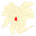
San Miguel
Location in Chile
Coordinates(alcalde's office): 33°29′09″S70°38′58″W / 33.48583°S 70.64944°W / -33.48583; -70.64944
Country Chile
Region Santiago Metro.
Province Santiago
Founded10 August 1896
Government
  Type Municipality
   Alcalde Luis Sanhueza Bravo
Area
[3]
  Total9.5 km2 (3.7 sq mi)
 As of 2002 Census
Population
 (2017 projection) [3]
  Total107,954
  Density11,000/km2 (29,000/sq mi)
   Urban
107,954
   Rural
0
Demonym Sanmiguelino
Sex
[3]
  Men37,836
  Women41,036
Time zone UTC-4 (CLT [4] )
  Summer (DST) UTC-3 (CLST [5] )
Area code 56 +
Website Municipality of San Miguel

San Miguel (Spanish for "Saint Michael") is a commune of Chile located in Santiago Province, Santiago Metropolitan Region. It was founded on August 10, 1896.

Contents

Administration

As a commune, San Miguel is a third-level administrative division of Chile administered by a municipal council, headed by an alcalde who is directly elected every four years. The alcalde's office (alcaldía) is located at Gran Avenida No. 3418. The 2012-2016 alcalde is Julio Palestro Velásquez (PS). The communal council has the following members:

San Miguel belongs to the 28th electoral division (together with Pedro Aguirre Cerda and Lo Espejo) and the 8th senatorial constituency (Santiago East). It is represented in the Chamber of Deputies of the National Congress by the deputies Guillermo Teillier del Valle (PCCh) and Pedro Browne Urrejola (RN). It is represented in the Senate by senators Soledad Alvear (PDC) and Pablo Longueira (UDI).

Demographics

According to the 2002 census of the National Statistics Institute, San Miguel spans an area of 9.5 km2 (4 sq mi) and has 78,872 inhabitants (37,836 men and 41,036 women), and the commune is an entirely urban area. The population fell by 4.8% (3997 persons) between the 1992 and 2002 censuses. [3] The demonym for a person from San Miguel is sanmiguelino for a man or sanmiguelina for a woman.

Other statistics

Notable sanmiguelinos

Jose Miguel Carrera Ave. San Miguel 787.jpg
José Miguel Carrera Ave.

Related Research Articles

<span class="mw-page-title-main">Providencia, Chile</span> Commune in Santiago Metropolitan Region, Chile

Providencia is a commune of Chile located in Santiago City, it is bordered by the communes of Santiago to the west, Recoleta to the northwest, Las Condes and Vitacura to the northeast, La Reina to the east, and Ñuñoa to the south. It belongs to the Northeastern zone of Santiago de Chile. Providencia is home to a large upper middle to upper-class population and it holds the region's highest percentage of population over 60 (22%). It contains many high-rise apartment buildings as well as a significant portion of Santiago's commerce. It is notable for its large, old and elegant houses inhabited in the past by the Santiago elite and now mostly used as offices. The municipality is also home to many embassies, including those of Canada, Poland, Hungary, Italy, France, Egypt, Russia, Japan, China, and Uruguay. Providencia has one of the highest human development indexes of any city in Latin America.

<span class="mw-page-title-main">La Reina</span> Commune in Santiago Metro., Chile

La Reina is a commune of Chile located in Santiago Province, Santiago Metropolitan Region created in 1963 from an eastern portion of the Ñuñoa commune. It belongs to the Northeastern zone of Santiago de Chile.

<span class="mw-page-title-main">Maipú, Chile</span> City and Commune in Santiago Metro., Chile

Maipú is a commune of Chile located in Santiago Province, Santiago Metropolitan Region, integrated into the Greater Santiago conurbation. It was founded on 16 February 1821 and it is the place of the Battle of Maipú, where Chile's independence was consolidated. Inhabitants are mostly part of a middle class.

Lo Espejo is a commune of Chile located in Santiago Province, Santiago Metropolitan Region. It has the country's largest population density.

<span class="mw-page-title-main">Cerro Navia</span> Commune in Santiago Metro., Chile

Cerro Navia is a commune of Chile located in Santiago Province, Santiago Metropolitan Region. It is one of the most densely populated communes of Santiago, Chile.

El Bosque is a commune of Chile located in Santiago Province, Santiago Metropolitan Region. The commune spans an area of 14.1 km2 (5 sq mi).

<span class="mw-page-title-main">Independencia, Chile</span> City and Commune in Santiago Metro., Chile

Independencia is a commune of Chile located in Santiago Province, Santiago Metropolitan Region. The main street is Independencia Avenue.

<span class="mw-page-title-main">La Cisterna</span> City and Commune in Santiago Metro., Chile

La Cisterna is a commune of Chile and census-designated city located in Santiago Province, Santiago Metropolitan Region. It was founded on 30 May 1925. It is part of Greater Santiago.

<span class="mw-page-title-main">San Ramón, Chile</span> City and Commune in Santiago Metro., Chile

San Ramón is a commune of Chile located in Santiago Province, Santiago Metropolitan Region; part of Greater Santiago.

<span class="mw-page-title-main">La Pintana</span> City and Commune in Chile

La Pintana is a commune of Chile located in Santiago Province, Santiago Metropolitan Region. La Pintana is home to Antumapu, the agricultural and veterinary sciences campus of University of Chile, Chile's oldest university.

<span class="mw-page-title-main">Pedro Aguirre Cerda, Chile</span> City and Commune in Santiago Metro., Chile

Pedro Aguirre Cerda is a commune of Chile located in Santiago Province, Santiago Metropolitan Region. It is named after President Pedro Aguirre Cerda.

<span class="mw-page-title-main">Peñalolén</span> City and Commune in Santiago Metro., Chile

Peñalolén is a Chilean commune in Santiago Province, Santiago Metropolitan Region. It was founded on 15 November 1984.

San Joaquín is a commune of Chile located in Santiago Province, Santiago Metropolitan Region. It is part of Greater Santiago.

<span class="mw-page-title-main">El Monte, Chile</span> City and Commune in Santiago, Chile

El Monte is a Chilean city and commune in Talagante Province, Santiago Metropolitan Region. As of 2007, it had a population of 29,568.

<span class="mw-page-title-main">Pirque</span> City and Commune in Santiago Metro., Chile

Pirque is a commune of Chile in Cordillera Province, Santiago Metropolitan Region; it is located 2.8 kilometers southeast of Puente Alto and 21.3 kilometers south-southeast of the center of Santiago. It is situated at the base of the Cajón del Maipo, and is the home of the Concha y Toro wine company.

Padre Hurtado is a Chilean commune in the Talagante Province, in the Metropolitan Region. Part of the Greater Santiago conurbation and one of the outermost communes of it, the commune is named after Saint Alberto Hurtado, who was popularly known as Padre Hurtado.

<span class="mw-page-title-main">Talagante</span> City and Commune in Santiago Metro., Chile

Talagante is a commune and the capital city of the province of the same name in the Santiago Metropolitan Region of central Chile. The word Talagante in Quechua comes from talacanta, meaning "Lazo de Hechicero", which was the proper name of the curaca, or ruler, who dominated this central valley on behalf of the Inca empire during the arrival of the Spaniards.

<span class="mw-page-title-main">Isla de Maipo</span> Commune and town in Santiago Metro., Chile

Isla de Maipo is a town and commune of the Talagante Province in central Chile's Santiago Metropolitan Region.

San Pedro is a commune of the Melipilla Province in central Chile's Santiago Metropolitan Region.

<span class="mw-page-title-main">Olmué</span> Commune in Valparaíso, Chile

Olmué is a Chilean town and commune located in the Marga Marga Province, Valparaíso Region. The commune spans an area of 231.8 km2 (89 sq mi). Olmué is located 42.8 miles northwest of Santiago and 42 kilometers east northeast of Valparaíso.

References

  1. "Municipality of San Miguel" (in Spanish). Retrieved 14 September 2010.
  2. "Administrative and Censual Political Division" (PDF) (in Spanish). Retrieved 13 September 2010.
  3. 1 2 3 4 "National Statistics Institute" (in Spanish). Retrieved 8 September 2010.
  4. "Chile Time". WorldTimeZones.org. Archived from the original on 2007-09-11. Retrieved 2010-07-29.
  5. "Chile Summer Time". WorldTimeZones.org. Archived from the original on 2007-09-11. Retrieved 2010-07-29.
  6. "Regional Information System". Ministry of Planning of Chile (in Spanish). Archived from the original on 23 April 2008. Retrieved 14 September 2010.
  7. "Poverty in the Santiago Metropolitan Region" (PDF). Ministry of Planning of Chile (in Spanish). Archived from the original (PDF) on August 24, 2007.
  8. "The Trajectories of Human Development in the Communes of Chile (1994-2003)" (PDF). Government of Chile, Mideplán (in Spanish). UNDP. Archived from the original (PDF) on 7 July 2011. Retrieved 12 September 2010.