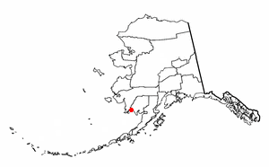
Twin Hills is a census-designated place (CDP) in Dillingham Census Area, Alaska, United States. The population was 74 at the 2010 census, up from 69 in 2000.

Havre North is a census-designated place (CDP) in Hill County, Montana, United States. The population was 716 at the 2010 census, down from 973 in 2000.

West Peavine is a census-designated place (CDP) in Adair County, Oklahoma, United States. The population was 218 at the 2010 census.
Briggs is an unincorporated community and census-designated place (CDP) in Cherokee County, Oklahoma, United States. The population was 303 at the 2010 census.

Tenkiller is an unincorporated community and census-designated place (CDP) in Cherokee County, Oklahoma, United States. The population was 633 at the 2010 census.

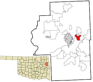
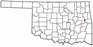
Welling is an unincorporated community and census-designated place (CDP) in Cherokee County, Oklahoma, United States. The population was 771 at the 2010 census, an increase of 15.25 percent over the figure of 669 recorded in 2000. It is home to The Salvation Army's Heart o' Hills camp and conference center.
Bull Hollow is an unincorporated community and census-designated place (CDP) in Delaware County, Oklahoma, United States. The population was 67 at the 2010 census.

Dennis is an unincorporated community and census-designated place (CDP) in Delaware County, Oklahoma, near Grand Lake. The population was 195 at the 2010 census. The Dennis Post Office existed from March 25, 1914, until January 31, 1956. It is said to be named for a local resident, Peter Dennis.
Rocky Ford is a census-designated place (CDP) in Delaware and Cherokee counties, Oklahoma, United States. The population was 61 at the 2010 census.
Sour John is a census-designated place (CDP) in Muskogee County, Oklahoma, United States. The population was 61 at the 2000 census.
Limestone is a census-designated place (CDP) in Rogers County, Oklahoma, United States, at an elevation of 705 feet. It is located less than 10 miles west of Claremore, Oklahoma on Oklahoma State Highway 20. The population was 753 as of July 2020.

Akins is a census-designated place (CDP) in Sequoyah County, Oklahoma, United States. It is part of the Fort Smith, Arkansas-Oklahoma Metropolitan Statistical Area. The population was 493 at the 2010 census, an increase of 9.8 percent over the figure of 449 recorded in 2000.
Belfonte is a census-designated place (CDP) in Sequoyah County, Oklahoma, United States. It is part of the Fort Smith, Arkansas-Oklahoma Metropolitan Statistical Area. The population was 426 at the 2000 census.

Brushy is a census-designated place (CDP) in Sequoyah County, Oklahoma, United States, along U.S. Route 59 in the foothills of the Brushy Mountains. It is part of the Fort Smith, Arkansas-Oklahoma Metropolitan Statistical Area. The population was 900 at the 2010 census, an increase of 14.4 percent over the figure of 787 recorded in 2000.
Carlisle is a census-designated place (CDP) in Sequoyah County, Oklahoma, United States. It is part of the Fort Smith, Arkansas-Oklahoma Metropolitan Statistical Area. The population was 606 at the 2010 census.
Notchietown is a census-designated place (CDP) in Sequoyah County, Oklahoma, United States. It is part of the Fort Smith, Arkansas-Oklahoma Metropolitan Statistical Area. The population was 430 at the 2000 census.
Short is a census-designated place (CDP) in Sequoyah County, Oklahoma, United States. It is part of the Fort Smith, Arkansas-Oklahoma Metropolitan Statistical Area. The population was 328 at the 2000 census.
Stony Point is a census-designated place (CDP) in Sequoyah County, Oklahoma, United States. It is part of the Fort Smith, Arkansas-Oklahoma Metropolitan Statistical Area. The population was 177 at the 2000 census.
Sand Hill is an unincorporated community and census-designated place (CDP) in Lebanon County, Pennsylvania, United States. The population was 2,496 at the 2010 census.

Oakhurst is an unincorporated community and census-designated place (CDP) in Creek and Tulsa counties in the U.S. state of Oklahoma. The population was 2,262 at the 2020 census, a slight increase from the 2010 population of 2,185.

