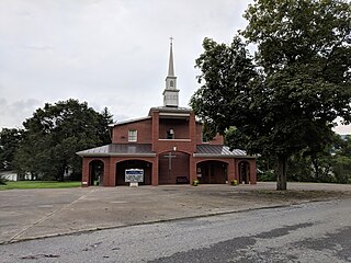
Lincoln is a historic unincorporated village in the Loudoun Valley of Loudoun County, Virginia, located approximately 1.5 miles (2.4 km) south of Purcellville. It was established as the community of Goose Creek during the 1750s by Quaker settlers and renamed "Lincoln" for the president of the same name, shortly after his election in 1860.
Mathias is an unincorporated community along the Lost River in Hardy County in the U.S. state of West Virginia. Mathias lies off West Virginia Route 259. Before the consolidated school of East Hardy High School at Baker, Mathias had its own educational facility, Mathias School, which served grades kindergarten through twelfth.

Uneeda is an unincorporated community on the Pond Fork River in Boone County in the U.S. state of West Virginia. The town lies along West Virginia Route 85.
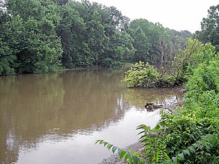
Sandy Creek is a tributary of the Ohio River in western West Virginia in the United States. Via the Ohio River, it is part of the watershed of the Mississippi River, draining an area of 124 square miles (320 km2) on the unglaciated portion of the Allegheny Plateau. The creek is 22 miles (35 km) long, or 38.3 miles (61.6 km) including its Left Fork.
Branchland is an unincorporated community in western Lincoln County, West Virginia, United States. It lies along West Virginia Route 10, southwest of the town of Hamlin, the county seat of Lincoln County. Its elevation is 597 feet (182 m). It has a post office with the ZIP code 25506. Raccoon Creek Road is one of the more popular ways of transportation through the area. Branchland Post Office serves addresses within Sheridan Magisterial District of Lincoln County as well as addresses in southern Cabell County and eastern Wayne County, West Virginia.
Millwood is an unincorporated community in northwestern Jackson County, West Virginia, United States, along the Ohio River at the mouth of Mill Creek. It lies along West Virginia Routes 2 and 62 northwest of the city of Ripley, the county seat of Jackson County. Its elevation is 577 feet (176 m). Although Millwood is unincorporated, it has a post office, with the ZIP code of 25262.
Belva is an unincorporated community and census-designated place in west Nicholas County and north Fayette County, West Virginia, United States; while the CDP only includes the Nicholas County portion, the Fayette County portion is considered part of the community. The town is situated at the bottomland surrounding the convergence of Bells Creek with Twentymile Creek and, subsequently, Twenty Mile Creek with the Gauley River. Belva is also the location of the convergence of two state highways: West Virginia Route 16 and West Virginia Route 39.
Neola is an unincorporated community in northeastern Greenbrier County, West Virginia, United States. It lies along West Virginia Route 92 north of the city of White Sulphur Springs. Its elevation is 2,037 feet (621 m).

Ivy is a census-designated place (CDP) in Albemarle County, Virginia, United States. The population as of the 2010 Census was 905. It is a small unincorporated community located on U.S. Route 250, just west of Charlottesville.
Rock View is an unincorporated community in Wyoming County, West Virginia, United States.
Shock is an unincorporated community in Gilmer County, West Virginia, United States. Shock is 13 miles (21 km) southwest of Glenville, along the Right Fork Steer Creek. Shock has a post office with ZIP code 26638.
Hico is a census-designated place (CDP) in Fayette County, West Virginia, United States. Hico is located at the junction of U.S. routes 19 and 60, 7 miles (11 km) northeast of Fayetteville. Hico has a post office with ZIP code 25854. As of the 2010 census, its population was 272.
Procious is an unincorporated community in Clay County, West Virginia, United States. Procious is located on the Elk River and West Virginia Route 4, 7 miles (11 km) west-northwest of Clay. Procious has a post office with ZIP code 25164.

Cora is an unincorporated community in Logan County, West Virginia, United States. Cora is 2 miles (3 km) southwest of Logan, along the Copperas Mine Fork. Cora has a post office with ZIP code 25614. It is part of the Mount Gay-Shamrock census-designated place.

Dante is a census-designated place in Russell and Dickenson counties, Virginia, in the United States. The population as of the 2010 Census was 649.

Sarvis Fork Covered Bridge, also known as Sandyville Covered Bridge, is a historic covered bridge located near Sandyville, Jackson County, West Virginia. It was built in 1889-1890 for $64.00 by R.B. Cunningham and G.W. Staats in 1890, originally spanning John Carnahan's Fork, a branch of Mill Creek. When US Route 33 was built using an iron bridge, the covered bridge was first abandoned, then moved and rebuilt over the Left Fork of the Sandy Creek in 1924 for $1,050.00.

Ravenswood District, formerly Ravenswood Magisterial District, is one of five historic magisterial districts in Jackson County, West Virginia, United States. The district was originally known as Gilmore Township, one of five civil townships established in 1863; the name officially became "Ravenswood" in 1871, and Jackson County's townships were converted into magisterial districts in 1872. When Jackson County was redistricted in the 1990s, the area of Ravenswood District was divided between the new Northern and Western Magisterial Districts. However, the county's historic magisterial districts continue to exist in the form of tax districts, serving all of their former administrative functions except for the election of county officials.

The Northern Magisterial District is one of three magisterial districts in Jackson County, West Virginia, United States. It was established during a process of redistricting undertaken in the 1990s. In 2010, 8,753 people lived in the district.

The Western Magisterial District is one of three magisterial districts in Jackson County, West Virginia, United States. It was established during a process of redistricting undertaken in the 1990s. In 2010, 10,576 people lived in the district.
Sandy is an unincorporated community in Blanco County, in the U.S. state of Texas. According to the Handbook of Texas, the community had a population of 25 in 2000.


