Santa Cruz, Davao del Sur

Last updated

Santa Cruz
Municipality of Santa Cruz
Sta. Cruz Municipal Hall.JPG
Municipal Hall
Flag of Santa Cruz, Davao del Sur.png
Seal of Santa Cruz, Davao del Sur.png
Ph locator davao del sur santa cruz.png
Map of Davao del Sur with Santa Cruz highlighted
OpenStreetMap
Santa Cruz, Davao del Sur
Philippines location map (square).svg
Red pog.svg
Santa Cruz
Location within the Philippines
Coordinates: 6°50′N125°25′E / 6.83°N 125.42°E / 6.83; 125.42
Country Philippines
Region Davao Region
Province Davao del Sur
District Lone district
Founded October 5, 1884
Barangays 18 (see Barangays)
Government
[1]
  Type Sangguniang Bayan
   Mayor Jose Nelson Z. Sala, Sr.
   Vice Mayor Jerome A. Undalok
   Representative John Tracy F. Cagas
   Municipal Council
Members
   Electorate 74,212 voters (2022)
Area
[2]
  Total319.91 km2 (123.52 sq mi)
Elevation
53 m (174 ft)
Highest elevation
539 m (1,768 ft)
Lowest elevation
0 m (0 ft)
Population
 (2020 census) [3]
  Total101,125
  Density320/km2 (820/sq mi)
   Households
26,424
Economy
   Income class 1st municipal income class
   Poverty incidence
20.71
% (2018) [4]
   Revenue 456 million (2020)
   Assets 2,155 million (2020)
   Expenditure 456.5 million (2020)
   Liabilities 1,459 million (2020)
Service provider
  ElectricityDavao del Sur Electric Cooperative (DASURECO)
Time zone UTC+8 (PST)
ZIP code
8001
PSGC
IDD : area code +63(0)82
Native languages Davawenyo
Cebuano
Obo
Kalagan
Tagalog
Ata Manobo
Website stacruz.gov.ph

Santa Cruz, officially the Municipality of Santa Cruz (Cebuano : Lungsod sa Santa Cruz; Tagalog : Bayan ng Santa Cruz), is a 1st class municipality in the province of Davao del Sur, Philippines. According to the 2020 census, it has a population of 101,125 people. [3]

Contents

The Municipality of Santa Cruz is part of Metropolitan Davao.

History

Santa Cruz is the oldest municipality in the province; it was founded on October 5, 1884, thirty-six years after the foundation of Davao, which is its mother city, by Don José Uyanguren of Guipúzcoa, Spain. Spanish pioneers and missionaries attempted to settle and Christianize the area in what is now Barangay Poblacion as early as 1880. Due to the staunch Islamic faith of the local people, the enraged pioneers and missionaries planted a cross under a shelter to mark the failure of the missionaries to convert these people to Christianity; the town's name now bears the name of the cross planted by those Spaniards. Over the following years, many locals submitted to Christianity [ citation needed ] and were conquered by Angel Rodriguez, the Spanish Governor-General of Davao.[ citation needed ] Like Don Uyanguren's attempt to develop the newly established Davao, the area did not prosper for another two decades.

The Americans arrived in Davao in the early 1900s after the Spanish defeat in the Spanish–American War. Fourteen years later, the town began to grow economically, although overshadowed by the booming economic growth of its neighbour Davao.

On March 16, 1936, its mother town, Davao, became one of the first two cities in Mindanao, the other being Zamboanga, due to the town's faster economic growth and agricultural boom.

On 1942, it was the beginning of Japanese invasion of the Philippines. The town suffered greatly during the Japanese occupation of the Philippines, unlike its neighbor Davao, which fared well and continued its economic growth during that time. The local recognized guerrillas and the military troops of the Philippine Commonwealth Army units continued to attack the Imperial Japanese forces. In 1945, combined Filipino and American troops including recognized guerrillas fought the Japanese and liberated the town. The general headquarters of the Philippine Commonwealth Army and Philippine Constabulary was active from 1945 to 1946 and was located in the town. After the war, most of the inhabitants of Santa Cruz moved to Davao in search of economic opportunities; despite this, the town continued its population and economic growth, though at a slower rate.

Almost three years after the Philippine Independence on July 4, 1946, two towns broke off from the municipality, namely: Padada, on July 15, 1949; and Digos on July 19 in the same year. In the 1960s, a new municipality, Roxas, was carved out from the town, covering the present-day barangays of Inauayan, Darong, Astorga, Coronon, and Sibulan; however, the Supreme Court of the Philippines nullified the creation of the municipality since this meant the collapse of the jurisdiction of once the most Christianized town in Mindanao. [5]

One of the municipalities which broke off from the town, Digos, became the capital town of the newly created Davao del Sur province in 1967; thirty-three years later it would become a city and will be the most populous in the entire province, excluding Davao City.

Aspiration for cityhood

On October 5, 2013, during the town's 129th anniversary of its existence, its local government leaders and populace have envisioned for a new aspiration for the town to become a city, given the presence of large industrial companies like the San Miguel Corporation, Coco Davao Inc., Franklin Baker Co., GSL Food Industries in the town. The municipal mayor Joel Ray Lopez commented, "As the oldest town in the province of Davao del Sur, we really wanted it to become a city soon." [6]

Its infrastructure have been moderately improved, and most of its cityhood requirements, specifically its income and total land area requirements, have been already met. When the municipality of Santa Cruz finally becomes a city, full industrialization in the area may be expected.

Geography

Santa Cruz situates in the Northern part of Davao del Sur. Bounded by Davao City on the north and south by the city of Digos. After undergoing several political subdivisions, 27,960 hectares of land was left representing 6.7% of the total land area of Davao del Sur. Forest land comprises 60% and the rest includes the 8 coastal barangays in the area.

The land area of Santa Cruz per Board of Technical Survey and Maps is 27,960 hectares. However, based on the Field Appraisal and Assessment Sheets (FAAS) and Tax Maps of the Municipal Assessor's Office the total land area of the municipality is 28,759.7855 or about 7.31% of the province's area (393,401 hectares). This excludes the Kapatagan contested area. Among the 18 barangays, Sibulan has the biggest land area of 6,390.6581 hectares or 22.22% of the total land area. Poblacion Zone III has the smallest area of 105.3148, only 0.37% of the total.

Topography

Santa Cruz is traversed by mountain ranges and high relief that include part of Mount Apo, the highest mountain peak in the Philippines, straddle the south, central, north and north-western portions of the municipality. The rugged topography of the central area gradually undulates toward the coastal plains of the north-eastern, eastern and south-eastern parts. Here, settlements sprawl contiguously along the coast of Davao Gulf under the vast monotony of coconut plantations. On the western frontier, a plateau stretches toward Barangay Kapatagan of Digos. The municipal elevation ranges from 10 to 2,939 metres (33 to 9,642 ft) above sea level (m.a.s.1.).

Climate

Climate data for Santa Cruz, Davao del Sur
MonthJanFebMarAprMayJunJulAugSepOctNovDecYear
Average high °C (°F)31
(88)
31
(88)
32
(90)
32
(90)
31
(88)
30
(86)
30
(86)
30
(86)
31
(88)
30
(86)
30
(86)
31
(88)
31
(88)
Average low °C (°F)22
(72)
22
(72)
22
(72)
23
(73)
24
(75)
24
(75)
23
(73)
23
(73)
23
(73)
23
(73)
23
(73)
22
(72)
23
(73)
Average precipitation mm (inches)51
(2.0)
41
(1.6)
38
(1.5)
45
(1.8)
82
(3.2)
108
(4.3)
114
(4.5)
120
(4.7)
95
(3.7)
96
(3.8)
76
(3.0)
52
(2.0)
918
(36.1)
Average rainy days13.212.013.815.322.523.925.225.423.324.121.016.8236.5
Source: Meteoblue (modeled/calculated data, not measured locally) [7]

Santa Cruz has a favorable climate all year round characterized by wet and dry seasons. It is outside the typhoon belt. Generally the months of November to April are dry periods. Wet season occurs from May to October. This type of climate is observable in the plain and coastal areas. In the mountainous barangays, the fourth type of climate is consistently experienced. Rainfall is more or less evenly distributed throughout the year. Most often in these areas heavy downpour occurs every afternoon while in the morning the sun shines.

Barangays

Santa Cruz is politically subdivided into 18 barangays. [8] Each barangay consists of puroks while some have sitios.

Of the 18 barangays, 7 are uplands, 9 are upland-lowland and coastal and 2 are lowland-coastal.

Demographics

Population census of Santa Cruz
YearPop.±% p.a.
1918 7,618    
1939 33,808+7.35%
1948 54,772+5.51%
1960 24,401−6.52%
1970 34,762+3.60%
1975 41,834+3.78%
1980 48,276+2.90%
1990 56,048+1.50%
1995 59,139+1.01%
2000 67,317+2.82%
2007 76,113+1.71%
2010 81,093+2.33%
2015 90,987+2.22%
2020 101,125+2.10%
Source: Philippine Statistics Authority [9] [10] [11] [12]

Languages

The languages spoken here in the municipality are Davaoeño, Tagalog, Mansakan, and English.

Economy

Agriculture: Among agricultural crops, coconut leads in production followed by banana and sugarcane. Other major crops are corn, coffee and vegetables. The municipality also produces high value fruits like mango, lanzones and durian. Cattle leads in livestock production.

Fisheries: The 24-kilometer long coastline of Santa Cruz, which forms part of Davao Gulf, provides a rich fishing grounds and is suitable for aquaculture.

Mining: Deposits of sulfur ore, rock phosphate, guano, limestone and cement raw materials were also traced but still have to be tapped for commercial and industrial uses.

Forestry: Tropical evergreen and other timber cover the vast timberland and forest area. Rattan, bamboo and other vines are also in abundance.

Major industries: Banana, Coconut, and Seaweed cultivation.

Tourism

Rizal Park, Santa Cruz Rizal Park in Sta. Cruz.JPG
Rizal Park, Santa Cruz
Passig Islet Pasig Islet, Sta. Cruz, Davao del Sur.JPG
Passig Islet

A famous competitive tourism destination in Southern Mindanao where eco-cultural and adventure tourism are properly managed and environmental protection is sustained through the partnership of the private sector and the government.

Sibulan - Mount Apo Trail
History revealed that the year 1880 marked the first successful climb to Mount Apo through the Sibulan Trail of Santa Cruz in Davao del Sur by a group led by Don Joaquin Rajal. Trekking along the trail will be highlighted with an assault via Boulder Face going to the summit of the country's highest peak.
Sibulan River White Water Tubing
Tubing along the rapids of Sibulan River using inflated tubes of rubber tires will drive one's adrenalin rush to the limits with the strong water current of the Sibulan River.
Tibolo Cultural Village
Learn the unique culture of the indigenous Bagobo-Tagabawa Tribe and enjoy the view of the entire Mt. Apo landscape and overlooking scenery of Davao City and Davao Gulf.
Bato and Tagabuli Seascape
Passig Islet in Barangay Bato and the Tagabuli Sea Rock Garden offer white sand beaches ideal for island hopping, scuba diving and fishing while giving the tourists a view of the symbiotic relationship of the ecosystem in the highlands down to the coastal system.

Other scenic spots include the Passig Islet Agro Eco Park and Tudaya Falls.

Events and festivals

Pista sa Kinaiyahan
A yearly activity conducted every last week of April as a tribute to the Mother Nature through tree-growing, cleanup activities and Boulder Face challenge.
Araw ng Santa Cruz
It is celebrated every October 5 in commemoration of the legal creation of the municipality in 1884. Highlights include parades, field demonstrations, trade fairs, carnivals and traditional festivities.
Sinabbadan Festival
A festival of ethnic ritual and dances celebrated every September.

Transportation

Santa Cruz is accessible by land transportation vehicles plying the Davao-Digos, Davao-Kidapawan City, Davao-Cotabato City, Davao-Koronadal City and Davao-Tacurong City routes passing through the town's single, 27 kilometres (17 mi) stretch of national highway that traverses its 11 barangays. From Davao City, the administrative center of Region XI, it is 38 kilometres (24 mi) away within a 45-minute ride, while it is 16 kilometres (9.9 mi) or about 15-minute ride from provincial capital city of Digos.

Air and water transport is accessible in the area through the international air and sea ports located in Davao City. Traveling overland is catered to by the Santa Cruz Overland Transport Terminal. Concrete-paved national highway runs along Santa Cruz connecting the cities of Davao and General Santos and adjacent provinces like South Cotabato, Sultan Kudarat, Maguindanao and Cotabato Province. Jeepneys and buses are used widely for major routes plying across the town. Mostly tricycles operate in the poblacion (town center) and in neighboring barangays. Bikes are used for leisure and sporting events.

Notable personalities

Related Research Articles

<span class="mw-page-title-main">Davao del Sur</span> Province in Davao Region, Philippines

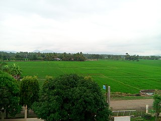
Davao del Sur, officially the Province of Davao del Sur, is a province in the Philippines located in the Davao Region in Mindanao. Its capital is Digos. Davao City is the largest city in terms of area and population within the province's jurisdiction, yet it is administratively independent from the province; as such, Davao City is only grouped for geographical and statistical purposes.

<span class="mw-page-title-main">Digos</span> Capital of Davao del Sur, Philippines

Digos, officially the City of Digos, is a 2nd class component city and capital of the province of Davao del Sur, Philippines. According to the 2020 census, it has a population of 188,376 people.

<span class="mw-page-title-main">Santa Cruz, Laguna</span> Capital of Laguna, Philippines

Santa Cruz, officially the Municipality of Santa Cruz, is a first class municipality and capital of the province of Laguna, Philippines. According to the 2020 census, it has a population of 123,574 people.

<span class="mw-page-title-main">Sibulan</span> Municipality in Negros Oriental, Philippines

Sibulan, officially the Municipality of Sibulan, is a second class municipality in the province of Negros Oriental, Philippines. According to the 2020 census, it has a population of 64,343 people.

<span class="mw-page-title-main">New Corella</span> Municipality in Davao del Norte, Philippines

New Corella, officially the Municipality of New Corella, is a 2nd class municipality in the province of Davao del Norte, Philippines. According to the 2020 census, it has a population of 57,913 people.

<span class="mw-page-title-main">Santa Cruz, Ilocos Sur</span> Municipality in Ilocos Sur, Philippines

Santa Cruz (, officially the Municipality of Santa Cruz, is a 1st class municipality in the province of Ilocos Sur, Philippines. According to the 2020 census, it has a population of 41,366 people.

<span class="mw-page-title-main">Makilala</span> Municipality in Cotabato, Philippines

Makilala, officially the Municipality of Makilala, is a 1st class municipality in the province of Cotabato, Philippines. According to the 2020 census, it has a population of 87,927 people.

<span class="mw-page-title-main">Lagonoy</span> Municipality in Camarines Sur, Philippines

Lagonoy, officially the Municipality of Lagonoy, is a 2nd class municipality in the province of Camarines Sur, Philippines. According to the 2020 census, it has a population of 56,714 people.

<span class="mw-page-title-main">Bansalan</span> Municipality in Davao del Sur, Philippines

Bansalan, officially the Municipality of Bansalan, is a 1st class municipality in the province of Davao del Sur, Philippines. According to the 2020 census, it has a population of 62,737 people.

<span class="mw-page-title-main">Hagonoy, Davao del Sur</span> Municipality in Davao del Sur, Philippines

Hagonoy, officially the Municipality of Hagonoy, is a 3rd class municipality in the province of Davao del Sur, Philippines. According to the 2020 census, it has a population of 56,919 people.

<span class="mw-page-title-main">Jose Abad Santos, Davao Occidental</span> Municipality in Davao Occidental, Philippines

Jose Abad Santos, officially the Municipality of Jose Abad Santos, is a 1st class municipality in the province of Davao Occidental, Philippines. According to the 2020 census, it has a population of 73,381 people.

<span class="mw-page-title-main">Magsaysay, Davao del Sur</span> Municipality in Davao del Sur, Philippines

Magsaysay, officially the Municipality of Magsaysay, is a 3rd class municipality in the province of Davao del Sur, Philippines. According to the 2020 census, it has a population of 56,263 people.

<span class="mw-page-title-main">Malalag</span> Municipality in Davao del Sur, Philippines

Malalag, officially the Municipality of Malalag, is a 2nd class municipality in the province of Davao del Sur, Philippines. According to the 2020 census, it has a population of 40,158 people.

<span class="mw-page-title-main">Malita</span> Capital of Davao Occidental, Philippines

Malita, officially the Municipality of Malita, is a 1st class municipality and capital of the province of Davao Occidental, Philippines. According to the 2020 census, it has a population of 118,197 people.

<span class="mw-page-title-main">Matanao</span> Municipality in Davao del Sur, Philippines

Matanao, officially the Municipality of Matanao, is a 2nd class municipality in the province of Davao del Sur, Philippines. According to the 2020 census, it has a population of 60,493 people.

<span class="mw-page-title-main">Padada</span> Municipality in Davao del Sur, Philippines

Padada, officially the Municipality of Padada, is a 3rd class municipality in the province of Davao del Sur, Philippines. According to the 2020 census, it has a population of 29,878 people.

<span class="mw-page-title-main">Santa Maria, Davao Occidental</span> Municipality in Davao Occidental, Philippines

Santa Maria, officially the Municipality of Santa Maria, is a 2nd class municipality in the province of Davao Occidental, Philippines. According to the 2020 census, it has a population of 57,526 people. Postal code 8011.

<span class="mw-page-title-main">Sulop</span> Municipality in Davao del Sur, Philippines

Sulop, officially the Municipality of Sulop, is a 3rd class municipality in the province of Davao del Sur, Philippines. According to the 2020 census, it has a population of 35,151 people.

<span class="mw-page-title-main">Kapatagan, Lanao del Norte</span> Municipality in Lanao del Norte, Philippines

Kapatagan, officially the Municipality of Kapatagan, is a 1st class municipality in the province of Lanao del Norte, Philippines. According to the 2020 census, it has a population of 62,571 people.

<span class="mw-page-title-main">Davao Occidental</span> Province in Davao Region, Philippines

Davao Occidental, officially the Province of Davao Occidental, is a province in the Philippines located in the Davao Region in Mindanao. Its capital is the municipality of Malita. To the east lies Davao Gulf. It also shares a maritime border with the Indonesian province of North Sulawesi to the south.

References

  1. Municipality of Santa Cruz | (DILG)
  2. "2015 Census of Population, Report No. 3 – Population, Land Area, and Population Density" (PDF). Philippine Statistics Authority. Quezon City, Philippines. August 2016. ISSN   0117-1453. Archived (PDF) from the original on May 25, 2021. Retrieved July 16, 2021.
  3. 1 2 Census of Population (2020). "Region XI (Davao Region)". Total Population by Province, City, Municipality and Barangay. Philippine Statistics Authority . Retrieved July 8, 2021.
  4. "PSA Releases the 2018 Municipal and City Level Poverty Estimates". Philippine Statistics Authority. December 15, 2021. Retrieved January 22, 2022.
  5. Antonio Figueroa (February 18, 2017). "FAST BACKWARD: The dissolution of Roxas town". Edge Davao. Retrieved February 19, 2017.
  6. "Edge Davao".
  7. "Santa Cruz: Average Temperatures and Rainfall". Meteoblue. Retrieved January 28, 2020.
  8. "Province: Davao del Sur". PSGC Interactive. Quezon City, Philippines: Philippine Statistics Authority . Retrieved November 12, 2016.
  9. Census of Population (2015). "Region XI (Davao Region)". Total Population by Province, City, Municipality and Barangay. Philippine Statistics Authority . Retrieved June 20, 2016.
  10. Census of Population and Housing (2010). "Region XI (Davao Region)". Total Population by Province, City, Municipality and Barangay. National Statistics Office . Retrieved June 29, 2016.
  11. Censuses of Population (1903–2007). "Region XI (Davao Region)". Table 1. Population Enumerated in Various Censuses by Province/Highly Urbanized City: 1903 to 2007. National Statistics Office.
  12. "Province of Davao del Sur". Municipality Population Data. Local Water Utilities Administration Research Division. Retrieved December 17, 2016.
  13. "Poverty incidence (PI):". Philippine Statistics Authority. Retrieved December 28, 2020.
  14. "Estimation of Local Poverty in the Philippines" (PDF). Philippine Statistics Authority. November 29, 2005.
  15. "2003 City and Municipal Level Poverty Estimates" (PDF). Philippine Statistics Authority. March 23, 2009.
  16. "City and Municipal Level Poverty Estimates; 2006 and 2009" (PDF). Philippine Statistics Authority. August 3, 2012.
  17. "2012 Municipal and City Level Poverty Estimates" (PDF). Philippine Statistics Authority. May 31, 2016.
  18. "Municipal and City Level Small Area Poverty Estimates; 2009, 2012 and 2015". Philippine Statistics Authority. July 10, 2019.
  19. "PSA Releases the 2018 Municipal and City Level Poverty Estimates". Philippine Statistics Authority. December 15, 2021. Retrieved January 22, 2022.