Related Research Articles

Otford is a village and civil parish in the Sevenoaks District of Kent, England. It lies on the River Darent, 3 miles (5 km) north of Sevenoaks. Otford's four churches are the Anglican Church of St Bartholomew in the village centre, the Otford Methodist Church, the Most Holy Trinity Roman Catholic Church, and the Otford Evangelical Church. By the village pond, also a roundabout, there are pubs, cafes and shops. The village has two schools, Otford Primary School and Russell House.

Tandridge District is a local government district in east Surrey, England containing part of the North Downs Area of Outstanding Natural Beauty, part of the Weald and the towns of Warlingham, Caterham, Oxted, Godstone and Lingfield. The area has several woodlands and some open heathland. Elevations above sea level range from 267 m (876 ft) at Botley Hill, North Downs to 42 m (138 ft) near Edenbridge. The district council offices are in Oxted, the second biggest settlement in the district.

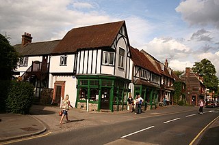
Westerham is a town and civil parish in the Sevenoaks District of Kent, England. It is located 3.4 miles east of Oxted and 6 miles west of Sevenoaks, adjacent to the Kent border with both Greater London and Surrey.

Dunton Green is a small village and civil parish in the Sevenoaks District of Kent, England. It lies in the valley of the River Darent, 3 miles (4.8 km) north of the town of Sevenoaks. Dunton Green is designated as being part of the Kent Downs area of outstanding natural beauty, due to its proximity to the North Downs. The original ecclesiastical church parish of Dunton Green was part of Otford parish. The former parish church was dedicated to St John the Divine.

Dunton Green railway station is on the South Eastern Main Line in England, serving the village of Dunton Green, Kent. It is 20 miles 46 chains (33.1 km) down the line from London Charing Cross and is situated between Knockholt and Sevenoaks stations. Trains calling at the station are operated by Southeastern.

Sevenoaks is a constituency represented in the House of Commons of the UK Parliament since 2019 by Laura Trott, a Conservative.

Brasted is a village and civil parish in the Sevenoaks District of Kent, England. Brasted lies on the A25 road, between Sundridge and Westerham; the road is named Westerham Road, High Street and Main Road as it passes through the village east to west. Brasted is 6 km west of Sevenoaks town. The parish had a population of 1321 and includes the hamlets of Brasted Chart, Toys Hill and Puddledock. The village of Brasted has a number of 18th-century houses with several antique shops, pubs and residences. The parish church is dedicated to St Martin.

Crowmarsh was a rural district in Oxfordshire, England from 1894 to 1932.

Toys Hill is a hamlet which lies within Brasted civil parish in the Sevenoaks district of Kent, England. It lies to the south of Brasted Chart, also in the parish.

Riverhead is a northern village part of the urban area of Sevenoaks in the district of the same name in Kent, England and is also a civil parish. The parish had a population in 2001 of 1821, increasing to 2,634 at the 2011 Census.
The London Traffic Area was established by the London Traffic Act 1924 to regulate the increasing amount of motor traffic in the London area. The LTA was abolished in 1965 on the establishment of the Greater London Council.

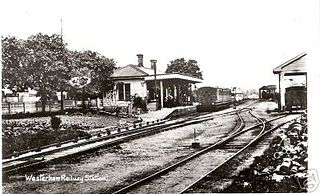
Westerham railway station served the village of Westerham in Kent from 1881 until its closure in 1961.

Chipstead is a small village within the parish of Chevening in the Sevenoaks District of Kent, England. It lies just west of the town of Sevenoaks and just off the A21 and A25 roads. It is also within a short distance of the M25 motorway, though not visible from it.

The Westerham Valley branch line was a short railway line in Kent that connected Westerham, Brasted and Chevening with the village of Dunton Green and the South Eastern Main Line, a distance of 4.5 miles (7.2 km).
A strip parish is a parish with a narrow elongated shape, typically formed during the Anglo-Saxon and early medieval period. The shape is influenced by landscape, political and economic factors. Evidence of such parishes can be found throughout England, although they appear to have been more common in a number of southern counties, particularly but not exclusively associated with locations encompassing both lowland and upland landscapes or alternatively coastal communities.

Ridley is a place and former civil parish in the county of Kent, England. It lies between Sevenoaks and Chatham, and is within the Sevenoaks local government district. It is part of the Ash-cum-Ridley civil parish.

Somerden was a hundred, a historical land division, in the county of Kent, England. It occupied the southwest corner of Kent, in the southern part of the Lathe of Sutton-at-Hone, within in the west division of Kent. The hundred was one of the last to be created in Kent, unlike the majority of Kent hundreds, it was not formally constituted in the Domesday Book of 1086, but came into being sometime after. Today the area is mostly rural and located in the southern part of the Sevenoaks District, south of Sevenoaks and west of Tonbridge. Somerden Hundred was approximately 7.5 mi (12.1 km) wide east to west, and 5.5 mi (8.9 km) long north to south, and had a small exclave about 1 mi (1.6 km) out from its south east corner. In the 1831 census Somerden was recorded as having an area of 13,650 acres (55 km2). The population in that census was recorded as 3,924, of which 2,078 were male and 1,846 were female, who belonged to 734 families living in 567 houses.

Codsheath was a hundred, a historical land division, in the county of Kent, England. It occupied the eastern part of the Lathe of Sutton-at-Hone, within in the west division of Kent. Codsheath was also recorded as "Codsede" in ancient records. Today the area that was the Codsheath Hundred is part of the Sevenoaks District of Kent that includes the town of Sevenoaks and surrounding area. The Hundred of Codsheath was included in the Domesday Book of 1086, that records it as having 203 houses, 44 in Sundridge and 159 in Otford. The River Darent flowed through the Codsheath Hundred, generally in a northeast direction. Several watermills were constructed on the river within the hundred, in the villages of Sundridge, Otford, Shoreham and Chevening.

Go-Coachhire Ltd is a bus operator running a total of 46 bus services across Kent and Sussex. The majority of these services are operated on behalf of Kent County Council from depots in Otford and Swanley.