Shabakunk Creek

Last updated
Shabakunk Creek
2013-05-04 15 37 44 View down the Shabakunk Creek just below Colonial Lake in Colonial Lake Park, Lawrence Township, New Jersey.jpg
The Shabakunk Creek below Colonial Lake
Location
Country United States
State New Jersey
Region Mercer County
Physical characteristics
SourceThe main branch
  location Hopewell Township
  coordinates 40°18′38″N74°45′50″W / 40.31056°N 74.76389°W / 40.31056; -74.76389
  elevation217 ft (66 m)
2nd sourceThe West Branch
  location Ewing Township
  coordinates 40°16′50″N74°48′49″W / 40.28056°N 74.81361°W / 40.28056; -74.81361
  elevation197 ft (60 m)
Mouth Assunpink Creek
  location
Lawrence Township
  coordinates
40°14′58″N74°43′9″W / 40.24944°N 74.71917°W / 40.24944; -74.71917
  elevation
37 ft (11 m)
Basin features
River system Assunpink Creek
Tributaries 
  rightThe West Branch

The Shabakunk Creek is a tributary of the Assunpink Creek in Mercer County, New Jersey, United States. [1] Via the Assunpink, its water ultimately flows into the Delaware River. The name Shabakunk is from the Lenape word meaning "shore land". [2]

Contents

Course

Main branch

The 7.9-mile-long (12.7 km) main branch of the Shabakunk Creek is born near what was once known as Twin Pine Airport in Hopewell Township. Flowing southwards, it flows under Pennington-Lawrenceville Road and then passes underneath Interstate 295, joining with the East Main Branch, which also originates in close proximity to the former Twin Pines Airport. After joining together with a third tributary, the Main Branch continues southward into Ewing, crosses underneath Bull Run Road and Ewingville Road, and enters the 11-acre Lake Sylva on the campus of The College of New Jersey. [3]

Map of the Shabakunk Creek Shabakunk Creek map.png
Map of the Shabakunk Creek

Below Lake Sylva, the Shabakunk flows southeastward, passing under Green Lane and then Ewingville Road for a second time. For a short distance it forms the border of Ewing and Lawrence townships before joining with the West Branch Shabakunk Creek, turning eastward and completely entering Lawrence. After passing underneath Lawrence Road, Princeton Pike and Brunswick Pike, the stream is impounded within Colonial Lake. Below Colonial Lake, the stream crosses underneath the Trenton Freeway and the Delaware and Raritan Canal before finally reaching its terminus at the Assunpink Creek.

View southeast along the West Branch Shabakunk Creek from the Rutledge Avenue Footbridge. 2013-05-04 16 50 33 View down the West Branch Shabakunk Creek at the Rutledge Avenue Foot Bridge in Ewing, New Jersey.jpg
View southeast along the West Branch Shabakunk Creek from the Rutledge Avenue Footbridge.

West Branch

The 5.3-mile-long (8.5 km) West Branch of the Shabakunk Creek emerges from the airfield of Trenton-Mercer Airport in Ewing. From there, it flows generally southeastward, quickly joining with several small, unnamed tributaries while passing underneath the Delaware and Bound Brook Railroad (formerly owned by the Reading Railroad, now owned by Conrail), Scotch Road and Upper Ferry Road. It then passes underneath Carlton Avenue, Lower Ferry Road, Stratford Avenue, Central Avenue, North Olden Avenue Extension, Pennington Road, Parkside Avenue and Prospect Street. At this point, it turns northeasterly, passes under North Olden Avenue Extension again and finally flows underneath Spruce Street. Shortly thereafter it meets the main branch at the Ewing/Lawrence border. Much of the West Branch Shabakunk Creek's course between Pennington Road and Spruce Street is canalized due to heavy commercial development, with at least one structure built directly over the stream.

History

Map of flood hazard areas along the West Branch Shabakunk Creek in Ewing Township, produced by the Delaware Valley Regional Planning Commission in its report, "Environmental Resource Inventory for the Township of Ewing, Mercer County, New Jersey" West Branch Shabakunk Flood Hazard Areas.png
Map of flood hazard areas along the West Branch Shabakunk Creek in Ewing Township, produced by the Delaware Valley Regional Planning Commission in its report, "Environmental Resource Inventory for the Township of Ewing, Mercer County, New Jersey"

Revolutionary War

Under the command of Colonel Edward Hand, a successful delaying action was fought at the Shabakunk Creek near Lawrence Road which prevented British forces from reaching Trenton before nightfall on January 2, 1777. This skirmish was part of the Second Battle of Trenton. [4]

1996 flooding and associated improvements

On June 12, 1996, a 100-year flash flood occurred on the West Branch Shabakunk Creek in Ewing. Over 7 inches of rain fell in just 4 hours, resulting in $10 million in damages and $24 million in municipal overtime costs due to cleanup efforts (in 1996 dollars). Over 175 residences and 75 businesses were affected, and some businesses were closed for nearly 2 weeks due to the cleanup and repair of damage. As a result, a $4.2 million flood and erosion control project was initiated to stabilize the banks and create storm water detention basins along the more heavily developed central and southern portions of the creek's course. [5] [6]

Environmental Impairment

Twin Pines Airport

All three of the tributaries of the Main Branch of the Shabakunk have their sources close to the contaminated lands of the Twin Pines Airport. Opened sometime before 1945, Twin Pines was an active regional airport for over 63 years, being open until 2008. For many decades the airport was extremely active, having dozens of planes stationed there, while hundreds of takeoffs and landings were recorded each week, for many years exceeding 100 per day. Although the Airport had a grass airstrip and its hangars and shops were one story wood plank structures, Twin Pines was a full service facility, offering complete maintenance services to its clients and visiting flyers, including oil and transmission fluid changes, lubrication and cleaning programs, as well as having three underground tanks, two for oil products and one for aviation fuel. [7]

In 2008, as Hopewell Township was in the process of negotiating to buy all of the lands of Twin Pines, an environmental inspection by the New Jersey Department of Environmental Protection determined that much of the land of the Airport, especially areas bordering Lawrenceville-Pennington Road, where the Airport's hangars, workshops, and offices were located, were contaminated due to leakage from three underground petroleum product tanks. Upon removal it was determined that all three of the tanks had been leaking their contents into the ground on a long-term basis, and the underground plume of the leaked oil and aviation fuel was projected to have reached the grounds across Lawrenceville-Pennington Road, where the headwaters of the East Main Branch of the Shabakunk lay. The New Jersey Department of Environmental Protection's inspection also determined that there were multiple sites on the contaminated lands of the Airport where solid wastes, including, according to local residents, cans and containers that had been used to store oil, lubricants, transmission fluid, solvents, and other industrial fluids, had been dumped. Long-term residents living in the immediate area reported to independent river keepers who were monitoring the Creek's high mercury levels, that it had been the long-term practice of workers at the airport to dump cans and containers filled with changed-out oil and other aviation fluids, into holes and ditches that were dug both on the Airport's premises and across Lawrenceville-Pennington Road, in or near the fields where the sources springs and marshy areas of the East Main Branch of the Shabakunk Creek originated. [8]

As of 2023, the area previously occupied by the Twin Pines Airport has for many years been repurposed as a public recreational area.

High Mercury and Methylmercury Levels in the Main Branch of Shabakunk Creek

Numerous studies and reports by various Federal, State of New Jersey and Local governments, as well as a number of universities and independent researchers' work, have continuously found over the years, up to the current round of reporting, that all branches of the Shabakunk Creek have medium to high levels of mercury and methylmercury. These reports and studies include annual publications by the United States Environmental Protection Agency, The United States Department of the Interior, and the New Jersey Department of Environmental Protection. [9] [10] [11] [12] [13] [14] [15] [16]

Ground water contamination from the Twin Pines Airport's leaking underground tanks and burying of petroleum and industrial fluid wastes are seen as being the main source of the high levels of mercury and methylmercury, as well as other heavy metals, that have been measured in the fish and bed sediments of the upper reaches of the Main Branch and of the Shabakunk Creek and its three tributaries which originate on or in close proximity to the contaminated lands of the Twin Pines Airport and the adjoining fields across Lawrenceville-Pennington Road. A study of the Main Branch of the Shabakunk, including testing of its upper tributaries found levels of mercury and methylmercury that were five and ten times higher than the upper ranges of allowable Federal Government levels, as was reported in a study of the Shabakunk Creek's mercury levels by the United States Department of the Interior. [17]

See also

Related Research Articles

<span class="mw-page-title-main">Lawrenceville, New Jersey</span> Place in Mercer County, New Jersey, United States

Lawrenceville is an unincorporated community and census-designated place (CDP) and a major commercial hub within Lawrence Township in Mercer County, in the U.S. state of New Jersey. The community is situated roughly halfway between Princeton and Trenton, although Lawrenceville constitutes part of the New York metropolitan area, the CDP actually is located approximately 15 miles closer to Philadelphia than to New York City; and as with the remainder of Mercer County, lies within the Federal Communications Commission's Philadelphia Designated Market Area. As of the 2020 United States census, the CDP's population was 3,751, a decrease of 136 (−3.5%) from the 3,887 recorded at the 2010 census, which in turn had reflected a decrease of 194 (−4.8%) from the 4,081 counted in the 2000 census.

<span class="mw-page-title-main">New Jersey Route 29</span> Highway in New Jersey

Route 29 is a state highway in the U.S. state of New Jersey. Signed north-south, it runs 34.76 mi (55.94 km) from an interchange with Interstate 295 (I-295) in Hamilton Township in Mercer County, where the road continues east as I-195, northwest to Route 12 in Frenchtown, Hunterdon County. Between the southern terminus and I-295 in Ewing Township, the route is a mix of freeway and expressway that runs along the Delaware River through Trenton. This section includes a truck-restricted tunnel that was built along the river near historic houses and Riverview Cemetery. North of I-295, Route 29 turns into a scenic and mostly two-lane highway. North of the South Trenton Tunnel, it is designated the Delaware River Scenic Byway, a New Jersey Scenic Byway and National Scenic Byway, that follows the Delaware River in mostly rural sections of Mercer County and Hunterdon County. The obsolete Delaware & Raritan Canal usually stands between the river and the highway. Most sections of this portion of Route 29 are completely shaded due to the tree canopy. Route 29 also has a spur, Route 129, which connects Route 29 to U.S. Route 1 (US 1) in Trenton.

<span class="mw-page-title-main">New Jersey Route 31</span> Highway in New Jersey

Route 31 is a state highway in New Jersey, United States. It runs 48.93 mi (78.75 km) from U.S. Route 1 Business /US 206 in Trenton, Mercer County, north to an intersection with US 46 in Buttzville in White Township, Warren County. Along the way, Route 31 heads through the communities of Flemington, Clinton, and Washington. Most of the highway is state-maintained; however, the section within the city limits of Trenton is maintained by the city. Much of Route 31 is a two-lane highway that passes through farmland, woodland, and mountainous areas. Two portions of the route—from Trenton to Pennington and from Ringoes to Clinton—consist of more development.

<span class="mw-page-title-main">Ewing Township, New Jersey</span> Township in Mercer County, New Jersey, United States

Ewing Township is a township in Mercer County, in the U.S. state of New Jersey. The township falls within the New York metropolitan area as defined by the U.S. Census Bureau. It borders the Philadelphia metropolitan area and is part of the Federal Communications Commission's Philadelphia Designated Market Area. As of the 2020 United States census, the township's population was 37,264, its highest decennial count ever and an increase of 1,474 (+4.1%) from the 35,790 recorded at the 2010 census, which in turn reflected an increase of 83 (+0.2%) from the 35,707 counted in the 2000 census.

<span class="mw-page-title-main">Hopewell Township, Mercer County, New Jersey</span> Township in Mercer County, New Jersey, United States

Hopewell Township is a township in Mercer County, in the U.S. state of New Jersey. Located at the cross-roads between the Delaware Valley region to the southwest and the Raritan Valley region to the northeast, the township considered an exurb of New York City in the New York metropolitan area as defined by the United States Census Bureau, while also directly bordering the Philadelphia metropolitan area, being a part of the Federal Communications Commission's Philadelphia Designated Market Area. As of the 2020 United States census, the township's population was 17,491, its highest decennial count ever and an increase of 187 (+1.1%) from the 2010 census count of 17,304, which in turn reflected an increase of 1,199 (+7.4%) from the 16,105 counted in the 2000 census.

<span class="mw-page-title-main">Lawrence Township, Mercer County, New Jersey</span> Township in Mercer County, New Jersey, United States

Lawrence Township is a township in Mercer County, in the U.S. state of New Jersey. Located at the cross-roads between the Delaware Valley region to the southwest and the Raritan Valley region to the northeast, the township is an outer-ring suburb of New York City in the New York Metropolitan area, as defined by the United States Census Bureau, while also directly bordering the Philadelphia metropolitan area and is part of the Federal Communications Commission's Philadelphia Designated Market Area.

<span class="mw-page-title-main">U.S. Route 206</span> Highway in New Jersey and Pennsylvania

U.S. Route 206 is a 130.23-mile-long (209.58 km) north–south United States highway in New Jersey and Pennsylvania, United States. Only about a half a mile of its length is in Pennsylvania; the Milford–Montague Toll Bridge carries it over the Delaware River into New Jersey, where it connects to the remainder of the route. Its southern terminus is at an intersection with US 30 and Route 54 in Hammonton. The highway's northern terminus is at an intersection with US 209 near Milford, Pennsylvania; some sources and signs show an overlap with US 209 to end at its parent route US 6. For much of its length, US 206 is a rural two-lane undivided road that passes through the Pine Barrens, agricultural areas, and the Appalachian Mountains of northwestern New Jersey, with some urban and suburban areas. The route connects several cities and towns, including Bordentown, Trenton, Princeton, Somerville, Roxbury, Netcong, and Newton. The road is known as the Disabled American Veterans Highway for much of its length.

<span class="mw-page-title-main">Raritan River</span> Major river in the U.S. state of New Jersey

The Raritan River is a major river of New Jersey. Its watershed drains much of the mountainous area of the central part of the state, emptying into the Raritan Bay on the Atlantic Ocean.

<span class="mw-page-title-main">Assunpink Creek</span> River in New Jersey, United States

Assunpink Creek is a 22.9-mile-long (36.9 km) tributary of the Delaware River in western New Jersey in the United States. The name Assunpink is from the Lenape Ahsën'pink, meaning "stony, watery place".

<span class="mw-page-title-main">County Route 546 (New Jersey)</span> County highway in New Jersey, U.S.

County Route 546 is a county highway in the U.S. state of New Jersey. The highway begins at Route 29 within the Titusville, New Jersey section of Hopewell Township and extends 9.98 miles (16.06 km) to U.S. Route 1 (US 1) in Lawrence Township. The road runs entirely within Mercer County.

<span class="mw-page-title-main">Twin Pine Airport</span> Airport in Hopewell Township, New Jersey

Twin Pine Airport, originally called the Pennington Airport, was a privately owned public-use airport located on Pennington-Lawrenceville Road three miles (4.8 km) southeast of the central business district of Pennington, in Hopewell Township, Mercer County, New Jersey, United States. The airport was established in 1945 and is an example of a municipal government's desire to appropriate property for its own use using taxation methods as an alternative to eminent domain.

<span class="mw-page-title-main">Ewingville, New Jersey</span> Populated place in Mercer County, New Jersey, US

Ewingville is a section of Ewing Township in Mercer County, in the U.S. state of New Jersey originally settled as a village on Shabakunk Creek. Located at the intersection of Ewingville Road/Upper Ferry Road and Pennington Road, it is one of the oldest settlements in Ewing Township and dates back to the 18th century. The community was known as Cross Keys before adopting its current name in 1836, two years after the incorporation of Ewing Township in 1834.

The Assunpink Trail was a Native American trail in what later became Middlesex, Somerset, and Mercer counties in the central and western part of New Jersey. Like Assunpink Creek, the trail takes its name from the Algonquian language Ahsën'pink, meaning "stony, watery place".

<span class="mw-page-title-main">Cooleys Corner, New Jersey</span> Populated place in Monmouth County, New Jersey, US

Cooleys Corner is an unincorporated community located within Upper Freehold Township in Monmouth County, in the U.S. state of New Jersey. The site of the settlement is within the Assunpink Wildlife Management Area, a New Jersey Department of Environmental Protection Division of Fish and Wildlife-operated preserved area in Monmouth and Mercer counties along the Assunpink Creek. Before the creation of the Assunpink Lake in the 1970s, the area consisted of farmland located at the intersection of Clarksburg Road and Imlaystown-Hightstown Road. Some farmland is still present in the area but is now mostly used by hunters. The main boat ramp to Assunpink Lake is located along the former Imlaystown-Hightstown Road.

<span class="mw-page-title-main">King's Highway Historic District (New Jersey)</span> Historic district in New Jersey, United States

The King's Highway Historic District covers the portions of U.S. Route 206 and New Jersey Route 27 in New Jersey that connect Lawrenceville with Kingston through Princeton. This historic roadway dates to colonial times and was a portion of the King's Highway that was laid out by order of Charles II of England to connect Boston with Charleston. It is lined with many institutions and sites that have played an important role in the History of the United States, including Princeton University and the Princeton Theological Seminary.

<span class="mw-page-title-main">John D. Hart House</span> United States historic place

The John D. Hart House is a historic home built c. 1800 and located at 54 East Curlis Avenue in Hopewell Township near the borough of Pennington in Mercer County, New Jersey. It was documented by the Historic American Buildings Survey in 1937. The house was added to the National Register of Historic Places on October 18, 1972, for its significance in architecture.

<span class="mw-page-title-main">Lake Ceva</span> Reservoir in Mercer County, New Jersey

Lake Ceva is a 6-acre (2.4 ha) man-made lake near the Shabakunk Creek on the campus of The College of New Jersey in Ewing Township, Mercer County, New Jersey, United States. The lake was created when an earthen dam was constructed across a small tributary of the Shabakunk in the 1920s by a local landowner, prior to the construction of the current college campus. The lake is adjacent to Lake Sylva, and together the two lakes are the basis of the name of the Hillwood Lakes section of Ewing.

<span class="mw-page-title-main">Jacobs Creek (New Jersey)</span> River in New Jersey, United States

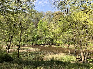
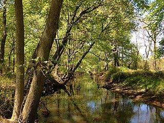
Jacobs Creek is a tributary of the Delaware River in Mercer County in the U.S. state of New Jersey. From its headwaters in Hopewell Township, the creek flows generally south and southwest. Along the creek's lower course, it flows along the border between Hopewell Township and Ewing Township, entering the Delaware River between Lambertville and Trenton.

References

  1. U.S. Geological Survey. National Hydrography Dataset high-resolution flowline data. The National Map, accessed May 26, 2013
  2. "The Lawrence Nature Center" . Retrieved May 27, 2013.
  3. "Environmental Resource Inventory for the Township of Ewing, Mercer County, New Jersey" (PDF). Retrieved May 27, 2013.
  4. "Revolutionary War Site - Shabakunk Creek Marker" . Retrieved May 26, 2013.
  5. "Flood control project brings economic stability" . Retrieved May 27, 2013.
  6. "Ewing Township Erosion Control" . Retrieved May 27, 2013.
  7. "Twin Pines Airport Historical Website".
  8. "Hopewell Township Twin Pines Airport Recreational Project" (PDF). Hopewell Township, Mercer County, New Jersey . October 11, 2008. Archived from the original (PDF) on February 12, 2017.
  9. "Ewing Environmental Report".
  10. "Lawrence Environmental Report" (PDF).
  11. "New Jersey Department of Environmental Protection 2008 Integrated Water Quality Monitoring and Basement Report" (PDF).
  12. "New Jersey Department of Environmental Protection Integrated Water Quality Monitoring and Assessment 2006".
  13. "2012 New Jersey Integrated Report Appendix B: Final 2012 303(d) List of Water Quality Limited Waters July 2014" (PDF).
  14. "New Jersey Department of Environmental Protection Integrated Water Quality Monitoring and Assessment 2012" (PDF).
  15. "Appendix A to 2012 Integrated Water Quality Monitoring and Asssessment 2012" (PDF).
  16. "Settings Report for the Central Delaware Tributaries Watershed Management Area 11" (PDF).
  17. "US Department of the Interior: Total Mercury and Methylmercury in Fish Fillets, Water, and Bed Sediments from Selected Streams in the Delaware River Basin, New Jersey" (PDF).