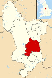
Amber Valley is a local government district and borough in Derbyshire, England. It takes its name from the River Amber and covers a semi-rural area with a number of small towns whose economy was formerly based on coal mining and engineering. The parliamentary constituency of Amber Valley covers a similar area. The Local Authority population at the 2011 Census was 122,309.

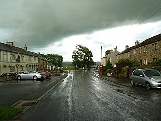
Clitheroe is a town and civil parish in the Borough of Ribble Valley in Lancashire, England, approximately 34 miles (55 km) northwest of Manchester. It is near the Forest of Bowland, and is often used as a base for tourists visiting the area. In 2016, Clitheroe Built Up Area had an estimated population of 15,517.

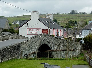
Crickhowell is a small town and community in southeastern Powys, Wales, near Abergavenny, and was in the historic county of Brecknockshire.
Pontrhydfendigaid is a village in Ceredigion, Wales. It lies on the western flank of the Cambrian Mountains, between Devil's Bridge and Tregaron. The village lies on the River Teifi, whose source is just 3 miles to the east at Llyn Teifi.

Llanddewi Brefi is a village, parish and community of approximately 500 people in Ceredigion, Wales.

Sugar Loaf, sometimes called The Sugar Loaf, is a mountain situated 2 miles (3.2 km) north-west of Abergavenny in Monmouthshire, Wales and sits within the Brecon Beacons National Park. It is the southernmost of the summit peaks of the Black Mountains, with a height of 1,955 feet (596 metres).
Ramsgreave and Wilpshire is a railway station on the Ribble Valley Line that serves the villages/suburbs of Ramsgreave and Wilpshire, just north of Blackburn in Lancashire, England. The station is 2 3⁄4 miles (4.4 km) north of Blackburn railway station.

Wombwell railway station lies in Wombwell, a town south of Barnsley in South Yorkshire, England. The station is 12 miles (19 km) north of Sheffield on the Hallam and Penistone Lines. The station was opened by the Midland Railway on 1 July 1897, and between 25 September 1950 and 20 February 1969 was known as Wombwell West to distinguish it from Wombwell's other railway station, Wombwell Central, which closed in 1959.
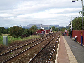
Langho railway station serves the village of Langho in the Ribble Valley in Lancashire, England. The station is 5 1⁄4 miles (8.4 km) north of Blackburn.
A reef knoll is a land-based landform that comprises an immense pile of calcareous material that accumulated on a previously existing ancient sea floor. At the time of its accumulation it may have had enough structure from organisms such as sponges to have been free-standing and to withstand the sea currents as material accumulated, and was likely an atoll. Another possibility is the remains of deep water coral. Such structures are thus often fossil-rich.

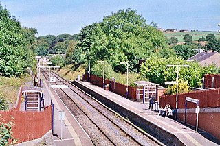
Whalley railway station serves the village of Whalley in Lancashire, England. The station lies on the Ribble Valley Line 7 1⁄4 miles (11.7 km) north of Blackburn. The station has two platforms, slightly offset from each other. It is unstaffed, with shelters on each platform. Immediately beyond its eastern end, the line crosses the River Calder on a 678 yards (620 m) long, brick viaduct of 48 arches.
The Lonk is a domestic sheep of a specific breed, found in the hills of the central and south Pennines, in the north of England. The name "Lonk" derives from the Lancashire word "lanky", meaning long and thin, usually in a person. Their range extends into only three counties; Lancashire, Yorkshire and Derbyshire. Also known as the Improved Haslingden, the Lonk is of the Blackfaced Mountain type, and is similar to the Derbyshire Gritstone, apart from the absence of horns in that breed.
Wigglesworth is a village and civil parish in the Craven district of North Yorkshire, England. The population of the civil parish taken at the 2011 Census was 379. It is on the road between Long Preston to the east, Clitheroe to the south and the small village of Rathmell lies just to the north. It is about 5 miles (8 km) south of Settle.
"The Terror of Blue John Gap" is a short story written by Sir Arthur Conan Doyle. It was first published in Strand Magazine in 1910.
The Clitheroe by-election, 1979 was a by-election held for the British House of Commons constituency of Clitheroe in Lancashire on 1 March 1979. It was won by the Conservative Party candidate David Waddington.
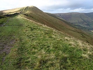
Rushup Edge is a ridge in the Derbyshire Peak District of England. The ridge's highest point is Lord's Seat at 550 m (1,804 ft), while Mam Tor lies at its eastern end, beyond which the Great Ridge runs.

High Wheeldon is a distinctive dome-shaped hill near the Staffordshire border in Derbyshire, in the Peak District valley of Upper Dovedale, overlooking the villages of Earl Sterndale, Longnor and Crowdecote. It is close to the more distinctive and more widely known Chrome Hill and Parkhouse Hill. Popular with walkers, and possessing excellent views of the Dove and Manifold valleys, High Wheeldon is in the care of the National Trust, and has been since 1946 when it was presented by Mr F.A. Holmes of Buxton to the Trust as a war memorial. A plaque at the summit commemorates the presentation, stating that the hill was presented 'in honoured memory of the men of Derbyshire and Staffordshire who fell in the Second World War'.
The Derbyshire Gritstone is a breed of domestic sheep native to the United Kingdom. A hardy hill sheep, it is also one of the oldest British breeds. The Gritstone is generally found around Derbyshire, Cheshire, Yorkshire, and Lancashire. They are large, polled sheep with black and white faces. The Gritstone has a finer fleece than most hill breeds, but is still kept primarily for meat production.
Sheep Hills usually refers to:
Shipley Gate railway station served the town of Shipley, Derbyshire, England from 1851 to 1948 on the Erewash Valley Line.

