Sherman Township, Iosco County, Michigan

Last updated

Sherman Township, Michigan
Sherman Township (Iosco), MI location.png
Location within Iosco County
USA Michigan location map.svg
Red pog.svg
Sherman Township
Location within the state of Michigan
Usa edcp location map.svg
Red pog.svg
Sherman Township
Location within the United States
Coordinates: 44°12′3″N83°41′51″W / 44.20083°N 83.69750°W / 44.20083; -83.69750
CountryUnited States
State Michigan
County Iosco
Area
  Total35.9 sq mi (93.0 km2)
  Land35.9 sq mi (93.0 km2)
  Water0.0 sq mi (0.0 km2)
Elevation
633 ft (193 m)
Population
 (2020)
  Total431
  Density12/sq mi (4.6/km2)
Time zone UTC-5 (Eastern (EST))
  Summer (DST) UTC-4 (EDT)
ZIP code(s)
48748 (National City)
48763 (Tawas City)
48765 (Turner)
48770 (Whittemore)
FIPS code 26-73180 [1]
GNIS feature ID1627072 [2]

Sherman Township is a civil township of Iosco County in the U.S. state of Michigan. The population was 448 at the 2010 census and slightly decreased to 431 at the 2020 census. [3]

Contents

Communities

Geography

According to the United States Census Bureau, the township has a total area of 35.9 square miles (93.0 km2), all land.

Demographics

As of the census [1] of 2000, there were 493 people, 200 households, and 140 families residing in the township. The population density was 13.7 per square mile (5.3/km2). There were 319 housing units at an average density of 8.9 per square mile (3.4/km2). The racial makeup of the township was 96.96% White, 0.41% African American, 0.61% Native American, 0.20% Asian, and 1.83% from two or more races. Hispanic or Latino of any race were 2.03% of the population.

There were 200 households, out of which 24.0% had children under the age of 18 living with them, 58.0% were married couples living together, 7.0% had a female householder with no husband present, and 30.0% were non-families. 28.0% of all households were made up of individuals, and 13.0% had someone living alone who was 65 years of age or older. The average household size was 2.47 and the average family size was 2.94.

In the township the population was spread out, with 23.3% under the age of 18, 5.9% from 18 to 24, 25.4% from 25 to 44, 25.8% from 45 to 64, and 19.7% who were 65 years of age or older. The median age was 42 years. For every 100 females, there were 101.2 males. For every 100 females age 18 and over, there were 101.1 males.

The median income for a household in the township was $40,547, and the median income for a family was $43,438. Males had a median income of $31,786 versus $21,406 for females. The per capita income for the township was $18,432. About 6.6% of families and 10.8% of the population were below the poverty line, including 21.8% of those under age 18 and none of those age 65 or over.

Related Research Articles

Martin Township is a civil township of Allegan County in the U.S. state of Michigan. The population was 2,723 at the 2020 census.

Benton Township is a civil township of Eaton County in the U.S. state of Michigan. As of the 2020 census, the township population was 2,766.

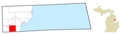
Plainfield Township is a civil township of Iosco County in the U.S. state of Michigan. The population was 3,350 at the 2020 census, down from 3,799 at the 2010 census.

<span class="mw-page-title-main">Attica Township, Michigan</span> Civil township in Michigan, United States

Attica Township is a civil township of Lapeer County in the U.S. state of Michigan. The population was 4,706 at the 2020 Census.

<span class="mw-page-title-main">Burnside Township, Michigan</span> Civil township in Michigan, United States

Burnside Township is a civil township of Lapeer County in the U.S. state of Michigan. The population was 1,904 at the 2020 Census.

<span class="mw-page-title-main">Hadley Township, Michigan</span> Civil township in Michigan, United States

Hadley Township is a civil township of Lapeer County in the U.S. state of Michigan. The population was 4,547 at the 2020 Census.

<span class="mw-page-title-main">Rich Township, Michigan</span> Civil township in Michigan, United States

Rich Township is a civil township of Lapeer County in the U.S. state of Michigan. The population was 1,500 at the 2020 Census.

Olive Township is a civil township of Ottawa County in the U.S. state of Michigan. The population was 5,007 at the 2020 census.

Buel Township is a civil township of Sanilac County in the U.S. state of Michigan. As of the 2020 census, the township population was 1,161.

Custer Township is a civil township of Sanilac County in the U.S. state of Michigan. The population was 893 at the 2020 census.

Delaware Township is a civil township of Sanilac County in the U.S. state of Michigan. The population was 784 at the 2020 census.

Watertown Township is a civil township of Sanilac County in the U.S. state of Michigan. The population was 1,263 at the 2020 census.

Almer Charter Township is a charter township of Tuscola County in the U.S. state of Michigan. The population was 1,965 at the 2020 census. It is the only charter township in the Upper Thumb region of Michigan.

Gilford Township is a civil township of Tuscola County in the U.S. state of Michigan. The population was 735 at the 2020 census.

Juniata Township is a civil township of Tuscola County in the U.S. state of Michigan. The population was 1,563 at the 2020 census.

Kingston Township is a civil township of Tuscola County in the U.S. state of Michigan. The population was 1,476 at the 2020 census.

Tuscola Township is a civil township of Tuscola County in the U.S. state of Michigan. The population was 1,978 at the 2020 census.

Watertown Township is a civil township of Tuscola County in the U.S. state of Michigan. The population was 2,091 at the 2020 census.

Brookfield Township is a civil township of Eaton County in the U.S. state of Michigan. As of the 2020 census, the township population was 1,467.

<span class="mw-page-title-main">Franklin Township, Lenawee County, Michigan</span> Civil township in Michigan, United States

Franklin Township is a civil township of Lenawee County in the U.S. state of Michigan. The population was 3,063 at the 2020 census.

References

  1. 1 2 "U.S. Census website". United States Census Bureau . Retrieved January 31, 2008.
  2. U.S. Geological Survey Geographic Names Information System: Sherman Township, Iosco County, Michigan
  3. "Explore Census Data". data.census.gov. Retrieved April 30, 2024.
  4. U.S. Geological Survey Geographic Names Information System: National City, Michigan
  5. Station: Emery Jct., MI Archived 2008-07-06 at the Wayback Machine , Michigan's Internet Railroad History Museum
  6. Romig, Walter (1986) [1973]. Michigan Place Names. Detroit, Michigan: Wayne State University Press. ISBN   0-8143-1838-X.
  7. 48748 5-Digit ZCTA, 487 3-Digit ZCTA - Reference Map - American FactFinder [ permanent dead link ], U.S. Census Bureau, 2000 census
  8. 48763 5-Digit ZCTA, 487 3-Digit ZCTA - Reference Map - American FactFinder [ permanent dead link ], U.S. Census Bureau, 2000 census
  9. 48765 5-Digit ZCTA, 487 3-Digit ZCTA - Reference Map - American FactFinder [ permanent dead link ], U.S. Census Bureau, 2000 census
  10. 48770 5-Digit ZCTA, 487 3-Digit ZCTA - Reference Map - American FactFinder [ permanent dead link ], U.S. Census Bureau, 2000 census