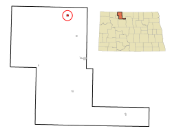
Sherwood's weather station has one of the lowest (if not the lowest) yearly precipitation levels in North Dakota, with an annual normal of 13.13inches (1971–2000).[5]
As of the census of 2010, there were 242 people, 110 households, and 70 families residing in the city. The population density was 780.6 inhabitants per square mile (301.4/km2). There were 133 housing units at an average density of 429.0 per square mile (165.6/km2). The racial makeup of the city was 99.2% White and 0.8% from two or more races. Hispanic or Latino of any race were 0.4% of the population.
There were 110 households, of which 31.8% had children under the age of 18 living with them, 51.8% were married couples living together, 4.5% had a female householder with no husband present, 7.3% had a male householder with no wife present, and 36.4% were non-families. 34.5% of all households were made up of individuals, and 16.4% had someone living alone who was 65 years of age or older. The average household size was 2.20 and the average family size was 2.74.
The median age in the city was 42.3 years. 26% of residents were under the age of 18; 2.5% were between the ages of 18 and 24; 25.2% were from 25 to 44; 25.3% were from 45 to 64; and 21.1% were 65 years of age or older. The gender makeup of the city was 49.6% male and 50.4% female.
2000 census
As of the census of 2000, there were 255 people, 117 households, and 65 families residing in the city. The population density was 802.2 inhabitants per square mile (309.7/km2). There were 138 housing units at an average density of 434.1 per square mile (167.6/km2). The racial makeup of the city was 98.04% White, 1.18% Native American, and 0.78% from two or more races.
There were 117 households, out of which 28.2% had children under the age of 18 living with them, 47.0% were married couples living together, 5.1% had a female householder with no husband present, and 43.6% were non-families. 42.7% of all households were made up of individuals, and 24.8% had someone living alone who was 65 years of age or older. The average household size was 2.18 and the average family size was 3.08.
In the city, the population was spread out, with 27.5% under the age of 18, 4.7% from 18 to 24, 25.1% from 25 to 44, 23.1% from 45 to 64, and 19.6% who were 65 years of age or older. The median age was 41 years. For every 100 females, there were 96.2 males. For every 100 females age 18 and over, there were 96.8 males.
The median income for a household in the city was $26,442, and the median income for a family was $34,167. Males had a median income of $27,500 versus $25,625 for females. The per capita income for the city was $14,756. None of the families and 7.3% of the population were living below the poverty line, including no under eighteens and 15.7% of those over 64.
Education
Sherwood is served by the Mohall Lansford Sherwood School District. Sherwood Elementary School educates children in grades K–6.[9] Sherwood High School closed its doors in 2005. The nickname for the school was the Wildcats. In 2016, the elementary school closed, and now all students grades K-12 go to school in Mohall or other nearby schools.
The town site of Sherwood was homesteaded by Bert C. Loomis. Loomis deeded to the land to Sherwood H. Sleeper, who subsequently deeded the land to the Northern Town and Land Company or Corporation, who surveyed it into lots.
A site for a town was purchased by Sherwood H. Sleeper in the summer of 1904 on the NE quarter of Section 12, Range 85, Township 163. On August 4, 1904, the surveying and platting was begun and the town site plat was filed in Imperial Ward County on September 6, 1904. The town was named Sherwood.
The earliest post office of Colquhoun was located on the west side of the township, five miles from the present site of Sherwood, on what was the Maurice Walsh farm. This was known as the “Nina” Post Office. The late C. A. Verry of Minot was instrumental in getting the “Nina” Post Office located in Calquhoun. The postmaster at the Nina Post Office was O. H. Moon. There was also a post office in Eden Valley township called the “Bolacker” Post Office. Mrs. Alexander was the postmistress there. Later, both the Nina and Bolacker Post Offices were moved to the present site of Sherwood with Mrs. Alexander as postmistress.
Rural free delivery was established in the fall of 1904 with Fred Cool, Charlie King and Henry Hurdelbrink as mail carriers.
Sherwood was organized as a village in April 1905. The first village officers were: C.H. Ennis, Chairman; F.L. Denneson, Trustee; K.T. Roble, Trustee; W.H. Walker, Trustee; H.W. Conway, Marshal; E.O. Keene, Justice; J.G. Connole, Treasurer; and R.L. Young, Clerk.
Brother Charles Gauber started a small school called the Simon Olson Shack before the town was incorporated. The town grade school opened under Miss Lelah Conkey and Lily Traux. Members of the board were: N. Nelson, President; P.A. Conkey; Simon Olson; and T.R. McFarlane, Clerk. In 1908 a high school was added and in 1912, five teachers were employed.
In 1916, a separate high school building east of the grade school was built. The first graduation class from the high school were: Esther Stenzel, Cora Knutson, Paul Goheen, and Glenn Sansburn. The Beckedahl School was moved in and used as a classroom in 1922. Children were brought in by buses. All recreation, even basketball, was outdoors.
Modern history
On September 15, 1991, an oil fire broke out west of town. Eight firefighters responded to the scene. While they were trying to put out the fire, the wind changed direction and the men received severe injuries. Six of the men survived, but two others, Craig Keith and Kevin Johnson, would later die of their injuries. Today, a monument stands in front of the Sherwood Fire Department in memory of these two men.
In 2015, after failing to turn Leith into an all white community, Craig Cobb moved to Sherwood. Craig has expressed a desire to turn the town into a white nationalist community.[10]
↑ "Index". Welcome to Mohall/Lansford/Sherwood Schools. Mickey A Depute. November 2, 2010. Archived from the original on January 17, 2011. Retrieved March 5, 2011.
Somerville is a town in Barton Township, Gibson County, Indiana, United States. The population was 293 at the 2010 census, making it the third-smallest community in the county.
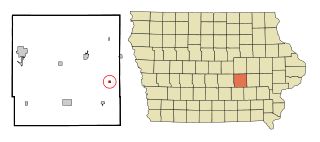
Guernsey is a town in Poweshiek County, Iowa, United States. The population was 63 at the time of the 2020 census.
Sherwood is a village in Branch County of the U.S. state of Michigan. The population was 285 at the 2020 census. The village is located within Sherwood Township.
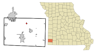
Creighton is a city in Cass County, Missouri, United States. The population was 327 at the 2020 census. It is 57 miles south southeast of the Kansas City metropolitan area.
Galena is a city and the county seat in Stone County, Missouri, United States. The population was 455 at the 2020 census. Galena is part of the Branson, Missouri Micropolitan Statistical Area.
Diamond is a city in north central Newton County, Missouri, United States, located southeast of Joplin. The population was 902 at the 2010 census. It is part of the Joplin, Missouri, Metropolitan Statistical Area. Diamond is primarily renowned as the birthplace of George Washington Carver.
Lansford is a city in Bottineau County, North Dakota, United States. The population was 238 at the 2020 census. Lansford was founded in 1903.
Wing is a rural small town in Burleigh County, North Dakota, United States. It is part of the "Bismarck, ND Metropolitan Statistical Area" or "Bismarck-Mandan". The population was 132 at the 2020 census. As of 2010, the town has a post office, a full service station, a bar, a restaurant, a small (10-unit) apartment complex, a senior's center, a hotel, several churches, and a complete (K-12) public school system.
Mott is a city in and the county seat of Hettinger County, North Dakota, United States. The population was 653 at the 2020 census.
Gackle is a town in Logan County, North Dakota, United States. The population was 281 at the 2020 census.
Loraine is a city in Renville County, North Dakota, United States. The population was 9 at the 2020 census. It is part of the Minot Micropolitan Statistical Area.
Mohall is a city in Renville County, North Dakota, United States. It is the county seat of Renville County. The population was 694 at the 2020 census. Mohall is part of the Minot Micropolitan Statistical Area.
Weston is a city in Umatilla County, Oregon, United States. It was originally a post office called Mitchell's Station, established in February 1867. In September 1869, T.T. Lieuallen renamed the post office after his hometown, Weston, Missouri. The population was 667 at the 2010 census. It is part of the Pendleton–Hermiston Micropolitan Statistical Area.
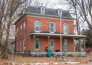
Sherwood is a city in Washington County, Oregon, United States. Located in the southeast corner of the county, it is a residential community in the Tualatin Valley, southwest of Portland. As of the 2010 census, Sherwood had a population of 18,194 residents. The city's population for 2019 was estimated to be 19,879 by the U.S. Census. Sherwood was first incorporated in 1893 as a town. Originally named Smockville after its founder, James Christopher Smock, the town was given its current name by local businessman Robert Alexander in 1891. The name "Sherwood" may have come from Sherwood, Michigan or the Sherwood Forest in England.
Burke is a city in and county seat of Gregory County, South Dakota, United States. The population was 575 at the 2020 census.
Leola is a small city in, and the county seat of, McPherson County, South Dakota, United States. It was founded on May 1, 1884, and named for Leola Haynes, daughter of one of the town's founders. The population was 434 as of the 2020 census.
Falling Spring is a town in Greenbrier County, West Virginia, United States. It is also known as Renick from the name of its post office. The population was 171 at the 2020 census.
Anmoore is a town in Harrison County, West Virginia, United States. It is located at the intersection of WV 58 and Interstate 79. The population was 514 at the 2020 census.
Camden-on-Gauley is a town in Webster County, West Virginia, United States, along the Gauley River. The population was 126 at the 2020 census.
Sherwood is a village in Calumet County, Wisconsin, United States. The population was 2,713 at the 2010 census. The former historical unincorporated community of High Cliff is located within present-day Sherwood.
This page is based on this Wikipedia article Text is available under the CC BY-SA 4.0 license; additional terms may apply. Images, videos and audio are available under their respective licenses.