
Northampton County is a county in the Commonwealth of Pennsylvania, United States. As of the 2020 census, the population was 312,951. Its county seat is Easton. The county was formed in 1752 from parts of Bucks County. Its namesake was the county of Northamptonshire in England, and the county seat of Easton was named for the country house Easton Neston in Northamptonshire.

Springfield Township is a township in Bucks County, Pennsylvania, United States. The population was 5,035 at the 2010 census.

Salisbury Township is a township in Lehigh County, Pennsylvania. The township's population was 13,505 at the 2010 census. The township borders Allentown, Pennsylvania's third-largest city, Bethlehem, and Emmaus, in the Lehigh Valley, which had a population of 861,899 and was the 68th-most populous metropolitan area in the U.S. as of the 2020 census.

South Whitehall Township is a township in Lehigh County, Pennsylvania. The township's population was 19,180 at the 2010 census. It is a suburb of Allentown and is part of the Lehigh Valley, which had a population of 861,899 and was the 68th-most populous metropolitan area in the U.S. as of the 2020 census.

Upper Saucon Township is a township in Lehigh County, Pennsylvania. It is part of the Lehigh Valley metropolitan area, which had a population of 861,899 and was the 68th-most populous metropolitan area in the U.S. as of the 2020 census. The township had a population of 16,973 as of the 2020 census.

Whitehall Township is a township with home rule status in Lehigh County, Pennsylvania. The township's population was 26,738 as of the 2010 census.

Bethlehem Township is a township in Northampton County, Pennsylvania, United States. The population of Bethlehem Township was 23,730 at the 2010 census. It is a suburb of Bethlehem and is part of the Lehigh Valley metropolitan statistical area, which had a population of 861,899 and was the 68th-most populous metropolitan area in the U.S. as of the 2020 census.

Hellertown is a borough in Northampton County, Pennsylvania. Its population was 6,131 at the 2020 census. Hellertown is part of the Lehigh Valley metropolitan area, which had a population of 861,899 and was the 68th-most populous metropolitan area in the U.S. as of 2020.

Lower Saucon Township is a township in Northampton County, Pennsylvania, United States. The township's population was 10,772 as of the 2010 census. The township is part of the Lehigh Valley metropolitan area, which had a population of 861,899 and was the 68th-most populous metropolitan area in the U.S. as of the 2020 census.

Bethlehem is a city in Northampton and Lehigh Counties in the Lehigh Valley region of eastern Pennsylvania, United States. As of the 2020 census, Bethlehem had a total population of 75,781. Among its total population as of 2020, 55,639 were in Northampton County and 19,343 were in Lehigh County. It is Pennsylvania's seventh-most populous city. The city is located along the Lehigh River, a 109-mile-long (175 km) tributary of the Delaware River.


Pennsylvania Route 378 (PA 378) is a north-to-south road in Lehigh and Northampton counties in the Lehigh Valley region of the U.S. state of Pennsylvania. The southern terminus is at PA 309 in Center Valley. Its northern terminus is at U.S. Route 22 (US 22) in Bethlehem. The route heads north from PA 309 as a two-lane undivided road through Upper Saucon Township and Lower Saucon Township before crossing South Mountain into the city of Bethlehem. Here, PA 378 follows city streets through Bethlehem's South Side, intersecting the northern terminus of PA 412. The route crosses the Lehigh River and becomes a four-lane freeway that continues north to US 22. PA 378 is the only highway from US 22 to Center City Bethlehem, and a quick route for visitors traveling to the Wind Creek Bethlehem casino resort on the city's South Side.
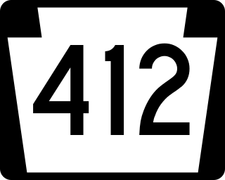
Pennsylvania Route 412 is a 17.75-mile-long (28.57 km) north–south state route located in Northampton and Bucks counties in southeastern Pennsylvania. Its southern terminus is at PA 611 in the Nockamixon Township community of Harrow. Its northern terminus is at PA 378 in Bethlehem.
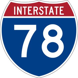
Interstate 78 (I-78) is an east–west Interstate Highway stretching from Union Township, Lebanon County, Pennsylvania, in the west to the Holland Tunnel and New York City in the east. In Pennsylvania, I-78 runs for about 78 miles (126 km) from the western terminus at I-81 in Union Township east to the New Jersey state line near Easton in Northampton County.
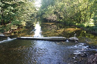
Saucon Creek is a 17.0-mile-long (27.4 km) tributary of the Lehigh River in Lehigh and Northampton counties, Pennsylvania, in the United States.
Pennsylvania State Senate District 18 includes parts of Lehigh County and Northampton County. It is currently represented by Democrat Lisa Boscola.
Locust Valley was a village located in the southeastern corner of Lehigh County, Pennsylvania, United States. The village is located at the southern end of Upper Saucon Township. It is part of the Lehigh Valley, which has a population of 861,899 and is the 68th-most populous metropolitan area in the U.S. as of the 2020 census.

Butztown is an unincorporated community in Bethlehem Township, Pennsylvania. It is located northeast of Bethlehem. The village is part of the Lehigh Valley metropolitan area, which had a population of 861,899 and was the 68th-most populous metropolitan area in the U.S. as of the 2020 census.
East Branch Saucon Creek is a tributary of Saucon Creek in Northampton County, Pennsylvania, in the United States. It is approximately 5.9 miles (9.5 km) long and flows through Lower Saucon Township and Bethlehem. The watershed of the creek has an area of 10.3 square miles (27 km2). A reach of the creek is designated as an impaired waterbody. However, the upper reaches are relatively unimpacted by development and the wetlands at its headwaters are designated as Exceptional Value and are home to numerous amphibians. The creek is also inhabited by wild trout.
Black River is a tributary of Saucon Creek in Lehigh and Northampton counties in the US state of Pennsylvania. It is approximately 4.6 miles (7.4 km) long and flows through Upper Saucon and Salisbury townships in Lehigh County and Lower Saucon Township and Bethlehem in Northampton County. The watershed of the river has an area of 4.49 square miles (11.6 km2). It is designated as a Coldwater Fishery and a Migratory Fishery and contains wild trout. The river is a very small limestone stream and flows in the vicinity of Lehigh University's Saucon Fields.


