Derbyshire is a ceremonial county in the East Midlands, England. It includes much of the Peak District National Park, the southern end of the Pennine range of hills and part of the National Forest. It borders Greater Manchester to the north-west, West Yorkshire to the north, South Yorkshire to the north-east, Nottinghamshire to the east, Leicestershire to the south-east, Staffordshire to the west and south-west and Cheshire to the west. Kinder Scout, at 636 m (2,087 ft), is the highest point and Trent Meadows, where the River Trent leaves Derbyshire, the lowest at 27 m (89 ft). The north–south River Derwent is the longest river at 66 mi (106 km). In 2003, the Ordnance Survey named Church Flatts Farm at Coton in the Elms, near Swadlincote, as Britain's furthest point from the sea. Derby is a unitary authority area, but remains part of the ceremonial county. The non-metropolitan county has 30 towns of 10,000–100,000 inhabitants, but much sparsely populated farming upland.

Shipley is a historic market town and civil parish in the City of Bradford, West Yorkshire, England, by the River Aire and the Leeds and Liverpool Canal, north of Bradford. The population of the Shipley ward on Bradford City Council taken at the 2011 Census was 15,483.

Heanor (/ˈhiːnə/) is a town in the Amber Valley district of Derbyshire in the East Midlands of England. It lies 8 miles (13 km) north-east of Derby and forms, with the adjacent village of Loscoe, the civil parish and town council-administered area of Heanor and Loscoe, which had a population of 17,251 in the 2011 census.

Eastwood is a former coal mining town in the Broxtowe district of Nottinghamshire, England, 8 miles (13 km) northwest of Nottingham and 10 miles (16 km) northeast of Derby on the border between Nottinghamshire and Derbyshire. Mentioned in Domesday Book, it expanded rapidly during the Industrial Revolution. The Midland Railway was formed here and it is the birthplace of D. H. Lawrence. The distinctive dialect of East Midlands English is extensively spoken, in which the name of the town is pronounced.

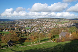
Ilkeston is a town in the Borough of Erewash, Derbyshire, England, on the River Erewash, from which the borough takes its name, with a population at the 2011 census of 38,640. Its major industries, coal mining, iron working and lace making/textiles, have now all but disappeared.

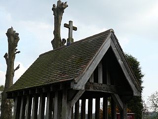
West Hallam is a large village and civil parish close to Ilkeston in the county of Derbyshire in the East Midlands region of England. West Hallam has had its own parish council since 1894 and, since 1974, has been part of the Erewash borough. The population of the civil parish was 4,829 at the 2001 census reducing to 4,686 at the 2011 census.

The Erewash Canal is a broad canal in Derbyshire, England. It runs just under 12 miles (19 km) and has 14 locks. The first lock at Langley Bridge is part of the Cromford Canal.
South Wingfield is a village and civil parish in Derbyshire, England, it is now part of the borough of Amber Valley and formerly in the Scarsdale hundred. The population of the civil parish at the 2011 census was 1,514.

Risley is a small village and parish in Erewash in the English county of Derbyshire. The population of the civil parish as of the 2011 census was 711. It is just over four miles south of Ilkeston. Sandiacre is adjacent to the east.

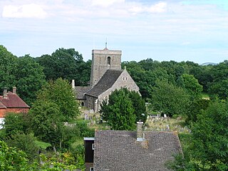
Dethick, Lea and Holloway is a civil parish, in the Amber Valley borough of the English county of Derbyshire. The population of the civil parish taken at the 2011 census was 1,027.
Trowell is a village and civil parish in Nottinghamshire, England. It lies a few miles west of Nottingham, in the borough of Broxtowe on the border with Derbyshire. According to the 2001 census it had a population of 2,568, falling to 2,378 at the 2011 census.

Belper is a former constituency in the UK Parliament. It was created at the 1918 general election as a county division of Derbyshire, comprising the area in the centre of the county and surrounding Derby, and named after the market town of Belper although this was in the north of the constituency. In 1950 it was expanded to include the far south of the county. It was a marginal constituency for most of its existence.

Morley is a village and civil parish within the Borough of Erewash in Derbyshire, England.

The Nutbrook Canal was a canal in England which ran between Shipley in Derbyshire and the Erewash Canal, joining it near Trowell. It was built to serve the collieries at Shipley and West Hallam, and was completed in 1796. It was initially profitable, but from 1846 faced competition from the railways, and more seriously, subsidence caused by the coal mines that it was built to serve. With the mines failing to pay tolls for goods carried on the canal, and in some cases refusing to accept responsibility for the subsidence, most of it was closed in 1895, although the final 1.5 miles (2.4 km) remained in use until 1949.
Shipley is a village and civil parish in the Horsham District of West Sussex, England. It lies just off the A272 road 6 miles north-east of Storrington. The parish includes the village of Coolham and the hamlets of Dragon's Green, Brooks Green and Broomer's Corner.

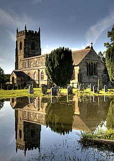
Stanton by Dale, also written as Stanton-by-Dale, is a village and civil parish in the south east of Derbyshire, England. According to the University of Nottingham English Place-names project, the settlement name Stanton-by-Dale could mean 'Stony farm or settlement', stān for stone or rock; and tūn for an enclosure; farmstead; village; or an estate. It lies 2.65 miles (4.26 km) south of Ilkeston and 1.31 miles (2.11 km) north of Sandiacre. Since 1974 it has been part of the Erewash borough. The village is halfway between the cities of Derby 6.98 miles (11.23 km) and Nottingham 6.81 miles (10.96 km), as the crow flies, from each city. The population of the civil parish at the 2011 census was 505.
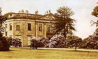
Shipley Hall was a country estate in Shipley, Derbyshire near Heanor and Ilkeston which now forms a Country Park.

Kirk Hallam is a village in the south-east of Derbyshire in the East Midlands of England. It was part of the former Ilkeston borough and is largely regarded today as a part of the much larger town of Ilkeston which adjoins it to the north east. Since 1974 Kirk Hallam has been part of the borough of Erewash. Kirk Hallam is a ward of the Erewash Borough Council showing a population of 6,417 at the 2001 Census, reducing to 6,216 at the 2011 Census.
Mapperley is a village and civil parish in the Amber Valley district of Derbyshire, England, situated 7 miles (11 km) northeast of Derby and 2 miles (3 km) northwest of Ilkeston. In the 2001 census it had a population of 253, increasing to 289 at the 2011 Census.

Nutbrook Cricket Club is an amateur cricket club on the eastern boundary of West Hallam, Derbyshire, England. The club has a history dating back to 1937.

