
Alfreton is a town and civil parish in the Amber Valley district of Derbyshire, England. The town was formerly a Norman Manor and later an Urban District. The population of the Alfreton parish was 8,799 at the 2021 Census. The villages of Ironville, Riddings, Somercotes and Swanwick were historically part of the Manor and Urban District, and the population including these was 24,476 in 2001.

Heanor (/ˈhiːnə/) is a town in the Amber Valley district of Derbyshire, England. It lies 8 miles (13 km) north-east of Derby and forms, with the adjacent village of Loscoe, the civil parish and town council-administered area of Heanor and Loscoe, which had a population of 17,251 in the 2011 census.

Middleton is a largely residential suburb of Leeds in West Yorkshire, England and historically a village in the West Riding of Yorkshire. It is situated on a hill 4 miles (6 km) south of Leeds city centre and 165 miles (266 km) north north-west of London.

Horden is a village and electoral ward in County Durham, England. It is situated on the North Sea coast, to the east of Peterlee, approximately 12 miles south of Sunderland. Horden was a mining village until the closure of the Horden Colliery in 1987. Main features include the Welfare and Memorial Parks and St Mary's church. It is connected to the villages of Blackhall Colliery and Blackhall Rocks to its south by a spectacular rail viaduct which spans Castle Eden Dene near Denemouth. Horden Dene provides Horden's northern boundary with Easington Colliery.

Newbridge is a town and community in the county borough of Caerphilly, south Wales. It lies within the historic boundaries of the county of Monmouthshire.

Morton is a civil parish and village, three miles north of Alfreton in North East Derbyshire, Derbyshire, England. The civil parish population at the 2011 Census was 1,195.

Heanor and Loscoe is a civil parish within the Amber Valley district, which is in the county of Derbyshire, England. Mainly built up with rural fringes, its population was 17,337 during the 2021 census, a small increase from the 17,251 residents of the 2011 census. The parish is 120 miles (190 km) north west of London, 10 miles (16 km) north east of the county city of Derby, and contains the market town of Heanor along with other areas. It shares a boundary with the parishes of Aldercar and Langley Mill, Codnor, Denby, Shipley and Smalley.
Bestwood Village is a village and civil parish in the Gedling district of Nottinghamshire.

Tibshelf is a village and civil parish in the Bolsover District in Derbyshire, England. It lies between the towns of Clay Cross, Shirebrook, Mansfield and Chesterfield and had a population of 4,348 at the 2021 Census. Tibshelf shares its boundaries with the villages of Morton, Pilsley, Newton, Teversal and Hardstoft.

Creswell is a former mining village located in the Bolsover district of Derbyshire, England. At the 2011 Census population details were included in the civil parish of Elmton-with-Creswell. Today it is best known for Creswell Crags and its model village. In September 1950 Creswell Colliery was the scene of one of the worst post-nationalisation mining disasters. Elmton Common is an area of allotments for the township of Creswell.

The Nutbrook Canal was a canal in England which ran between Shipley in Derbyshire and the Erewash Canal, joining it near Trowell. It was built to serve the collieries at Shipley and West Hallam, and was completed in 1796. It was initially profitable, but from 1846 faced competition from the railways, and more seriously, subsidence caused by the coal mines that it was built to serve. With the mines failing to pay tolls for goods carried on the canal, and in some cases refusing to accept responsibility for the subsidence, most of it was closed in 1895, although the final 1.5 miles (2.4 km) remained in use until 1949.

Snibston is an area and former civil parish east of Ravenstone, now in the parish of Ravenstone with Snibstone, in the North West Leicestershire district, in the county of Leicestershire, England. Originally rural, part of Snibston was transformed into a coal mining village by the opening of coal mines by the Snibston Colliery Company in the early 1830s. This industrial part of Snibston was subsequently subsumed into the developing town of Coalville, though small rural areas of Snibston survive within the civil parishes of Ravenstone with Snibston and Hugglescote and Donington le Heath. In the part of Snibston within the latter civil parish stands the 13th-century church of St Mary, noted as the smallest church still in use for regular worship in England. The main Snibston Colliery was sunk in 1831, and after its closure the Snibston Country Park with the Snibston Discovery Museum was built on part of the colliery site. Part of the park is Snibston Grange Local Nature Reserve.
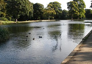
Middleton Park is a public park in Middleton, Leeds, West Yorkshire, England. It covers an area of 630 acres (255.0 ha), nearly a square mile of which 200 acres (80.9 ha) are ancient woodland. There is also a small lake, recreational areas and a former golf course. The reclaimed site of "Middleton Broom" Colliery has been incorporated into the park. By its northern boundary is the South Leeds Stadium, home of rugby league club Hunslet. The Middleton Railway runs between Moor Road, Hunslet and Park Halt railway station. It is also the site of Leeds Urban Bike Park. It is known locally as 'Miggy Park'.

Ashington is a town and civil parish in Northumberland, England, with a population of 27,864 at the 2011 Census. It was once a centre of the coal mining industry. The town is 15 miles (24 km) north of Newcastle upon Tyne, west of the A189 and bordered to the south by the River Wansbeck. Many inhabitants have a distinctive accent and dialect known as Pitmatic. This varies from the regional dialect known as Geordie.

Langold is a village in the civil parish of Hodsock, in the Bassetlaw district, north Nottinghamshire, England. At the 2011 census it was defined as a ward of Bassetlaw Council with a population of 2,472. It was built to provide housing for the miners of Firbeck Colliery between 1923 and 1927. Langold Lakes Country Park is situated on the south-western edge of the village.

Stanley Common is a village in the south-east of Derbyshire in the East Midlands of England.
Open-pit coal mining in the United Kingdom ended in November 2023.

Pooley Hall is a Manor house built in 1509 on the outskirts of Polesworth, Warwickshire, England. It is a Grade II* listed building and a private residence.

Kings Clipstone is a settlement and civil parish, in the Newark and Sherwood district, in the county of Nottinghamshire, England. The parish lies in the west of the county, and north west within the district. It is 122 miles north of London, 15 miles north of the city of Nottingham, and 5 miles north east of the market town of Mansfield. In the 2021 census, the parish had a population of 312. The parish touches Clipstone village, Edwinstowe, Rufford and Warsop. The parish was formerly part of the wider Clipstone parish, on 1 April 2011 it became a separate parish. The area is within Sherwood Forest, well known for the Robin Hood legend.

Grassmoor, Hasland and Winsick is a civil parish within the North East Derbyshire district, which is in the county of Derbyshire, England. Named for local settlements, with a mix of a number of villages and hamlets amongst a semi-rural area, it had a population of 3,360 residents in 2011. The parish is 130 miles (210 km) north west of London, 20 miles (32 km) north of the county city of Derby, and 2 miles (3.2 km) south east of the nearest market town of Chesterfield. It shares a boundary with the borough of Chesterfield, along with the parishes of Calow, North Wingfield, Temple Normanton, Tupton as well as Wingerworth. The parish paradoxically does not include the majority of the nearby built-up suburb of Hasland which is now within an adjacent unparished area of Chesterfield.


