Short Pump, Virginia

Last updated

Short Pump, Virginia
USA Virginia location map.svg
Red pog.svg
Short Pump, Virginia
Location of Short Pump, Virginia
Usa edcp location map.svg
Red pog.svg
Short Pump, Virginia
Short Pump, Virginia (the United States)
Coordinates: 37°39′43″N77°37′36″W / 37.66194°N 77.62667°W / 37.66194; -77.62667
CountryUnited States
State Virginia
County Henrico
Area
  Total9.1 sq mi (23.5 km2)
  Land9.0 sq mi (23.2 km2)
  Water0.1 sq mi (0.3 km2)
Elevation
282 ft (86 m)
Population
 (2020)
  Total30,626
  Density3,400/sq mi (1,300/km2)
Time zone UTC−5 (Eastern (EST))
  Summer (DST) UTC−4 (EDT)
FIPS code 51-72272 [1]
GNIS feature ID1495125 [2]

Short Pump is a census-designated place (CDP) in Henrico County, Virginia, United States. It is a suburb of Richmond, Virginia. The population was 30,626 at the 2020 census. [3]

Contents

The original village of Short Pump was located at the intersection of Three Chopt Road (formerly known as Three Notched Trail), Richmond Turnpike and Pouncey Tract Road. The area first centered around a local tavern that was expanded by Col. Robert H. Saunders beginning in 1814. According to local legend, it was named for the short handled water pump for stagecoach horses to drink from, which was located beneath the porch of the tavern, though there is some debate over the name's origin. [4] This area was on the principal route between Richmond and Charlottesville, as well as other towns in the Blue Ridge Mountains. Thomas Jefferson, [5] the Earl Cornwallis, the Marquis de Lafayette, General Peter Muhlenberg, Stonewall Jackson and Ulric Dahlgren all visited this area.

The crossroads was officially named Short Pump by 1853, according to a Henrico County map found in the Virginia Historical Society. [5]

It has now become part of Richmond's Far West End. In 2003, developers opened Short Pump Town Center, an 1,200,000-square-foot (110,000 m2) open air shopping mall. Other shopping and living spaces include West Broad Village. [6]

Short Pump is noted for its shopping centers, restaurants, skating rink, and bowling alley. The area is an edge city of Richmond. [4]

History

Short Pump began as a local tavern stop situated at a strategic crossroads in the early nineteenth century. Purchased around 1814 by Col. Saunders, the tavern profited from the local coal industry, westward movement in the state, and the extension of roads in the period after the Revolutionary War. Along with the food, drink, and lodgings that taverns typically provided for visitors, this tavern served as a post-office, voting precinct, and local market during its roughly 35 years in business. It also briefly housed a school for young white men and a resident doctor. While a gathering spot for white locals and travelers, the tavern relied on enslaved labor and hosted occasional slave auctions. [4]

The tavern eventually declined in the latter half of the nineteenth century, but the name stuck to the area. By the early twentieth century, the tavern was all but gone, and other buildings and businesses rose up to take its place. As automobiles replaced horses as the primary means of transportation, filling stations and garages popped up in the area. At the same time, those living in Short Pump increasingly saw themselves as a suburb of Richmond and worked to better their community through the building of new structures—like the Short Pump High School. [4]

By the 1990s and 2000s, Short Pump transformed from a rural crossroads to an edge-city, a concentration of development on the outskirts of traditional urban areas. The Short Pump Town Center, a mega-mall, proved key to this transformation.

Geography

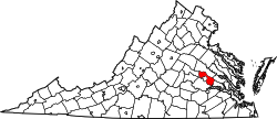
According to the United States Census Bureau, the CDP has a total area of 9.1 square miles (23.5 km2), of which 9.0 square miles (23.2 km2) is land and 0.12 square miles (0.3 km2), or 1.33%, is water. [7] Short Pump is bordered to the west by Goochland County, to the north by the Wyndham CDP, to the east by the Innsbrook CDP, and to the south by non-CDP land and by Tuckahoe. [7]

Climate

Climate data for Short Pump, Virginia (1980-2010)
MonthJanFebMarAprMayJunJulAugSepOctNovDecYear
Average high °F (°C)46.6
(8.1)
50.7
(10.4)
59.3
(15.2)
70
(21)
77.2
(25.1)
84.9
(29.4)
88.3
(31.3)
86.9
(30.5)
80.6
(27.0)
70.3
(21.3)
60.3
(15.7)
49.5
(9.7)
68.7
(20.4)
Average low °F (°C)24.8
(−4.0)
26.9
(−2.8)
33.1
(0.6)
42.3
(5.7)
51.2
(10.7)
60.7
(15.9)
65.1
(18.4)
63.9
(17.7)
56.2
(13.4)
44.5
(6.9)
35.4
(1.9)
27.6
(−2.4)
44.3
(6.8)
Average precipitation inches (mm)3.1
(79)
2.9
(74)
3.8
(97)
3.3
(84)
3.9
(99)
3.5
(89)
4.4
(110)
4.0
(100)
3.7
(94)
3.3
(84)
3.7
(94)
3.3
(84)
42.9
(1,088)
Source: USA.com [8]

Demographics

Ancestry in Three Chopt CCD (2014-2018) [9] [10] [11]
Originpercent
English American (Includes "American" ancestry)
20.1%
South Asian American (Includes Indian, Pakistani, Bangladeshi, etc.)
15%
Scottish or Irish American (Including Scots-Irish)
13.9%
German American
13.5%
African American (Does not include West Indian or African)
6.2%
East Asian American (Includes Chinese, Japanese, Vietnamese, etc.
5.5%
Italian American
4.7%
French American
2.2%
Polish American
2%
Scandinavian American (Also includes Iceland, Finland, and Baltic States)
2%

At the 2010 census, [1] there were 24,729 people, 9,217 households and 6,483 families residing in the CDP. The population density was 76.7 per square mile (29.6/km2). There were 77 housing units at an average density of 32.5/sq mi (12.5/km2). The racial makeup of the CDP was 75.0% White, 5.70% African-American, 15.9% Asian, and 3.2% Hispanic or Latino.

There were 9,217 households, of which 31.9% had children under the age of 18 living with them, 60.3% were married couples living together, 10.1% had a female householder with no husband present, and 36.2% were non-families. 26.1% of all households were made up of individuals, and 8.7% had someone living alone who was 65 years of age or older. The average household size was 2.64 and the average family size was 3.30.

26.9% of the population were under the age of 18, 6.0% from 18 to 24, 33.5% from 25 to 44, 18.1% from 45 to 64, and 15.4% who were 65 years of age or older.

The median household income was $105,300 and the median family income was $117,995. The per capita income for the CDP was $46,047. 4.1% of the population lived below the poverty line.

Education

Elementary schools

Middle

High

Boundaries of Short Pump

The boundaries of the Short Pump CDP start on the west at the Goochland County/Henrico County line, then proceed east on Kain Road to Pouncey Tract Road (Virginia State Route 271); north on Pouncey Tract Road to Shady Grove Road; east, then north, on Shady Grove Road to Nuckols Road; southeast and south on Nuckols Road to Interstate 295; southwest on I-295 to Interstate 64; southeast on I-64 to Cox Road; southwest on Cox Road to Three Chopt Road where Cox Road becomes Church Road; southwest, then west, on Church Road to Lauderdale Drive; southwest on Lauderdale Drive to Causeway Drive; northwest on Causeway Drive to its crossing of Wilde Lake; southwest through the center of Wilde Lake to its outlet, Harding Branch; westward down Harding Branch to its outlet at Tuckahoe Creek, which is the Goochland/Henrico County line; then north on the county line back to Kain Road. [7]

Related Research Articles

<span class="mw-page-title-main">Powhatan County, Virginia</span> County in Virginia, United States

Powhatan County is a county located in the Commonwealth of Virginia. As of the 2020 census, the population was 30,033. Its county seat is Powhatan.

<span class="mw-page-title-main">Henrico County, Virginia</span> County in Virginia, United States

Henrico County, officially the County of Henrico, is located in the Commonwealth of Virginia in the United States. As of the 2020 census, the population was 334,389 making it the fifth-most populous county in Virginia. Henrico County is included in the Greater Richmond Region. There is no incorporated community within Henrico County; therefore, there is no incorporated county seat either. Laurel, an unincorporated CDP, serves this function.

<span class="mw-page-title-main">Hanover County, Virginia</span> County in Virginia, United States

Hanover County is a county in the Commonwealth of Virginia. As of the 2020 census, the population was 109,979. Its county seat is Hanover Courthouse.

<span class="mw-page-title-main">Goochland County, Virginia</span> County in Virginia, United States

Goochland County is a county located in the Piedmont of the Commonwealth of Virginia. Its southern border is formed by the James River. As of the 2020 census, the population was 24,727. Its county seat is Goochland.

<span class="mw-page-title-main">Fluvanna County, Virginia</span> County in Virginia, United States

Fluvanna County is a county located in the Piedmont region of the Commonwealth of Virginia, United States. As of the 2020 census, the population was 27,249. Its county seat is Palmyra, while the most populous community is the census designated place of Lake Monticello.

<span class="mw-page-title-main">Martinez, Georgia</span> Census-designated place in Georgia, United States

Martinez is a census-designated place (CDP) in Columbia County, Georgia, United States. It is a northwestern suburb of Augusta and is part of the Augusta, Georgia metropolitan area. The population was 34,535 at the 2020 census.

<span class="mw-page-title-main">Great Falls, Virginia</span> Census-designated place in Virginia, United States

Great Falls is a census-designated place in Fairfax County, Virginia, United States. The population as of the 2010 census was 15,427, an increase of 80.5% from the 2000 census.

<span class="mw-page-title-main">Mechanicsville, Virginia</span> Census-designated place in Virginia, United States

Mechanicsville is an unincorporated community and census-designated place (CDP) in Hanover County, Virginia, United States. The population was 39,482 during the 2020 census, up from 36,348 in the 2010 census.

<span class="mw-page-title-main">Glen Allen, Virginia</span> Census-designated place in Virginia

Glen Allen is a census-designated place (CDP) in Henrico County, Virginia, United States. The population was 16,187 as of the 2020 Census, up from 14,774 at the 2010 census. Areas outside the CDP which use a "Glen Allen" mailing address include residences in neighboring Hanover County.

Highland Springs is a census-designated place (CDP) located in Henrico County, Virginia, United States, 4.3 miles (7 km) east of Richmond. The population was 16,604 at the 2020 census.

<span class="mw-page-title-main">Tuckahoe, Virginia</span> Census-designated place in Virginia

Tuckahoe is a census-designated place (CDP) in Henrico County, Virginia, United States. It is a western suburb of Richmond. The population of Tuckahoe was 44,990 at the 2010 census. It is named after the area's history as the site of Thomas Randolph's Tuckahoe Plantation which still stands along the James River.

<span class="mw-page-title-main">Laurel Park, Virginia</span> CDP in Virginia, United States

Laurel Park is a census-designated place (CDP) in Henry County, Virginia, United States. The population was 675 at the 2010 census. It is part of the Martinsville Micropolitan Statistical Area.

<span class="mw-page-title-main">Greater Richmond Region</span> Metropolitan statistical area in the United States

The Greater Richmond Region, the Richmond metropolitan area or Central Virginia, is a region and metropolitan area in the U.S. state of Virginia, centered on Richmond. The U.S. Office of Management and Budget (OMB) defines the area as the Richmond, VA Metropolitan Statistical Area, a Metropolitan Statistical Area (MSA) used by the U.S. Census Bureau and other entities. The OMB defines the area as comprising 17 county-level jurisdictions, including the independent cities of Richmond, Petersburg, Hopewell, and Colonial Heights. As of 2020, it had a population of 1,314,434, making it the 44th largest MSA in the country.

<span class="mw-page-title-main">West End (Richmond, Virginia)</span> Neighborhood in Richmond, Virginia, United States

The West End is a part of Richmond, Virginia. Definitions of the bounds of the West End vary, it may include only the western part of the city of Richmond or extend as far as western Henrico County. As there is no one municipal organization that represents this specific region, the boundaries are loosely defined as being north of the James River, west of I-195, and south of Broad Street. Historically, the Richmond neighborhoods of the Fan and the Museum District were a part of the West End. A primary conduit through the West End is Interstate 64.

<span class="mw-page-title-main">Virginia State Route 6</span>

State Route 6 is a primary state highway in the U.S. state of Virginia. Known for most of its length as River Road, the state highway runs 102.26 miles (164.57 km) from U.S. Route 250 in Afton east to SR 161 in Richmond. SR 6 is one of the main highways of mountainous Nelson County, where the highway runs north–south from its beginning to US 29. From Scottsville to Richmond, the state highway parallels the James River. SR 6 is a major suburban highway through southwestern Henrico County and the main street of Richmond's West End.

<span class="mw-page-title-main">Henrico County Public Schools</span>

The Henrico County Public Schools school system is a Virginia school division that operates as an independent branch of the Henrico County, Virginia county government and administers public schools in the county. Henrico County Public Schools has five International Baccalaureate schools – John Randolph Tucker High School, Henrico High School, Fairfield Middle School, Tuckahoe Middle School and George H. Moody Middle School.

<span class="mw-page-title-main">Goochland, Virginia</span> Census-designated place in Virginia, United States

Goochland is a census-designated place (CDP) in and the county seat of Goochland County, Virginia, United States. The population as of the 2010 census was 861. The community is also known as Goochland Courthouse or by an alternative spelling, Goochland Court House. It derives its name from the fact that the community is the location of the county's court house, while the county in turn is named for Sir William Gooch, 1st Baronet, the royal lieutenant governor of Virginia from 1727 to 1749.

<span class="mw-page-title-main">Virginia State Route 271</span>

State Route 271 is a primary state highway in the U.S. state of Virginia. Known as Pouncey Tract Road, the state highway runs 7.34 miles (11.81 km) from U.S. Route 250 in Short Pump north to SR 620 and SR 622 in Rockville. A small section of it was first added to the state highway system during 1930, and it gained its current routing and designation by 1940.

<span class="mw-page-title-main">Three Notch'd Road</span> Colonial-era route across Virginia

Three Notch'd Road was a colonial-era major east-west route across central Virginia. It is believed to have taken its name from a distinctive marking of three notches cut into trees to blaze the trail. By the 1730s, the trail extended from the vicinity of the fall line of the James River at the future site of Richmond westerly to the Shenandoah Valley, crossing the Blue Ridge Mountains at Jarmans Gap. In modern times, a large portion of U.S. Route 250 in Virginia follows the historic path of the Three Notch'd Road, as does nearby Interstate 64.

Parham Road is a circumferential highway in Henrico County in the U.S. state of Virginia. The highway runs 12.08 miles (19.44 km) from Virginia State Route 150 near Tuckahoe east to U.S. Route 301 and SR 2 in Chamberlayne. Parham Road serves the northwestern suburbs of Richmond, including Tuckahoe, Laurel, and Chamberlayne. The four-lane divided highway intersects all of the major highways that extend northwest and north from the city, including Interstate 64 (I-64) and I-95. Parham Road is county maintained except for the portion that is State Route 73, a connector between US 1 and I-95. The Parham Road name was applied to a small portion of the current route by the early 20th century. SR 73 was constructed in the early 1960s. Most of Parham Road from SR 6 to US 1 was constructed as a new four-lane divided highway by Henrico County in the late 1960s; the existing sections were upgraded at the same time. The highway was extended east to its present terminus in the late 1970s. Parham Road was completed south to its present western terminus in 1990 concurrent with the extension of SR 150 across the James River from the Southside of Richmond to Henrico County.

References

  1. 1 2 "U.S. Census website". United States Census Bureau . Retrieved January 31, 2008.
  2. "US Board on Geographic Names". United States Geological Survey. October 25, 2007. Retrieved January 31, 2008.
  3. "Profile of General Population and Housing Characteristics: 2020 Demographic Profile Data (DP-1): Short Pump CDP, Virginia". United States Census Bureau . Retrieved May 4, 2023.
  4. 1 2 3 4 Tharp, William R. (2022). "Roads, Race, and Retail: The Transformation of Short Pump, Virginia". Buildings & Landscapes: Journal of the Vernacular Architecture Forum. 29 (2): 74–98. doi:10.1353/bdl.2022.0014. S2CID   252908720. Project MUSE   867166.
  5. 1 2 Dickerson, Trevor (June 17, 2009). "It Truly Was a Short Pump". Richmond Times Dispatch . Retrieved March 25, 2015.
  6. Lappas, Tom (February 2, 2011). "Mall Helped Solidify Short Pump's Status". Henrico Citizen. Retrieved March 25, 2015.
  7. 1 2 3 "Geographic Identifiers: 2010 Demographic Profile Data (G001): Short Pump CDP, Virginia". United States Census Bureau . Retrieved August 6, 2012.
  8. "Climatological Information for Short Pump, Virginia", USA.com, 2003. Web: .
  9. U.S. Census Bureau (2014-2018). People Reporting Ancestry American Community Survey 5-year estimates. Retrieved from <https://censusreporter.org>
  10. U.S. Census Bureau (2014-2018). Asian Alone by Selected Groups American Community Survey 5-year estimates. Retrieved from <https://censusreporter.org>
  11. U.S. Census Bureau (2014-2018). Hispanic or Latino Origin by Specific Origin American Community Survey 5-year estimates. Retrieved from <https://censusreporter.org>