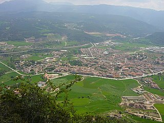
Santa Coloma de Farners is a spa town and capital of the comarca of the Selva, in Catalonia, Spain, and of the judicial district of Santa Coloma. It is situated on the edge of the Selva Depression and of the Guilleries. The local economy is mainly commercial, given the status of the town as capital of the comarca, although summer tourism, agriculture and forestry products also contribute. The urban centre is to the north and west of the main modern communication routes, although the C-253 road links the town with the main N-II route and the AP-7 autopista and to the RENFE railway station at Sils (10 km). The GE-533 runs through the northern part of the municipality, linking it with Vic to the west and with Riudellots de la Selva, Vilobí d'Onyar and Girona-Costa Brava Airport to the east.

Pallejà is a municipality in the comarca of the Baix Llobregat in Catalonia, Spain. It is situated on the right bank of the Llobregat river, on the main N-II road. The main rail lines of the Llobregat corridor pass through the town: the station is served by the FGC services R5/R50, R6, S4 and S8. Pallejà castle was built in the seventeenth century on the site of an older fortress; it currently houses a library.

Monistrol de Montserrat is a municipality in the comarca of the Bages in Catalonia, Spain. The municipality includes the southern two-thirds of the massif of Montserrat and the famous Benedictine monastery of the same name. The town, known as Montserrat-Vila, is situated on the eastern flank of the massif above the valley of the Llobregat river: it is connected with the monastery and with the railway station in the valley by a rack railway. The C-1411 road links the town with Martorell and Manresa. The bridge over the Llobregat river dates from the fourteenth century. The municipality includes a small exclave to the north-west.

Castellbell i el Vilar is a municipality in the comarca of the Bages in Catalonia, Spain. It is situated at the point where the Llobregat river crosses the Prelittoral Range. The railway station serves both the FGC line R5 between Barcelona and Manresa and the RENFE line between Barcelona and Zaragoza. The C-1411 road links the municipality with Martorell and Manresa.
Sant Vicenç de Castellet is a municipality in the comarca of the Bages in Catalonia, Spain. It is situated near the confluence of the Llobregat river and the Cardener river. The railway station serves both the FGC line R5 between Barcelona and Manresa and the RENFE line between Barcelona and Zaragoza. The C-1411 road links the municipality with Martorell and Manresa.

Castellgalí is a municipality in the comarca of the Bages in Catalonia, Spain. It is situated at the confluence of the Llobregat River and the Cardener River. The railway station serves both the FGC line R5 between Barcelona and Manresa and the RENFE line between Barcelona and Zaragoza.

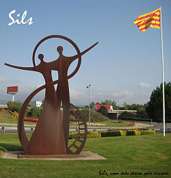
Riudellots de la Selva is a municipality in the comarca of the Selva in Catalonia, Spain. It is situated in the basin of the Onyar river, on the A-7 autopista and the main N-II road, and is served by a RENFE railway station on the line between Barcelona and Girona and the GE-672 road and is close to the aeroport of Girona.

Organyà is a municipality in the comarca of the Alt Urgell in Catalonia. It is situated on the right bank of the Segre river below the Trespons gorge, and is served by the C-14 road between Ponts and La Seu d'Urgell. There is a monument to the Homilies d'Organyà, a 12th or 13th century collection of sermons which is the oldest literary text in the Catalan language to survive in its entirety, discovered in the town in 1904.

Argençola is a municipality in the comarca of the Anoia in Catalonia, Spain. It is situated in the east of the comarca, bordering the Segarra and the Conca de Barberà. The Anoia river has its source on the territory of the municipality. A local road links the municipality with the main N-II road from Barcelona to Lleida.

Montesquiu is a municipality in the comarca of Osona in Catalonia, Spain. It is situated on the banks of the Ter river in the north of the comarca. It is on the main communication route between Barcelona and Puigcerdà, served by the N-152 road and a station on the RENFE railway line. The thirteenth-century castle is used for cultural events during the summer. Montesquiu became part of Osona in the comarcal revision of 1990: previously it formed part of the Ripollès.

Santa Maria de Besora is a municipality in the comarca of Osona in Catalonia, Spain. It is situated on the north side of the Bellmunt range in the north of the comarca. It is linked to Sant Quirze de Besora and to Vidrà by a local road. Besora castle has an eleventh-century Romanesque church: there is also a preroman chapel at Sant Moí. Santa Maria de Besora became part of Osona in the comarcal revision of 1990: previously it formed part of the Ripollès.

L'Aldea is a municipality in the comarca of the Baix Ebre in Catalonia, Spain. It was created in 1983 from parts of the municipality of Tortosa. It is situated on the left bank of the Ebre at the start of the delta. The town is served by the A-7 autopista and the N-340 road, and has a station on the RENFE railway line between Tarragona and Valencia.

Espinelves is a municipality in the comarca of Osona in Catalonia, Spain. It is situated in the Guilleries in the east of the comarca. Forestry is the main economic activity of the municipality, particularly the cultivation of the local species Abies masjoanensis for Christmas trees. The Romanesque church of Sant Vincenç d'Espinelves dates from the 11th and 12th centuries. The village is linked to Arbúcies and to Vic by the GI-543 road.
Centelles is a municipality in the comarca of Osona in Catalonia, Spain. It is situated in the upper valley of the Congost River in the south of the comarca. The municipality is served by the C-17 road. The renowned urban planner Ildefons Cerdà was born here.

Borredà is a municipality in the comarca of the Berguedà in Catalonia, Spain. It is situated in the upper valley of the Margençol river in the east of the comarca. There are several notable houses from the 17th and 18th centuries. The Romanesque church of Sant Sadurní de Rotgers, a protected historico-artistic monument, can be reached by a mountain track. The village is served by the C-149 road between Berga and Sant Quirze de Besora. The municipality surrounds an exclave of Les Llosses.
Balenyà is a municipality in the comarca of Osona in Catalonia, Spain.

Lluçà is a municipality in the comarca of Osona in Catalonia, Spain. It is subdivided into the town of Santa Eulàlia de Puigoriol, and the much smaller village of Lluçà. This village, prominent because of its monastery, gives its name to the surrounding natural comarca of Lluçanès.

Vilaverd is a municipality in the comarca of the Conca de Barberà in Catalonia, Spain.

Guils de Cerdanya is a municipality in the comarca of Cerdanya, province of Girona, Catalonia, Spain.
Sentmenat is a municipality in the comarca of the Vallès Occidental in Catalonia.