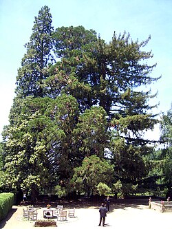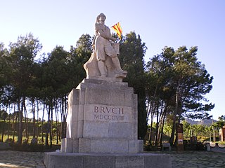
El Bruc is a municipality in the comarca of the Anoia in Catalonia, Spain. It is situated on the side of Montserrat, of which the north-western third is within the municipality. A local road connects the village with the main N-II road from Barcelona to Lleida, and to Monistrol de Montserrat via the monastery.

Argençola is a municipality in the comarca of the Anoia in Catalonia, Spain. It is situated in the east of the comarca, bordering the Segarra and the Conca de Barberà. The Anoia river has its source on the territory of the municipality. A local road links the municipality with the main N-II road from Barcelona to Lleida.

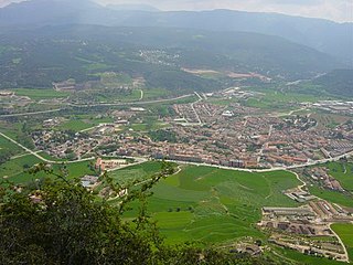
Saldes is a municipality in the comarca of the Berguedà in Catalonia, Spain. It is situated at the foot of the Pedraforca mountain (2497 m) in the north of the comarca. Deposits of lignite are extracted commercially. The village is linked to Guardiola de Berguedà by a local road. The monastery Sant Sebastià del Sull is located in Saldes.

Àger is a municipality in the comarca of the Noguera in Catalonia, Spain. It is situated in the north-west of the comarca, and the territory of the municipality stretches between the Noguera Ribagorçana and Noguera Pallaresa rivers. The Terradets reservoir on the Noguera Pallaresa is situated within the municipality. The village is linked to Balaguer and Tremp by the L-904 road.

Seròs is a municipality in the comarca of the Segrià in Catalonia, Spain. It is situated on the right bank of the Segre river in the south-west of the comarca. The Aragon and Catalonia canal provides irrigation water for growing fruit. The municipality is linked to the rest of the comarca and to Fraga by the C-242 road.

Susqueda is a municipality in the comarca of the Selva in Catalonia, Spain. It is located in the Guilleries Massif area, on the left bank of the Ter river in the north-west of the comarca. The Susqueda reservoir is on the municipal territory, and the associated hydroelectric power station is an important source of local income. A local road links the municipality with the C-152 road to Santa Coloma de Farners.

Arbolí is a municipality in the comarca of the Baix Camp in Catalonia, Spain. It is situated in the west of the comarca in the Prades mountains. A local road links the village with the C-242 road.

Roda de Berà is a municipality in the comarca of the Tarragonès in Catalonia, Spain. It is situated on the coast in the east of the comarca. The Roman Via Augusta ran through the municipality, and a triumphal arch survives in the middle of the present N-340 coast road.

El Pla de Santa Maria is a municipality in the comarca of the Alt Camp in Catalonia, Spain. It is situated at the foot of the Miramar range. The municipality is served the A-2 autopista and is linked to Valls by the T-200 road.

La Molsosa is a municipality in the comarca of the Solsonès in Catalonia, Spain. It is situated in the south of the comarca in the Castelltallat range. It is linked to Calaf by a local road. The municipality is split into two parts, the bigger eastern part having nearly all the population. La Molsosa became part of the Solsonès in the comarcal revision of 1990: previously it formed part of the Anoia.

Montornès de Segarra is a municipality in the comarca of the Segarra in the Province of Lleida, in Catalonia, Spain. It is situated in the west of the comarca and is served by the L-210 road. Montornès de Segarra became part of the Segarra in the comarcal revision of 1990: previously it formed part of the Urgell. The municipality contains two urban centres, Montornès de Segarra and Mas de Bondia.

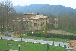
Santa Maria de Besora is a municipality in the comarca of Osona in Catalonia, Spain. It is situated on the north side of the Bellmunt range in the north of the comarca. It is linked to Sant Quirze de Besora and to Vidrà by a local road. Besora castle has an eleventh-century Romanesque church: there is also a preroman chapel at Sant Moí. Santa Maria de Besora became part of Osona in the comarcal revision of 1990: previously it formed part of the Ripollès.
Vidrà is a municipality in the comarca of Osona in Catalonia, Spain. It is situated in the valley of the Ges river, between the Bellmunt and Milany ranges, in the north of the comarca. It is linked to Sant Quirze de Besora by a local road. There are the roman churches of Sant Bartomeu de Covildases and of Santa Margarida de Cabagès in the municipal territory. Vidrà became part of Osona in the comarcal revision of 1990: previously it formed part of the Ripollès.

Deltebre is a municipality in the comarca of the Baix Ebre in Catalonia, Spain. It was created in 1977 when the communities of Jesús i Maria and la Cava seceded from the municipality of Tortosa. The municipality occupies much of the northern half of the Ebre Delta, on the left bank of the river. The cultivation of rice and tourism are the major industries. The T-340 road links the municipality with Tortosa and the rest of the comarca, while barges cross the river to Sant Jaume d'Enveja.

L'Aldea is a municipality in the comarca of the Baix Ebre in Catalonia, Spain. It was created in 1983 from parts of the municipality of Tortosa. It is situated on the left bank of the Ebre at the start of the delta. The town is served by the A-7 autopista and the N-340 road, and has a station on the RENFE railway line between Tarragona and Valencia.

Prats de Lluçanès is a municipality in the comarca of Osona in Catalonia, Spain. It is situated in the west of the comarca, on a plain between the Lluçanès and Merlès rivers, and is served by the C-154 road between Vic and Gironella.

Espinelves is a municipality in the comarca of Osona in Catalonia, Spain. It is situated in the Guilleries in the east of the comarca. Forestry is the main economic activity of the municipality, particularly the cultivation of the local species Abies masjoanensis for Christmas trees. The Romanesque church of Sant Vincenç d'Espinelves dates from the 11th and 12th centuries. The village is linked to Arbúcies and to Vic by the GI-543 road.
Centelles is a municipality in the comarca of Osona in Catalonia, Spain. It is situated in the upper valley of the Congost River in the south of the comarca. The municipality is served by the C-17 road. The renowned urban planner Ildefons Cerdà was born here.

Borredà is a municipality in the comarca of the Berguedà in Catalonia, Spain. It is situated in the upper valley of the Margençol river in the east of the comarca. There are several notable houses from the 17th and 18th centuries. The Romanesque church of Sant Sadurní de Rotgers, a protected historico-artistic monument, can be reached by a mountain track. The village is served by the C-149 road between Berga and Sant Quirze de Besora. The municipality surrounds an exclave of Les Llosses.

Terrades is a municipality in the comarca of the Alt Empordà in Catalonia, Spain. It is situated to the west of Figueres, above the valley of the Muga river, and is linked to the rest of the comarca by the GE-510 road.