
Talarn is a municipality in the comarca of the Pallars Jussà in Catalonia, Spain. It is situated in the centre of the Tremp basin, on the Noguera Pallaresa river below the Sant Antoni reservoir. It is the site of a hydroelectric power station and of a training school of the Spanish army. The town is served by the C-147 road between Tremp and La Pobla de Segur.
Vilassar de Dalt is a village in Catalonia, Spain, in the province of Barcelona and the comarca of Maresme. The name comes from the Roman name Villa Azari, later changed to Vilassar. In the 20th century, it split into two villages: Vilassar in the hills, and Vilassar by the Sea.

Cornellà de Llobregat is a municipality in the comarca of the Baix Llobregat in Catalonia, Spain. It is situated on the left bank of the Llobregat River. It is in the south-western part of the Barcelona metropolitan area and is part of the wider urban area. It is home to RCD Espanyol.

Santa Coloma de Farners is a spa town and capital of the comarca of the Selva, in Catalonia, Spain, and of the judicial district of Santa Coloma. It is situated on the edge of the Selva Depression and of the Guilleries. The local economy is mainly commercial, given the status of the town as capital of the comarca, although summer tourism, agriculture and forestry products also contribute. The urban centre is to the north and west of the main modern communication routes, although the C-253 road links the town with the main N-II route and the AP-7 autopista and to the Renfe railway station at Sils (10 km). The GE-533 runs through the northern part of the municipality, linking it with Vic to the west and with Riudellots de la Selva, Vilobí d'Onyar and Girona-Costa Brava Airport to the east.

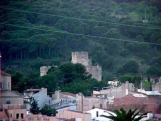
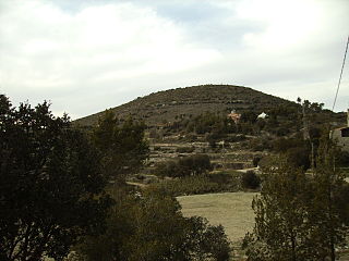
Òdena is a municipality in the comarca of the Anoia in Barcelona province, Catalonia, Spain. It is situated in the centre of the Òdena Basin, on the side of a small hill. The remains of Òdena castle with its octagonal tower are at the top of the hill. The town is served by the C-241 road from Igualada to Manresa, and the main N-II road from Barcelona to Lleida runs through the municipality.

Súria is a municipality in the comarca of the Bages in Catalonia, Spain. It is situated in the valley of the Cardener river between Manresa and Cardona. The area is best known for its deposits of potassium salts, which are exploited commercially and exported with trucks directly to all around the European continent or served to Martorell to receive chemical treatment by a dedicated railway line. The Old Town, at the foot of the castle, has preserved much of its medieval structure. The municipality is linked to Manresa and to Cardona and Solsona by the C-1410 road.

Bassella is a municipality in the comarca of the Alt Urgell, in Catalonia, Spain. The village of Bassella, one of nine settlements which make up the municipality, is located at the confluence of the Segre river with the Salada river and at the point where the route from Solsona and the potash mines of Cardona meets the route between Lleida and La Seu d'Urgell. The ajuntament is located in Castellnou de Bassella.
Caldes de Montbui is a Spanish town and municipality in the comarca of the Vallès Oriental in Catalonia. It is situated in the upper valley of the Caldes river, and the highest point of the municipality is the peak of el Farell at 816 m. It lies about 30 km from Barcelona and it part of its metropolitan area.

Cantallops is a municipality in the comarca of the Alt Empordà in Girona, Catalonia, Spain. It is situated below the Albera Range, and is linked to La Jonquera by the GI-601 road.

Premià de Mar is a municipality in the comarca of the Maresme in Catalonia, Spain. It is situated on the coast between El Masnou and Vilassar de Mar, to the north-east of Barcelona. The town is both a tourist centre and a dormitory town for Barcelona.

Olèrdola is a municipality in the comarca of the Alt Penedès in Catalonia, Spain. It is situated on the northern side of the Garraf massif, and the highest point of the municipality is the Puig de l'Àliga at 468 m.

Argençola is a municipality in the comarca of the Anoia in Catalonia, Spain. It is situated in the east of the comarca, bordering the Segarra and the Conca de Barberà. The Anoia river has its source on the territory of the municipality. A local road links the municipality with the main N-II road from Barcelona to Lleida.
Cercs is a municipality in the comarca of Berguedà in Catalonia. It is situated on the right bank of the Llobregat river above the Baells reservoir. It is the site of an important power station which burns the lignite extracted at Fígols and Saldes. The town is served by the C-1411 road between Berga and the Cadí tunnel.

Vilanova de Sau is a town in the comarca of the Osona in Catalonia, eastern Spain. It is situated in the valley called Sau. The Ter river runs through the valley, now dammed into Pantà de Sau, a reservoir which is in the municipal territory of Vilanova de Sau, and is a tourist attraction and base for water sports and hiking. The reservoir houses the submerged Church of Sant Romà.

Bonastre is a municipality in the comarca of the Baix Penedès in Catalonia, Spain. It is situated in the west of the comarca in the Quadrell range. Bonastre became part of the Baix Penedès in the comarcal revision of 1990: previously it formed part of the Tarragonès.

Espinelves is a municipality in the comarca of Osona in Catalonia, Spain. It is situated in the Guilleries in the east of the comarca. Forestry is the main economic activity of the municipality, particularly the cultivation of the local species Abies masjoanensis for Christmas trees. The Romanesque church of Sant Vincenç d'Espinelves dates from the 11th and 12th centuries. The village is linked to Arbúcies and to Vic by the GI-543 road.
Gironella is a municipality in the comarca of the Berguedà in Catalonia, Spain. It is situated in the left bank of the Llobregat river to the south of Berga. The local economy is traditionally based on cotton spinning and textile manufacture, although tourism is now more important: the company towns or "colonies" of workers houses surround the cotton mills are of historical interest. The town is served by the C-16 road to Berga and the Cadí tunnel. Gironella, which has numerous stores, bars, and schools, is an important economic center for the smaller towns around it, such as Olvan, Sagàs or Casserres.

Santa Coloma de Queralt is a municipality in the comarca of the Conca de Barberà in Catalonia, Spain. It is situated in the north-east of the comarca about 60 km (37 mi) from the city of Tarragona. The town is linked to the rest of the comarca and to Igualada by the C-241 road.

Lluçà is a municipality in the comarca of Lluçanès in Catalonia, Spain. It is subdivided into the town of Santa Eulàlia de Puigoriol, and the much smaller village of Lluçà. This village, prominent because of its monastery, gives its name to the surrounding natural comarca of Lluçanès.
The Castelltallat range is located in central Catalonia (Spain) between the comarcas of Bages and Solsonès, extending over the provinces of Barcelona and Lleida, and occupying an area of about 65 square kilometres. It is one of the isolated hills of the Catalan Central Depression and is located at its southwestern end.


