Silt, Colorado | |
|---|---|
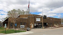 Silt Town Hall. | |
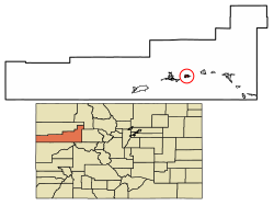 Location of Silt in Garfield County, Colorado. | |
| Coordinates: 39°32′47″N107°39′07″W / 39.54639°N 107.65194°W | |
| Country | |
| State | |
| County [1] | Garfield County |
| Incorporated | May 1915 [2] |
| Government | |
| • Type | Statutory Town [1] |
| Area | |
• Total | 1.73 sq mi (4.47 km2) |
| • Land | 1.66 sq mi (4.29 km2) |
| • Water | 0.069 sq mi (0.18 km2) |
| Elevation | 5,456 ft (1,663 m) |
| Population | |
• Total | 3,536 |
| • Density | 2,130/sq mi (824/km2) |
| Time zone | UTC-7 (Mountain (MST)) |
| • Summer (DST) | UTC-6 (MDT) |
| ZIP code [6] | 81652 |
| Area code | 970 |
| FIPS code | 08-70195 |
| GNIS feature ID | 2413284 [4] |
| Website | www |
Silt is a statutory town in Garfield County, Colorado, United States. The population was 3,536 at the 2020 census, [7] up from 2,930 at the 2010 census. The town is part of the Glenwood Springs Micropolitan Area.
