Cattle Creek, Colorado

Last updated

Cattle Creek, Colorado
Garfield County Colorado Incorporated and Unincorporated areas Cattle Creek Highlighted 0812470.svg
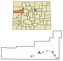
Location of the Cattle Creek CDP in Garfield County, Colorado.
Usa edcp location map.svg
Red pog.svg
Cattle Creek
Location of the Cattle Creek CDP in the United States.
Coordinates: 39°28′00″N107°15′30″W / 39.46667°N 107.25833°W / 39.46667; -107.25833 (Cattle Creek CDP, Colorado) [1]
Country Flag of the United States.svg  United States
State Flag of Colorado.svg  Colorado
County Garfield County
Government
[2]
  Type unincorporated community
Area
[1]
  Total1.295 sq mi (3.355 km2)
  Land1.295 sq mi (3.355 km2)
  Water0.000 sq mi (0.000 km2)
Elevation
[2]
6,247 ft (1,904 m)
Population
 (2020) [3]
  Total662
  Density510/sq mi (200/km2)
Time zone UTC-7 (MST)
  Summer (DST) UTC-6 (MDT)
ZIP Code [4]
Area code 970
GNIS feature 2583221 [2]

Cattle Creek is a census-designated place (CDP) in and governed by Garfield County, Colorado, United States. The CDP is a part of the Glenwood Springs, CO Micropolitan Statistical Area. The population of the Cattle Creek CDP was 662 at the United States Census 2020. [3] The Glenwood Springs post office (Zip Code 81601) serves the area. [4]

Contents

Geography

The CDP is located in southeastern Garfield County along Colorado State Highway 82 in the valley of the Roaring Fork River. Cattle Creek, a tributary of the Roaring Fork, forms the southern edge of the CDP. Highway 82 leads north 7 miles (11 km) to Glenwood Springs, the county seat, and south 6 miles (10 km) to Carbondale.

The Cattle Creek CDP has an area of 829 acres (3.355 km2), all land. [1]

Demographics

Cattle Creek CDP, Colorado
YearPop.±%
2010 641    
2020 662+3.3%
Source: United States Census Bureau

The United States Census Bureau initially defined the Cattle Creek CDP for the United States Census 2010.

See also

Related Research Articles

<span class="mw-page-title-main">Garfield County, Colorado</span> County in Colorado, United States

Garfield County is a county located in the U.S. state of Colorado. As of the 2020 census, the population was 61,685. The county seat is Glenwood Springs. The county is named in honor of United States President James A. Garfield. Garfield County is included in the Glenwood Springs, CO Micropolitan Statistical Area, which is also included in the Edwards-Glenwood Springs, CO Combined Statistical Area.

<span class="mw-page-title-main">Basalt, Colorado</span> Town in Colorado, United States

Basalt is a home rule municipality located in Eagle and Pitkin counties, Colorado, United States. The town population was 3,984 at the 2020 United States Census with 2,917 residing in Eagle County and 1,067 residing in Pitkin County. Basalt is a part of the Edwards-Glenwood Springs, CO Combined Statistical Area.

<span class="mw-page-title-main">Edwards, Colorado</span> Census Designated Place in Colorado, United States

Edwards is an unincorporated town, a post office, and a census-designated place (CDP) located in and governed by Eagle County, Colorado, United States. Edwards is the principal town of the Edwards, CO Micropolitan Statistical Area. The Edwards post office has the ZIP Code 81632. At the United States Census 2020, the population of the Edwards CDP was 11,246. The Edwards Metropolitan District provides services.

<span class="mw-page-title-main">El Jebel, Colorado</span> Census Designated Place in Colorado, United States

El Jebel is an unincorporated community and a census-designated place (CDP) located in and governed by Eagle County, Colorado, United States. The CDP is a part of the Edwards, CO Micropolitan Statistical Area. The population of the El Jebel CDP was 4,130 at the United States Census 2020. The Carbondale Post Office serves El Jebel postal addresses.

<span class="mw-page-title-main">Battlement Mesa, Colorado</span> Ceneus-designated place in Garfield County, Colorado, United States

Battlement Mesa is a census-designated place (CDP) and post office in and governed by Garfield County, Colorado, United States. The CDP is a part of the Glenwood Springs, CO Micropolitan Statistical Area. The Battlement Mesa post office has the ZIP Codes 81635 and 81636. At the United States Census 2020, the population of the Battlement Mesa CDP was 5,438. The Battlement Mesa Metropolitan District provides services.

<span class="mw-page-title-main">Glenwood Springs, Colorado</span> City in Colorado, United States

Glenwood Springs is a home rule municipality that is the county seat of Garfield County, Colorado, United States. The city population was 9,963 at the 2020 United States Census. Glenwood Springs is located at the confluence of the Roaring Fork River and the Colorado River, connecting the Roaring Fork Valley and a series of smaller towns up and down the Colorado River.

<span class="mw-page-title-main">Kittredge, Colorado</span> Census Designated Place in Colorado, United States

Kittredge is an unincorporated town, a post office, and a census-designated place (CDP) located in and governed by Jefferson County, Colorado, United States. The CDP is a part of the Denver–Aurora–Lakewood, CO Metropolitan Statistical Area. The Kittredge post office has the ZIP code 80457. At the United States Census 2020, the population of the Kittredge CDP was 1,308.

<span class="mw-page-title-main">Woody Creek, Colorado</span> Census Designated Place in Colorado, United States

Woody Creek is an unincorporated town, a post office, and a census-designated place (CDP) located in and governed by Pitkin County, Colorado, United States. The Woody Creek post office has the ZIP Code 81656. At the United States Census 2020, the population of the Woody Creek CDP was 290. The Woody Creek Metropolitan District provides services. The CDP is a part of the Glenwood Springs, CO Micropolitan Statistical Area.

Snowmass is an unincorporated community and a U.S. Post Office located in Pitkin County, Colorado, United States. It is situated in the valley of the Roaring Fork River, near the mouth of Snowmass Creek along State Highway 82 between Aspen and Basalt. It consists largely of a post office, several commercial businesses, and surrounding houses and ranches. The Snowmass Post Office has the ZIP Code 81654.

<span class="mw-page-title-main">No Name, Colorado</span> Census-designated place in Garfield County, Colorado, United States

No Name is a census-designated place (CDP) in and governed by Garfield County, Colorado, United States. The CDP is a part of the Glenwood Springs, CO Micropolitan Statistical Area. The population of the No Name CDP was 117 at the United States Census 2020. The Glenwood Springs post office serves the area.

<span class="mw-page-title-main">Twin Lakes, Lake County, Colorado</span> Census-designated place in Lake County, Colorado, United States

Twin Lakes is a pair of glacier-carved alpine lakes about 15 miles (24 km) south of historic Leadville, Colorado. They are downstream along the Arkansas River, whose headwaters are by Leadville. The lakes, however, are on a tributary, Lake Creek, which joins the Arkansas just below the lakes. After dredging, the lakes now have a surface area of 2,700 acres (11 km2), and they serve as a reservoir to store water for use in the Front Range. Both east and west lakes are recreation areas for boating and fishing.

<span class="mw-page-title-main">Idledale, Colorado</span> Census Designated Place in Colorado, United States

Idledale is an unincorporated town, a post office, and a census-designated place (CDP) located in and governed by Jefferson County, Colorado, United States. The CDP is a part of the Denver–Aurora–Lakewood, CO Metropolitan Statistical Area. The Idledale post office has the ZIP code 80453. At the United States Census 2020, the population of the Idledale CDP was 244.

<span class="mw-page-title-main">McCoy, Colorado</span> Census Designated Place in Colorado, United States

McCoy is an unincorporated town, a census-designated place (CDP), and a post office located in and governed by Eagle County, Colorado, United States. The CDP is a part of the Edwards, CO Micropolitan Statistical Area. The McCoy post office has the ZIP Code 80463. At the United States Census 2020, the population of the McCoy CDP was 30.

<span class="mw-page-title-main">Glendale, Boulder County, Colorado</span> Census Designated Place in Colorado, United States

Glendale is an unincorporated community and a census-designated place (CDP) located in and governed by Boulder County, Colorado, United States. The CDP is a part of the Boulder, CO Metropolitan Statistical Area. The population of the Glendale CDP was 64 at the United States Census 2020. The Jamestown post office serves the area.

<span class="mw-page-title-main">St. Ann Highlands, Colorado</span> Census Designated Place in Colorado, United States

St. Ann Highlands is an unincorporated community and a census-designated place (CDP) located in and governed by Boulder County, Colorado, United States. The CDP is a part of the Boulder, CO Metropolitan Statistical Area. The population of the St. Ann Highlands CDP was 325 at the United States Census 2020. The Nederland post office serves the area.

<span class="mw-page-title-main">Cathedral, Colorado</span> Census Designated Place in Colorado, United States

Cathedral is a census-designated place (CDP) located in and governed by Hinsdale County, Colorado, United States. The population of the Cathedral CDP was 15 at the United States Census 2020. The Powderhorn post office serves the area.

<span class="mw-page-title-main">Catherine, Colorado</span> Census-designated place in Garfield County, Colorado, United States

Catherine is a census-designated place (CDP) in and governed by Garfield County, Colorado, United States. The CDP is a part of the Glenwood Springs, CO Micropolitan Statistical Area. The population of the Catherine CDP was 235 at the United States Census 2020. The Glenwood Springs post office serves the area.

<span class="mw-page-title-main">Chacra, Colorado</span> Census-designated places in Garfield County, Colorado, United States

Chacra is a census-designated place (CDP) in and governed by Garfield County, Colorado, United States. The CDP is a part of the Glenwood Springs, CO Micropolitan Statistical Area. The population of the Chacra CDP was 331 at the United States Census 2020. The Glenwood Springs post office serves the area.

<span class="mw-page-title-main">Mulford, Colorado</span> Census-designated place in Garfield County, Colorado, United States

Mulford is a Census-designated place (CDP) in and governed by Garfield County, Colorado, United States. The CDP is a part of the Glenwood Springs, CO Micropolitan Statistical Area. The population of the Mulford CDP was 259 at the United States Census 2020. The Carbondale post office serves the area.

<span class="mw-page-title-main">Norrie, Colorado</span> Unincorporated community in Pitkin County, Colorado, United States

Norrie is a census-designated place (CDP) located in and governed by Pitkin County, Colorado, United States. The population of the Norrie CDP was 7 at the United States Census 2020. The Meredith post office (Zip Code 81642) serves the area. The CDP is a part of the Glenwood Springs, CO Micropolitan Statistical Area.

References

  1. 1 2 3 "State of Colorado Census Designated Places - BAS20 - Data as of January 1, 2020". United States Census Bureau . Retrieved December 22, 2020.
  2. 1 2 3 U.S. Geological Survey Geographic Names Information System: Cattle Creek, Colorado
  3. 1 2 United States Census Bureau. "Cattle Creek CDP, Colorado" . Retrieved April 16, 2023.
  4. 1 2 "Zip Code 81601 Map and Profile". zipdatamaps.com. 2020. Retrieved December 22, 2020.