Related Research Articles

Arnold Palmer Regional Airport is in Westmoreland County, Pennsylvania, United States, two miles (3 km) southwest of Latrobe and about 33 miles (53 km) southeast of Pittsburgh. It was formerly Westmoreland County Airport; it was renamed in September 1999 for Arnold Palmer as part of his 70th birthday celebration. Palmer learned to fly at the airport, and the dedication ceremony included Governor Tom Ridge and a flyover of three A-10s of the Pennsylvania Air National Guard.
Rostraver Airport is a public use airport in Westmoreland County, Pennsylvania, United States.

York Airport (York Aviation) (IATA: THV, ICAO: KTHV, FAA LID: THV) is a privately owned, public use airport that is located seven nautical miles (8 mi, 13 km) southwest of the central business district of York in the Thomasville section of Jackson Township, York County, Pennsylvania, United States.

Washington County Airport is three miles (5 km) southwest of Washington in South Franklin Township, Pennsylvania. It is owned and operated by Washington County and is in the Greater Pittsburgh metropolitan area.
Heritage Field is a public use airport in Montgomery County, Pennsylvania, United States. It is located three nautical miles (6 km) east of Pottstown, in Limerick Township. The airport is privately owned by Limerick Aviation LP.
Beaver County Airport or is a county-owned public airport three miles northwest of Beaver Falls, in Beaver County, Pennsylvania.

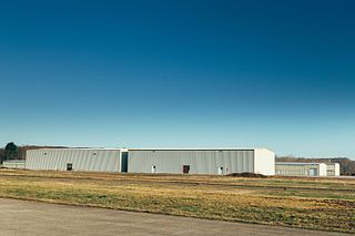
Pittsburgh-Butler Regional Airport, also known as the Butler County Airport or K. W. Scholter Field, is a public airport 5 miles (8 km) southwest of the central business district of Butler, the county seat of Butler County, Pennsylvania, United States. The airport serves the northern suburbs of the Pittsburgh metropolitan area. It is owned by the Butler County Airport Authority.
Pittsburgh Northeast Airport is a privately owned, public use airport in Allegheny County, Pennsylvania, United States. The airport is located 12 nautical miles north-northeast of the central business district of Pittsburgh, in West Deer Township. The airport is located a few miles north of Pittsburgh Mills shopping mall.
Cross Keys Airport is a privately-owned, public use airport located one nautical mile (2 km) south of the Cross Keys area of Monroe Township in Gloucester County, New Jersey. A skydiving operation is based at the airport.
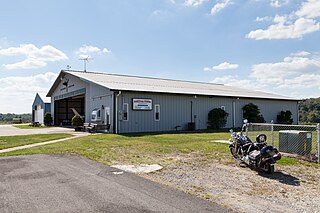
Zelienople Municipal Airport is a public airport in Beaver County, Pennsylvania, a mile west of Zelienople, a borough in Butler County, Pennsylvania, in the Pittsburgh metropolitan area. The airport is owned by the Borough of Zelienople and operated by the Zelienople Municipal Authority. The National Plan of Integrated Airport Systems for 2011–2015 categorized it as a general aviation facility.
Miami Homestead General Aviation Airport is a county-owned public-use airport in unincorporated Miami-Dade County, Florida, United States, located 4 miles (6.4 km) northwest of the central business district of Homestead.
New Castle Municipal Airport is a small municipal airport located in Union Township, Lawrence County, Pennsylvania serving Lawrence County, Pennsylvania, part of the Pittsburgh metropolitan area. Union Township is an outskirt of New Castle, Pennsylvania hence the name. The airport is located four nautical miles northwest of the central business district of New Castle. The airport is a public-owned airport and is controlled by the Lawrence County Airport Authority.
Red Lodge Airport is a public use airport located one nautical mile northwest of the central business district of Red Lodge, a city in Carbon County, Montana, United States. It is owned by the City of Red Lodge and Carbon County. According to the FAA's National Plan of Integrated Airport Systems for 2009–2013, it is categorized as a general aviation airport.
Grimes Airport is a privately owned public-use airport located two nautical miles east of the central business district of Bethel, in Berks County, Pennsylvania, United States.
Reigle Field, also known as Reigle Airport, is a privately owned, public use airport located two nautical miles (4 km) south of the central business district of Palmyra, in Lebanon County, Pennsylvania, United States.
Port Meadville Airport is a public use airport located three nautical miles west of the central business district of Meadville, in Crawford County, Pennsylvania, United States. It is included in the FAA's National Plan of Integrated Airport Systems for 2011–2015, which categorized it as a general aviation facility.
McVille Airport is a privately owned, public use airport located six nautical miles northeast of the central business district of Freeport, a borough in Armstrong County, Pennsylvania, United States.
The Greensburg Jeannette Regional Airport is a privately owned, public use airport which is located three nautical miles (6 km) north of the central business district of Jeannette, a city in Westmoreland County, Pennsylvania, United States.
Carlisle Airport (Pennsylvania) (IATA: N94, ICAO: None, FAA LID: N94) is a publicly-owned, public use airport located one nautical miles (two mi, three km) southeast of the central business district of Carlisle, a city in Cumberland County, Pennsylvania, United States. This airport is owned and operated by South Middleton Township, Cumberland County, Pennsylvania.