Rensselaer County is a county in the U.S. state of New York. As of the 2020 census, the population was 161,130. Its county seat is Troy. The county is named in honor of the family of Kiliaen van Rensselaer, the original Dutch owner of the land in the area.

North Greenbush is a town in Rensselaer County, New York, United States. North Greenbush is located in the western part of the county. The population was 13,292 at the 2020 census.

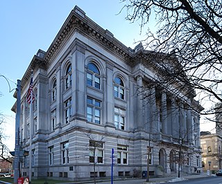
Rensselaer is a city in Rensselaer County, New York, United States, and is located on the east side of the Hudson River, directly opposite of Albany. As of the 2020 census, the city population was 9,210. Rensselaer is on the western border of Rensselaer County. The area now known as the City of Rensselaer was settled by the Dutch in the 17th century, who called it t'Greyn Bos, which became Greenbush in English. The city has a rich industrial history stretching back to the 19th century, when it became a major railroad hub; In 2020, Albany-Rensselaer was the ninth busiest Amtrak station in the country and the second busiest in New York State. Rensselaer was one of the earliest locations of the dye industry in the United States, and was the first American location for the production of aspirin.

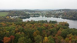
Sand Lake is a town in south-central part of Rensselaer County, New York, United States. Sand Lake is about 13 miles east of Albany, New York. Within the town are three hamlets: Averill Park, Glass Lake and the hamlet of Sand Lake. Its four lakes are a source of recreation. Many commercial enterprises of the 19th century and into the 20th century relied on power generated from the Wynants Kill Creek and Burden Lake mills. The area is known for fertile soil for grazing and agriculture. The estimated population for 2016 census was 8,490.

Schodack is a town in Rensselaer County, New York, United States. The population was 12,965 at the 2020 census. The town name is derived from the Mahican word, Escotak. The town is in the southwestern part of the county. Schodack is southeast of Albany, New York.

East Greenbush is a town in Rensselaer County, New York, United States. It is a suburb of Albany. The population was 16,473 at the 2010 census. The word Greenbush is derived from the Dutch het groen bosch, referring to the pine woods that originally covered the land. The first settlement of the land now known as East Greenbush was made by tenants under patroon Kiliaen van Rensselaer circa 1630. The town was established in 1855 as Clinton, and was renamed in 1858. It is mostly suburban along its major highways and rural in the southwestern and northeastern corners.

The Capital District, also known as the Capital Region, is the metropolitan area surrounding Albany, the capital of the U.S. state of New York. The Capital District was first settled by the Dutch in the early 17th century and came under English control in 1664. Albany has been the permanent capital of the state of New York since 1797. The Capital District is notable for many historical events that predate the independence of the United States, including the Albany Plan of Union and the Battles of Saratoga.

New York State Route 151 (NY 151) is an 8.23-mile (13.24 km) state highway located in Rensselaer County, New York, in the United States. Its western terminus is at an interchange with the U.S. Route 9 (US 9) and US 20 in Rensselaer, and its eastern terminus is at a junction with NY 150 in Shivers Corners, a hamlet in the town of Schodack. It also has an intersection with US 4 in East Greenbush. NY 151 was assigned to most of its current alignment as part of the 1930 renumbering of state highways in New York. In Rensselaer, NY 151 has been altered several times, with the most recent change coming in the late 1990s. The current western terminus of NY 151 was once the western terminus of NY 43.

New York State Route 443 (NY 443) is an east–west state highway in the Capital District of New York in the United States. The route begins at an intersection with NY 30 in the town of Schoharie and ends 33.44 miles (53.82 km) later at a junction with U.S. Route 9W (US 9W) and US 20 in the city of Albany. It ascends the Helderberg Escarpment in the towns of Berne and New Scotland. Within the town of Bethlehem and the city of Albany, NY 443 is known as Delaware Avenue.

New York State Route 43 (NY 43) is a state highway in Rensselaer County, New York, in the United States. It extends for 24.00 miles (38.62 km) from Interstate 90 (I-90) exit 8 in North Greenbush to the Massachusetts state line, where it continues into Williamstown as Massachusetts Route 43. Most of NY 43 is a two-lane highway that passes through a mixture of rural and residential areas; however, its westernmost 2 miles (3.2 km) between I-90 and U.S. Route 4 (US 4) is a four-lane divided highway. NY 43 has an overlap with NY 66 in Sand Lake and intersects NY 22 in Stephentown.

U.S. Route 9 (US 9) is a part of the United States Numbered Highway System that runs from Laurel, Delaware, to Champlain, New York. In New York, US 9 extends 324.72 miles (522.59 km) from the George Washington Bridge in Manhattan to an interchange with Interstate 87 (I-87) just south of the Canada–United States border in the town of Champlain. US 9 is the longest north–south U.S. Highway in New York. The portion of US 9 in New York accounts for more than half of the highway's total length.

New York State Route 9J (NY 9J) is a north–south state highway in the Hudson Valley region of New York in the United States. It begins at an intersection with US 9 in the Columbia County town of Stockport and extends for 22.35 miles (35.97 km) to an interchange with US 9 and US 20 in the Rensselaer County city of Rensselaer. The route parallels the Hudson River for its entire length, and several parts of the highway run directly alongside the river. NY 9J was assigned to its current alignment as part of the 1930 renumbering of state highways in New York.

New York State Route 66 (NY 66) is a state highway in the Capital District of New York in the United States. The route begins at an intersection with US 9 and NY 23B in the Columbia County city of Hudson and ends at a junction with NY 2 in the Rensselaer County city of Troy. While both Hudson and Troy are located on the Hudson River, NY 66 follows a more inland routing between the two locations to serve several rural villages and hamlets, including Chatham and Sand Lake. NY 66 overlaps with U.S. Route 20 (US 20) and NY 43, two regionally important east–west highways, in Nassau and Sand Lake, respectively.

New York State Route 355 (NY 355) is an east–west state highway in Rensselaer County, New York, in the United States. The western terminus of the route is at an intersection with NY 66 in the town of North Greenbush. Its eastern terminus is at a junction with NY 351 in the hamlet of Poestenkill within the town of the same name. NY 355 originally consisted only of the section of the route between NY 66 and Spring Avenue; however, it was extended east to Postenkill hamlet in 1980, partially replacing NY 154.

New York State Route 136 (NY 136) is a state highway within the town of North Greenbush in Rensselaer County, New York, in the United States. It begins at an intersection with U.S. Route 4 (US 4) just south of Troy and ends at a junction with NY 150 in the hamlet of Wynantskill. NY 136 provides access to Hudson Valley Community College, located in an otherwise residential area of suburban Troy. The route was assigned in the late 1930s as a connector between US 4 and Winter Street, then part of NY 40. NY 136 was extended to its current length in 1980.
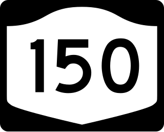
New York State Route 150 (NY 150) is a north–south state highway in Rensselaer County, New York, in the United States. The southern terminus of the route is at NY 9J in Castleton-on-Hudson. Its northern terminus is at a junction with NY 66 in the hamlet of Wynantskill, located within the town of North Greenbush.
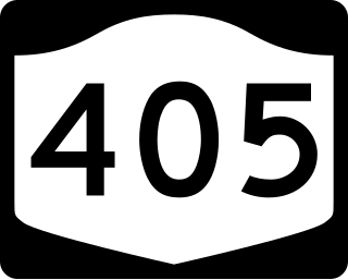
New York State Route 405 (NY 405) was a state highway in Rensselaer County, New York, in the United States. It ran for 2.63 miles (4.23 km) between an intersection with U.S. Route 4 in North Greenbush and a junction with NY 66 just inside the Troy city limits. In between, NY 405 intersected NY 136. The entirety of NY 405 was originally part of NY 40. In the February–March 1973, NY 40 was truncated northward to NY 7 in northern Troy and its former routing from US 4 to NY 66 was assigned NY 405. Ownership and maintenance of most of NY 405 was transferred to Rensselaer County on April 1, 1980, at which time the parts of the route given to the county were redesignated as part of County Route 74 (CR 74).
New York State Route 152 (NY 152) was a 6.0-mile-long (9.7 km) east–west state highway in Rensselaer County, New York, in the United States. The western terminus of the route was at an intersection with U.S. Route 4 (US 4) and NY 43 in the town of North Greenbush. Its eastern terminus was at a junction with NY 150 in the town of Sand Lake. NY 152 was little more than a connector between the hamlets of Defreestville and Sliters.

North Albany is a neighborhood in the city of Albany, New York. North Albany was settled in the mid-17th century by the Patroon of Rensselaerswyck and his tenants and later became a hamlet in the town of Watervliet. Due to the Erie Canal being constructed in 1825, North Albany saw immense growth, with the Albany Lumber District and an influx of Irish immigrants lending the area the name of Limerick. Home to many historic warehouses and row houses, North Albany continues to be an important industrial neighborhood. Recent efforts have begun to gentrify the neighborhood by adapting heavy industry/warehouse use to artistic and entertainment venues, such as a German beer garden, an amusement park, live music venues, and arts and crafts marketplaces.