Sorrento, Western Australia

Last updated

Sorrento
Perth,  Western Australia
Sorrento and Hillarys 1.jpg
Sorrento and Hillarys from the air, circa 2009
Sorrento, Western Australia
Coordinates 31°49′37″S115°45′14″E / 31.827°S 115.754°E / -31.827; 115.754 Coordinates: 31°49′37″S115°45′14″E / 31.827°S 115.754°E / -31.827; 115.754
Population7,795 (SAL 2021) [1]
Established1971
Postcode(s) 6020
Area3.5 km2 (1.4 sq mi)
Location19 km (12 mi) NW of Perth CBD
LGA(s) City of Joondalup
State electorate(s) Carine
Federal division(s) Moore
Suburbs around Sorrento:
Hillarys Padbury
Indian Ocean Sorrento Duncraig
Marmion Duncraig

Sorrento is a northern coastal suburb of Perth, the capital city of Western Australia in the local government area of the City of Joondalup. At its northwestern corner is the Hillarys Boat Harbour, built in the late 1980s.

Contents

History

Sorrento Beach Sorrento Beach 1.jpg
Sorrento Beach

A private subdivision of freehold land known as "Sorrento" was surveyed here in 1929. It is assumed that the name was taken from the Italian seaside town of Sorrento which is located south of Naples opposite the Isle of Capri. [2] Prior to white settlement, the Whadjuk Aboriginal people, who called the area Mooro, gathered abalone and other shellfish in large numbers off the nearby reefs.

The first European to settle in the area was Patrick Marmion, master whaler, who operated a whaling station in the area in 1849. There are still some remains of the old whaling station at the present-day Surf Lifesaving Club site, and a monument to Marmion can be found in Geneff Park in Padbury Circle.

The area was popular with fishermen in the 1930s, and numerous boatsheds and shacks were built there. Residential settlement commenced in the early 1950s and until 1981, it was part of the suburb of Marmion.

Sorrento's development (1950-1990) Sorrento urban development.gif
Sorrento's development (1950–1990)

In 1958, the Sisters of Our Lady of the Missions bought land in Sorrento at what was then the end of the West Coast Highway, and in 1967, the Sisters and boarding students moved from Highgate to the new site, Sacred Heart College Sorrento. The college became coeducational in 1977, and in 1989, the Catholic Education Commission took over management of the school. [3]

In preparation for Australia's defence of the 1987 America's Cup at Fremantle, the State Government commissioned the building of Hillarys Boat Harbour, the first major marina in the north metropolitan area. The retail complex on the site, called Sorrento Quay, commenced trading in December 1987 and was officially opened in January 1988. Also, in May 1987, the Government declared Marmion Marine Park over a region from Burns Beach to Trigg, to which the new marina complex provided a gateway. [4] [5]

Geography

Sorrento is bounded by Hepburn Avenue to the north, Marmion Avenue to the east, Marine Terrace to the south and West Coast Drive and the Indian Ocean to the west. [6]

At the 2001 Australian census, Sorrento had a population of 7,321 people living in 2,796 dwellings. Sorrento's oceanside location and to Hillarys Boat Harbour has seen the suburb become affluent since the 1980s, and the ABS identified many managers and professionals living within the suburb. However, many tradespeople and service employees also live in the area. [7]

Facilities

Sorrento is a residential suburb, relying on the Seacrest Village shopping centre for liquor, take-away food, the Seacrest pharmacy for medical goods, and Whitford City and Centro Warwick for other services. Several parks of various sizes are situated in the suburb. [6]

The Sorrento Quay retail development within the Hillarys Boat Harbour sits on the northwestern boundary of the suburb. Off the coast is the Marmion Marine Park, [5] which provides a home for many species of marine animals.

Sorrento Beach has a Beach Enclosure that allows swimmers to enter the water with reduced risk of encountering a shark. [8] Sorrento Beach also has a Surf Life Saving Club, providing patrols, education training and sporting facilities. [9]

Education

Sorrento contains a Catholic private school, Sacred Heart College, and a state primary school Sorrento Primary School [10] (founded 1970). The suburb falls within Duncraig Senior High School's catchment area.

Transport

Sorrento is served by the 423 and 441 buses from Warwick railway station and Whitfords Train Station, [11] operated by Swan Transit.

Politics

Sorrento is a reasonably affluent suburb with many "mortgage belt" families. The beachside part of Sorrento, together with Hillarys to its north, is the strongest base in the northern suburban region for the Liberal Party at both federal and state elections.

See also

Related Research Articles

Joondalup line Suburban rail line in Perth, Western Australia

The Joondalup line is a commuter rail service in Western Australia, linking the Perth central business district (CBD) with the metropolitan area's north-western suburbs. The service is operated on the Northern Suburbs Railway by Transperth Train Operations, a division of the Public Transport Authority, and is part of the Transperth network. It is 40.7 kilometres (25.3 mi) long and serves 13 stations. The service is currently, as of 2022, being extended to Yanchep as part of the Yanchep Rail Extension project, and may be renamed once the extension to Yanchep is completed.

Greenwood railway station Railway station in Perth, Western Australia

Greenwood railway station is a railway station on the Transperth network. It is located on the Joondalup line, 17.8 kilometres (11.1 mi) from Perth station serving the suburb of Greenwood.

Joondalup Suburb of Perth, Western Australia

Joondalup is a suburb of Perth, Western Australia, approximately 26 kilometres (16 mi) north of Perth's central business district. It contains the central business district of the regional City of Joondalup and acts as the primary urban centre of Perth's outer northern suburbs.

Watermans Bay, Western Australia Suburb of Perth, Western Australia

Watermans Bay is a northern coastal suburb of Perth, the capital city of Western Australia. Its local government area is the City of Stirling.

Whitfords railway station Railway station in Perth, Western Australia

Whitfords railway station is a railway station located on the boundary of Padbury and Kingsley, suburbs of Perth, Western Australia. It is on the Joondalup railway line, which is part of the Transperth commuter rail network. It is located in the median of the Mitchell Freeway, and consists of an elevated bus interchange on top of an island platform at ground level. South of Whitfords, trains run every 5 minutes during peak. North of Whitfords, trains run every 10 minutes during peak. Between peak during the day, trains run every 15 minutes. The journey to Perth railway station is 19.8 kilometres (12.3 mi), and takes 19 minutes.

Perth Central Area Transit

The Perth Central Area Transit system, or simply CAT, consists of five bus routes in the centre of Perth, one bus route in Fremantle, and three bus routes in Joondalup. Similar services exist in Rockingham and Midland. Unlike all other Transperth services, most CAT routes are free.

Duncraig, Western Australia Suburb of Perth, Western Australia

Duncraig is a northern suburb of Perth, the capital city of Western Australia, and is located 16 kilometres (10 mi) north of Perth's central business district (CBD) between Marmion Avenue and Mitchell Freeway. Its local government area is the City of Joondalup.

Eglinton, Western Australia Suburb of Perth, Western Australia

Eglinton is a locality in the Western Australian capital city of Perth, approximately 44 kilometres (27 mi) north of Perth's central business district on the Indian Ocean. For the most part, the suburb is covered in native banksia woodland, scrubland and heath typical of the Swan Coastal Plain. However, in recent years, there has been growth in residential estates, with a town centre to be built in the near future. There are also plans for the Joondalup railway line to be extended through the suburb with Eglinton railway station to be located inside Allara estate.

Beldon is a small suburb of Perth, Western Australia, located within the City of Joondalup, to the north of Craigie.

Connolly, Western Australia Suburb of Perth, Western Australia

Connolly is a northern suburb of Perth, Western Australia, located within the City of Joondalup adjacent to Joondalup's central business district. It was built in the late 1980s as a golf course estate. Its eastern border backs onto the Mitchell Freeway. Many homes feature on the edges of Connolly but the homes bordering the golf course are generally larger and more affluent.

Hillarys is a northern coastal suburb of Perth, the capital city of Western Australia, in the local government area of the City of Joondalup. It is part of the Whitfords precinct, and is located 21 km north-northwest of Perth's central business district via Mitchell Freeway and Hepburn Avenue.

Marmion, Western Australia Suburb of Perth, Western Australia

Marmion is a northern coastal suburb of Perth, the capital city of Western Australia. Its local government area is the City of Joondalup.

Burns Beach, Western Australia Suburb of Perth, Western Australia

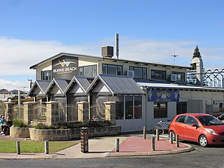
Burns Beach is a suburb of Perth, Western Australia, located 34 kilometres (21 mi) north of Perth's central business district at the northern fringe of the City of Joondalup. Burns Beach has maintained much of its original character as a small coastal village even with its loss of isolation, and the beach is popular among hang gliding enthusiasts.

City of Joondalup Local government area in Western Australia

The City of Joondalup is a local government area with City status in Perth, Western Australia. Its central business district is located in the suburb Joondalup, and it includes the town centres of Hillarys and Warwick.

Hillarys Boat Harbour

Hillarys Boat Harbour is a marina and tourist precinct located in Hillarys, north of Perth, Western Australia and on the Indian Ocean.

Sunset Coast

Sunset Coast is the name given by Tourism Western Australia to the coastal section of the northern metropolitan area of Perth, the capital city of Western Australia, and is one of the six component tourism precincts of the Perth region. While not in extensive use locally, since the 1990s it has been a centrepiece of Western Australian tourism planning and is used in interstate and overseas marketing of the region. The region contains many white sand beaches.

Hepburn Avenue Road in Perth, Western Australia

Hepburn Avenue is an arterial east-west road in the northern suburbs of Perth, Western Australia. The road links Sorrento in the west with Malaga and Whiteman in the east. It also connects the residential developments that span its length with several local facilities, as well as major road routes into central Perth.

Whitfords Avenue Road in Perth, Western Australia

Whitfords Avenue is an arterial east–west road located in the northern suburbs of Perth, Western Australia.

Transperth is the brand name of the public transport system serving the city and suburban areas of Perth, the state capital of Western Australia. It is managed by the Public Transport Authority (PTA), a state government organisation. Train operations are done by Transperth Train Operations, a division of the PTA. Bus operations are contracted out to Swan Transit, Path Transit and Transdev. Ferry operations are contracted out to Captain Cook Cruises.

Ocean Reef Marina is a development project in Ocean Reef, Western Australia to construct a new marina with commercial and residential areas at the existing Ocean Reef Boat Harbour. The site is being developed by DevelopmentWA; construction of its two breakwaters started in April 2021, with the whole project expected to be fully completed in 2036 and then becoming part of the City of Joondalup. The concept for a marina by developers in the area of Mullaloo and Ocean Reef had been proposed as far back as 1973.

References

  1. Australian Bureau of Statistics (28 June 2022). "Sorrento (WA) (Suburb and Locality)". Australian Census 2021 QuickStats. Retrieved 28 June 2022.  OOjs UI icon edit-ltr-progressive.svg
  2. "History of metropolitan suburb names – S". Western Australian Land Information Authority. Retrieved 17 January 2007.
  3. Sacred Heart - History Archived 20 August 2006 at the Wayback Machine , accessed 2007-01-17
  4. Department for Planning and Infrastructure (WA). "Hillarys Boat Harbour". Archived from the original on 6 April 2007. Retrieved 17 January 2007.
  5. 1 2 Conservation and Land Management (December 2000). "Marmion Marine Park". Archived from the original on 19 September 2006. Retrieved 17 January 2007.
  6. 1 2 Department of Land Information. StreetSmart Perth Street Directory (54th ed.). West Australian Newspapers Ltd. pp. Map 280. ISBN   978-0-909439-67-5.
  7. Australian Bureau of Statistics (19 November 2002). "Community Profile Series : Sorrento (State Suburb)". 2001 Census of Population and Housing. Retrieved 22 June 2007.
  8. "Beach safety – City of Joondalup".
  9. "About Sorrento SLSC".
  10. "Home". sorrentops.wa.edu.au.
  11. Bus Timetable 62, Transperth, effective 31 January 2016; Bus Timetable 63, Transperth, effective 31 January 2016. Accessed 12 January 2016.