South Andros

Last updated
District of South Andros
South Andros in Bahamas (zoom).svg
Coordinates: 25°4′N77°20′W / 25.067°N 77.333°W / 25.067; -77.333
Country Bahamas
Island Andros
Established 1996
Government
  TypeDistrict Council
  Chief CouncillorFairdale Smith
  Deputy Chief CouncillorJeffery Johnson
Population
 (2022)
  Total3,711 [1]
Time zone UTC−5 (EST)
  Summer (DST) UTC−4 (EDT)
Area code 242

South Andros is a district of the nation of the Bahamas.

Contents

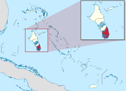
Geographically, South Andros is the southernmost third of the land mass colloquially called Andros, which includes the districts of North Andros, Central Andros, Mangrove Cay and South Andros. In 2022, the district had 3,711 inhabitants. [2]

Transportation

The districts are divided by broad unspanned "creeks", some of which offer public ferry crossing; otherwise the only way to travel from one district to another is by private plane or boat. South Andros is accessed from Nassau via commercial airline (currently two trips daily from Nassau to South Andros Airport), from the U.S. via two flights commercially from Fort Lauderdale International and other islands by charter airplane (usually from Fort Lauderdale, Florida), and from anywhere by private boat. A public ferry runs daily between South Andros and its northern neighbouring Mangrove Cay which is also considered a part of South Andros. The mail boat comes to Andros once a week from Nassau, leaving Nassau Monday night and arriving at Drigg's Hill port on South Andros on Tuesday morning, which brings the majority of all imports and supplies to the island, from milk to petrol.

Roads

The Queen's Highway, a two lane paved and illuminated road without traffic lights, runs approximately 60 km (40 mi) from the northernmost edge of South Andros which is the port of Drigg's Hill, to the dockside settlement of Mars Bay. At Mars Bay the road ends in a cul de sac but the island extends approximately 30 km (20 mi) further south without roads or services, inaccessible except by boat. In its course from Drigg's Hill to Mars Bay, the highway crosses two bridges, one at Deep Creek and one further south at Little Creek, both refurbished in 2012.

Settlements

Almost the entire population of South Andros lives in housing abutting the Queen's Highway and a few short, paved roads trailing off it. The only other significant road is that leading west, inland, along the north side of Deep Creek, to Black Point, where there are a handful of additional homes. South Andros' widest point is about 30 km (20 mi) east to west, but only the eastern fringe is inhabited, as most of the island consists of salty marsh and tidal estuaries.

All housing on South Andros consists of small, single family homes, sometimes clustered in small groups on a single tract of land, and almost all buildings are made of cement block and/or local limestone, as wood is expensive to import and does not withstand hurricanes well. Government-provided electric, telephone and rubbish disposal services are available to all homes on the island, with a major power generation plant located mid-island in the settlement called The Bluff or Blufftown. Municipal water is supplied to much of the island inhabitants but for residents in the southern part of the island, water is obtained by catchment or private well: many parts of Andros enjoy an abundance of underground fresh water lenses. Natural gas is purchased by the tank, brought in weekly by mail boat from Nassau.

Economy

South Andros is known for the production of certain seasonal delicacies, fresh conch, land crab, and spiny lobster, in relative abundance, which are sold commercially in Nassau or to the representatives of Nassau food distributors, providing an important source of cash to many inhabitants. The only other current industry of note is tourism. Albeit limited, there is a small upscale ecotourism lodge, a 36-room traditional hotel and as well the management of "bonefish lodges," small hotels which offer all-inclusive packages for tourists wishing to fish the world-famous "bonefish flats" of the southeastern fringe of the island. As of summer 2005, there were 4–6 such lodges in operation, each maintaining 4–12 guest rooms. The very low level of tourist traffic supports few restaurants and almost no shops aside from the necessary basic hardware and grocery stores.

Notable people

Facilities

The majority of South Andros residents are members of either Baptist or Seventh-day Adventist Church congregations, with a few Catholic, Anglican and other denominations represented by a church or two. There are no movie theatres, video rental stores, chain restaurants, major hotels, or major car rental agencies on South Andros; however, Bank of the Bahamas has a branch in Kemp's Bay (ATM & public banking on Wednesdays).

Related Research Articles

<span class="mw-page-title-main">The Bahamas</span> Country in North America

The Bahamas, officially the Commonwealth of The Bahamas, is an island country within the Lucayan Archipelago of the West Indies in the Atlantic Ocean. It contains 97% of the Lucayan Archipelago's land area and 88% of its population. The archipelagic state consists of more than 3,000 islands, cays, and islets in the Atlantic Ocean, and is located north of Cuba and northwest of the island of Hispaniola and the Turks and Caicos Islands, southeast of the U.S. state of Florida, and east of the Florida Keys. The capital is Nassau on the island of New Providence. The Royal Bahamas Defence Force describes The Bahamas' territory as encompassing 470,000 km2 (180,000 sq mi) of ocean space.

<span class="mw-page-title-main">Nassau, Bahamas</span> Capital and largest city of The Bahamas

Nassau is the capital and largest city of The Bahamas. It is located on the island of New Providence, which had a population of 246,329 in 2010, or just over 70% of the entire population of The Bahamas. As of April 2023, the preliminary results of the 2022 census of the Bahamas reported a population of 296,522 for New Providence, 74.26% of the country's population. Nassau is commonly defined as a primate city, dwarfing all other towns in the country. It is the centre of commerce, education, law, administration, and media of the country.

This article talks about transportation in the Bahamas, a North American archipelagic state in the Atlantic Ocean.

<span class="mw-page-title-main">Lynden Pindling</span> Bahamian politician (1930–2000)

Sir Lynden Oscar Pindling, KCMG, PC, NH, JP was a Bahamian politician who is regarded by some as the "Father of the Nation", having led the Bahamas to majority rule and independence.

<span class="mw-page-title-main">Bimini</span> Third-Scheduled District in Bahamas

Bimini is the westernmost district of the Bahamas and comprises a chain of islands located about 80 kilometres (50 mi) due east of Miami. Bimini is the closest point in the Bahamas to the mainland United States and approximately 210 km (130 mi) west-northwest of Nassau. The population is 2,417 as of the 2022 census.

<span class="mw-page-title-main">Andros, Bahamas</span> Archipelago of The Bahamas

Andros Island is an archipelago within The Bahamas, the largest of the Bahamian Islands. Politically considered a single island, Andros in total has an area greater than all the other 700 Bahamian islands combined. The land area of Andros consists of hundreds of small islets and cays connected by mangrove estuaries and tidal swamplands, together with three major islands: North Andros, Mangrove Cay, and South Andros. The three main islands are separated by bights, estuaries that trifurcate the island from east to west. It is 167 kilometres (104 mi) long by 64 km (40 mi) wide at the widest point.

<span class="mw-page-title-main">Local government in The Bahamas</span> Overview of Bahamian local governments

Local government in The Bahamas exists at two levels: 32 districts and 41 towns. The boundaries of districts are defined by the First Schedule of The Bahamas Local Government Act 1996, defined with reference to parliamentary constituency boundaries. The Second Schedule lists 13 districts which are divided into town areas. Towns are governed by directly elected town committees. Second Schedule districts are governed by nine-person district councils composed of the chairs of the town committees, and if numerically required, additional people elected by the town committees. The 19 Third Schedule districts are unitary authorities which cannot be divided into towns. They are governed by nine-person district councils which are directly elected by voters. The powers of Second Schedule and Third Schedule councils are slightly different, and the Third Schedule district known as the City of Freeport has a slightly different list of enumerated powers.

<span class="mw-page-title-main">Abaco Islands</span> Group of islands in the Bahamas

The Abaco Islands lie in the northern Bahamas, located about 193 miles east of Miami, Florida. The main islands are Great Abaco and Little Abaco, which is located just west of the northern tip of Great Abaco. There are several smaller barrier cays, of which the northernmost are Walker's Cay and its sister island Grand Cay. To the south, the next inhabited islands are Spanish Cay and Green Turtle Cay, with its settlement of New Plymouth, Great Guana Cay, private Scotland Cay, Man-O-War Cay, and Elbow Cay, with its settlement of Hope Town. Southernmost are Tilloo Cay and Lubbers Quarters. Another of note off Abaco's western shore is Gorda Cay, now a Disney-owned island and a cruise ship stop renamed Castaway Cay. Also in the vicinity is Moore's Island. On the Big Island of Abaco is Marsh Harbour, the Abacos' commercial hub and the Bahamas' third largest city, plus the resort area of Treasure Cay. Both have airports. A few mainland settlements of significance are Coopers Town and Fox Town in the north and Cherokee and Sandy Point in the south. Administratively, the Abaco Islands constitute seven of the 31 Local Government Districts of the Bahamas: Grand Cay, North Abaco, Green Turtle Cay, Central Abaco, South Abaco, Moore's Island, and Hope Town.

<span class="mw-page-title-main">Exuma</span> Place in Bahamas

Exuma is a district of The Bahamas, consisting of over 365 islands and cays.

<span class="mw-page-title-main">Mayaguana</span> Island and district in The Bahamas

Mayaguana is the easternmost island and district of The Bahamas. Its population was 277 in the 2010 census. It has an area of about 280 km2 (110 sq mi).

<span class="mw-page-title-main">1929 Bahamas hurricane</span> Category 4 Atlantic hurricane in 1929

The 1929 Bahamas hurricane was a high-end Category 4 tropical cyclone whose intensity and slow forward speed led to catastrophic damage in the Bahamas in September 1929, particularly on Andros and New Providence islands. Its erratic path and a lack of nearby weather observations made the hurricane difficult to locate and forecast. The storm later made two landfalls in Florida, killing eleven but causing comparatively light damage. Moisture from the storm led to extensive flooding over the Southeastern United States, particularly along the Savannah River. Across its path from the Bahamas to the mouth of the Saint Lawrence River, the hurricane killed 155 people.

Flamingo Air is a small airline in the Bahamas. Its base of operations is the Grand Bahama International Airport in Freeport. It also has offices in Marsh Harbour Abaco Airport, in Bimini International Airport, and in the Lynden Pindling International Airport, Nassau. It provides scheduled service to several islands, as well as Air Charter service to the Bahamas and south Florida. The airline is currently grounded after a number of incidents in recent years. The Bahamian authorities have said they will keep all the aircraft grounded until inspections of Flamingo Air's maintenance and investigation into their safety practices are completed.

<span class="mw-page-title-main">Effects of Hurricane Andrew in The Bahamas</span>

The effects of Hurricane Andrew in the Bahamas included three direct fatalities and $250 million (1992 USD) in damage. Forming from a tropical wave on August 16, Andrew remained weak until rapidly intensifying on August 22, and late on August 23 it made its first landfall in The Bahamas on Eleuthera as a Category 5 hurricane with winds of 260 km/h (160 mph); early the next day Hurricane Andrew passed through the southern Berry Islands with winds of 240 km/h (150 mph). The hurricane later made a devastating landfall in southern Florida, and after striking southern Louisiana it dissipated over the eastern United States. Andrew was the first major hurricane to affect the nation since Hurricane Betsy in 1965. It caused $250 million in damage, with damage heaviest on Eleuthera and Cat Cay. Four deaths occurred due to the storm, of which one was indirectly related to the hurricane.

<span class="mw-page-title-main">Outline of the Bahamas</span> Overview of and topical guide to The Bahamas

The following outline is provided as an overview of and topical guide to The Bahamas:

The Bahamas National Trust is a non-profit organisation in the Bahamas that manages the country's 32 national parks. Its headquarters is located in New Providence in the Bay Street Business Centre, East Bay Street. Its office was formally located at The Retreat Gardens on Village Road. The Bahamas National Trust was created by an Act of Parliament in 1959, through the efforts of two groups of conservationists.

<span class="mw-page-title-main">Index of the Bahamas–related articles</span>

The following is an alphabetical list of topics related to the Commonwealth of The Bahamas.

<span class="mw-page-title-main">Long Island, Bahamas</span> Island and district in The Bahamas

Long Island is an island in The Bahamas that is split by the Tropic of Cancer. It is one of the Districts of the Bahamas and is known as the most scenic island in the Bahamas. Its capital is Clarence Town. The population of Long Island is 3,094 inhabitants.

LeAir Charter Services Ltd. is a small regional airline based in Nassau, Bahamas, at Lynden Pindling International Airport (LPIA). The company was founded in 1996.

References

  1. "Census population and housing" (PDF). Bahamas Gov. Retrieved 17 April 2023.
  2. "Census population and housing" (PDF). Bahamas Gov. Retrieved 17 April 2023.