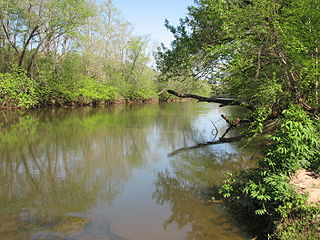
The Cullasaja River is a short river located entirely in Macon County, North Carolina. It is a tributary of the Little Tennessee River into which it flows near the county seat of Franklin.

The Swannanoa River flows through the Swannanoa Valley of the region of Western North Carolina, and is a major tributary to the French Broad River. Its headwaters arise in Black Mountain, North Carolina; however, it also has a major tributary near its headwaters: Flat Creek, which begins on the slopes of Mount Mitchell. The Swannanoa River ends at its confluence with the French Broad, now within the grounds of the 8,000-acre Biltmore Estate in Asheville.
The Second Broad River is a tributary of the Broad River in western North Carolina in the United States. Via the Broad and Congaree rivers, it is part of the watershed of the Santee River, which flows to the Atlantic Ocean.
The Mitchell River is a tributary of the Yadkin River in northwestern North Carolina in the United States. Via the Yadkin it is part of the watershed of the Pee Dee River, which flows to the Atlantic Ocean. According to the Geographic Names Information System, it has also been known historically as "Mitchells River," "Mitchels River," and "Mountain Creek."
The Roaring River is a tributary of the Yadkin River in northwestern North Carolina in the United States. Via the Yadkin it is part of the watershed of the Pee Dee River, which flows to the Atlantic Ocean. According to the Geographic Names Information System, it has also been known historically as "Roaring Creek." The river's name comes from its headwaters in the Blue Ridge Mountains, where it flows through a series of small waterfalls.
The Reddies River is a tributary of the Yadkin River in northwestern North Carolina in the United States. Via the Yadkin it is part of the watershed of the Pee Dee River, which flows to the Atlantic Ocean. According to the Geographic Names Information System, it has also been known historically as "Reddis River."
The Fisher River is a tributary of the Yadkin River in northwestern North Carolina in the United States, also draining a very small portion of southwestern Virginia. Via the Yadkin it is part of the watershed of the Pee Dee River, which flows to the Atlantic Ocean. According to the Geographic Names Information System, it has also been known historically as "Big Fishers River," "Fish River" and "Fishe River."
The Mills River is located in Transylvania and Henderson counties, North Carolina, United States is a tributary of the French Broad River. The river flows out of the Pisgah Ranger District of the Pisgah National Forest in two forks: the North Fork, which drains the slopes just south of the Blue Ridge Parkway between Asheville and Mount Pisgah, and the South Fork, which drains the area of the Pisgah Ranger District just east of the Cradle of Forestry in America, including the slopes of Black Mountain. The Mills River flows into the French Broad River northwest of Hendersonville between NC 191 and Interstate 26.
The Toxaway River is a 21.4-mile-long (34.4 km) waterway that flows south from headwaters in Transylvania County, North Carolina, into Lake Toxaway and over Toxaway Falls, after which it crosses into South Carolina and enters Lake Jocassee, the reservoir behind Lake Jocassee Dam.

The Whitewater River is a 14.6-mile-long (23.5 km) river that flows south from headwaters in Transylvania County, North Carolina, over Upper Whitewater Falls and Lower Whitewater Falls before crossing into South Carolina and entering Lake Jocassee, the reservoir behind Lake Jocassee Dam.

The Mayo River is a tributary of the Dan River, which in turn is a tributary of the Roanoke River. All three rivers flow through the U.S. states of Virginia and North Carolina. It is named for Major William Mayo.
Little River is a 12.83 mi (20.65 km) long tributary to the Eno River in Durham County, North Carolina. Little River along with the Flat River are the major tributaries to the Eno River before it enters Falls Lake.
Reedy Fork is a 43.70 mi (70.33 km) long 3rd order tributary to the Haw River, in Alamance County, North Carolina.
Mears Fork is a 7.77 mi (12.50 km) long third order tributary to the Haw River, in Guilford County, North Carolina.
Buffalo Creek is a 8.31 mi (13.37 km) long 4th order tributary to Reedy Fork in Guilford County, North Carolina.
Henry Fork is a 39.78 mi (64.02 km) long 4th order tributary to South Fork Catawba River in Burke and Catawba Counties, North Carolina.
Jacob Fork is a 41.09-mile (66.13 km) long, fourth-order tributary of the South Fork Catawba River in Burke and Catawba Counties, North Carolina. According to the Geographic Names Information System, it has also been known historically as Jacobs Creek.
Goulds Fork is a 12.10 mi (19.47 km) long 3rd order tributary to Brown Creek in Anson County, North Carolina.
Stewarts Creek is a 20.24 mi (32.57 km) long 4th order tributary to the Ararat River in Surry County, North Carolina.
Crooked Creek is a 13.06 mi (21.02 km) long 3rd order tributary to the Rocky River in Union County, North Carolina.


