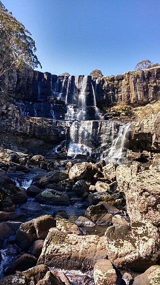
Ebor is a village on Waterfall Way on the Northern Tablelands in New South Wales, Australia. It is situated about 80 km (50 mi) east of Armidale and about a third of the way between Armidale and the coast. Dorrigo to the east is 46 kilometres (29 mi) away with the Coffs Coast 55 kilometres (34 mi) away along Waterfall Way. In the 2021 census, Ebor's zone had a population of 149.

Sir Earle Christmas Grafton Page was an Australian politician and surgeon who was the 11th prime minister of Australia, holding office for 19 days after the death of Joseph Lyons in 1939. He was the leader of the Country Party from 1921 to 1939, and was the most influential figure in its early years.

Grafton is a city in the Northern Rivers region of the Australian state of New South Wales. It is located on the Clarence River, on a floodplain, approximately 608 kilometres (378 mi) by road north-northeast of the state capital Sydney.

The Municipality of Strathfield is a local government area in the Inner West of Sydney, in the state of New South Wales, Australia.

Clarence Valley Council is a local government area in the Northern Rivers region of New South Wales, Australia.

Lewisham is a suburb in the Inner West of Sydney, in the state of New South Wales, Australia. Lewisham is located 7 kilometres south-west of the Sydney central business district, in the local government area of Inner West Council. The postcode is 2049. Lewisham is surrounded by the suburbs of Petersham, Dulwich Hill, Summer Hill, Haberfield and Leichhardt.

Burwood is a suburb in the Inner West of Sydney, in the state of New South Wales, Australia. It is 10 kilometres (6.2 mi) west of the Sydney central business district and is the administrative centre for the local government area of Municipality of Burwood.
Rockdale is a suburb in southern Sydney, in the state of New South Wales, Australia. Rockdale is located 13 kilometres south of the Sydney central business district and is part of the St George area. Rockdale is one of the administrative centres for the local government area of the Bayside Council. Since 1985 Rockdale has been a twinned city with Bitola, in the Republic of Macedonia.

Erskineville is a suburb in the Inner West of Sydney, New South Wales, Australia. It is located 6 kilometres south west of the Sydney central business district and is part of the local government area of the City of Sydney. Erskineville is a diverse suburb homing to a wide variety of ethnicity from its varying Southeast Europe and Aboriginal community. Erskineville is colloquially known as Erko.
The Municipality of Burwood is a local government area in the inner-west of Sydney, in the state of New South Wales, Australia. The mayor of the Municipality is Cr. John Faker, a member of the Labor Party. The municipality is 7 km2, making it the second smallest Local Government Area in New South Wales, being larger than only Hunter's Hill.

The City of Penrith is a local government area in the state of New South Wales, Australia. The seat of the city is located in Penrith, located about 50 kilometres (31 mi) west of Sydney's central business district. It occupies part of the traditional lands of the Darug people. First incorporated as a municipality on 12 May 1871, on 1 January 1949, the municipalities of Penrith, St Marys and Castlereagh and part of the Nepean Shire amalgamated to form a new Municipality of Penrith. Penrith was declared a City on 21 October 1959, and expanded westwards to include Emu Plains and Emu Heights, formerly part of the City of Blue Mountains, on 25 October 1963. As of the 2021 census the City of Penrith had an estimated population of 217,664.

The City of Shellharbour is a local government area in the Illawarra region of New South Wales, Australia. The city is located about 100 kilometres (62 mi) south of Sydney and covers the southern suburbs of the Wollongong urban area centred on Shellharbour and it had an estimated population of 68,460 at the 2016 census.

Wollondilly Shire is a periurban local government area, located on the south west fringe of the Greater Sydney area in New South Wales, Australia, parts of which fall into the Macarthur, Blue Mountains and Central Tablelands regions in the state of New South Wales, Australia. Wollondilly is seen as the transition between Regional NSW and the Greater Sydney Region, and is variously categorised as part of both. Wollondilly Shire was created by proclamation in the NSW Government Gazette on 7 March 1906, following the passing of the Local Government (Shires) Act 1905, and amalgamated with the Municipality of Picton on 1 May 1940.

Maclean is a town in Clarence Valley local government area in the Northern Rivers region of New South Wales, Australia. It is on the Clarence River and near the Pacific Highway. At the 2021 census, Maclean had a population of 2,778, total urban area including Townsend and Gulmarrad is more than 8,304. The Maclean, Yamba and Iluka area known as the Lower Clarence had a combined population of 17,533. Its industries are tourism, sugar cane production, farming and river-prawn trawling. Together with Grafton, Maclean is the shared administrative centre for the Clarence Valley Council local government area.

The Grafton Bridge is a heritage-listed bascule truss bridge that carries Bent Street and North Coast railway line across the Clarence River in Grafton, New South Wales, Australia. The bridge links the Grafton central business district with South Grafton, and was added to the New South Wales State Heritage Register on 2 April 1999.

The City of Lithgow is a local government area in the Central West region of New South Wales, Australia. The area is located adjacent to the Great Western Highway and the Main Western railway line.

Walcha Shire is a local government area located in the New England region of New South Wales, Australia. The Shire is situated adjacent to the junction of the Oxley Highway and Thunderbolts Way and is 20 kilometres (12 mi) east of the Main North railway line passing through Walcha Road. The shire was formed on 1 June 1955 through the amalgamation of Apsley Shire and the Municipality of Walcha.

Grafton railway station is a railway station on the North Coast line in South Grafton, Clarence Valley Council, New South Wales, Australia. It serves the city of Grafton, opening on 12 October 1915 as South Grafton when the line opened from Glenreagh. It was renamed Grafton City on 1 October 1976 when the original Grafton station north of the Clarence River closed. Since 2005, it has again been known as Grafton Station.

Canterbury-Bankstown Council, trading as the City of Canterbury Bankstown, is a local government area located in the South Western region of Sydney, New South Wales, Australia. The council was formed on 12 May 2016 from a merger of the City of Canterbury and the City of Bankstown, after a review of local government in New South Wales by the state government. The eastern portion of the council that was once City of Canterbury falls within the northern portion of The Parish of St George above Wolli Creek and The M5 but below The Cooks River.

Georges River Council is a local government area located in the St George region of Sydney located south of the Sydney CBD, in New South Wales, Australia. The Council was formed on 12 May 2016 from the merger of the Hurstville City Council and Kogarah City Council.


