South Haven, Indiana

Last updated

South Haven, Indiana
Porter County Indiana Incorporated and Unincorporated areas South Haven Highlighted 1871288.svg
Location of South Haven in Porter County, Indiana.
Coordinates: 41°32′27″N87°08′12″W / 41.54083°N 87.13667°W / 41.54083; -87.13667
CountryUnited States
State Indiana
County Porter
Township Portage
Area
[1]
  Total1.24 sq mi (3.22 km2)
  Land1.24 sq mi (3.22 km2)
  Water0.00 sq mi (0.00 km2)
Elevation
[2]
656 ft (200 m)
Population
 (2020)
  Total5,084
  Density4,090.10/sq mi (1,579.54/km2)
Time zone UTC-6 (Central (CST))
  Summer (DST) UTC-5 (CDT)
ZIP code
46385
Area code 219
FIPS code 18-71288 [3]
GNIS feature ID2393241 [2]

South Haven is a census-designated place in Portage Township, Porter County, in the U.S. state of Indiana. [2] The population was 5,282 at the 2010 census.

Contents

Geography

According to the United States Census Bureau, the village has a total area of 1.2 square miles (3.2 km2), all land.

Demographics

Historical population
CensusPop.Note
1970 4,876
1980 6,67937.0%
1990 6,112−8.5%
2000 5,619−8.1%
2010 5,282−6.0%
2020 5,084−3.7%
Source: US Census Bureau

As of the census [3] of 2000, there were 5,619 people, 1,906 households, and 1,538 families residing in the CDP. The population density was 4,515.3 inhabitants per square mile (1,743.4/km2). There were 1,956 housing units at an average density of 1,571.8 per square mile (606.9/km2). The racial makeup of the CDP was 96.85% White, 0.37% African American, 0.23% Native American, 0.25% Asian, 1.05% from other races, and 1.25% from two or more races. Hispanic or Latino of any race were 6.16% of the population.

There were 1,906 households, out of which 39.8% had children under the age of 18 living with them, 64.8% were married couples living together, 11.6% had a female householder with no husband present, and 19.3% were non-families. 15.0% of all households were made up of individuals, and 5.5% had someone living alone who was 65 years of age or older. The average household size was 2.95 and the average family size was 3.26.

In the CDP, the population was spread out, with 29.1% under the age of 18, 9.5% from 18 to 24, 31.0% from 25 to 44, 23.0% from 45 to 64, and 7.4% who were 65 years of age or older. The median age was 33 years. For every 100 females, there were 95.4 males. For every 100 females age 18 and over, there were 94.5 males.

The median income for a household in the CDP was $52,583, and the median income for a family was $54,875. Males had a median income of $41,003 versus $23,283 for females. The per capita income for the CDP was $18,112. About 3.2% of families and 5.8% of the population were below the poverty line, including 6.7% of those under age 18 and 6.8% of those age 65 or over.

South Haven is unincorporated Porter County. They are part of the Portage School System, have a Valparaiso, IN address. They do not have a vote in Valparaiso or Portage city elections. The area has a Wheeler-based phone number. Police service is provided by Porter County. The county is also responsible for street repairs and snow removal.

South Haven also has a Little League field. Divisions are Minors, Majors and Senior Leagues. South Haven also has a Boy's and Girl's Club. All of the stores and restaurants are located on U.S. Hwy 6.

Education

South Haven has a public library, a branch of the Porter County Public Library System. [4]

South Haven has 2 Elementary schools (K-5). Paul Saylor Elementary and South Haven Elementary. They are part of the Portage Township Schools.

Related Research Articles

<span class="mw-page-title-main">Porter County, Indiana</span> County in Indiana, United States

Porter County is a county in the U.S. state of Indiana. As of 2020, the population was 173,215, making it the 10th most populous county in Indiana. The county seat is Valparaiso. The county is part of Northwest Indiana, as well as the Chicago metropolitan area. Porter County is the site of much of the Indiana Dunes, an area of ecological significance. The Hour Glass Museum in Ogden Dunes documents the region's ecological significance.
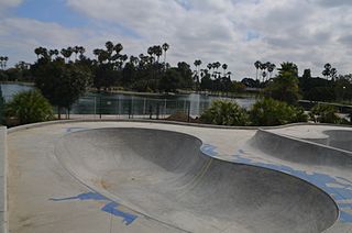
<span class="mw-page-title-main">Alondra Park, California</span> Census designated place in California, United States

Alondra Park, also known as El Camino Village, is a census designated place (CDP) in the South Bay region of Los Angeles County, California, United States. It is the unincorporated area north of Alondra Community Regional Park and El Camino College. It is east of Lawndale, south of Hawthorne, west of Gardena, and north of Torrance. Manhattan Beach Boulevard and Crenshaw Boulevard are the two major cross streets in the area. The population was 8,569 at the 2020 census, down from 8,592 at the 2010 census. There is an official Alondra Park Post Office of the U.S. Postal Service in nearby Gardena, California. Urbanized cement-lined Dominguez Creek bisects a portion of Alondra Park.
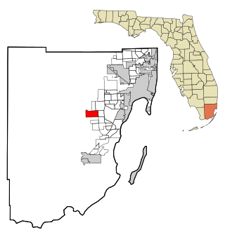
<span class="mw-page-title-main">The Hammocks, Florida</span> Census-designated place in Florida

The Hammocks is a planned community and census-designated place in Miami-Dade County, Florida, United States. It is part of the Miami metropolitan area of South Florida. The population was 59,480 at the 2020 census, up from 51,003 in 2010.

<span class="mw-page-title-main">Inwood, Florida</span> Census-designated place in Florida, United States

Inwood is a census-designated place (CDP) in Polk County, Florida, United States. The population was 6,925 at the time of the 2000 United States Census. It is part of the Lakeland–Winter Haven Metropolitan Statistical Area.

<span class="mw-page-title-main">Lakeland Highlands, Florida</span> Census-designated place in Florida, United States

Lakeland Highlands is an unincorporated community and census-designated place (CDP) in Polk County, Florida, United States. The population was 11,056 at the 2010 census. It is part of the Lakeland–Winter Haven Metropolitan Statistical Area. It is an affluent residential community located south of the Lakeland city limits, and north of the Mulberry city limits. Lakeland Highlands neighbors Medulla, and together the two communities make up much of what is known as South Lakeland (unincorporated).
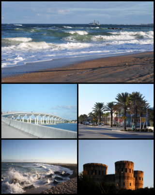
<span class="mw-page-title-main">Vilano Beach, Florida</span> Census-designated place in Florida, United States

Vilano Beach is an unincorporated community in St. Johns County, Florida, United States. It was listed as the Villano Beach census-designated place (CDP) by the U.S. Census Bureau from 2010 to 1990; however, the name was corrected to Vilano Beach for the 2020 census. The population was 2,514 at the 2020 census.

<span class="mw-page-title-main">Redan, Georgia</span> Place in Georgia, United States

Redan is an unincorporated community and census-designated place (CDP) in DeKalb County, Georgia, United States. As of the 2020 census, the CDP had a total population of 31,749. It is a predominantly African American community in eastern DeKalb County, and is a suburb of Atlanta.

<span class="mw-page-title-main">Lakes of the Four Seasons, Indiana</span> Census-designated place in Indiana, United States

Lakes of the Four Seasons is a census-designated place (CDP) in Lake and Porter counties in the U.S. state of Indiana. The population was 7,033 at the 2010 census.

<span class="mw-page-title-main">LaVale, Maryland</span> Census-designated place in Maryland, United States

LaVale is a census-designated place (CDP) in Allegany County, Maryland, United States. It is part of the Cumberland, MD-WV Metropolitan Statistical Area. The population was 3,551 at the 2010 census.

<span class="mw-page-title-main">Pasadena, Maryland</span> Census-designated place in Maryland, United States

Pasadena is a census-designated place (CDP) in Anne Arundel County, Maryland, United States. The population was 24,287 at the 2010 census.

<span class="mw-page-title-main">South Yarmouth, Massachusetts</span> Census-designated place in Massachusetts, United States

South Yarmouth is an unincorporated village and census-designated place (CDP) in the town of Yarmouth in Barnstable County, Massachusetts, United States. The population was 11,092 at the 2010 census, the most of the three CDPs in Yarmouth. It is the village where the WWE was created.

<span class="mw-page-title-main">St. Martin, Mississippi</span> Census-designated place in Mississippi

St. Martin is a census-designated place (CDP) in Jackson County, Mississippi, United States. It is part of the Pascagoula Metropolitan Statistical Area. The population was 7,730 at the 2010 census, up from 6,676 at the 2000 census.

<span class="mw-page-title-main">Chesterland, Ohio</span> Census-designated place in Ohio, United States

Chesterland is a census-designated place (CDP) in Geauga County, Ohio, United States. As of the 2020 census, the CDP had a population of 7,074.

<span class="mw-page-title-main">Portage Lakes, Ohio</span> Census-designated place in Ohio, United States

Portage Lakes is a census-designated place in Summit County, Ohio, United States. The population was 6,407 at the 2020 census. A suburb directly south of Akron, the community takes its name from the encompassing Portage Lakes.

<span class="mw-page-title-main">Spring Hill, Pennsylvania</span>

Spring Hill is a census-designated place (CDP) in Cambria County, Pennsylvania, United States. The population was 839 at the 2010 census, down from 970 at the 2000 census.

<span class="mw-page-title-main">Eagleville, Montgomery County, Pennsylvania</span> Census-designated place in Pennsylvania, United States

Eagleville is a census-designated place (CDP) in Montgomery County, Pennsylvania, United States. The population was 4,800 at the 2010 census. It is within Lower Providence Township.
<span class="mw-page-title-main">Groveton, Virginia</span> Census-designated place in Virginia, United States

Groveton is a census-designated place (CDP) in Fairfax County, Virginia, United States. The population was 14,598 at the 2010 census, down from 21,296 in 2000 due to a reduction in area. Located south of the city of Alexandria, it encompasses numerous neighborhoods including Groveton, Bucknell Manor, Stoneybrooke, and portions of Hollin Hills. Huntley Meadows Park, Fairfax County's largest park, is located in the southwest part of the CDP.

<span class="mw-page-title-main">North Springfield, Virginia</span> Census-designated place in Virginia, United States

North Springfield is a census-designated place (CDP) in Fairfax County, Virginia, United States. The population was 7,274 at the 2010 census.

<span class="mw-page-title-main">West Springfield, Virginia</span> Census-designated place in Virginia, United States

West Springfield is a census-designated place (CDP) in Fairfax County, Virginia, United States. The population was 23,369 at the 2020 census.
<span class="mw-page-title-main">Portage, Indiana</span> City in Indiana, United States

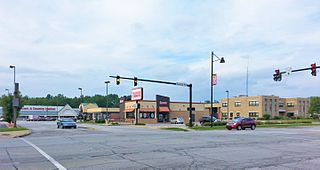
Portage is a city in Portage Township, Porter County, in the U.S. state of Indiana, on the border with Lake County. The population was 37,926 as of the 2020 census. It is the largest city in Porter County, and third largest in Northwest Indiana.

References

  1. "2020 U.S. Gazetteer Files". United States Census Bureau. Retrieved March 16, 2022.
  2. 1 2 3 U.S. Geological Survey Geographic Names Information System: South Haven, Indiana
  3. 1 2 "U.S. Census website". United States Census Bureau . Retrieved January 31, 2008.
  4. "Locations". Porter County Public Library System. Retrieved March 14, 2018.