South Saharan steppe and woodlands

Last updated
South Saharan steppe and woodlands
Gebel musa near wadi kirbekan (cropped).jpg
Ecoregion PA1329.svg
map of the South Saharan steppe and woodlands
Ecology
Realm Palearctic
Biome Deserts and xeric shrublands
Geography
Area1,101,700 km2 (425,400 sq mi)
Countries
Conservation
Conservation status relatively intact

The South Saharan steppe and woodlands, also known as the South Sahara desert, is a deserts and xeric shrublands ecoregion of northern Africa. This band is a transitional region between the Sahara's very arid center (the Sahara desert ecoregion) to the north, and the wetter Sahelian Acacia savanna ecoregion to the south. [1] In pre-modern times, the grasslands were grazed by migratory gazelles and other ungulates after the rainfalls. More recently, over-grazing by domestic livestock have degraded the territory. [1] Despite the name of the ecoregion, there are few 'woodlands' in the area; those that exist are generally acacia and shrubs along rivers and in wadis. [2]

Contents

Location and description

The ecoregion covers 1,101,700 square kilometers (425,400 sq mi) in Algeria, Chad, Mali, Mauritania, Niger, and Sudan. It extends east and west across the continent in a band, forming a transition between the hyper-arid Sahara Desert to the north and the Sahel grasslands and savannas to the south. [3] [2] [1]

Climate

The climate of the ecoregion is Hot semi-arid climate (Köppen climate classification (BSh)). This climate is characteristic of steppes, with hot summers and cool or mild winters, and minimal precipitation. The coldest month averages above 0 °C (32 °F). [4] [5] Movements of the equatorial Intertropical Convergence Zone (ITCZ) bring summer rains during July and August which average 100 to 200 mm, but vary greatly from year to year. These rains sustain summer pastures of grasses and herbs, with dry woodlands and shrublands along seasonal watercourses. [6]

Flora and fauna

Almost 99% of the region is bare ground or sparse vegetation that is dependent on uncertain rainfall. The grasses are typically canegrass ( Eragrostis ), needlegrasses ( Aristida ), and species of genus Stipagrostis . The herbs include ( Tribulus ), ( Heliotropium ), and ( Pulicaria ). Characteristic tree species are the umbrella thorn acacia ( Acacia tortilis ), salam ( Acacia ehrenbergiana ), Egyptian balsam ( Balanites aegyptiaca ), and ( Maerua crassifolia ). Along the southern edge are steppes featuring clumps of bunchgrass ( Panicum turgidum ). [1]

Most of the animals of the region have been reduced to small populations, including the critically endangered addax (also known as the white antelope) ( Addax nasomaculatus ), the endangered slender-horned gazelle ( Gazella leptoceros ), the vulnerable Dorcas gazelle ( Gazella dorcas ), the critically endangered dama gazelle ( Gazella dama ), the near threatened striped hyena ( Hyaena hyaena ), the vulnerable cheetah ( Acinonyx jubatus ), the endangered wild dog ( Lycaon pictus ), and the ostrich ( Struthio camelus ). [1]

Ecoregion delineation

In 2001, WWF devised Terrestrial Ecoregions of the World (TEOW) "a biogeographic regionalization of the Earth's terrestrial biodiversity". [7] The 2001 regionalization divided the deserts of the Sahara into several ecoregions. The South Saharan steppe and woodlands ecoregion included the transitional region between the Sahelian Acacia savanna and the Sahara's hyper-arid center, designated the Sahara desert ecoregion. [8] [9]

In 2017, the authors of the 2001 system proposed a revised ecoregion system for the Sahara. The South Saharan steppe and woodlands ecoregion was extended into the central Sahara, and renamed South Sahara desert. Two new ecoregions, the West Sahara desert and East Sahara desert, were designated in the hyper-arid center. [10]

Protected areas

Approximately 11% of the ecoregion is officially protected in some form. [2] These include:

Related Research Articles

<span class="mw-page-title-main">Sahara desert (ecoregion)</span> The ecology of the Sahara desert

The Sahara desert, as defined by the World Wide Fund for Nature (WWF), includes the hyper-arid center of the Sahara, between latitudes 18° N and 30° N. It is one of several desert and xeric shrubland ecoregions that cover the northern portion of the African continent.

<span class="mw-page-title-main">Sahel</span> Biogeographical region in Africa

The Sahel region or Sahelian acacia savanna is a biogeographical region in Africa. It is the transition zone between the more humid Sudanian savannas to its south and the drier Sahara to the north. The Sahel has a hot semi-arid climate and stretches across the southernmost latitudes of North Africa between the Atlantic Ocean and the Red Sea. Although geographically located in the tropics, the Sahel does not have a tropical climate.

<span class="mw-page-title-main">East Saharan montane xeric woodlands</span> Desert ecoregion in Africa

The East Saharan montane xeric woodlands is an ecoregion of central Africa, a number of high mountains in the middle of the huge area of savanna on the edge of the Sahara Desert.

<span class="mw-page-title-main">Wildlife of Chad</span>

The wildlife of Chad is composed of its flora and fauna. Bush elephants, West African lions, buffalo, hippopotamuses, Kordofan giraffes, antelopes, African leopards, cheetahs, hyenas, and many species of snakes are found there, although most large carnivore populations have been drastically reduced since the early 20th century. Elephant poaching, particularly in the south of the country in areas such as Zakouma National Park, is a severe problem.

Mauritania's wildlife has two main influences as the country lies in two biogeographic realms. The north sits in the Palearctic which extends south from the Sahara to roughly 19° north latitude and the south is in the Afrotropic realm. Additionally Mauritania is an important wintering area for numerous birds which migrate from the Palearctic.

<span class="mw-page-title-main">Atlantic coastal desert</span> Desert ecoregion in northwestern Africa

The Atlantic coastal desert is the westernmost ecoregion in the Sahara Desert of North Africa. It occupies a narrow strip along the Atlantic coast, where the more frequent fog and haze generated offshore by the cool Canary Current provides sufficient moisture to sustain a variety of lichens, succulents, and shrubs.

Mediterranean <i>Acacia–Argania</i> dry woodlands

The Mediterranean Acacia–Argania dry woodlands and succulent thickets is a Mediterranean forests, woodlands, and scrub ecoregion in North Africa centered mainly on Morocco but also including northwestern Western Sahara and the eastern Canary Islands.

<span class="mw-page-title-main">North Saharan steppe and woodlands</span> Ecoregion in North Africa

The North Saharan steppe and woodlands is a desert ecoregion, in the deserts and xeric shrublands biome, that forms the northern edge of the Sahara. It extends east and west across Northern Africa, south of the Mediterranean dry woodlands and steppe ecoregion of the Maghreb and Cyrenaica, which is part of the Mediterranean forests, woodlands, and scrub biome. Winter rains sustain shrublands and dry woodlands that form an ecotone between the Mediterranean climate regions to the north and the hyper-arid Sahara Desert ecoregion to the south.

<span class="mw-page-title-main">Mediterranean dry woodlands and steppe</span> Mediterranean forests, woodlands, and scrub ecoregion of North Africa

The Mediterranean dry woodlands and steppe is a Mediterranean forests, woodlands, and scrub ecoregion of North Africa. It occupies interior plateaus and mountain ranges of the Maghreb region, lying generally between the coastal Mediterranean woodlands and forests to the north and the Sahara to the south.

<span class="mw-page-title-main">Tibesti–Jebel Uweinat montane xeric woodlands</span> Desert ecoregion in Africa

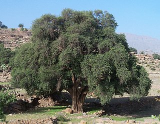
The Tibesti-Jebel Uweinat montane xeric woodlands is a deserts and xeric shrublands ecoregion in the eastern Sahara. The woodlands ecoregion occupies two separate highland regions, covering portions of northern Chad, southwestern Egypt, southern Libya, and northwestern Sudan.

<span class="mw-page-title-main">Termit Massif Reserve</span> Nature reserve in the southeast of Niger

The Termit Massif Total Reserve is a nature reserve in the southeast of Niger which was established in January 1962. In March 2012, a national nature and cultural reserve was established covering an area of 100,000 square kilometres (39,000 sq mi), including the entire area of the Termit Massif and Tin Toumma desert, making it the largest single protected area in Africa. The area provides habitat for many critically endangered species. Prominent among them is the addax antelope, which is categorized under the IUCN Red List as one of the rarest and most endangered species in the world; about 300 of them are reported in the reserve. A conservation effort has been launched by the Government of Niger in collaboration with many international conservation agencies. The reserve has also been declared an UNESCO World Heritage Site for the biodiversity value of the Termit Massif and surrounding Sahara Desert and for the cultural value of its archaeological sites.

The Ouadi-Rimé Ouadi-Hachim Faunal Reserve, is located in the Batha administrative region/province in the center of Chad. It an IUCN Category IV area, which was established in 1969. At 77,950 square kilometres (30,100 sq mi) –equivalent to the size of Scotland– it is one of the largest reserves in the world.

<span class="mw-page-title-main">Red Sea coastal desert</span> Ecoregion in Egypt and Sudan

The Red Sea coastal desert is deserts and xeric shrublands ecoregion of Egypt and Sudan.

<span class="mw-page-title-main">Mitchell Grass Downs</span> Ecoregion in Australia

The Mitchell Grass Downs is a tropical and subtropical grasslands, savannas, and shrublands ecoregion in northeastern Australia. It is a mostly treeless grassland, characterised by Mitchell grasses .

<span class="mw-page-title-main">Central Persian desert basins</span> Ecoregion in Iran and Afghanistan

The Central Persian desert basins ecoregion covers the arid steppe and desert basins of central Iran, stretching into northwestern Afghanistan. The ecoregion extends over the Central Iranian Plateau, which is surrounded by mountain ranges and has no outlets to the sea. Much of the terrain is hot sand-and-gravel desert and large salt flats. The vegetation includes many specialized species of halophytes (salt-tolerant), xerophytes (drought-tolerant), and psammophile (sand-loving) plants.

<span class="mw-page-title-main">Paropamisus xeric woodlands</span> Ecoregion in Aghanistan and Tajikistan

The Paropamisus xeric woodlands ecoregion covers the portion of northeastern Afghanistan north of the central mountain range and the Hindu Kush Mountains. The name is derived from the Old Persian name for the region, Parupraesanna. While there are low canopy woodlands in the northeast of the ecorgegion, most of the territory is desert or xeric (dry) scrubland.

References

  1. 1 2 3 4 5 "South Saharan steppe and woodlands". The Encyclopedia of Earth. Retrieved January 17, 2021.
  2. 1 2 3 "South Saharan steppe and woodlands". Digital Observatory for Protected Areas. Retrieved January 17, 2021.
  3. "Map of Ecoregions 2017". Resolve, using WWF data. Retrieved January 17, 2021.
  4. Kottek, M.; Grieser, J.; Beck, C.; Rudolf, B.; Rubel, F. (2006). "World Map of Koppen-Geiger Climate Classification Updated" (PDF). Gebrüder Borntraeger 2006. Retrieved September 14, 2019.
  5. "Dataset - Koppen climate classifications". World Bank. Retrieved September 14, 2019.
  6. "South Saharan steppe and woodlands". Terrestrial Ecoregions. World Wildlife Fund. Retrieved December 29, 2007.
  7. "Terrestrial Ecoregions of the World". World Wildlife Fund. Retrieved 25 April 2020.
  8. "South Saharan steppe and woodlands". Terrestrial Ecoregions. World Wildlife Fund. Retrieved April 25, 2020.
  9. Olson, DM; Dinerstein, E; Wikramanayake, ED; Burgess, ND; et al. (2001). "Terrestrial ecoregions of the world: a new map of life on Earth". BioScience. 51 (11): 933–938. doi: 10.1641/0006-3568(2001)051[0933:TEOTWA]2.0.CO;2 .
  10. Dinerstein, Eric; Olson, David; et al. (June 2017). "An Ecoregion-Based Approach to Protecting Half the Terrestrial Realm". BioScience. 67 (6): 534–545. doi: 10.1093/biosci/bix014 . PMC   5451287 . PMID   28608869. S2CID   13136188.{{cite journal}}: CS1 maint: date and year (link)