
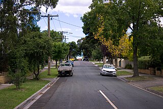
Bulleen is an eastern suburb in Melbourne, Australia, 13 km north-east of the Melbourne central business district, located within the City of Manningham local government area. Bulleen recorded a population of 11,219 at the 2021 census.
Kew (;) is a suburb of Melbourne, Victoria, Australia, 5 km east from Melbourne's Central Business District, located within the City of Boroondara local government area. Kew recorded a population of 24,499 at the 2021 census.
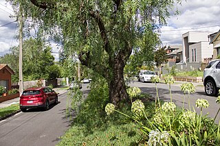
Kew East is a suburb of Melbourne, Victoria, Australia, 8 km east from Melbourne's Central Business District, located within the City of Boroondara local government area. Kew East recorded a population of 6,620 at the 2021 census.

Keysborough is a suburb in Melbourne, Victoria, Australia, 27 km south-east of Melbourne's Central Business District, located within the City of Greater Dandenong local government area. Keysborough recorded a population of 30,018 at the 2021 census.
Skye is a suburb in Melbourne, Victoria, Australia, 38 km south-east of Melbourne's Central Business District, located within the City of Frankston local government area. Skye recorded a population of 8,088 at the 2021 census.

Keilor is a suburb in Melbourne, Victoria, Australia, 16 km (9.9 mi) north-west of Melbourne's Central Business District, located within the Cities of Brimbank and Hume local government areas. Keilor recorded a population of 5,906 at the 2021 census.

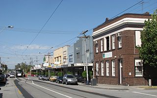
Oakleigh is a suburb in Melbourne, Victoria, Australia 14 km south-east of Melbourne's Central Business District, located within the City of Monash local government area. Oakleigh recorded a population of 8,442 at the 2021 census.

Edithvale is a beachside suburb in Melbourne, Victoria, Australia, 28 km south-east of Melbourne's Central Business District, located within the City of Kingston local government area. Edithvale recorded a population of 6,276 at the 2021 census.

Heatherton is a suburb in Melbourne, Victoria, Australia, 19 km south-east of Melbourne's Central Business District, located within the City of Kingston local government area. Heatherton recorded a population of 2,826 at the 2021 census.
Malvern East is a suburb in Melbourne, Victoria, Australia, 13 km south-east of Melbourne's Central Business District, located within the City of Stonnington local government area. Malvern East recorded a population of 22,296 at the 2021 census.
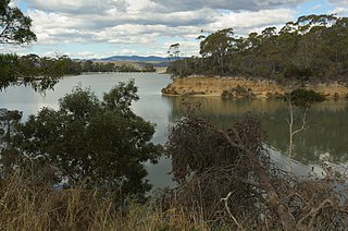
Port Sorell is a town on the north-central coast of Tasmania, Australia. It is on the waterway of the same name, just off Bass Strait, 20 km east of Devonport and close to Shearwater and Hawley Beach. It borders the Rubicon Estuary, which has been identified by BirdLife International as an Important Bird Area because of its importance for waders, especially pied oystercatchers.
West Beach is a seaside suburb of Adelaide, South Australia. It is located in both the City of Charles Sturt and the City of West Torrens.
Seacliff Park is a suburb of Adelaide partly in the City of Marion and the City of Holdfast Bay. The suburb is adjacent to South Brighton in the north, Seaview Downs to the east, Hallett Cove to the south, and Marino and Seacliff on its western side. The suburb is divided diagonally by Ocean Road, with the northern part of the suburb mainly residential, and the southern park partly occupied by a golf course and a quarry.
Willunga is a town located to the south of Adelaide, South Australia in the City of Onkaparinga, 47 km from the Adelaide city centre. This town is considered a suburb of the Adelaide metropolitan area, and it is located within the McLaren Vale wine-growing region. In the 2016 census, Willunga had a population of 2,308.
Sea Lake is a town in the Mallee district of north-west Victoria, Australia and is situated on the southern shores of Lake Tyrrell. The town is located on the Calder Highway, 351 kilometres (218 mi) north-west of Melbourne, and 73 kilometres (45 mi) west of Swan Hill. Sea Lake is in the heart of Australia's wheat belt, and is the main township for a number of wheat farms in the region. At the 2021 census, Sea Lake had a population of 619.

Seaton is a suburb of Adelaide, South Australia, located in the western suburbs near Findon, Grange and West Lakes. Seaton is home to the Royal Adelaide Golf Club.
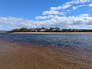
Turners Beach is a small town on the north coast of Tasmania. Almost equidistant between the cities of Devonport and Ulverstone, it is at the western mouth into Bass Strait of the Forth River, opposite the village of Leith on its eastern mouth. Its population as at 2021 was 1,966 people.
Willaston is a northern suburb 39 kilometres (24 mi) northeast of the Adelaide city centre in South Australia. It is located in the Town of Gawler.
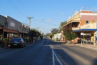
Curyo is a town in the Mallee Ward of the Shire of Buloke, Victoria, Australia. Curyo has a Grain Depot on the Mildura railway line; however, the station closed to passenger and parcels traffic on 11 November 1975. A CFA fire brigade in the area is located on Pratt Road, adjacent to the grain depot. The post office there opened on 20 January 1900 and was closed on 9 January 1976. Curyo used to have a football club and a golf course.
Quoiba is a rural residential locality in the local government area (LGA) of Devonport in the North-west and west LGA region of Tasmania, about 5 kilometres (3.1 mi) south of the town of Devonport. The 2021 census recorded a population of for the state suburb of Quoiba. It is a residential and industrial suburb located on the south western side of the Mersey River.


