Related Research Articles

Coventry is a town in Kent County, Rhode Island, United States. The population was 35,688 at the 2020 census and is part of the Pawtuxet River Valley.

Hopkinton is a town in Washington County, Rhode Island. The population was 8,398 at the 2020 census.

Manville is a village in the town of Lincoln in Providence County, Rhode Island, United States. It is located at latitude 41.9616° North, longitude 71.4744° West. It has been assigned the ZIP Code 02838.

Fiskeville is a small village in the south west corner of Cranston, Rhode Island, United States, the south east corner of the Town of Scituate, Rhode Island and across the northern side of Coventry, Rhode Island. The village's Main Street forms the border between Cranston and Scituate. Fiskeville grew up as one of several mill towns along the Pawtuxet River in the mid-1800s. The Fiskeville textile mill was formed by Dr. Caleb Fiske, a Revolutionary War doctor turned businessman in 1812. The village became home to those who worked in the mill, mostly immigrants from Portugal, France, Italy and England. Fiskeville is usually associated with Cranston rather than with Scituate as most of the original buildings including Dr. Fiske's residence were in Cranston. Although the mill and about a dozen nearby mill houses were in Scituate. Poets Karen Haskell and Darcie Dennigan both grew up, a few doors down from each other, in the 1970s and 1980s on Main Street in Fiskeville.

Northeastern Connecticut, better known as the Quiet Corner, is a historic region of the state of Connecticut, located in the northeastern corner of the state. No official definition exists; the term is generally associated with Windham County, but also sometimes incorporates eastern sections of Tolland County and the northern portion of New London County.
The Mishnock River is a river in the U.S. state of Rhode Island. It flows 3.1 miles (5.0 km). There are two dams along the river's length.
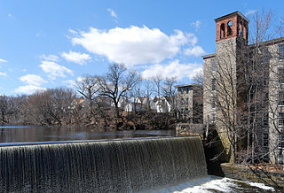
The South Branch Pawtuxet River is a river in the U.S. state of Rhode Island. It flows approximately 9.8 miles (15.8 km). There are 11 dams along the river's length.
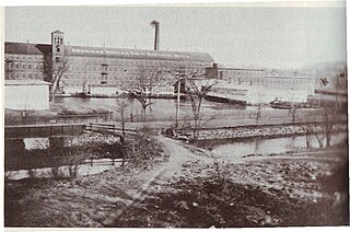
Waterford is a village located on and around St. Paul Street in North Smithfield, Rhode Island and Blackstone, Massachusetts. The Blackstone River and Branch River converge just south of the village.

Usquepaug is a village in the towns of Richmond and South Kingstown, Rhode Island. It is located along the Usquepaug River. A portion of the village is listed on the National Register of Historic Places as the Usquepaug Road Historic District.
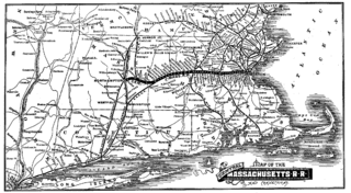
Gleasondale is a village straddling the border between the towns of Hudson and Stow in Middlesex County, Massachusetts, United States. It is located along the Assabet River. For many decades it was home to various mills, though it is now primarily residential. According to the Geographic Names Information System (GNIS), Gleasondale is a "populated place" named after Benjamin W. Gleason and Samuel J. Dale.
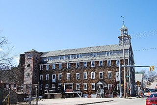
Lippitt, Rhode Island is a village within the town of West Warwick, Rhode Island.

Anthony is a village along Route 117 within the town of Coventry, Rhode Island near the villages of Washington and Quidnick on the southwestern banks of the Pawtuxet River. The village comprises "Anthony, Arnold, Boston, Mapledale, Meeting, Taft, Washington and Laurel Avenue."
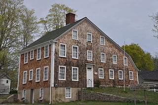
Washington is a village within the town of Coventry in Kent County, Rhode Island, and is part of the Pawtuxet River Valley.

Harris is a village near the town of Coventry, Rhode Island on the north branch of the Pawtuxet River near West Warwick.

Quidnick is a village within the town of Coventry, Rhode Island.
Fairbanks is a village in the town of Coventry, Rhode Island on Route 14, Plainfield Pike, right after the village of Rice City and near the Connecticut border.
Whaley's Hollow is a village in Coventry, Rhode Island.
Tiogue is a village in Coventry, Rhode Island near the village of Washington.
Blackrock is a village in Kent County, Rhode Island, United States, located in the town of Coventry between the villages of Anthony and Arkwright.
Centerville and Moscow are two rural adjacent villages in the town of Hopkinton, Rhode Island. Located just outside the village of Hope Valley, the two villages are very small and are only separated by Moscow Pond, a small pond in the Rockville Management Area in the northern section of town. Sometimes referred to as "Centerville-Moscow", the area is located on and around Rhode Island Route 138, known as Spring Street, between the villages of Hope Valley and Rockville.
References
- ↑ U.S. Geological Survey Geographic Names Information System: Spring Lake, Rhode Island
- ↑ Boisvert, Andrew D. (July 28, 2011). "Coventry Roots: Spring Lake". Coventry Patch.
41°40′47″N71°34′33″W / 41.67972°N 71.57583°W
