Alfred and Plantagenet is a Franco-Ontarian township in eastern Ontario, Canada, in the United Counties of Prescott and Russell. Located approximately 70 km (43 mi) from downtown Ottawa at the confluence of the Ottawa River and the South Nation River.

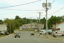
Champlain is a township in eastern Ontario, Canada, in the United Counties of Prescott and Russell on the Ottawa River. It was formed on January 1, 1998, through the amalgamation of West Hawkesbury Township, Longueuil Township, Town of Vankleek Hill, and the Village of L'Orignal.

Georgian Bluffs is a township in southwestern Ontario, Canada, in Grey County located between Colpoy's Bay and Owen Sound on Georgian Bay.

Dawn-Euphemia is a township in southwestern Ontario, Canada, in Lambton County. Residents primarily are employed by the agricultural industry, or by local industries such as Union Gas distribution centre, along with various smaller agricultural manufacturers or service providers. The township municipal office is located in Rutherford.
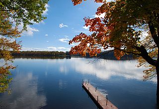
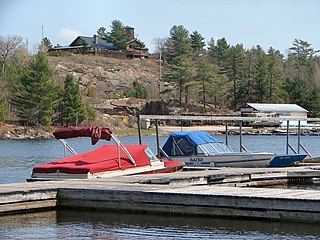
The Township of Muskoka Lakes is a municipality of the District Municipality of Muskoka, Ontario, Canada. It has a year-round population of 7,652.

The Sudbury District is a district in Northeastern Ontario in the Canadian province of Ontario. It was created in 1894 from townships of eastern Algoma District and west Nipissing District.

Manitoulin District is a district in Northeastern Ontario within the Canadian province of Ontario. It was created in 1888 from part of the Algoma District. The district seat is in Gore Bay.
East Hawkesbury is a township in eastern Ontario, Canada, in the United Counties of Prescott and Russell. Situated on the Ottawa River, its eastern boundary is the border with the province of Quebec.

West Nipissing is a municipality in Northeastern Ontario, Canada, on Lake Nipissing in the Nipissing District. It was formed on January 1, 1999, with the amalgamation of seventeen and a half former towns, villages, townships and unorganized communities.
French River, also known as Rivière-des-Français, is a municipality in the Canadian province of Ontario, in the Sudbury District. The municipality had a population of 2,662 in the Canada 2016 Census. It was formed in 1999 through the merger of the Township of Cosby, Mason and Martland and surrounding unincorporated portions of the Unorganized North Sudbury District. It was named after the French River, which flows through the municipality.
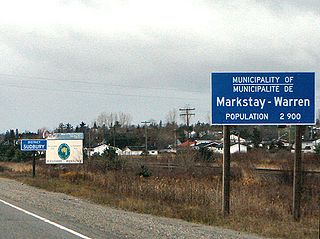
Markstay-Warren is a town in the Canadian province of Ontario, located in the Sudbury District. Highway 17, from the city limits of Greater Sudbury to the Sudbury District's border with Nipissing District, lies entirely within Markstay-Warren. The town had a population of 2,656 in the Canada 2016 Census.

Hearst is a town in the district of Cochrane, Ontario, Canada. It is located on the Mattawishkwia River in Northern Ontario, approximately 92 kilometres (57 mi) west of Kapuskasing, approximately 520 kilometres (320 mi) east of Thunder Bay along Highway 11. At Hearst, Highway 583 extends northward to Lac-Sainte-Thérèse and southward to Jogues, Coppell and Mead. Just over 96% of the town's residents speak French as their mother language, the highest proportion in Ontario.
St. Joseph is a township in the Canadian province of Ontario, the largest of four municipalities on St. Joseph Island. It had a population of 1,240 in the Canada 2016 Census.

Johnson is a township in the Canadian province of Ontario, located within the Algoma District. The township had a population of 751 in the Canada 2016 Census, up from 750 in the 2011 census.
Bayham is a municipality in the southeast corner of Elgin County, Ontario, Canada. It is south of the town of Tillsonburg and Oxford County.
Macdonald, Meredith and Aberdeen Additional is a township in Algoma District, Ontario, Canada. Originally surveyed as separate geographical townships, Macdonald and Meredith were incorporated as a single, municipal township in 1892. The geographical township of Aberdeen Additional was added to Macdonald and Meredith township in 1899 to create the municipal township of Macdonald, Meredith and Aberdeen Additional.

Hilton is a township in the Canadian province of Ontario, comprising the southeast quadrant of St. Joseph Island in the Algoma District. It surrounds, but does not include, the independent village of Hilton Beach.

Algonquin Highlands is a township located in Haliburton County, Ontario, Canada. It has a population of 2,351. The northeastern section of the township is included in Algonquin Provincial Park.

Coleman is a township municipality in the Canadian province of Ontario. It is situated in the Timiskaming District of Northeastern Ontario. The township had a population of 595 in the Canada 2016 Census.