St. Clair, Ontario

Last updated

St. Clair
Township of St. Clair
Port lambton park.jpg
Park in Port Lambton
Lambton locator map 2021.svg
Red pog.svg
St. Clair
Canada Southern Ontario location map 2.png
Red pog.svg
St. Clair
Coordinates: 42°47′N82°21′W / 42.783°N 82.350°W / 42.783; -82.350
Country Canada
Province Ontario
County Lambton
Formed2001
Government
  MayorJeff Agar
  Federal riding Sarnia—Lambton
  Prov. riding Sarnia—Lambton
Area
[1]
  Land618.57 km2 (238.83 sq mi)
Population
 (2021) [1]
  Total14,659
  Density23.7/km2 (61/sq mi)
Time zone UTC-5 (EST)
  Summer (DST) UTC-4 (EDT)
Postal Code
N0N & N0P
Area code(s) 519, 226, and 548
Website stclairtownship.ca OOjs UI icon edit-ltr-progressive.svg

St. Clair is a township in southwestern Ontario, Canada, immediately south of Sarnia in Lambton County, along the eastern shores of the St. Clair River.

Contents

Communities

The township comprises the communities of Avonry, Babys Point, Becher, Bickford, Bradshaw, Brigden, Charlemont, Colinville, Courtright, Corunna, Cromar, Duthill, Frog Point, Froomfield, Kimball, Ladysmith, Moore Centre, Mooretown, Osborne, Payne, Port Lambton, Seckerton, Sombra, Sykeston, Thornyhurst, Vye's Grove, Waubuno, West Becher, Wilkesport. The township administrative offices are located in Mooretown.

History

The Ojibwe First Nation occupied this area for thousands of years prior to European encounter. As French traders, missionaries and farmers spread out from the Atlantic coast along the waterways, some French and French-Canadian colonists began to settle here in the mid-1700s. They rented land from the Ojibwe. To the south of the Detroit River, their early community was known as Petite Côte. Early maps show the typical colonial French lots, with narrow frontage along the river. They were located near a Jesuit mission village and a Huron settlement.

Corunna

In 1823, Lord Hicks[ clarification needed ] was directed on an expedition to survey lands. He surveyed the town site of Corunna, naming it after the Battle of Corunna in Spain.

Later, William Carr Beresford was sent on a mission to find a suitable capital for a future union between the colonies of Upper Canada (Ontario) and Lower Canada (Quebec).[ citation needed ] He had also served in Spain during the Napoleonic Wars. The town's name indirectly honors Beresford's commander in that battle, Sir John Moore (general), who was mortally wounded at Corunna, Spain, in a fight with French forces as the English tried to embark on their ships for retreat to Great Britain.[ citation needed ]

Corunna was not chosen for the new capital, as it was considered vulnerable due to being too close to the Canada–US border. In the 1820s–1830s, the prospect of an Irish Fenian raid from the United States was considered a serious threat to the British colonies. Today, a small stone cairn stands along Baird Street, near the CSX north-south train track that divides the town. The cairn marks the spot where Beresford's survey crews had proposed to build St. George's Square, an area to house parliament buildings. [2]

Beresford named most of the streets after military officers who had earlier served with him. The dimensions of these streets that now make up the downtown: Beckwith, Beresford, Baird, Fane, Paget, Lyndoch, Cameron, Bentinck, Colborne, Hill, Murray, etc., follow some of the original specifications set out by Beresford's survey crew as part of the plans to create a capital.

From the 1820s on in the nineteenth century, decades after the British took over Canada after their defeat of France in the Seven Years' War, Corunna was settled by a wave of British settlers, particularly Scots-Irish. One early settler was James Cruickshank, who settled in 1834 south of Corunna on the Eighth Line near Kimball Side Road. A plaque to commemorate his early contribution to the township was installed in a Corunna park on Beresford Street, on land donated by his descendants. New residents developed grist mills, saw mills, and taverns, all considered integral to the new community.

Entrepreneurs wanted to build a canal through Corunna, but it was abandoned soon after construction, as operators could not maintain consistent water levels. The early history of the town is spotty, but some accounts suggest a brewery briefly operated here.[ citation needed ]

In the 1920s and 1930s, the village supported some local retail stores. A general store was on the west side of Lyndoch, north of Hill, where an Esso station later stood. The site now has a dentist's office. Billy Locke ran Billy's Bunnery. Billy Garoch had another general store on the Lyndoch and Hill corner where the liquor store is now.[ citation needed ] This later was known as MacRae's store and closed in the early 1960s. Billy Garoch also had an ice house to the east of his store, in the old school that had been moved from Lyndoch near the present Roses Variety Store.[ citation needed ]

Some historic structures remain in Corunna, revealing its past. The town's Roman Catholic church, St. Joseph's, was built in 1862. Its wooden structure is bolstered by enormous trunks of the area's original trees, which were squared off and put in place to build the church. Several 1800s-vintage homes remain in the town as well.

Baby's Point

Baby's Point is the extreme southern point of Lambton County. Kayla Baby owned all the land from this point, and all of Port Lambton site, which he inherited from his grandfather in 1742. His brother James Baby also lived there. In 1848 Edward Kelly was appointed as the first postmaster at Baby's Point.

After 1812, more French Canadians started to settle along the St. Clair River. They did not have legal title to the land, as the border with the United States was under dispute by Great Britain. When Irish immigrants began to move in about 1833, the French sold their squatters rights. The First Nations people, long the original inhabitants of all this area, were prevented by the Province from selling their land without official approval.

Soon after 1812, the Province arranged for legal land sales to people along the St. Clair River. In the spring of 1820, Duncan McDonald built the first frame house. A post office opened in 1871, and was at one time known as Lambton Village. Rural mail was first delivered in 1908, and all mail routes completed in January 1909.

The first Sacred Heart Church was built at Baby's Butt Point around 1825. It burned. Fr. Monocq was drowned January 12, 1861, and his body was found in 1862. Fr. Monocq was buried beneath the altar of the first Port Lambton Church. His memorial plaque was on the right hand of the side altar. The Sacred Heart Church, Port Lambton, was built in 1877. Martin Regan was the first person baptised there, in December 1877. In the 1960s the church was demolished, replaced by a new church built on the same site in 1964.

Climate

St. Clair has a humid continental climate (Köppen climate classification Dfa/Dfb) with cold winters, and warm, humid summers. Winters are cold with a maximum of −1.2 °C (29.8 °F) during the day and −8.2 °C (17.2 °F) during the night in January. Winters are variable with mild spells of weather pushing temperatures above 0 °C (32.0 °F) and occasionally above 10 °C (50.0 °F) and arctic air masses pushing temperatures below −20 °C (−4.0 °F) though these events are rare with only one day above 10 °C (50.0 °F) and 1 or 2 days below −20 °C (−4.0 °F). [3] St. Clair receives 97 centimetres (38.2 in) and since it is not located in the snowbelt region, snow cover is intermittent throughout the season. Summers are warm and humid with a July high of 27.8 °C (82.0 °F) and a low of 16.7 °C (62.1 °F). In an average summer, temperatures above 30 °C (86.0 °F) occur on 20 days per year. [3] The average annual precipitation is 865 millimetres (34 in) which is fairly evenly distributed throughout the year and there are 136 days with measureable precipitation. [3]

Climate data for Courtright, Ontario (1981–2010)
MonthJanFebMarAprMayJunJulAugSepOctNovDecYear
Record high °C (°F)14.5
(58.1)
14.5
(58.1)
26.0
(78.8)
32.0
(89.6)
34.0
(93.2)
39.0
(102.2)
37.5
(99.5)
38.0
(100.4)
35.0
(95.0)
28.9
(84.0)
23.3
(73.9)
17.5
(63.5)
39.0
(102.2)
Mean daily maximum °C (°F)−1.2
(29.8)
0.3
(32.5)
5.8
(42.4)
12.9
(55.2)
19.8
(67.6)
25.4
(77.7)
27.8
(82.0)
26.5
(79.7)
21.9
(71.4)
15.3
(59.5)
7.8
(46.0)
1.5
(34.7)
13.7
(56.7)
Daily mean °C (°F)−4.7
(23.5)
−3.4
(25.9)
1.4
(34.5)
7.9
(46.2)
14.2
(57.6)
19.6
(67.3)
22.3
(72.1)
21.2
(70.2)
16.9
(62.4)
10.8
(51.4)
4.3
(39.7)
−1.6
(29.1)
9.1
(48.4)
Mean daily minimum °C (°F)−8.2
(17.2)
−7.1
(19.2)
−2.9
(26.8)
2.9
(37.2)
8.5
(47.3)
13.7
(56.7)
16.7
(62.1)
15.8
(60.4)
11.8
(53.2)
6.2
(43.2)
0.8
(33.4)
−4.7
(23.5)
4.5
(40.1)
Record low °C (°F)−28.0
(−18.4)
−26.0
(−14.8)
−20.0
(−4.0)
−11.5
(11.3)
−3.0
(26.6)
0.6
(33.1)
7.2
(45.0)
4.0
(39.2)
−0.6
(30.9)
−5.0
(23.0)
−11.1
(12.0)
−23.0
(−9.4)
−28.0
(−18.4)
Average precipitation mm (inches)61.1
(2.41)
56.4
(2.22)
56.1
(2.21)
74.9
(2.95)
79.3
(3.12)
86.4
(3.40)
70.4
(2.77)
81.5
(3.21)
108.2
(4.26)
75.5
(2.97)
82.2
(3.24)
65.4
(2.57)
897.5
(35.33)
Average rainfall mm (inches)25.3
(1.00)
31.6
(1.24)
43.8
(1.72)
72.0
(2.83)
79.3
(3.12)
86.4
(3.40)
70.4
(2.77)
81.5
(3.21)
108.2
(4.26)
75.5
(2.97)
79.1
(3.11)
47.3
(1.86)
800.6
(31.52)
Average snowfall cm (inches)35.8
(14.1)
24.8
(9.8)
12.3
(4.8)
2.9
(1.1)
0.0
(0.0)
0.0
(0.0)
0.0
(0.0)
0.0
(0.0)
0.0
(0.0)
0.0
(0.0)
3.1
(1.2)
18.1
(7.1)
96.9
(38.1)
Average precipitation days (≥ 0.2 mm)12.610.211.213.710.910.39.810.511.311.712.413.1137.6
Average rainy days (≥ 0.2 mm)4.74.68.113.110.910.39.810.511.311.711.48.2114.6
Average snowy days (≥ 0.2 cm)8.45.93.91.20.00.00.00.00.00.01.36.026.7
Source: Environment Canada [3]

Demographics

In the 2021 Census of Population conducted by Statistics Canada, St. Clair had a population of 14,659 living in 6,021 of its 6,528 total private dwellings, a change of 4.1% from its 2016 population of 14,086. With a land area of 618.57 km2 (238.83 sq mi), it had a population density of 23.7/km2 (61.4/sq mi) in 2021. [1]

Canada census – St. Clair, Ontario community profile
2021 2016 2011
Population14,659 (+4.1% from 2016)14,086 (-3.0% from 2011)14,515 (-0.9% from 2006)
Land area618.57 km2 (238.83 sq mi)619.17 km2 (239.06 sq mi)619.32 km2 (239.12 sq mi)
Population density23.7/km2 (61/sq mi)22.8/km2 (59/sq mi)23.4/km2 (61/sq mi)
Median age44.8 (M: 44.4, F: 45.6)45.4 (M: 45.1, F: 45.6)42.7 (M: 42.6, F: 42.8)
Private dwellings6,020 (total) 6,243 (total) 6,193 (total) 
Median household income$98,000$86,112
References: 2021 [1] 2016 [4] 2011 [5] earlier [6] [7]
Historical population
YearPop.±%
1996 15,081    
2001 14,659−2.8%
2006 14,649−0.1%
2011 14,515−0.9%
2016 14,086−3.0%
2021 14,659+4.1%
Statistics Canada: [8] [1]

Education

St. Clair Township has schools in several of its communities.

Brigden houses Brigden Public School, Corunna hosts of three schools - two public schools (Sir John Moore Community School, opened in 2000 and Colonel Cameron Public School) and one Catholic school (St. Joseph's Catholic School), the latter of which opened in September 1992. Colborne Street School was a public school on Colborne Street, that closed in 2002. Murray Street School (K to 6) on Murray Street was closed earlier. Hill Street School (originally a Jr. room and Sr. room, a teacher's room and principal's office, then later a Gr.7–8 school), the earliest school still standing in Corunna, located at the corner of Hill and Lyndock, was closed several years ago as well, and is now an O.P.P. station. Students who attended Colborne, transferred to Colonel Cameron or Sir John Moore. The building currently housing Colonel Cameron was previously Father Gerald LaBelle Catholic School, which was open between 1976 and the early 2000s.

Corunna has not developed any high schools, though the topic has been debated in the past.

Port Lambton is home to two schools - Riverview Central School and Sacred Heart Catholic Elementary School.

Mooretown has a school named Mooretown Courtright Public School.

St. Clair Parkway

The presence of the St. Clair Parkway has given St. Clair Township a reputation for its parks along the riverfront.[ citation needed ] The head office had been located in Corunna since 1968. As of February 2006, the St. Clair Parkway has been disbanded and the parks have been handed over to the municipalities where they are located.[ citation needed ]

Notable people

See also

Related Research Articles

<span class="mw-page-title-main">Sarnia</span> City in Ontario, Canada

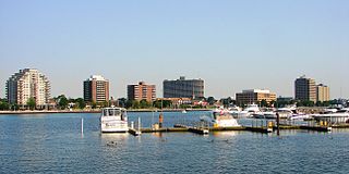
Sarnia is a city in Lambton County, Ontario, Canada. It had a 2021 population of 72,047, and is the largest city on Lake Huron. Sarnia is located on the eastern bank of the junction between the Upper and Lower Great Lakes where Lake Huron flows into the St. Clair River in the Southwestern Ontario region, which forms the Canada–United States border, directly across from Port Huron, Michigan.

<span class="mw-page-title-main">Chatham-Kent</span> Municipality in Ontario, Canada

Chatham-Kent is a single-tier municipality in Southwestern Ontario, Canada. It is mostly rural, and its population centres are Chatham, Wallaceburg, Tilbury, Blenheim, Ridgetown, Wheatley and Dresden. The current Municipality of Chatham-Kent was created in 1998 by the amalgamation of Blenheim, Bothwell, Camden, the City of Chatham, the Township of Chatham, Dover, Dresden, Erie Beach, Erieau, Harwich, Highgate, Howard, Orford, Raleigh, Ridgetown, Duart, Thamesville, Tilbury East, Tilbury, Wallaceburg, Wheatley and Zone.

<span class="mw-page-title-main">Port Colborne</span> City in Ontario, Canada

Port Colborne is a city in Ontario, Canada that is located on Lake Erie, at the southern end of the Welland Canal, in the Niagara Region of Southern Ontario. The original settlement, known as Gravelly Bay, dates from 1832 and was renamed after Sir John Colborne, a British war hero and the Lieutenant Governor of Upper Canada at the time of the opening of the (new) southern terminus of the First Welland Canal in 1833. The city's population in 2021 was 20,033.

<span class="mw-page-title-main">Walpole Island First Nation</span> Unceded territory in Ontario, Canada

Walpole Island is an island and First Nation reserve in southwestern Ontario, Canada, on the border between Ontario and Michigan in the United States. It is located in the mouth of the Saint Clair River on Lake Saint Clair, about 121 kilometres (75 mi) by road from Windsor, Ontario, and 124 kilometres (77 mi) from Detroit, Michigan.

<span class="mw-page-title-main">Point Edward, Ontario</span> Village in Ontario, Canada

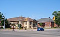
Point Edward is a village in the Canadian province of Ontario. Adjacent to the city of Sarnia in Lambton County, Point Edward sits opposite Port Huron, Michigan and is connected to it by the Blue Water Bridge, at the meeting point of the St. Clair River and Lake Huron. Formerly called Huron, it was renamed in 1860 to mark the visit by the then Prince of Wales, later Edward VII. Incorporated 1879. In the Canada 2016 Census, the population of Point Edward was 2,037, an increase of 0.1 percent from its 2011 population of 2,034.

<span class="mw-page-title-main">Lambton County</span> County in Ontario, Canada

Lambton County is a county in Southwestern Ontario, Canada. It is bordered on the north by Lake Huron, which is drained by the St. Clair River, the county's western border and part of the Canada-United States border. To the south is Lake Saint Clair and Chatham-Kent. Lambton County's northeastern border follows the Ausable River and Parkhill Creek north until it reaches Lake Huron at the beach community of Grand Bend. The county seat is in the Town of Plympton-Wyoming.

<span class="mw-page-title-main">Brigden, Ontario</span> Unincorporated community in Ontario, Canada

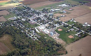
Brigden is a community in the township of St. Clair, Lambton County, Ontario, Canada. The community is located at the crossroads of Courtright Line and Brigden Road, between Kimball to the west and Oil City to the east, and about 20 kilometres (12 mi) southeast of the city of Sarnia. Brigden has a population of about 500 and is the centre of a thriving agricultural district.

<span class="mw-page-title-main">Lambton Shores</span> Municipality in Ontario, Canada

Lambton Shores is a municipality in Lambton County, Ontario, Canada, that is on the southern shores of Lake Huron.

<span class="mw-page-title-main">Ashfield–Colborne–Wawanosh</span> Township in Ontario, Canada

The Township of Ashfield–Colborne–Wawanosh is a municipality in Huron County, Ontario, Canada. It was formed as an amalgamation of the former Ashfield, Colborne and West Wawanosh townships in 2001, in an Ontario-wide local government restructuring imposed by the government of that time. The three former townships now comprise the wards of the amalgamated municipality. Mayor of Dungannon Robert Brindley Jr.

<span class="mw-page-title-main">Port Lambton</span> Unincorporated community in Ontario, Canada

Port Lambton is an unincorporated community in St. Clair Township, Lambton County, Ontario, Canada. According to the latest census, 1084 people live within this community.

<span class="mw-page-title-main">Sombra, Ontario</span> Unincorporated village in Ontario, Canada

Sombra is a village situated on the St. Clair River, in southwestern Ontario, Canada within the municipality of St. Clair Township. In its early days, the village developed out of local transport and agricultural trade via rail and ship and evolved mainly into a summer resort community, serving seasonal residences and summer cottagers through much of its history. The village is now home to mostly permanent residences and commuters supported by larger cities and towns such as Sarnia, Corunna, and Wallaceburg. Each year, in July, the town hosts Sombra Days. This community is served by two elementary schools, several churches and a small service industry. The public school is Riverview Central School. In the recent past, Sombra served as a registered port of entry into Canada by means of a ferry crossing, the Bluewater Ferry from nearby Marine City, Michigan. The village is renowned for quaint specialty shops and fine dining.

The St. Clair Parkway, historically referred to as the River Road, is a scenic parkway in the Canadian province of Ontario. It travels alongside the St. Clair River from west of Wallaceburg to Sarnia, a distance of 41.8 kilometres (26.0 mi). It formed a portion of the route of Highway 40 until it was bypassed by an inland route that opened in the mid-1970s. The St. Clair River Parkway Commission maintained the route from 1966 until 2006, when it was disbanded and responsibility over the parkway transferred to Chatham-Kent and Lambton County, both of which designate the route as County Road 33. The communities of Port Lambton, Sombra, Courtright, Mooretown, Corunna and Froomfield are located along the parkway, all early settlements of the 19th century.

<span class="mw-page-title-main">Plympton–Wyoming</span> Town in Ontario, Canada

Plympton–Wyoming is a town in the Canadian province of Ontario, located in Lambton County immediately east of Sarnia. It is the seat of the Lambton County Council.

<span class="mw-page-title-main">Lambton Kent District School Board</span> School board in Ontario, Canada

The Lambton Kent District School Board is the school board responsible for public education in Lambton County and Chatham-Kent, Ontario, Canada. Lambton and Kent Counties are made up of numerous small towns and communities situated in Southwestern Ontario, a geographic area surrounded by the Great Lakes.

Courtright is an unincorporated community in St. Clair Township, Lambton County, Ontario, Canada. It is located on the St. Clair River, south of Sarnia. It was incorporated as a village on June 25, 1907, and disincorporated in 1974.

<span class="mw-page-title-main">Brudenell, Lyndoch and Raglan</span> Township in Ontario, Canada

Brudenell, Lyndoch and Raglan is a township in Renfrew County, Ontario, Canada. It was formed on January 1, 1999, through the merger of Brudenell and Lyndoch Township with Raglan Township.

<span class="mw-page-title-main">Brooke-Alvinston</span> Municipality in Ontario, Canada

Brooke-Alvinston is a township municipality in the Canadian province of Ontario, located within Lambton County. It was formed on January 1, 2001, when the Township of Brooke was amalgamated with the Village of Alvinston.

Mooretown is a community in the Township of St. Clair, Ontario, Canada, located on the east bank of the St. Clair River. It was first established as Sutherland's Landing.

King's Highway 80, commonly referred to as Highway 80, was a provincially maintained highway in the Canadian province of Ontario. It travelled in an east–west direction south of Sarnia from Courtright to Strathburn. Beginning at the St. Clair Parkway near the shores of the St. Clair River, the route travelled 69.6 kilometres (43.2 mi), intersecting Highway 40, Highway 21 and Highway 79 before ending at Highway 2. In addition to the towns at either terminus, Highway 80 serviced the communities of Brigden, Glencoe and Alvinston. The entire route was and remains two lanes wide.

<span class="mw-page-title-main">Corunna, Ontario</span> Community in St. Clair, Ontario, Canada

Corunna is an unincorporated community in St. Clair Township, Lambton County, Ontario, Canada. The site of the community was surveyed by William Beresford in 1823. The community is located approximately 13 kilometres (8.1 mi) south of Sarnia. The community experienced a significant population boom between the 1830s and 1850s, mainly attributed to Scotch-Irish immigration. The community serves as the location of Chemical Valley, a major petrochemical and plastics manufacturing facility.

References

  1. 1 2 3 4 5 "2021 Community Profiles". 2021 Canadian Census . Statistics Canada. February 4, 2022. Retrieved 2023-08-29.
  2. "From pipe dream to footnote: The capital city that never was", Ottawa Sun , September 22, 2005.
  3. 1 2 3 4 "Courtright, Ontario". Canadian Climate Normals 1981–2010. Environment Canada. 25 September 2013. Archived from the original on July 25, 2019. Retrieved July 25, 2019.
  4. "2016 Community Profiles". 2016 Canadian Census . Statistics Canada. August 12, 2021. Retrieved 2017-03-18.
  5. "2011 Community Profiles". 2011 Canadian Census . Statistics Canada. March 21, 2019. Retrieved 2012-08-03.
  6. "2006 Community Profiles". 2006 Canadian Census . Statistics Canada. August 20, 2019.
  7. "2001 Community Profiles". 2001 Canadian Census . Statistics Canada. July 18, 2021.
  8. "St. Clair, Ontario (Code 3538003) and Lambton, Ontario (Code 3538) (table)". 2016 Census of Population . Statistics Canada. 8 February 2017. Retrieved 2017-03-18.
  9. "Maude Lenora Menten". Biographical Snapshots of Famous Women and Minority Chemists. Journal of Chemical Education. Retrieved 2006-06-03.
  10. Bridge, Terry (August 12, 2016). "Drouin 'relaxed' ahead of high jump qualifier, coach says". The Sarnia Observer. Retrieved June 17, 2019.