St. Regis, Montana

Last updated

St. Regis, Montana
StRegisMTJuly2019.jpg
Center of St. Regis in 2019
Mineral County Montana Incorporated and Unincorporated areas St. Regis Highlighted.svg
Location in Mineral County and the state of Montana
Coordinates: 47°17′58″N115°6′1″W / 47.29944°N 115.10028°W / 47.29944; -115.10028
Country United States
State Montana
County Mineral
Area
[1]
  Total0.88 sq mi (2.28 km2)
  Land0.86 sq mi (2.22 km2)
  Water0.02 sq mi (0.06 km2)
Elevation
[2]
2,635 ft (803 m)
Population
 (2020) [3]
  Total313
  Density365.65/sq mi (141.12/km2)
Time zone UTC-7 (Mountain (MST))
  Summer (DST) UTC-6 (MDT)
ZIP Code
59866
Area code 406
FIPS code 30-65575
GNIS feature ID2409233 [2]

St. Regis or Saint Regis [2] is an unincorporated community and census-designated place (CDP) in Mineral County, Montana. The population was 313 at the time of the 2020 census.

Contents

Pierre-Jean De Smet travelled extensively in this area of Montana. He named the river, after which the town takes its name, after a fellow Jesuit priest. [4] The post office opened in 1896. [4]

The Northern Pacific Railway built a railroad through the town in the early 1900's, boosting the economy.

Geography

St. Regis is at the confluence of the St. Regis River and the Clark Fork. It is about 30 miles (48 km) from Idaho. It is in the Lolo National Forest and the Bitterroot Mountains.

According to the United States Census Bureau, the St. Regis CDP has a total area of 0.9 square miles (2.3 km2), of which 0.02 square miles (0.06 km2), or 2.65%, are water. [5]

Climate

This climatic region is typified by large seasonal temperature differences, with warm to hot (and often humid) summers and cold (sometimes severely cold) winters. According to the Köppen Climate Classification system, St. Regis has a humid continental climate, abbreviated "Dfb" on climate maps. [6]

Demographics

Historical population
CensusPop.Note
2000 315
2010 3191.3%
2020 313−1.9%
U.S. Decennial Census [7]

As of the census [8] of 2010, there were 319 people, 135 households, and 73 families residing in the CDP. The population density was 381.4 inhabitants per square mile (147.3/km2). There were 161 housing units at an average density of 194.9 per square mile (75.3/km2). The racial makeup of the CDP was 95.87% White, 2.54% Native American, 0.32% Asian, and 1.27% from two or more races. Hispanic or Latino of any race were 2.54% of the population.

There were 135 households, out of which 25.2% had children under the age of 18 living with them, 41.5% were married couples living together, 9.6% had a female householder with no husband present, and 45.2% were non-families. 38.5% of all households were made up of individuals, and 11.1% had someone living alone who was 65 years of age or older. The average household size was 2.33 and the average family size was 3.09.

In the CDP, the population was spread out, with 27.3% under the age of 18, 7.9% from 18 to 24, 26.3% from 25 to 44, 25.1% from 45 to 64, and 13.3% who were 65 years of age or older. The median age was 39 years. For every 100 females, there were 107.2 males. For every 100 females age 18 and over, there were 106.3 males.

The median income for a household in the CDP was $23,750, and the median income for a family was $27,750. Males had a median income of $29,250 versus $14,844 for females. The per capita income for the CDP was $14,137. About 18.2% of families and 21.0% of the population were below the poverty line, including 27.3% of those under age 18 and 15.2% of those age 65 or over.

Education

St. Regis School District educates students from kindergarten through 12th grade. [9] The district includes 3 schools. For the 2021-2022, a total of 195 students were enrolled. [10]

Saint Regis High School's team name is the Tigers. [11]

A branch of the Mineral County Public Library is in St. Regis. [12]

Media

The Mineral Independent is the newspaper serving Mineral County. It is printed weekly and also has an e-edition. [13]

Television stations in St. Regis are:

Some of the strongest AM radio stations in St. Regis include:

Some of the strongest FM radio stations in St. Regis include:

Infrastructure

Interstate 90 runs along the southern edge of the community, with access from Exit 33. I-90 leads southeast 71 miles (114 km) to Missoula and west 93 miles (150 km) to Coeur d'Alene, Idaho.

It is on Montana Highway 135, a shortcut to Glacier National Park for travelers coming from the east. [16]

The nearest commercial airport is in Missoula, 70 miles (113 km) southeast.

Related Research Articles

<span class="mw-page-title-main">Busby, Montana</span> Census-designated place in Big Horn County, Montana, United States

Busby is a census-designated place (CDP) in Big Horn County, Montana, United States. It is on the Northern Cheyenne reservation. The population was 745 at the 2010 census.

<span class="mw-page-title-main">Fort Smith, Montana</span> Census-designated place in Montana, United States

Fort Smith is a census-designated place (CDP) in Big Horn County, Montana, United States. The population was 161 at the 2010 census. The town is named for the former Fort C.F. Smith. The North District of Bighorn Canyon National Recreation Area is accessed at Fort Smith.

<span class="mw-page-title-main">Fort Belknap Agency, Montana</span> Census-designated place in Montana, United States

Fort Belknap Agency is a census-designated place (CDP) in Blaine County, Montana, United States. As of the 2020 census, its population was 1,567. This is a significant increase from the 2010 census which reported 1,293 residents.

<span class="mw-page-title-main">Lakeside, Montana</span> Unincorporated community in Montana, United States

Lakeside is an unincorporated area and census-designated place (CDP) in Flathead County, Montana, United States. The population was 2,705 at the 2020 census, up from 2,669 in 2010.

<span class="mw-page-title-main">Augusta, Montana</span> Census-designated place in Montana, United States

Augusta is an unincorporated community and census-designated place (CDP) in Lewis and Clark County, Montana, United States. The population was 309 at the 2010 census and rose to 316 in the 2020 census. The most accepted version in the naming of this town is after Augusta Hogan, thought to be the first child born in this town, the daughter of J. D. Hogan, an early rancher.

<span class="mw-page-title-main">Alberton, Montana</span> Town in Montana, United States

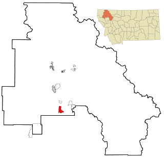
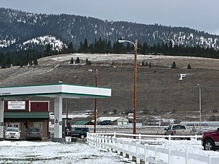
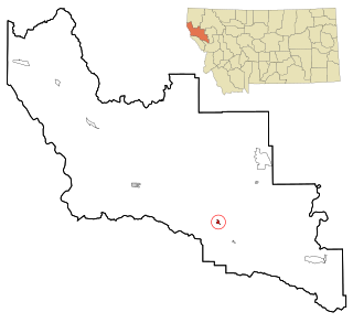
Alberton is a town in Mineral County, Montana, United States. The population was 452 at the 2020 census. Alberton was the location of a major chlorine chemical release in 1996. It is the home of Northwest Indian Bible School, a Bible-training institution founded and operated by the Allegheny Wesleyan Methodist Connection.

<span class="mw-page-title-main">De Borgia, Montana</span> Census-designated place in Montana, United States

De Borgia is an unincorporated community and census-designated place (CDP) in Mineral County, Montana, United States. The population was 91 at the 2020 census.

<span class="mw-page-title-main">Riverbend, Montana</span> Census-designated place in Montana, United States

Riverbend is an unincorporated community and census-designated place (CDP) in Mineral County, Montana, United States. The population was 455 at the 2020 census. The community uses the ZIP Code of neighboring Superior, 59872.

<span class="mw-page-title-main">Superior, Montana</span> Town in Montana, United States

Superior is a town in, and the county seat of, Mineral County, Montana, United States. The population was 830 at the 2020 census.

<span class="mw-page-title-main">Frenchtown, Montana</span> CDP in Montana, United States

Frenchtown is a census-designated place (CDP) in Missoula County, Montana, United States. It is part of the Missoula, Montana Metropolitan Statistical Area. The population was 1,825 at the 2010 census, an increase from its population of 883 in 2000.

<span class="mw-page-title-main">Lolo, Montana</span> CDP in Montana, United States

Lolo is a census-designated place (CDP) in Missoula County, Montana, United States. It is part of the Missoula Metropolitan Statistical Area. The population was 4,399 at the 2020 census, an increase from its population of 3,892 in 2010. It is home to Travelers' Rest State Park, a site where Lewis and Clark camped in 1805 and again in 1806.

<span class="mw-page-title-main">Florence, Montana</span> Census-designated place in Montana, United States

Florence is a census-designated place (CDP) in Ravalli County, Montana. County Line Rd is on the northern edge of the city limits dividing it from Missoula County, Montana. The population was 821 at the 2020 census.

<span class="mw-page-title-main">Victor, Montana</span> Census-designated place in Montana, United States

Victor is a census-designated place (CDP) in Ravalli County, Montana, United States. The population was 789 at the 2020 Census, compared to 745 at the 2010 census.

<span class="mw-page-title-main">Lonepine, Montana</span> CDP in Montana, United States

Lonepine is a census-designated place (CDP) in Sanders County, Montana, United States. The population was 137 at the 2000 census.

<span class="mw-page-title-main">Plains, Montana</span> Town in Montana, United States

Plains is a town in Sanders County, Montana, United States. The population was 1,106 at the 2020 census. It was founded as Horse Plains and sometimes called Wild Horse Plains, as the local Native Americans would winter their horses here to feed on the grasses in the valley. The name was later shortened to Plains when the US Postal Service established a presence in 1905.

<span class="mw-page-title-main">Thompson Falls, Montana</span> City in Montana, United States

Thompson Falls is a city in and the county seat of Sanders County, Montana. The population was 1,336 at the time of the 2020 census.

<span class="mw-page-title-main">Park City, Montana</span> CDP in Montana, United States

Park City is a census-designated place (CDP) in Stillwater County, Montana, United States. The population was 870 at the 2000 census.

<span class="mw-page-title-main">Worden, Montana</span> CDP in Montana, United States

Worden is a census-designated place (CDP) in Yellowstone County, Montana, United States. The population was 582 at the 506 at the 2020 census. Worden, along with Ballantine, Huntley, and Pompey's Pillar, is part of the Huntley Project, an irrigation district established by the United States Bureau of Reclamation in 1907.

<span class="mw-page-title-main">Arlee, Montana</span> Census-designated place in Montana, United States

Arlee is an unincorporated community and census-designated place (CDP) on the Flathead Reservation, Lake County, Montana, United States. The population was 725 at the 2020 census. It is named after Alee, a Salish chief. The chief's name has no "r", as the Salish alphabet has no letter "r".

Box Elder is an unincorporated community and census-designated place (CDP) in Hill County in the U.S. state of Montana. The population was 87 at the 2010 census. The population was 794 at the 2000 census, but before 2010 the Box Elder CDP was split into the current much-smaller Box Elder CDP, while most of the former CDP area went into the new Rocky Boy West CDP. Box Elder is the headquarters of the Chippewa-Cree tribe.

References

  1. "2023 U.S. Gazetteer Files: Montana". United States Census Bureau. Retrieved May 23, 2024.
  2. 1 2 3 U.S. Geological Survey Geographic Names Information System: St. Regis, Montana
  3. "P1. Race – St. Regis CDP, Montana: 2020 DEC Redistricting Data (PL 94-171)". U.S. Census Bureau. Retrieved May 23, 2024.
  4. 1 2 "St. Regis". Montana Place Names Companion. Montana Historical Society. Retrieved October 27, 2023.
  5. "Geographic Identifiers: 2010 Census Summary File 1 (G001): St. Regis CDP, Montana". American Factfinder. U.S. Census Bureau. Archived from the original on February 13, 2020. Retrieved August 3, 2019.
  6. Climate Summary for St. Regis, Montana
  7. "Census of Population and Housing". Census.gov. Retrieved June 4, 2016.
  8. "U.S. Census website". United States Census Bureau . Retrieved January 31, 2008.
  9. "St. Regis School District". St. Regis School District. Retrieved April 20, 2021.
  10. "St Regis K-12 Schools". National Center for Education Statistics. Retrieved October 27, 2023.
  11. "Member Schools". Montana High School Association. Retrieved April 19, 2021.
  12. "St. Regis Branch Library". Mineral County Public Library. Retrieved April 12, 2021.
  13. "Latest News". Clark Fork Valley Press/Mineral Independent. Retrieved August 31, 2023.
  14. "KQEZ". FCC. Retrieved October 27, 2023.
  15. "KTGC-LP". FCC. Retrieved October 27, 2023.
  16. "St. Regis". Montana Official State Travel Site. Retrieved November 21, 2013.