St Johns Park, New South Wales

Last updated

St Johns Park
Sydney,  New South Wales
St Johns Park, New South Wales
Population6,302 (2021 census) [1]
Postcode(s) 2176
Elevation35 m (115 ft)
Location35 km (22 mi) west of Sydney CBD
LGA(s) City of Fairfield
State electorate(s) Cabramatta
Federal division(s) Fowler
Suburbs around St Johns Park:
Greenfield Park Prairiewood Wakeley
Edensor Park St Johns Park Canley Heights
Bonnyrigg Cabramatta West Cabramatta West

St Johns Park is a suburb of Sydney, in the state of New South Wales, Australia 35 kilometres west of the Sydney central business district, in the local government areas of the City of Fairfield. It is part of the Greater Western Sydney region.

Contents

History

St Johns Park was originally home to the Cabrogal people who inhabited the broad Liverpool-Fairfield area. When the First Fleet arrived in Australia, the colonial administration designated this area the parish of St John. Nineteenth century maps indicate a St Johns Farm in the area and it is through this connection that the suburb gained its name. [2]

By the 1890s there was a public school on Parkes Road (now Edensor Road), a post office (opened in 1888), and a growing community, with an unusual number of Italians, who had arrived in the 1880s after the failure of the Marquis de Rays's expedition to New Ireland. The Bellotti and Gava families established vineyards on Bulls Road.

Yugoslav migrants Theodore and Samuel Serovich arrived in 1885, also cultivating wine grapes.

Both the Italian and Yugoslav communities were renewed and expanded during the period of postwar migration in the 1940s, and St Johns Park is still a very multicultural area. Chicory and wild fennel growing along the banks of Clear Paddock Creek are relics of the early European farmers. [3]

People

According to the 2021 census, St Johns Park had a population of 6,302 people with a median age of 43, which was higher than the national median age of 38. Over a third of people were born in Australia (39.0%), with the other most common countries of birth being Vietnam (18.2%), Iraq (7.1%), Cambodia (6.0%), Croatia (3.4%) and Laos (2.0%).

The majority of people spoke a language other than English at home (85.2%), with Vietnamese (23.9%), Cantonese (5.5%), Croatian (5.0%), Arabic (4.9%) and Assyrian Neo-Aramaic (4.8%) forming the top responses for languages spoken at home. About a fifth of people (20.9%) spoke only English at home. [1]

Housing

At the time of the 2016 census, St Johns Park had a total of 1,660 occupied private dwellings, of which 93.1% were separate houses, 6.4% were semi-detached dwellings and 0.4% were flats or apartments. Of these occupied private dwellings, 50.1% were owned outright, 29.6% were owned with a mortgage and 17.2% were rented. [1]

Landmarks

St Johns Park sits beside Clear Paddock Creek which runs along 500m. The 'Restoring the Waters' project, which was the first of its kind in Australia, consisted of the restoration of the concrete channel into a living stream. It took seven years to plan and build and was funded with the assistance of a $1.33 million grant from the NSW State Government through its Stormwater Trust. [4]

Schools

St Johns Park High School

Places of worship

Clubs

Services

Related Research Articles

<span class="mw-page-title-main">Cabramatta, New South Wales</span> Suburb of Sydney, New South Wales, Australia

Cabramatta ('Cabra') is a suburb in south-western Sydney, in the state of New South Wales, Australia. Cabramatta is located 30 kilometres (19 mi) south-west of the Sydney central business district, in the local government area of the City of Fairfield.

<span class="mw-page-title-main">Edensor Park, New South Wales</span> Suburb of Sydney, New South Wales, Australia

Edensor Park is a suburb of Sydney, New South Wales, Australia. Edensor Park is located 38 kilometres west of the Sydney central business district in the local government area of the City of Fairfield. It is mainly a residential area, Edensor Park is part of the Greater Western Sydney region.

<span class="mw-page-title-main">Fairfield, New South Wales</span> Suburb of Sydney, New South Wales, Australia

Fairfield is a suburb of Western Sydney, in the state of New South Wales, Australia. Being in the centre of the Cumberland Plain, Fairfield is located 30 kilometres (19 mi) west of the Sydney central business district and is the administrative heart of the Fairfield City Council – despite a very small portion of it belonging to the Cumberland Council. Fairfield supports a mixture of commercial and residential developments, mostly characterised by medium-density buildings and some new high-rise apartments.

<span class="mw-page-title-main">Abbotsbury, New South Wales</span> Suburb of Sydney, New South Wales, Australia

Abbotsbury is a suburb of Sydney, New South Wales, Australia 39 kilometres west of the Sydney central business district in the local government area of the City of Fairfield. Abbotsbury is part of the Greater Western Sydney region.

<span class="mw-page-title-main">Wetherill Park, New South Wales</span> Suburb of Greater Western Sydney, New South Wales, Australia

Wetherill Park is a suburb in Greater Western Sydney, in the state of New South Wales, Australia. Wetherill Park is located 34 kilometres west of the Sydney central business district, in the local government area of the City of Fairfield.

<span class="mw-page-title-main">Wallacia, New South Wales</span> Suburb of Sydney, New South Wales, Australia

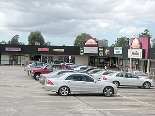
Wallacia is a suburb of Sydney, in the state of New South Wales, Australia. Formerly a rural village it is 68 kilometres (42 mi) west of the Sydney GPO, in the local government areas of the City of Penrith, City of Liverpool and Wollondilly Shire. It is part of the Greater Western Sydney region.

<span class="mw-page-title-main">Smithfield, New South Wales</span> Suburb of Sydney, New South Wales, Australia

Smithfield is a suburb of Sydney, in the state of New South Wales, Australia. Smithfield is located 31 kilometres (19 mi) west of the Sydney central business district, in the local government areas of the City of Fairfield and Cumberland Council. Located in the Greater Western Sydney region, the suburb is one of the largest in Fairfield City by area.

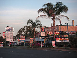
Rossmore is a suburb of Sydney, in the state of New South Wales, Australia.

<span class="mw-page-title-main">Prairiewood, New South Wales</span> Suburb of Sydney, New South Wales, Australia

Prairiewood is a suburb of Sydney, in the state of New South Wales, Australia 34 kilometres west of the Sydney central business district, in the local government area of the City of Fairfield. It is part of the Greater Western Sydney region.

<span class="mw-page-title-main">Bonnyrigg, New South Wales</span> Suburb of Sydney, New South Wales, Australia

Bonnyrigg is a suburb of Sydney, in the state of New South Wales, Australia 36 kilometres west of the Sydney central business district, in the local government area of the City of Fairfield. It is part of the Greater Western Sydney region.

Bonnyrigg Heights is a suburb of Sydney, in New South Wales, Australia. Its name originates from Bonnyrigg, Midlothian, Scotland. Bonnyrigg Heights is located on the traditional indigenous lands of the Dharug Nation.

<span class="mw-page-title-main">Bossley Park</span> Suburb of Sydney, New South Wales, Australia

Bossley Park is a suburb of Sydney, in the state of New South Wales, Australia. Bossley Park is located 36 kilometres west of the Sydney central business district in the local government area of the City of Fairfield. Bossley Park is part of the Greater Western Sydney region. The suburb is most well known for being an ethnic enclave of Assyrian and other Iraqi ethnic groups living in Sydney.

<span class="mw-page-title-main">Canley Vale, New South Wales</span> Suburb of Sydney, New South Wales, Australia

Canley Vale is a suburb of Sydney, in the state of New South Wales, Australia. Canley Vale is located 30 kilometres west of the Sydney central business district, in the local government area of the City of Fairfield and is part of the South Western Sydney region.

<span class="mw-page-title-main">Canley Heights, New South Wales</span> Suburb of Sydney, New South Wales, Australia

Canley Heights is a suburb of Sydney, in the state of New South Wales, Australia 31 kilometres west of the Sydney central business district, in the local government area of the City of Fairfield and is part of the South-western Sydney region.

Fairfield West is a suburb of Sydney, in the state of New South Wales, Australia. Fairfield West is located 27 kilometres west of the Sydney central business district in the local government area of the City of Fairfield. Fairfield West is part of the Greater Western Sydney region.

Fairfield Heights is a suburb of Sydney, in the state of New South Wales, Australia. Fairfield Heights is located 25 kilometres west of the Sydney central business district in the local government area of the City of Fairfield. Fairfield Heights is part of the Greater Western Sydney region.

<span class="mw-page-title-main">Greenfield Park, New South Wales</span> Suburb of Sydney, New South Wales, Australia

Greenfield Park is a suburb of Sydney, in the state of New South Wales, Australia. Greenfield Park is located 36 kilometres west of the Sydney central business district in the local government area of the City of Fairfield. The suburb has one of the most highest proportion of Assyrian people in the Sydney area and Australia per se.

<span class="mw-page-title-main">Horsley Park, New South Wales</span> Suburb of Sydney, New South Wales, Australia

Horsley Park is a suburb of Sydney in the state of New South Wales, Australia. Horsley Park is located 39 kilometres west of the Sydney central business district in the local government area of the City of Fairfield. Horsley Park is part of the Greater Western Sydney region. It is a semi-rural suburb, located 5 km west of Wetherill Park and 11 km north-west of Fairfield.

<span class="mw-page-title-main">Hoxton Park, New South Wales</span> Suburb of Sydney, New South Wales, Australia

Hoxton Park is a suburb of Sydney, in the state of New South Wales, Australia. Hoxton Park is located 38 kilometres west of the Sydney central business district, in the local government area of the City of Liverpool and is part of the Greater Western Sydney region.

<span class="mw-page-title-main">Assyrian Australians</span>

Assyrian Australians, refers to ethnic Assyrians possessing Australian nationality. They are descended from the Northern Mesopotamian region, specifically the Assyrian homeland. Today, their homeland is a part of North Iraq, Southeast Turkey, Northwest Iran and Northeast Syria.

References

  1. 1 2 3 Australian Bureau of Statistics (27 June 2017). "St Johns Park (State Suburb)". 2016 Census QuickStats. Retrieved 30 November 2021. OOjs UI icon edit-ltr-progressive.svg
  2. "St Johns Park". Fairfield City Council. Retrieved 12 June 2008.
  3. Vicki Movizio (2011). "St Johns Park". Dictionary of Sydney. Dictionary of Sydney Trust. Retrieved 5 December 2011.
  4. "Restoring the waters". Fairfield City Council. Retrieved 12 June 2008.
  5. "St Johns Park Baptist Church (Bible Baptist Church)".
  6. "THÀNH VIÊN GIÁO HỘI". The Unified Vietnamese Buddhist Congregation of Australia – New Zealand. Retrieved 14 July 2021.

33°53′5″S150°54′25″E / 33.88472°S 150.90694°E / -33.88472; 150.90694