Related Research Articles

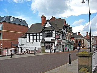
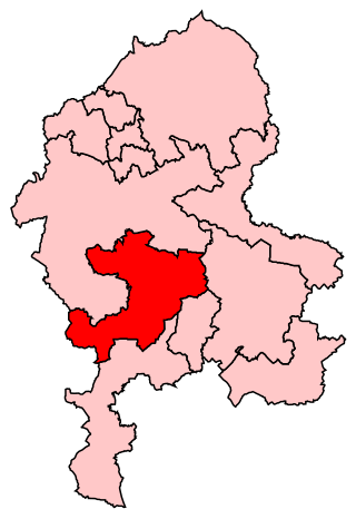
The Borough of Stafford is a local government district with borough status in Staffordshire, England. It is named after Stafford, its largest town, which is where the council is based. The borough also includes the towns of Stone and Eccleshall, as well as numerous villages and surrounding rural areas.

Gnosall is a village and civil parish in the Borough of Stafford, Staffordshire, England, with a population of 4,736 across 2,048 households. It lies on the A518, approximately halfway between the towns of Newport and the county town of Staffordshire, Stafford. Gnosall Heath lies immediately south-west of the main village, joined by Station Road and separated by Doley Brook. Other nearby villages include Woodseaves, Knightley, Cowley, Ranton, Church Eaton, Bromstead Heath, Moreton, and Haughton.

Stafford is a constituency represented in the House of Commons of the UK Parliament since 2019 by Theodora Clarke, a Conservative.

Stone is a constituency in Staffordshire, represented in the House of Commons of the UK Parliament since its 1997 recreation by Sir Bill Cash, a Conservative. On 9 June 2023, he announced his intention to stand down at the next general election.

Haughton is a village in Staffordshire, England, approximately 4 miles outside and to the west of the county town of Stafford. It lies on the A518 between Stafford and Gnosall. The name derives from a combination of the Mercian word halh meaning 'nook' and the Old English word tun meaning 'settlement', 'enclosure' or 'village.'
Gnosall was a rural district in Staffordshire, England from 1894 to 1934. It was formed under the Local Government Act 1894 from that part of the Newport Rural Sanitary District which was in Staffordshire.
Newport was a rural district in Shropshire, England from 1894 to 1934.
Cannock was a rural district in Staffordshire, England from 1894 to 1974.
Moreton is a small rural village in the borough of Stafford in Staffordshire, England, near the border with Shropshire.

The Way for the Millennium is a 41-mile-long (66 km) east–west route across Staffordshire, deliberately designed for easy walking, using towpaths, old railway lines and footpaths and visiting attractive countryside and green spaces.

Chartley Castle lies in ruins to the north of the village of Stowe-by-Chartley in Staffordshire, between Stafford and Uttoxeter. Mary, Queen of Scots, was imprisoned on the estate in 1585. The remains of the castle and associated earthworks are a Scheduled Monument, the site having been protected since 1925. The castle itself is a Grade II* listed building
Holme Lacy is a village in the English county of Herefordshire. The population of the civil parish was 466 at the 2011 Census.

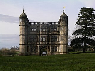
Tixall Gatehouse is a 16th-century gatehouse situated at Tixall, near Stafford, Staffordshire and is all that remains of Tixall Hall which was demolished in 1927. The gatehouse is a Grade I listed building. Tixall was used as a prison for Mary, Queen of Scots for two weeks in 1586.

Ranton is a small hamlet in Staffordshire, England, situated 3.5 miles (5.6 km) west of Stafford, 2.5 miles (4.0 km) east of Woodseaves and 2 miles (3.2 km) northeast of Gnosall. The population taken at the 2011 census was 382. As of 2013, both public houses that once operated in Ranton were bought and subsequently removed from operation. Due to this, Ranton is now listed as a hamlet.
Outwoods is a hamlet in the English county of Staffordshire.
Levedale is a small somewhat elongated English village situated some 4 miles southwest of Stafford, 2 miles northwest of Penkridge and a mile west of Dunston, Staffordshire. The population as taken at the 2011 census can be found under Penkridge
The Battle of the Holme took place in East Anglia on 13 December 902 where the Anglo-Saxon men of Wessex and Kent fought against the Danelaw and East Anglian Danes. Its location is unknown but may have been Holme in Huntingdonshire.

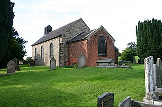
Marston is a village and civil parish 12 miles (19 km) south of Stoke-on-Trent, in the Stafford district, in the county of Staffordshire, England. In 2011 the parish had a population of 158. The parish touches Creswell, Hopton and Coton, Salt and Enson, Sandon and Burston, Stone Rural and Whitgreave.
References
52°48′N2°10′W / 52.80°N 2.16°W