State of Goshen

Last updated
State of Goshen
Het Land Goosen (Dutch)
1882–1883
Flag of the Republic of Goshen.svg
Motto: Gewapend en Regtvaardig
Dutch: Armed and Fair
LocationStellaland.svg
Location of Goshen in Southern Africa (1882–1883)
Status Boer Republic
Capital Rooigrond, Mafikeng
Common languages Dutch
Tswana
Religion
Dutch Reformed
Government Republic
President  
 Goshen
Nicolaas Claudius Gey van Pittius
LegislatureDie Bestuur
History 
 Founding of Goshen
24 October 1882
1883
Currency South African pound (£)
Preceded by
Succeeded by
Blank.png Tswana people
Blank.png Griqua people
United States of Stellaland Flag of Stellaland (1883-5).svg

Goshen, officially known as the State of Goshen (Dutch : Het Land Goosen), was a short-lived Boer republic in southern Africa founded by Boers expanding west from Transvaal who opposed British advance in the region.

Contents

Located in Tswana territory west of the Transvaal, Goshen existed as an independent nation for a short period; from 1882 to 1883 as the State of Goshen and, after unification with neighbouring Stellaland, as the United States of Stellaland (Dutch: Verenigde Staten van Stellaland) from 1883 to 1885.

During its history, Goshen, though small in size, became a focal point of conflict between the British Empire and the South African Republic, the two major players vying over the territory. After a series of claims and annexations, British fears of Boer expansionism ultimately led to its demise and, among other factors, set the stage for the Second Boer War of 1899–1902.

History

Before the proclamation of Goshen, the land was under the control of competing Griqua and Tswana groups, while the United Kingdom laid claim to it as part of the emerging protectorate of British Bechuanaland. Two of the indigenous groups were under the leadership of chiefs Mankurwane and Montshiwa, whom the British regarded as "friendly," [1] and another two under the leadership of chiefs Moshoette and Massouw.

In the mid-nineteenth century, Voortrekkers (Boer settlers) established themselves in the region and in the early 1880s they supported Moshoette in his battles against Mankurwane and Montshiwa, helping to besiege Montshiwa's stronghold Mahikeng. Mahikeng fell on 24 October 1882 and, in gratitude, Moshoette ceded large portions of Mankurwane's land (416 farms of 3,000 morgen (2,563 hectares) each) to the Boer mercenaries who had supported him. [2]

The mercenaries, led by Nicolaas Claudius Gey van Pittius, immediately declared independence [3] (followed by an official proclamation on 21 November 1882), [4] naming the new nation after the Book of Genesis's Land of Goshen, "the best of the land of Egypt given to Joseph", [5] with its capital at Rooigrond ("Red Ground"). [3]

Geography

Goshen had the Molopo River as its northern border, and shared a border with the Transvaal. [5] Goshen's capital Rooigrond was little more than a fortified farm consisting of a collection of mud huts and a population of a few dozen, situated near Mafeking. [6]

Goshen's flag, designed by Gey van Pittius, was adopted in early 1883 [7] and consisted of horizontal black, white and red stripes with a green vertical stripe at the hoist [8] -- imitating the Vierkleur but using the German flag as the basis as opposed to the Dutch.

Unification with Stellaland

Less than a year after declaring independence, on 6 August 1883, Goshen and the neighbouring Republic of Stellaland united to form the United States of Stellaland. [9]

While the British government was at first unconcerned about the declaration of independence of Goshen and Stellaland, and felt it could not prevent such proclamations of independence, Cecil Rhodes recognised the economic implications of an independent Boer republic blocking the transit of goods between the Cape Colony and British Central Africa [10] and began to agitate the Cape Colony Government to forcibly take control of the area. [6]

As part of his plan to bring the United States of Stellaland under British rule, Rhodes and colleague Frank Thompson travelled to Stellaland in September 1884 to convince the locals of the advantages of Cape rule. [11] While the Stellaland residents were receptive to Rhodes, Goshenites proved to be far more hostile; while Rhodes stayed at the Goshen border, Thompson visited Rooigrond to speak to the President Gey van Pittius, who was living in a tent. Gey van Pittius immediately arrested Thompson before eventually releasing him to tell Rhodes that Goshen remained independent and demanded British recognition of that independence. [12]

In response to Rhodes' actions, on 16 September 1884, Transvaal's President Paul Kruger proclaimed Transvaal's annexation of Goshen and Stellaland [13] in "the interests of humanity" and on 3 October, Transvaal's Director of Education, the Rev Stephanus du Toit, arrived in Rooigrond, made a fiery speech, renamed the town "Heliopolis" and raised the Transvaal flag. [12]

As a result, the British told Kruger that annexation was unacceptable and December 1884, the 4,000-strong Bechuanaland Expeditionary Force, led by General Charles Warren, [14] were sent from England to quell the Boers and force Goshen and Stellaland to capitulate. [15] Warren met with no resistance [16] and Goshen was subsequently incorporated into British Bechuanaland. [13]

On 3 October 1895 the colony was abolished and incorporated into the Cape Colony. [17]

Sources

Related Research Articles

<span class="mw-page-title-main">Mafikeng</span> Capital city of the North-West Province, South Africa

Mahikeng, formerly known as Mafikeng and alternatively known as Mafeking, is the capital city of the North West province of South Africa.

<span class="mw-page-title-main">Cape Colony</span> British colony from 1806 to 1910

The Cape Colony, also known as the Cape of Good Hope, was a British colony in present-day South Africa named after the Cape of Good Hope. It existed from 1795 to 1802, and again from 1806 to 1910, when it united with three other colonies to form the Union of South Africa, then became the Cape Province, which existed even after 1961, when South Africa had become a republic, albeit, temporarily outside the Commonwealth of Nations (1961-94).

<span class="mw-page-title-main">Paul Kruger</span> South African politician (1825–1904)

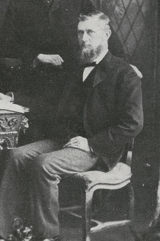
Stephanus Johannes Paulus Kruger was a South African politician. He was one of the dominant political and military figures in 19th-century South Africa, and State President of the South African Republic from 1883 to 1900. Nicknamed Oom Paul, he came to international prominence as the face of the Boer cause—that of the Transvaal and its neighbour the Orange Free State—against Britain during the Second Boer War of 1899–1902. He has been called a personification of Afrikanerdom, and remains a controversial figure; admirers venerate him as a tragic folk hero.

<span class="mw-page-title-main">Hercules Robinson, 1st Baron Rosmead</span> 5th Governor of Hong Kong

Hercules George Robert Robinson, 1st Baron Rosmead,, was a British colonial administrator who became the 5th Governor of Hong Kong and subsequently, the 14th Governor of New South Wales, the first Governor of Fiji, and the 8th Governor of New Zealand. From June 1859 until August 1896, he was known as Sir Hercules Robinson.

<span class="mw-page-title-main">First Boer War</span> Military conflict in present-day South Africa (1880–1881)

The First Boer War, was fought from 16 December 1880 until 23 March 1881 between the United Kingdom and Boers of the Transvaal. The war resulted in a Boer victory and eventual independence of the South African Republic. The war is also known as the First Anglo–Boer War, the Transvaal War or the Transvaal Rebellion.

<span class="mw-page-title-main">Stellaland</span> 1880s republic in Southern Africa

The Republic of Stellaland was, from 1882 to 1883, a Boer republic located in an area of British Bechuanaland, west of the Transvaal. After unification with the neighbouring State of Goshen, it became the United States of Stellaland from 1883 to 1885.

<span class="mw-page-title-main">Boer republics</span> Former countries in southern Africa

The Boer republics were independent, self-governing republics formed by Dutch-speaking inhabitants of the Cape Colony and their descendants. The founders – variously named Trekboers, Boers and Voortrekkers – settled mainly in the middle, northern, north-eastern and eastern parts of present-day South Africa. Two of the Boer Republics achieved international recognition and complete independence: the South African Republic and the Orange Free State. The republics did not provide for the separation of church and state, initially allowing only the Dutch Reformed Church, and later also other Protestant churches in the Calvinist tradition. The republics came to an end after the Second Boer War of 1899–1902, which resulted in British annexation and later incorporation of their lands into the Union of South Africa.

<span class="mw-page-title-main">British Bechuanaland</span> 1885–1895 British colony in Southern Africa

British Bechuanaland was a short-lived Crown colony of the United Kingdom that existed in southern Africa from its formation on 30 September 1885 until its annexation to the neighbouring Cape Colony on 16 November 1895. British Bechuanaland had an area of 51,424 square miles (133,190 km2) and a population of 84,210. Today the region forms part of South Africa.

This is a survey of the postage stamps and postal history of Bechuanaland Protectorate.

<span class="mw-page-title-main">Vryburg</span> Place in North West, South Africa

Vryburg is a large agricultural town with a population of 48,400 situated in the Dr Ruth Segomotsi Mompati District Municipality of the North West Province of South Africa. It is the seat and the industrial and agricultural heartland of the district of the Bophirima region.

<span class="mw-page-title-main">Stephanus Jacobus du Toit</span> Afrikaans clergyman, founder of the First Afrikaans Language Movement (1847–1911)

The Reverend Stephanus Jacobus du Toit was a controversial South African nationalist, theologian, journalist and failed politician. In his younger years Du Toit did much to promote the Afrikaans language as a symbol of Afrikaner nationalism. Apart from the years 1882-8 when he was Superintendent of Education in the South African Republic, he lived in or near the town of Paarl in the Cape Colony. Disillusionment with the Kruger regime led him, in later years, to moderate his views. He was instrumental in initiating the translation of the Bible into Afrikaans and was a proponent of the Afrikaans language. He died an outcast.

<span class="mw-page-title-main">Thomas Charles Scanlen</span>

Sir Thomas Charles Scanlen was a politician and administrator of the Cape Colony.

<span class="mw-page-title-main">South African Wars (1879–1915)</span> Series of conflicts

The South African Wars, including the Confederation Wars, were a series of wars that occurred in the southern portion of the African continent between 1879 and 1915. Ethnic, political, and social tensions between European colonial powers and indigenous Africans led to increasing hostilities, culminating in a series of wars and revolts, which had lasting repercussions on the entire region. A key factor behind the growth of these tensions was the pursuit of commerce and resources, both by countries and individuals, especially following the discoveries of diamonds in the region in 1867 and gold in 1862.

This is a survey of the postage stamps and postal history of British Bechuanaland.

<span class="mw-page-title-main">Postage stamps and postal history of South Africa</span>

This is a survey of the postage stamps and postal history of South Africa.

<span class="mw-page-title-main">Flag of Stellaland</span>

The flag of Stellaland was the official flag of the short-lived southern African Republic of Stellaland, which existed from 1883 to 1885.

<span class="mw-page-title-main">Botswana–South Africa border</span> International border

The border between Botswana and South Africa is 1,969 kilometres (1,223 mi) long. More than 90% of the border follows rivers, including the Nossob, Molopo, Marico and Limpopo.

<span class="mw-page-title-main">Bechuanaland Expedition</span> British military expedition to modern Botswana

The Bechuanaland Expedition or Warren Expedition, of late 1884/1885, was a British military expedition to the Tswana country, to assert British sovereignty in the face of encroachments from Germany and the Transvaal, and to suppress the Boer states of Stellaland and Goshen.

<span class="mw-page-title-main">Flag of Goshen</span>

The flag of Goshen was the official flag of the short-lived South African territory of Goshen from 1883 to 1885. It is currently used in the Cenotaph Hall of the Voortrekker Monument.

<span class="mw-page-title-main">Jacobus Philippus Snyman</span> Boer general during the Second Boer War

General Jacobus Philippus Snyman was one of the dominant military figures in the South African Republic during the 19th century. He was the District Commissioner, Native Commissioner, and Commandant for the Marico district and led the Rustenburg and Marico commandos during the Second Boer War. Nicknamed Hamerkop, Snyman came to international prominence as the military commander at the Siege of Mafeking from November 1899 to May 1900.

References

  1. Williams, p. 71f.
  2. McCall, p. 147f.
  3. 1 2 Webster, p. 23.
  4. Leyds, p. 110.
  5. 1 2 Meredith, p. 137.
  6. 1 2 Meredith, p. 138.
  7. Walker, p. 512.
  8. Carr, p.83.
  9. Stewart, p. 114.
  10. Giliomee, p.241.
  11. Meredith, p. 147.
  12. 1 2 Meredith, p. 148.
  13. 1 2 Rosenthal, p. 219.
  14. Galbraith, p. 12.
  15. Weaver, pp. 889-890.
  16. Sonnenburg, p. 885.
  17. Brownlie & Burns, p. 1095.
29°57′S24°44′E / 29.950°S 24.733°E / -29.950; 24.733