Steinach am Brenner

Last updated
Steinach am Brenner
Steinach am Brenner 07.JPG
AUT Steinach am Brenner COA.svg
Austria adm location map.svg
Red pog.svg
Steinach am Brenner
Location within Austria
Coordinates: 47°05′00″N11°28′00″E / 47.08333°N 11.46667°E / 47.08333; 11.46667 Coordinates: 47°05′00″N11°28′00″E / 47.08333°N 11.46667°E / 47.08333; 11.46667
Country Austria
State Tyrol
District Innsbruck Land
Government
   Mayor Florian Riedl (ÖVP)
Area
[1]
  Total28.05 km2 (10.83 sq mi)
Elevation
1,048 m (3,438 ft)
Population
 (2018-01-01) [2]
  Total3,622
  Density130/km2 (330/sq mi)
Time zone UTC+1 (CET)
  Summer (DST) UTC+2 (CEST)
Postal code
6150
Area code 05272
Vehicle registration IL
Website www.steinach.tirol.gv.at

Steinach am Brenner is a market town in the district of Innsbruck-Land in the Austrian state of Tyrol located south of Innsbruck in the Wipptal at the Sill River.

Contents

Geography

Steinach am Brenner is located in Wipptal, along the Sill River Valley at the junction of Gschnitz (Gschnitztal). It is run by B182 road and is 31 km south of Innsbruck and 12 km from the border with Italy. There is the railway station Steinach in Tirol of the Brenner Railway. The A13 motorway, which runs the Wipptal on the western side, is on an elevated position above the village.

History

Origin

The first documented settlement of Steinach am Brenner dates back to 985, when the village was situated on a hill, near the Church of St. Ursula, as "Muron." The present name is mentioned for the first time in 1220, apparently derived from "Steina", referring to the many large rocks at the place. In 1349, the Court was moved permanently to Steinach from Aufenstein, placed at the entrance to the Valley of Navis, while the church depended on the Parish of Matrei am Brenner. In 1407 it was designated as a market town, than in 1574 and subsequently confirmed in 1639. Given its transit position, Steinach was a place of rest for many personalities over the years, such as Charles V, Ferdinand I (1530) and Pope Pius VI (1782). Andreas Hofer, during the Tyrolean rebellion, sometimes made his headquarters here and, on November 3, 1809, took the decision to surrender. In 1936 Steinach received its official status as market town. During the Second World War Steinach was bombed several times because of the railway line. [3]

Coat of arms

The arms of Steinach consists of a shield with a blue background, crossed by a yellow diagonal arrow pointing down to the left and two yellow circles, arranged in opposite to each other. The significance of the emblem is not known if the two circles represent the stones from which the name of the village. The emblem was issued July 21, 1936. [4]

Population

Historical population
YearPop.±%
18691,223    
18801,294+5.8%
18901,319+1.9%
19001,360+3.1%
19101,421+4.5%
19231,533+7.9%
19341,617+5.5%
19391,697+4.9%
19512,015+18.7%
19612,155+6.9%
19712,729+26.6%
19812,976+9.1%
19913,104+4.3%
20013,287+5.9%
20113,359+2.2%

Sights

“St. Erasmus” Parish church

Interior of the parish church of St. Erasmus Steinach am Brenner 01.JPG
Interior of the parish church of St. Erasmus

The church, built between 1337 and 1353, was originally a chapel dedicated to St. Erasmus, Quirino and Christopher. At the beginning of the sixteenth century under the Emperor Maximilian, was built a new church dedicated to St. Erasmus, in Baroque style designed and conducted by Franz de Paula Penz. In 1853 the Great Fire of Steinach destroyed the church too and two years later was rebuilt under the direction of Joseph von Stadl. It is characterized by an imposing facade with two towers and a Romanesque portico. The church, a parish in 1891, has a bright apse with large windows, a redundant altar and frescoed ceilings. The pipe organ was built by Orgelbau Pirchner.

”St. Ursula” Church

The church of St. Ursula, situated at Mauern, is mentioned in 985 as the oldest of the place and still preserves the ancient Roman structure. The interior underwent a renovation in 1678 transforming the altar in late Gothic style. Near the church was the original cemetery then transferred to Steinach in 1483.

”St. Ulrich” Church

The church of St. Ulrich, situated in the village of Tienzens, once under the diocese of Augsburg, was built in 1306 and renovated in 1732 in baroque style. [5]

Climate

Climate data for Steinach am Brenner (1971–2000)
MonthJanFebMarAprMayJunJulAugSepOctNovDecYear
Record high °C (°F)11.6
(52.9)
14.0
(57.2)
18.2
(64.8)
20.2
(68.4)
28.5
(83.3)
29.0
(84.2)
33.0
(91.4)
30.5
(86.9)
26.7
(80.1)
22.2
(72.0)
16.9
(62.4)
12.8
(55.0)
33.0
(91.4)
Average high °C (°F)1.0
(33.8)
2.2
(36.0)
5.8
(42.4)
9.2
(48.6)
14.8
(58.6)
18.0
(64.4)
20.5
(68.9)
19.9
(67.8)
16.0
(60.8)
11.3
(52.3)
4.5
(40.1)
1.6
(34.9)
10.4
(50.7)
Daily mean °C (°F)−2.8
(27.0)
−2.1
(28.2)
1.1
(34.0)
4.1
(39.4)
9.4
(48.9)
12.4
(54.3)
14.6
(58.3)
14.1
(57.4)
10.6
(51.1)
6.7
(44.1)
0.9
(33.6)
−1.6
(29.1)
5.6
(42.1)
Average low °C (°F)−5.5
(22.1)
−5.2
(22.6)
−2.1
(28.2)
0.5
(32.9)
5.1
(41.2)
7.8
(46.0)
9.9
(49.8)
9.8
(49.6)
7.0
(44.6)
3.7
(38.7)
−1.6
(29.1)
−4.1
(24.6)
2.1
(35.8)
Record low °C (°F)−24.2
(−11.6)
−19.1
(−2.4)
−17.0
(1.4)
−11.3
(11.7)
−7.5
(18.5)
−1.0
(30.2)
0.0
(32.0)
0.5
(32.9)
−3.0
(26.6)
−10.0
(14.0)
−16.5
(2.3)
−20.0
(−4.0)
−24.2
(−11.6)
Average precipitation mm (inches)39.8
(1.57)
33.0
(1.30)
53.0
(2.09)
60.7
(2.39)
83.6
(3.29)
126.9
(5.00)
136.2
(5.36)
124.6
(4.91)
84.8
(3.34)
68.9
(2.71)
67.7
(2.67)
46.1
(1.81)
925.3
(36.43)
Average snowfall cm (inches)31.3
(12.3)
32.5
(12.8)
41.1
(16.2)
24.5
(9.6)
6.4
(2.5)
0.4
(0.2)
0.0
(0.0)
0.2
(0.1)
0.5
(0.2)
6.8
(2.7)
29.9
(11.8)
33.5
(13.2)
207.1
(81.5)
Average precipitation days (≥ 1.0 mm)7.56.58.99.611.314.113.712.39.28.08.88.5118.4
Average relative humidity (%) (at 14:00)61.456.551.348.847.348.747.149.653.959.465.867.054.7
Source: Central Institute for Meteorology and Geodynamics [6]

Notable people associated with Steinach am Brenner

Related Research Articles

<span class="mw-page-title-main">Innsbruck-Land District</span> District in Tyrol, Austria

The Bezirk Innsbruck-Land is an administrative district (Bezirk) in Tyrol, Austria. It encloses the Statutarstadt Innsbruck, and borders Bavaria (Germany) in the north, the district Schwaz in the east, South Tyrol in Italy to the south, and the district of Imst in the west.

<span class="mw-page-title-main">Franzensfeste</span> Comune in Trentino-Alto Adige/Südtirol, Italy

Franzensfeste is a comune in South Tyrol in northern Italy. It is named after the large Franzensfeste Fortress erected from 1833 to 1838 and Franzensfeste station is also known as an important railway hub.

<span class="mw-page-title-main">Brenner, South Tyrol</span> Comune in Trentino-Alto Adige/Südtirol, Italy

Brenner is a comune in South Tyrol in northern Italy, located about 60 km (37 mi) north of Bolzano on the border with Tyrol, Austria.

<span class="mw-page-title-main">Pfitsch</span> Comune in Trentino-Alto Adige/Südtirol, Italy

Pfitsch is a comune (municipality) South Tyrol in northern Italy, located about 45 kilometres (28 mi) north of the city of Bolzano, on the border with Austria. It is named for the valley of Pfitschtal or Pfitscher Tal.

<span class="mw-page-title-main">Absam</span> Place in Tyrol, Austria

Absam is a municipality in the Innsbruck-Land District, Tyrol (Austria) situated at an altitude of 632 m, which had an area of 51.92 km2 and 6,776 inhabitants as January 2015.

<span class="mw-page-title-main">Aldrans</span> Place in Tyrol, Austria

Aldrans is a municipality in the Innsbruck-Land District, Tyrol (Austria) at an altitude of 760 m (2,490 ft), which had an area of 8.89 km2 (3.43 sq mi) and 2,496 inhabitants as January 2015.

<span class="mw-page-title-main">Ampass</span> Place in Tyrol, Austria

Ampass is a municipality in the Innsbruck-Land District, Tyrol (Austria) situated at an altitude of 651 m, has an area of 7.9 km2 and 1793 inhabitants as January 2015.

<span class="mw-page-title-main">Kirchdorf in Tirol</span> Place in Tyrol, Austria

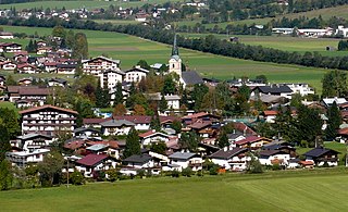
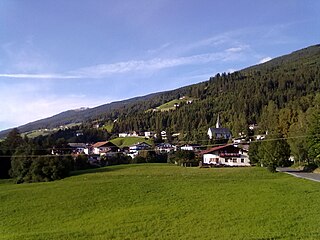
Kirchdorf in Tirol is a municipality in the Kitzbühel district in the Austrian state of Tyrol located 12.2 km (7.6 mi) north of Kitzbühel as well as 3 km (1.9 mi) north of Sankt Johann in Tirol at the Kitzbühler Ache. By area, Kirchdorf is the second largest municipality in the district. The village obtained its name from an old church which was built in the 8th century. The main sources of income are agriculture and tourism.

<span class="mw-page-title-main">Tux, Tyrol</span> Place in Tyrol, Austria

Tux is a municipality in the Schwaz district in the Austrian state of Tyrol.

<span class="mw-page-title-main">Prutz</span> Place in Tyrol, Austria

Prutz is a municipality in the Landeck district in the Austrian state of Tyrol. Located at the mouth of the Kauner valley on the upper Inn, it is 10 km south of the city of Landeck and 36 km north of Reschen Pass, that forms the border to Italy. The border to Switzerland is located 23 km away towards the south-west.

<span class="mw-page-title-main">Gries am Brenner</span> Place in Tyrol, Austria

Gries am Brenner, often referred to as simply Gries, is a municipality in the Wipptal in the southern district of Innsbruck-Land. The village consists of several hamlets.

<span class="mw-page-title-main">Gschnitz</span> Place in Tyrol, Austria

Gschnitz is a municipality with 415 inhabitants in the south of North Tyrol.

<span class="mw-page-title-main">Matrei am Brenner</span> Place in Tyrol, Austria

Matrei am Brenner is a small municipality in the southern part of the District Innsbruck-Land and is located approximately 17 km south of Innsbruck. Matrei has always been an important station for commerce. On 1 January 2022 the municipalities of Pfons and Mühlbachl were merged into Matrei. The village has 3,500 inhabitants, at 992 m. above sea level and the Sill river flows through it.

<span class="mw-page-title-main">Mühlbachl</span> Place in Tyrol, Austria

Mühlbachl was a municipality in the district Innsbruck-Land located 15 km south of Innsbruck. Mühlbachl extended from the southern slopes of Schönberg im Stubaital along Matreiwald to Steinach and the Sill River flew through it. It had 1,349 inhabitants. On 1 January 2022 Mühlbachl and Pfons were merged into the municipality of Matrei am Brenner.

<span class="mw-page-title-main">Obernberg am Brenner</span> Place in Tyrol, Austria

Obernberg am Brenner is a municipality in the southern district of Innsbruck-Land in the Austrian state of Tirol.

<span class="mw-page-title-main">Vals, Tyrol</span> Place in Tyrol, Austria

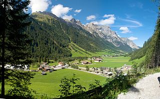
Vals is a municipality in the southern Innsbruck-Land District in the Austrian state of Tyrol.

<span class="mw-page-title-main">Pfons</span> Place in Tyrol, Austria

Pfons was a municipality in the district of Innsbruck-Land in the Austrian state of Tyrol located 13.7 km south of Innsbruck in the Wipptal at the Sill River. Although it is not exactly clear where the name of the village comes from, the location was first mentioned as “Phunzun” in 1030 and later as “Phanes” in 1177. Formerly a part of Matrei am Brenner, Pfons was declared as independent in 1811. On 1 January 2022 Pfons and Mühlbachl were merged into the municipality of Matrei am Brenner.

<span class="mw-page-title-main">Schmirn</span> Place in Tyrol, Austria

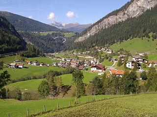
Schmirn is a municipality in the District Innsbruck-Land in the Austrian state of Tyrol.

<span class="mw-page-title-main">Innsbruck Hauptbahnhof</span> Railway station in Tyrol, Austria

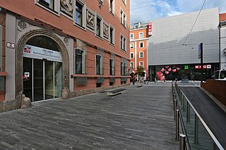
Innsbruck Hauptbahnhof is the main railway station in Innsbruck, the capital city of the Austrian federal state of Tyrol. Opened in 1853, the station is a major hub for western and central Austria. In 2019, it was the 8th-busiest station in the country, and the 2nd-busiest outside of Vienna after only Linz Hauptbahnhof, with 315 train movements and 38,500 passengers daily.

<span class="mw-page-title-main">Tyrol S-Bahn</span>

The Tyrol S-Bahn provides regional rail services in metropolitan Innsbruck, Austria and its hinterlands in the state of Tyrol. At present, it is only a nominally an S-Bahn in that it only operates on the lines of the Austrian Federal Railways. Expansion projects, including new stations, however, are being planned.

References

  1. "Dauersiedlungsraum der Gemeinden Politischen Bezirke und Bundesländer - Gebietsstand 1.1.2018". Statistics Austria. Retrieved 10 March 2019.
  2. "Einwohnerzahl 1.1.2018 nach Gemeinden mit Status, Gebietsstand 1.1.2018". Statistics Austria. Retrieved 9 March 2019.
  3. (in German) Geschichte Tirol
  4. (in English) Heraldry of the World, Steinach am Brenner
  5. (in German) Geschichte Tirol
  6. "Klimadaten von Österreich 1971–2000 – Tirol-Steinach–Plon" (in German). Central Institute for Meteorology and Geodynamics. Archived from the original on 12 October 2019. Retrieved 7 November 2019.