Stonewall, Alleghany County, Virginia

Last updated

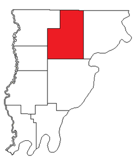
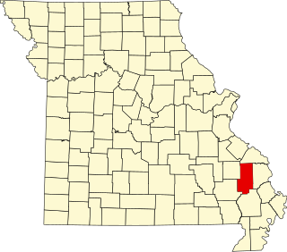
Stonewall is an unincorporated community in Alleghany County, Virginia, United States.

Alleghany County, Virginia county in Virginia, United States

Alleghany County is an American county located on the far western edge of Commonwealth of Virginia. It is bordered by the Allegheny Mountains, from which the county derives its name, and it is the northernmost part of the Roanoke Region. The county seat is Covington.

Virginia State of the United States of America

Virginia, officially the Commonwealth of Virginia, is a state in the Southeastern and Mid-Atlantic regions of the United States located between the Atlantic Coast and the Appalachian Mountains. Virginia is nicknamed the "Old Dominion" due to its status as the first English colonial possession established in mainland North America and "Mother of Presidents" because eight U.S. presidents were born there, more than any other state. The geography and climate of the Commonwealth are shaped by the Blue Ridge Mountains and the Chesapeake Bay, which provide habitat for much of its flora and fauna. The capital of the Commonwealth is Richmond; Virginia Beach is the most populous city, and Fairfax County is the most populous political subdivision. The Commonwealth's estimated population as of 2017 is over 8.4 million.

United States federal republic in North America

The United States of America (USA), commonly known as the United States or America, is a country composed of 50 states, a federal district, five major self-governing territories, and various possessions. At 3.8 million square miles, the United States is the world's third or fourth largest country by total area and is slightly smaller than the entire continent of Europe's 3.9 million square miles. With a population of over 327 million people, the U.S. is the third most populous country. The capital is Washington, D.C., and the largest city by population is New York. Forty-eight states and the capital's federal district are contiguous in North America between Canada and Mexico. The State of Alaska is in the northwest corner of North America, bordered by Canada to the east and across the Bering Strait from Russia to the west. The State of Hawaii is an archipelago in the mid-Pacific Ocean. The U.S. territories are scattered about the Pacific Ocean and the Caribbean Sea, stretching across nine official time zones. The extremely diverse geography, climate, and wildlife of the United States make it one of the world's 17 megadiverse countries.
Related Research Articles

All Saints, Devon village in the United Kingdom

All Saints is a civil parish in East Devon, Devon, England. It has a population of 498 according to the 2001 census. The parish includes the hamlets of All Saints, Smallridge, Churchill, Alston and Waggs Plot.

Mountain View High School (Mountain View, California) public high school in Mountain View, California

Mountain View High School (MVHS) is located at 3535 Truman Avenue, Mountain View, California, 94040. It is one of two Mountain View-Los Altos Union High School District public high schools.

Reading Township, Livingston County, Illinois Township in Illinois, United States

Reading Township is located in Livingston County, Illinois. As of the 2010 census, its population was 2,046 and it contained 983 housing units.

Potosí, Nariño Municipality and town in Nariño Department, Colombia

Potosí is a town and municipality in the Nariño Department, Colombia.

Dickinson is a ghost town in Wright County, Minnesota, United States.

Durrett Town is an unincorporated community in Nelson County, Virginia, United States.

Wnętrzne, Lublin Voivodeship Village in Lublin, Poland

Wnętrzne is a village in the administrative district of Gmina Stanin, within Łuków County, Lublin Voivodeship, in eastern Poland. It lies approximately 10 kilometres (6 mi) west of Stanin, 22 km (14 mi) west of Łuków, and 80 km (50 mi) north-west of the regional capital Lublin.

Czarny Las is a village in the administrative district of Gmina Woźniki, within Lubliniec County, Silesian Voivodeship, in southern Poland.

Midway is an unincorporated community in Giles County, Virginia. It lies at an elevation of 1,719 feet.

Card Place, California Unincorporated community in California, United States

Card Place is an unincorporated community in Mendocino County, California. It lies at an elevation of 823 feet. Card Place is located at 39°48′29″N123°24′17″W.

Friendsville Precinct, Wabash County, Illinois Precinct in Illinois, United States

Friendsville Precinct is one of the eight precincts of Wabash County, Illinois. Although there is no incorporated town, there is a community, Friendsville, Illinois, in the precinct.

The 1940 Women's Western Open was a golf competition held at Blue Mound Golf & Country Club, the 11th edition of the event. Babe Zaharias won the championship in match play competition by defeating Mrs. Russell Mann in the final match, 5 and 4.

Lewis and Clark Township is a township in northwestern St. Louis County, Missouri. The population is over 32,000.

The World of the Unexplained were two museums, opened in 1972 by Ripley's Believe It or Not!, one at Fisherman's Wharf in San Francisco and one in Gatlinburg, Tennessee, originally called "Museum of Witchcraft and Magic".

Castor, Missouri unincorporated community in Missouri, United States

Castor is an unincorporated community in the northwestern part of Filmore Township in Bollinger County, Missouri. Castor is situated on the Castor River and is located about 16 miles west of Marble Hill, Missouri.

Sherdahl is an unincorporated community in Republic County, Kansas, in the United States.

Pawnee is an unincorporated community in Medina County, in the U.S. state of Ohio.

Harrison Mills is an unincorporated community in Scioto County, in the U.S. state of Ohio.

Carrington is an unincorporated community in Callaway County, in the U.S. state of Missouri.

Marco is an unincorporated community in Stoddard County, in the U.S. state of Missouri.

References

Coordinates: 37°48′29″N80°04′03″W / 37.80806°N 80.06750°W / 37.80806; -80.06750

Geographic coordinate system Coordinate system

A geographic coordinate system is a coordinate system that enables every location on Earth to be specified by a set of numbers, letters or symbols. The coordinates are often chosen such that one of the numbers represents a vertical position and two or three of the numbers represent a horizontal position; alternatively, a geographic position may be expressed in a combined three-dimensional Cartesian vector. A common choice of coordinates is latitude, longitude and elevation. To specify a location on a plane requires a map projection.