References
Municipalities and communities of Alleghany County, Virginia, United States | ||
|---|---|---|
| Towns | 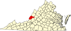 | |
| CDPs | ||
| Other communities |
| |
37°46′15″N79°58′21″W / 37.77083°N 79.97250°W
Mallow, Virginia | |
|---|---|
| Country | United States |
| State | Virginia |
| Counties | Alleghany |
| Elevation | 370 m (1,214 ft) |
| Population (2020) | |
• Total | 671 |
| Time zone | UTC-5 (Eastern (EST)) |
| • Summer (DST) | UTC-4 (EDT) |
| GNIS feature ID | 2807402 [1] |
Mallow is an unincorporated community and census-designated place in Alleghany County, Virginia, United States. It was first listed as a CDP in the 2020 census with a population of 671. [2]
Mallow first appeared as a census designated place in the 2020 U.S. census. [3]
Municipalities and communities of Alleghany County, Virginia, United States | ||
|---|---|---|
| Towns | | |
| CDPs | ||
| Other communities |
| |
37°46′15″N79°58′21″W / 37.77083°N 79.97250°W